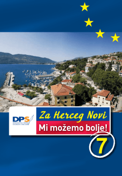
Mr.sci. Boris Ilijanić, arh.
URBANA GENEZA
Rektifikacija starih planova
Herceg Novi-Stari grad
Crna Gora, Istočna obala Jadranskog mora
istraživački rezime
Herceg Novi, Chieti, Wellington, 1985-1998
„OMNIA QUAE CERNIS MAGNO CONSTRUCTA LABORE:
MOENIA,TEMPLA,DOMUS,FONTES,STABULA, ATRIA THERMES”
„Sve što ti oko motri veljim je izgrađeno trudom:
zidine, crkve, kuće, česme, staje dvori i kupatila”
1
2
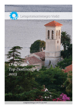
1.- Kanli Kula,
2.- Potkovičasta kula,
3.- Izvor Karadža,
4.- Zapadna vrata,
5.- Sv.Arhanđel Mihailo,
6.- Kula Sv.Jeronima,
7.- Peraška vrata,
8.- Upravni objekat,
9.- Sv.Jeronim,
10.- Sv.Frano/Sv.Leopold/,
11.- Zvonik Sv.Jeronim,
12.- Forte Mare,
13.- Kula Sv.Anta,
14.- Tvrđava Mezaluna
/polumjeseca/
3
4
Boris Ilijanić
URBANA GENEZA
Herceg Novi – Stari grad
(istraživački rezime)
5
6
Ovaj rad je izrađen kao dio magistarske teze u okviru
postdiplomskog studija Arhitektonskog fakulteta Sveučilišta u Zagrebu:
„Urbanizam i Prostorno planiranje“ pod voditeljstvom prof.dr. Bruna
Milića.
Glavni konsultanti na terenu, kojima dugujem veliku zahvalnost bili
su prof.dr. Jerko Marasović iz Splita, prof Svetislav Vučenović iz
Beograda, mr Ilija Pušić arheolog iz Herceg Novog, mr. Gligo Odalović
iz Herceg Novog, zatim ustanovama:
Republički Zavod za zaštitu spomenika kulture Crne Gore,
Hercegnovski Arhiv.
Arhitektonsko snimanje i izradu dokumentacije uradili su saradnici
Zavoda za projektovanje i urbanizam Herceg Novi.
Istovremeno se zahvaljujem osoblju institucija: Muzej Correr u
Veneciji, Biblioteka Marciana u Veneciji, Biblioteka San Marco u
Veneciji, Državnom Arhivu Venecije, Ratnom Arhivu u Beču na usluzi
prilikom pretraživanja arhivskih dokumenata.
Zahvaljujem za korišćenje privatnih dokumenata mr. Jovici
Martinoviću arheologu iz Kotora i fotografu gospodinu Stevu Lepetiću iz
Herceg Novog, a prof.dr. Radmili Benderać na pomoći pri sređivanju i
organizovanju teksta.
autor
7
8
9
10
11
12
Sadržaj
Predgovor ......................................................................................................7
Osnovni motivi, ideje i problematika ........................................................15
Terminologija i istraživački metod............................................................17
Urbani razvoj kroz rektifikaciju starih planova .......................................25
Nulta faza(KOD 010) ..........................................................................27
Uslovi za razvoj grada/do 1382/(K0D 020)........................................ 31
Srednjovijekovni grad/1382 do 1482/(K0D 030)................................ 35
Herceg Novi pod Turcima/1482 do 1687/(KOD 040 i 050) ................39
Venecijanski Castel Novo/1687 do 1797/(KOD 060)..........................61
Stari grad Herceg Novi pod Austrijskom upravom/1797 do 1918/
(KOD070) .............................................................................................85
Savremeni Stari grad Herceg Novi/1918 do 1982/(KOD 080)...........95
Zaključci i sugestije ..................................................................................113
Bibliografija ............................................................................................. 117
Spisak fotografija..................................................................................... 118
13
14
I Osnovni motivi, ideje i problematika
15
Poglavlje I
16
Osnovni motivi, ideje i problematika
Osnovni motivi, ideje i problematika
Shvatajuci aglomeraciju starog urbanog jezgra Herceg Novog,
kulturnom, estetskom, umjetničkom i turističkom vrijednošću, a obzirom
na vremensku distancu, kao istorijsko kontinuirani urbani kvalitet,
postavio se do voljno motivisan zadatak za istraživanje u oblasti urbane
geneze.Veća pažnja, koju ovaj prostor zaslužuje aktuelizirana je naročito
nakon poznatih destrukcija u pogledu urbanog života jezgra, i u fizičkom
i u duhovnom smislu. Znano je da je zemljotres od 15.04.1979. godine
samo ubrzao jedan proces umiranja istorijskog jezgra Herceg Novog, jer
je i ranije ovaj prostor već bio predodređen za formiranje „slum“
aglomeracije, kako su na to ukazivali životni tokovi, a naročito stihija u
planiranju.
Motivi za ovaj rad jos su vise potencirani saznanjem da ranije nije
bilo aktivnosti u ovoj urbanoj aglomeraciji u pravcu plansko istraživačkih
radova, te da nas u budućnosti, očekuje značajno osjetljiv i delikatan
posao i u planiranju obnove i revitalizacije Starog Grada. Zbog toga ovaj
rad ima pretenziju da obrađuje urbanu genezu istorijskog jezgra Herceg
Novog u cilju boljeg sagledavanja njegove današnje situacije u prostoru
i da pomogne istraživačkim i planerskim ekipama u cilju pravilnijeg
pristupanja rješavanju problema.
Terminologija i istraživački metod
Kad se govori o istraživanju urbane geneze starog gradskog urbanog
jezgra neosporno je da moramo bar djelomično obratiti pažnju na
terminologiju, koja je u tom domenu prisutna.
Svaki od pojmova, koji su ovdje zastupljeni imaju specifično značenje,
zato su vjerovatno i teže razumljivi. Sa dodatnim opisom, koji bolje
označava njegovo značenje i obuhvatijivost možemo ga lako i pravilno
upotrebiti. U praksi, mnogi pojmovi među sobom se zamjenjuju, dijelom
radi jezičkih nasljednosti, ali češće radi nepoznavanja pravog značenja.
Istorijski prostor označava prostor posebnog istorijskog događaja i
posve napadno se upotrebljava u imenu nekog mjesta
17
Poglavlje I
Istorijska mjesto označava dio mjesta ili cijelo mjesto, kao istorijsko
urbanu cjelinu
Istorijski kompleks, jezgro označava sveobuhvatni urbani
spomenik sa ambijentom
Ambijent urbane cjeline označava bitan kvalitet nekog prostora u
istorijskom, kulturnom, likovnooblikovnom smislu, što se odražava na
urbanu cjelinu.
Sanacija (asanacija) označava „zdravljenje“ materijala i
konstrukcija, ali i urbanog života.
Revitalizacija označava funkciju omogućavanja opstanka urbanog
života
Integralna rekonstrukcija označava ponovnu izgradnju
Restauracija označava djelomičnu obnovu prvobitnosti
Rektifikacija
(lat.rectificatio)
označava
ispravljanje,
poprav1janje, mat.pretvaranje krive linije u pravu, određivanje dužine
krivih linija
Rektifikovati (lat.rectificare od rectus) ispravljati, ispraviti,
popravljati, poboljšati, dotjerati, mat.odrediti dužinu krive.
Proučavanje paleogeneze, urbanizacije i samog urbanizma Herceg
Novog temelji se na izvornoj građi, kao i svako drugo istorijsko
istraživanje. Ti izvori su pisani, crpljeni iz djela raznih pisaca,
savremenika prošlih vremena i današnjih, ali i iz tekstova na
epigrafskim spomenicima. Za ta razmatranja su od velike važnosti i
materijalni ostaci ranijih naselja i elemenata arhitekture, do sada
otkriveni i obrađeni arheološkim istraživanjima na istom lokalitetu i u
blizoj i daljoj okolini.
U rješavanju mnogih problema iz domena urbanizma i urbanizacije
konkuriše više disciplina, od kojih svaka ima svoje područje istraživanja
i svoje metode naučnog rada.Takav interdisciplinarni pristup
istraživanju u urbanoj probematicii preporučili su jos stari klasični pisci:
Aristotel kod Grka i Vitruvije u Rimu.
18
Osnovni motivi, ideje i problematika
Savremene urbaniste često i život prisiljava da se okrenu problemu
istorijskog urbanizma, da se upoznaju sa rezultatima istraživanja do
kojih su došli arheolozi, istoričari, istoričari umjetnosti; uvijek kada
prionu na zadatak da traže nova rješenja za gradove ili njihove dijelove
sa dužom urbanom tradicijom. Jezgro tih gradova, kada su u pitanju
gradovi istočne obale Jadrana, veoma često imaju svoje početke u
antičkom razdoblju i isto tako mnogi od tih gradova formiranih u
srednjem vijeku, izgradili su svoja urbana jezgra na osnovu jedne
apstraktne, ali uvijek prisutne ideje mediteranskog tipa grada, koji je
ovdje doživio autonomni organski razvoj od protourbanog do danas.
Izrada rektifikacija starih crteža u domenu proučavanja urbane
geneze gradova je veoma značajna, jer kao istraživački metod, koji nije
primjenjivan ranije, omogućava otkrivanje niza novih činjenica i baca
novu svijetlost na nepoznanice urbanog razvoja.
Iako je, u narednim podglavljima urbani razvoj grada Herceg Novog,
kao primjera za primjenu navedenog istraživačkog metoda, prikazan,
kao i obično, hronološki prema redosljedu nastanka pojedinih faza, u
procesu istraživanja, kroz rektifikacije, išlo se obrnutim putem, od
poznatih činjenica kakve su danas, pa prema nepoznatim u prošlost i to
po pojedinim fazama.
Ove faze su podjeljene u osam (8) osnovnih kodova, gdje pojedini
imaju i podkodove.
Svaki kod, bilo osnovni ili pomoćni, a koji karakteriše određeni stari
crtež, ima niz jedinica (listova) i sve zajedno ga objašnjavaju. Svi kodovi
i njihov međusobni položaj jasno se sagledavaju prikazom u priloženoj
tabeli.
Može se pouzdano tvrditi da najranije prilično istinite informacije o
gradskim naseljima na obali istočnog Jadrana, daju katastarski planovi
sa kraja 19. vijeka. Na primjeru Herceg Novog to je Austrijski
katastarski plan iz 1890.godine. Ako se zna da su pomenuti gradovi u
svom razvoju stagnirali do početka 20. vijeka, onda su pojedini dijelovi
ovog plana dokumenti i ranijih faza, oblika urbane aglomeracije.
Rektifikacije starih crteža rađene su precrtavanjem istih preko
ažuriranih geodetskih podloga iz današnjeg doba, u razmjeri 1:1000 uz
korištenje svih savremenih pomagala i uređaja. Ovakve rektifikovane
19
Poglavlje I
crteže možemo direktno koristiti u daljim obradama.
Detaljnije rečeno, rađeno je po sledećoj metodi: Stari plan; čiji negativ
posjedujemo, geodetskim metodama, reambulacije, je doveden u
razmjeru 1:1000 i preklopijen preko savremene ažurirane geodetske
situacije, plana 1:1000 na astralon foliji, da bi se izbjegle deformacije
papira i time postigla što veća vijernost sa stvarnim dimenzijama. Zatim
je preko ova dva plana iscrtavana rektifikacija starog plana oslanjajući
se na prave dimenzije iz današnjeg plana i na poznate podatke za
obrađivani period iz arhivske građe.Na taj način dobili smo rektifikovan
stari plan.
Ako je uz taj stari plan bila prikazana i perspektiva, onda je njena
rektifikacija rađena na isti način.
Kao krajnji rezultat i jedne i druge rektifikacije crteža, imamo novu
interpretaciju, koja je proizišla iz novootkrivanih činjenica kroz samo
rektifikovanje.
Godine 1982, a u skladu sa zaključcima Stalne Konferencije gradova,
a u pogledu izučavanja urbanog razvoja gradova jadranske obale,
utvrđen je ovaj jasan metod, koji se primjenjuje i na izučavanje urbanog
razvoja Splita. U tom smislu ovaj gore navedeni metod je razrađivan i u
saradnji sa istraživačima iz Splita, Arhitektonskim fakultetom iz
Zagreba, odsjek Split, „Centar za Arhitekturu i Urbanizam” korištena je
naprava za crtanje konstruisanih perspektiva sa zadatim elementima,
kako je to dato u prilogu položaja Starog grada Herceg Novog.
20
Osnovni motivi, ideje i problematika
21
Poglavlje I
001
22
Osnovni motivi, ideje i problematika
002
23
Poglavlje II
24
II Urbani razvoj
kroz rektifikaciju starih planova
25
Poglavlje II
26
Nulta faza(KOD 010)
Urbani razvoj kroz rektifikaciju starih planova
Nulta faza (KOD 010)
Za što svestraniju i cjelokupniju sliku i obuhvat svih činjenica, koje
utiču i koje bi mogle uticati na urbanu problematiku starog gradskog
jezgra Herceg Novog osvrnimo se dakle, na istorijske uslove nastanka i
razvoja Herceg Novog.
Župa Dračevića spada u red srednjovjekovnih pokrajina, koje su
osnovali naši preci, doselivsi se u primorske krajeve. Naseljeno slavensko
stanovništvo brzo je počelo osnivati svoje društveno upravne organizacije
po uzoru na one koje je imalo u staroj domovini. Istina ove organizacije,
ugledale su se, u mnogome, na slične ustanove kod starosjedilaca.
Mnogobrojne tekovine ilirske i rimske civilizacije uticale su na
društveno formiranje naših predaka, ne samo u organizacionom pogledu
već i u kulturnom, urbanom i sl. Znatni arheološki i epitafski spomenici
nađeni na ovoj teritoriji jasno i nedvosmisleno govore o tome.
Dolaskom na obale jadranskog mora Slaveni naseljavaju obradive
površine, koje su bile aktivne i sposobne za poljoprivrednu delatnost još
iz rimskog doba. Ovi predjeli bili su povezani glavnom komunikacijom,
arterijom „via Adriatica“. Tu spadaju župe: Stonska, Zrnovica (kod
Epidaura), Grbalj, Konavle i Dračevica.
„Orbini veli, da su Boku, trojanski bjegunci, posle dugog lutanja,
naselili, a drugi, da je Sicilija njena mati, jer je Dionisie, sirakuški
tiranin, poslao naseobine onamo; neki je i starijom smatraju. Pleme
ilirsko Enhelei (jeguljari) stanovaše, gdje su danas općine hercegnovska
i risanska, a Adrijeri, gdje su danas općine grbaljska, budvanska,
pastrovska i na poluotocima Lustica i Vrmac. Livije i Plinije vele, da
bijahu 'Labeates' ilirski ogranci, gdje je danas Crna Gora i Krivošije.“1
Glavna primorska cesta rimskog vremena, koja je išla od Salone,
preko Ad Movas (kod Imotskog) na Bigeste (Humac kod Ljubuškog),
Naronu i odatle primorjem na Epidaurum (Cavtat).
Savo Nakićenović: „Boka“, Antropogeografska studija; Srpska akademija
Beograd.1913.god.
1
27
Poglavlje II
Od Epidaura iđaše na Sutorinu, a odatle kroz Boku i to najprije kroz
Hercegnovsku krajinu (Stolium), pokraj mora na Risan, Perast,
Orahovac i Dobrotu (Duleidia) za Kotor. Od Kotora iđaše na Škaljare,
preko Troice i Grblja na Budvu, Lastvu itd. Ovim vojničkim putem Boka
je došla u neposredan dodir sa Dalmacijom, Epirom, Enheleima,
Travuljanima i Dukljanima, te im bez dvojbe donosaše velike koristi.“2
„U Sutorini pak, bila je rimska tvrđava: zato se valjda i zove
Sutorina/Sub turris/.Tu se vojničke i trgovačke promjenjivale i
odmarale.“3
„Godine 395. po Hr., pošto se Rimsko carstvo podjelilo u istočno i
zapadno, Boka pripada zapadnom. Poslije biva seoba naroda uslijed koje
Boka postrada. Teodorih, kralj Ist.Gota, osvaja Boku 489.god. te pod njim
ostaje do 535.god. kad je Justinian ote Ist. Gotima, te da bi je osigurao
od navale divljih naroda, godine 532. gradi tvrđavu Kotor (Cattaro). Zna
se da je Kotor primio hrišćanstvo u to doba, jer se spominje god. 451.
Paulus Episcopus Cathari civitalis Histor coucil. p. 597.), a isto tako
jedan drugi (Johannes) iz 649.god. (Hist.conc. 603). Iz ovog doba su
vizantijski gradovi Stole (Stolium), Porto Rose, gradovi koje porušiše u
IX v. Saraceni ili usred potresa propadoše.”4
Oko 1018. godine Dračevica spada pod zetsku državu, a godine 1197.
potpada pod Nemanjiće. Posle Nemanjića Dračevica dolazi pod bosansku
državu i konačno krajem maja 1382.god. bosanski kralj Tvrtko I
Kotromanić, polaže temelje za izgradnju grada u sredini župe Dračevice,
u romantičnom Topljanskom zalivu Boke kotorske.
Ibidem
Ibidem
4
Ibidem
2
3
28
Nulta faza(KOD 010)
29
Poglavlje II
30
Uslovi za razvoj grada/do 1382
Uslovi za razvoj grada /do 1382.god./(KOD 020)
Sigurno je veoma interesantno potražiti odgovor na pitanje šta su to
prvi graditelji vidjeli na lokaciji današnjeg Starog grada Herceg Novog?
To je veoma značajno pitanje sa stanovišta proučavanja urbane
geneze svake pa i ove urbane aglomeracije. Zašto je grad nikao i zadržao
se do danas na ovoj lokaciji? U procesu izrade rektifikacija starih planova
obrađena je faza (KOD 010), koja jasno stvara sliku topografije terena i
njegov reljef, istaknute tačke i izvore kvalitetne vode.
Jasno se vidi da je teren, naročito prema zapadu strmih litica, koje
se pružaju od mora prema kopnu cca 380m dužine. One počinju sa
morske strane, prirodnim uzvišenjem (gdje je danas tvrđava Forte Mare)
i završavaju se istaknutim brežuljkom na kopnu sa kotom 85m (gdje je
danas tvrđava Kanli Kula)
Pored ovoga, niz stijena i hridi, ostavljalo je mogućnost, sa
minimalnim građevinskim intervencijama izradu solidne odbrambene
linije. U podnožju oba pomenuta brežuljka su izvori pitke vode od kojih
je gornji aktivan i kvalitetan i danas. Drugi je vremenom zatrpan kao
zagađen.
Nije potrebno, naročito ukazivati na ostale geografske, topografske i
klimatske uslove.Već sam prokaz (KOD 010) govori sam za sebe.
Jasno je onda da su stari graditelji, koristeći pogodnost terena,
izgradili grad prema njegovoj funkciji i kroz sve ostale periode građenja.
Ako posmatramo period od Nulte faze (KOD 010) do 1382.god. (KOD
020), ostaje velika nepoznanica prisutnosti objekata na ovoj lokaciji.
Dozvoljava se mogućnost postojanja određenih gradnji na visovima zbog
naročite topografsko strateške pogodnosti. Zbog tih pogodnosti, prosto je
nevjerovatno da ovdje nije postojala stražarnica, osmatračnica ili nešto
slično, iz ranijih perioda.
31
Poglavlje II
32
Uslovi za razvoj grada/do 1382
33
Poglavlje II
34
Srednjovijekovni grad/1382 do 1482/
Srednjovijekovni grad /1382 do 1482/ (KOD 030)
„Poznato je da je Tvrtko izlaskom na more i krunisanjem 1377.god.
za kralja Bosne i ostalih Srpskih zemalja došao u stalan sukob sa
ondašnjim svijetom, koji ga je okruživao.Na morskoj obali zatekao je luke
, koje su usljed velike konkurencije Dubrovnika izgubile svoj raniji
značaj, ili se uopšte nisu pojavljivale kao značajan trgovački faktor u
srednjem vijeku.U takvoj situaciji, koja nije nosila nikakva dobra
predviđanja, Tvrtko je planirao da podigne grad na dijelu svog slobodnog
mora i obale. Izabrao je vrlo atraktivno podneblje Župu Dračevicu, staru
travunjsku oblast, koja ima svoje pogodnosti da primami i zadrži
populaciju, ali ne u tolikoj mjeri da bi se urbano konsolidovale na pitanje
kojoj njenoj lokaciji u srednjem vijeku. Jedina perspektiva takvom gradu
je bila trgovina i tranzit. Tvrtko je to dobro znao pa je cijenio sve
vrijednosti koje bi takav grad donio. Znači, grad će izgraditi po planu i
budućnost mu prilagoditi sledećim uslovima: prvo grad je otvoren prema
moru i moći ce da primi transporte roba koje dolaze sa svih obala
Jadranskog mora: drugo grad je Sutorinskom dolinom povezan sa
dubrovačkim putem, koji ga spaja sa karavanskim putevima
Hercegovina i Bosne; a treće po našem mišljenju najvažnije , da je Tvrtko
čuo, a i mogao vidjeti da je na obali Sutorine nekada bila solana,
industrija za koju je Tvrtko imao naglašenu potrebu. Literatura je
usvojila podatak da je Tvrtko sagradio grad da bi se oslobodio velikog
nameta, što su ga dubrovčani nanosili u prevozu i prodaji soli kroz
bosansku zemlju, a i da bi se oslobodio carine, koja je za ovu vrstu artikla
bila vrlo velika. Tvrtko izričito kaže, da je grad sagrađen da u njemu
bude trg soli, „i tuzi bes reklo kraljevstvo postaviti slanicu i da budet trg
soli i prodavanija.“ I, zaista, prva dokumenta iz prepiske između Tvrtka
i Dubrovnika pominju samo trg soli „kumer soli“; a ne nikako da se tu
proizvodi so, kako to govore mnogo kasnija dokumenta.“ 5
Na osnovu dostupnih pisanih izvora i arhivskog materijala tačno se
može utvrditi period i godina osnivanja grada po nalogu bosanskog kralja
Tvrtka I Kotromanića, iako ne i njegov precizan položaj, obim i struktura.
Ilija Pušić: „Srednjovijekovni Herceg Novi,Urbanistička razmatranja do
pada pod Turke 1482.god.“
5
35
Poglavlje II
Otkrivenih planova iz ovog vremena nemamo. Kroz arhivsku građu
postoje određeni opisi grada, ali iz vremena Herceg Stjepana Vukšića
Kosače.
Određena naučna mišljenja dislociraju prvobitni Tvrtkov grad (Sveti
Stefan) sa današnjeg lokaliteta „Stari grad“, bliže solanama u Sutorini.
Međutim, materijalnih ostataka za potvrdu ovih mišljenja nema ili nisu
dovoljno istražena. Sigurno je da je najraniji period Herceg Novog (Sveti
Stefan) nerazjašnjen i zahtijeva strpljiv istraživački rad.
Ako govorimo o urbanoj genezi gradske aglomeracije, koja se danas
naziva Stari grad, tada ona ovdje, po arhivskoj građi egzistira od 15.
vijeka, za čiji je razvoj velike zasluge, prije svih, imao Herceg Stjepan
Vukšić Kosača, koji je grad obnovio, utvrdio, dao mu ekonomsku snagu
otvaranjem zanatskih radionica i novom trgovinom soli, nakon Tvrtkovog
zapostavljanja grada, krunisanjem za kralja Bosne i Srbije.
Vladavinom Hercega Stjepana grad je stekao uslove za brzi razvoj.
36
Srednjovijekovni grad/1382 do 1482/
37
Poglavlje II
Rektifikacijom crteža (KOD 040), došlo se do saznanja, koja rasvjetljavaju raniji period (KOD 030). Po grafikama Angela delli Oddi
Padovano (KOD 040A) iz djela „Viaggio della provincia di mare della
signoria Venetia...“, objavljenog u Veneciji 1584.god., a koja se smatra
za jednu od najstarijih poznatih za Herceg Novi; jer proučavanjem
urbanog razvoja nekih drugih jadranskih gradova, predstavljenim u
ovom djelu, posebno Splita, utvrđen je period nastanka te serije grafika
između 1435 i 1539.godine zatim po grafici (KOD 041A) od Camotio
Francesco iz djela „Isole famose porti, fortezze e terre maritime sotto
posto alla...“ objav-ljenog u Veneciji 1587.godine, po grafici Giacomo
Rossacio iz djela „Viaggio da Venetia a Constantinopoli“, objavljenog u
Veneciji (KOD 042A), i po grafici nepoznatog autora iz istog perioda
(KOD 043A), kao i po nekim drugim kasnijim planovima i njihovim
opisima i legendama, brežuljak koji dominira nad područjem današnje
Starog grada („Kanli Kula“), bio je označen kao gradska utvrda, stari
bedem („vechio recinto“), citadela, zadnje uporište i sl.
Ovo upućuje na razmišljanja da je taj dio grada najstariji branjeni
položaj.
Taj branjeni položaj je fortifikacija četvorougaonog oblika sa
sjeverozapadnom pravougaonom kulom i tri okrugle kule na uglovima i
petom u sredini južnog zida, prema moru i donjem gradu, uz koju je i
gradska kapija.Okrugle kule su novijeg perioda, fortifikacije, koje lakše
podnose udare topova.
Unutar bedema su objekti malih gabarita i usitnjene strukture beznačajne arhitekture, sa krovovima na dvije vode. Uz sjeverozapadnu
kulu locirana su dva veća objekta pravougaone osnove, velike visine i
krovovima u vidu kubeta. Ovi objekti imaju dominantan položaj u
fortifikaciji i na najvisočijoj su koti Starog grada.
Analizirajući grafiku A.delli Oddia (KOD 040A) dolazimo do novih
činjenica u mogućoj rekonstrukciji i interpretaciji grada ovog perioda
(KOD 030). Ispod pomenute fortifikacije (Citadella) je zidom opasan
četvorougaon grad sa okruglim kulama. Značajno je uporediti distancu
od južnog zida grada do mora, koju određuje predstavljen put, staza,
serpentina, od gradske kapije. Može se zaključiti da južni bedem grada
u ovom periodu nije bio na obali mora kako je to danas.
38
Herceg Novi pod Turcima/1482 do 1687/
Herceg Novi pod Turcima /1482 do 1687/ (KOD 040 i 050)
Turci su Novi zauzeli prvi put 1482.godine, dakle 100 godina od
Tvrtkove povelje o osnivanju grada. Period od 100 godina je je sigurno
dovoljan da bi se zaokružio određeni obim srednjovijekovnog utvrđenog
grada. O tome nam podatke daje sačuvana arhivska građa (Dubrovački
arhiv i dr.), tako da za vrijeme vladavine Tvrtkovih naslijednika,
Sandalja Hranića, a pogotovo Hercega Stjepana Vukšića Kosače tokom
15. vijeka, možemo pratiti razvoj Novoga.
Međutim, dosta je nejasan njegov urbani i arhitektonski i graditeljski
razvoj i izgled. Ostaje pitanje kakav su grad po obimu i strukturi Turci
zauzeli 1482. godine.
Po arhivskoj građi Herceg Stjepan je u svom dvoru u Novom primao
u audienciju, sklapao ugovore, odmarao se, držao stalnu vojsku i tu je i
umro. Za života je započeo crkvu Sv.Stefana sa dubrovačkim majstorima
klesarima crkve Male Braće.
Iz svega ovoga jasno je da se radilo o naselju gradskog karaktera,
rezidencijalne i strateške svrhe.
Prilikom studiranja crteža (KOD 040), otkrivamo nove činjenice koje
idu u prilog tumačenja oblika i strukture grada.
/040A/003
39
Poglavlje II
Po djelimično vec razmatranoj grafici A. delli Oddia iz 1584.godine (KOD
040A), u gornjem dijelu dominantne fortifikacije grada na visokom
kubetu vudljiv je znak moseje. Dakle, turci su već u gradu, što navodi na
zaključak da grafika predstavlja stanje grada najranije 1482.godine.,
kada su turci zauzeli Novi. Grafika ne pokazuje srednji bedem u gradu.
Znači ona odražava stanje najkasnije iz 1538.godine, po Camotio F., gdje
se prikazuje ovaj zid ili iz 1606.godine po Rossacio Giacomo.
/041A/004
Jasno je izdiferenciran grad. Na brežuljku je utvrda pravougaonog
oblika sa pet kula od kojih je sjeverozapadna pravougaonog oblika, što
navodi na zaključak da je ona možda iz ranijeg perioda. Uz
sjeverozapadnu kulu su podignuta dva visoka objekta. Sve ove
konstatacije se jasno potvrđuju na terenu kroz materijalne ostatke.
Unutar zida je usitnjena struktura objekata za stanovanje i smještaj
(„magazini“).
40
Herceg Novi pod Turcima/1482 do 1687/
/042A/005
Ispod tvrđave je gradska aglomeracija sa takođje usitnjenom i
gustom stambenom arhitekturom, objekata od kojih neki imaju i sprat.
Krovovi su kosi na dvije vode. Ističe se zvonik ili munare u donjem dijelu
grada.
U zapadnom bedemu su tri okrugle kule, južnom jedna okrugla uz
kapiju i u istočnom takođe jedna okrugla. Dakle, u gradskom perimetru
je glavnu odbrambenu funkciju grada vršila fortifikacija na brežuljku
(„Citadella“) sa svojih pet kula i gradskim bedemom i pet kula na
njemu.
Kroz gradsku kapiju u južnom zidu, koja brani zapadnu kulu vodi
staza do mora.
Nameću se na kraju određeni zaključci i to da grafika A. delli Oddia
odražava stanje grada između 1482. i 1538.godine, a južni bedem, koji je
prikazan, predstavlja srednji zid u današnjem gradu, što potvrđuju i
materijalni ostaci pomenute kapije, a gradski perimetar je bio branjen
sa pet okruglih kula.
Grafika od Camotio F.(K0D 041A) iz 1587.godine, predstavlja napad
hrišćanske vojske pod komandom Andrea Doria na Turski Novi
1538.god. Vidi se da je gradskim bedemima dodan današnji južni zid i
jos dvije kule tako da ih sada ima ukupno sedam. Možemo zaključiti da
su južni bedem gradili Turci između 1482 i 1538.god.
41
Poglavlje II
/043A/006
Grafike od Rossacio G.(KOD 042A) i od nepoznatog autora iz istog
perioda (KOD 043A) potvrđuju ove konstatacije.
Proučavajući dalji urbani razvoj rektifikacijom starih planova i
crteža, ulazimo u period do 1687.godine(KOD 050), kada Turci gube vlast
nad gradom od strane Venecije.
Rektifikacijom starog plana od Cornellia iz 1687.godine (KOD 050),
dolazimo do sledećih podataka:
42
Herceg Novi pod Turcima/1482 do 1687/
Grad je podjeljen u dva dijela i nad gornjim, visočijim dijelom,
dominira fortifikacija Kanli Kula („Krvava Kula“). U zapadnom zidu
su tri kule, uključujuću i južnu kulu Abaz paše (današnja Forte Mare).
Perimetar koji opasava donji, niži dio grada je prilično izlomljen, manje
naglašen i uglavnom se oslanja na fortifikaciju na morskoj obali
(„Mezaluna“).
U srednjem zidu grada su dvije poluokrugle kule i objekat, koji je
naslonjen na bedem na mjestu današnjeg zvonika crkve Sv.Jeronima.
Iako je orginalni plan prilično proizvoljan, ipak važno je ovdje
napomenuti određenu odbrambenu arhitekturu u gornjem desnom uglu
crteža van zone Starog grada, a približno, na lokalitetu Modra ploča.Ovo
je jedini od svih planova koji detaljnije prikazuje ovaj objekat. (?) Da li
su to ostaci neke ranije fortifikacije, sigurno treba prostudirati i istražiti.
Stari planovi Herceg Novog, često nisu prikazivali ostatke stare
arhitekture van zidina, u što se možemo uvjeriti po materijalnim
ostacima na terenu u bližoj okolini samog grada. (lokalitet Vojničke banje
i sl.)
43
Poglavlje II
44
Herceg Novi pod Turcima/1482 do 1687/
Proučavajući pomoćnu fazu (K0D 051), a posebno rektifikovani plan
od Coring.B. (?) (KOD 051 A, B, C), koji možemo datirati oko 1687.godine
jer u podgrađu „borgo“ nema ucrtanog starog lazareta na Toploj, (prvi
put se javlja na planovima iz 1700.godine), možemo zaključiti da je to
jedan od prvih planova, koji identifikuje gradsko tkivo unutar bedema
pa i u podgrađu.
Odmah je vidljiv značajan položaj zapadnih gradskih vrata, prilično
naglašen u odnosu na burg. Istočna vrata su na poziciji „Peraških vrata”
(1538.godina), koji E.Čelebija, turski putopisac onog vremena, naziva
Trnovica („Tarnovisce“), a nalaze se u vrtu kuće „Spalatina“ i štitila
je Begova kula („Fortezza di St.Girolamo“). Zapadna vrata, koja
vode na jugozapad, na pristan („Porta di Marina“) su uz samu južnu
kulu Abaz paše(„Forte Mare“).
Na ovom planu se u perimetru mogu jasno uočiti ostaci nekadašnjih
utvrđenja u zapadnom zidu, zatim kule pravougaonog oblika iza kule
Abaz paše, po E.Čelebiji, „Donja ravna kula“, a donji istočni zid poprima
oblik sa pet toriona poligonalne osnove. Prema moru je istaknut položaj
tvrđave „Mezaluna“ i kule St.Antona.
U samom gradu je prilično jasna regulacija ulica i trgova, koja se u
velikoj mjeri poklapa sa današnjim stanjem. Ipak, neke od ulica su
vremenom nestale i namjesto njih formirali su se vrtovi i bašte. To je
slučaj sa komunikacijom uz istočni bedem, sa njegove gradska strane, sa
prolazom (kapijom?) kroz srednji bedem i silazak u donji niži dio grada
(„Citta bassa“), zatim djelovi ulice u zapadnom dijelu nižeg grada. Na
donjem trgu (Sv.Jeronim) je iskrivljena regulaciona linija objekata u
odnosu na današnje stanje i ima pravac sjeverozapad, jugoistok (objekat
mošeje, a ranije crkve na istom mjestu). Isti je slučaj i na gornjem trgu
(„Belavista“), opet kod sakralnih objekata.
Iako crtež prilično detaljno obrađuje ulica, trgove i blokove objekata,
nije naznačio položaj istočnog zida sa kapijom, a koji se pruža od
Peraških vrata do Kanli Kule.
Možemo zaključiti da se ovaj plan u priličnoj mjeri podudara sa
opisom turskog putopisca E.Čelebije u djelu „Putovanje iz Ljubinja u
Dubrovnik“ iz 1664.godine pod naslovom „Čvrsta tvrđava i jaki bedem
grad Novi“ i „Oblik i položaj grada Novatejna“ (Novatejn je arapski dual,
od Nova što znaci dva Nova).
45
Poglavlje II
U korelaciju ovih konstatacija potrebno je ukazati na tri jaka
zemljotresa i to iz 1608.godine od 9° MCS, poslije kojeg E.Čelebija piše
svoj putopis(1664.GOD.), zatim zemljotres iz 1667.godine od 9° MCS.
Posto je E.Čelebija pisao 1664.godine da je južni bedem od hrastovih
greda, možemo zaključiti da je u kamenu izgrađen tek poslije zemljotresa
iz 1667.godine, jer ga u planu iz 1687.godine možemo identifikovati kao
kameni bedem. Za potvrdu ovih konstatacija, podatke nam daje i grafika
od G.G.Rossia (K0D 051A) iz 1687.god.
Ovdje treba pomenuti i zemljotres iz 1563.godine od 9° do 10° MCS,
koji je razrušio grad, a koji po arhivskim podacima Turci popravljaju.
Na planu grada sa pogledima iz 1688.godine, nepoznatog autora
(K0D 052A), daje se plan buduće gradnje u gradu i oko njega, ali isto
tako pogledi, fasade i opisi, legende otkrivaju neke činjenice iz starijeg
perioda.
Jasno se vide munare mošeje na gornjem i donjem trgu. Na gornjem
trgu je „Moshea maggiore hora Chiesa da S.Girolamo“, dakle prva crkva
Sv.Jeronima, nije bila na donjem trgu gdje je danas, već na gornjem trgu
„Belavista“. Na približnoj lokaciji današnje crkve S.Jeronima bila je
crkva S.Frana („Altra Chiesa di padre Cappucini... St.Frano“), koja
se kasnije premješta ispod srednjeg zida grada uz objekat „Spedale“. Uz
ovu crkvu nalazilo se i manje groblje, gdje su sahranjivani sveštenici, sto
je potvrđeno materijalnim ostacima grobova i grobnica, a cijeli plato je
bio niži u odnosu na današnji prosječno cea 100 cm.
Rektifikacijom je ustanovljeno da se oblik i položaj gradskog bedema
poklapa sa današnjim stanjem. Veoma je značajno da ovaj plan pokazuje
ucrtanom linijom stari bedem u ostacima sa dvije okrugle kule van
istočnog, aktuelnog bedema („Vojničke banje“).
Plan grada i okoline iz 1687.godine od Calergi Zorzia (KOD 053A)
opet prikazuje objekat koji smo pomenuli u planu Cornellia kao lokalitet
„Modra ploča“.
Pier Mortier je grafikom predstavio stanje grada za vrijeme Turaka
i to poslije zemljotresa 1667.godine, jer se vidu južni bedem izgrađen od
kamena.
Čitav niz venecijanskih planova oko 1687.godine predstavlja stanje
46
Herceg Novi pod Turcima/1482 do 1687/
grada za vrijeme vladavine Turaka ili odmah neposredno nakon
zauzimanja od strane Venecije. Tumačeći naredne planove iz kasnijeg
perioda (KOD 060) ukazaćemo na neke činjenice, koje će još više
osvijetliti ovaj period.
007
Uopšte za turski period možemo reći sledeće:
Dva su perioda pod njihovom vladavinom. Prvi između 1482. i
1538.godine, i drugi od 1539. do 1687.godine.
Turci su prvi put zauzeli grad sa utvrđenom kulom na brijegu i
gradskim zidom sa pet kula u njemu unutar kojeg je bila smještena
varoš, bez borbe, znači bez razaranja odbrambenog sistema.
Gornja fortifikacija „Kanli Kula“ je bila manjeg obima nego danas i
imala je pet kula od kojih dvije pravougaone. Ostale kule su bile okrugle
sa kordon vijencem(potvrda u materijalnim ostacima, arheološkim
iskopavanjem).Vjerovatni rezidencijalni dio unutar tvrđave je u
sjeverozapadnim visokim objektima.
Gradsko tkivo su usitnjeni, prizemni, rijetko spratni objekti sa kosim
krovovima na dvije vode, gdje se ističe u donjem dijelu grada jedan
zvonik ili minaret.
Do godine 1538. Turci bedemom opasavaju i donji, niži dio grada i
grade juzni bedem sa fortifikacijom „Mezaluna“, koji teško oštećuje
hrišćanska vojska i flota A. Dorije 1538.godine prilikom osvajanja.
Hairedin Barbarosa turski admiral je 1539.godine vratio Turcima grad
poslije teških borbi i rušenja.
47
Poglavlje II
Godine 1563. zemljotres od 9° do 10° MCS je razrusio grad, a konačno
se gube dijelovi južnog bedema.Godine 1632 zemljotres od 9° MCS
pogodio je grad nakon čega 1664.godine E.Čelebija daje svoj opis grada
(južni bedem od hrastovih greda).
Do 1664.godine Turci su proširili grad na istok po liniji Kanli Kula,
Begova Kula (tvrđava St.Girolamo), kapija Trnovica (Peraška vrata).
Dakle, ovaj dio grada je dodat između 1606.godine (po Rossaciu) i 1664,
godine (po E.Čelebiji).
Godine 1667. zemljotres od 9° MCS je teško oštetio grad. Juzni zid u
današnjem obliku je podignut između 1667 i 1687.godine kada grad
zauzimaju venecijanci. (KOD 051B).
Gradsko tkivo pa i podgrađe je prilično razvijeno. Ističu se dva trga
(„Belavista“ i kod crkve Sv.Jeronima) sa sakralnim objektima na
istaknutim mjestima. Tu su još gradska uprava, škole, kupatila, pekara,
zanatske radnje, ekonomski objekti i dr. Funkcioniše gradski vodovod i
kanalizacija. Jasno je postavljena regulacija ulica i izgrađenih blokova.
Objekti su usitnjene i niske arhitekture. Tri su gradske kapije koje se
zatvaraju.
Na osnovu ovih konstatacija, dobijamo jasniju sliku urbanog razvoja
i kontinuiteta grada za 200 godina Turske vladavine.
008
48
Herceg Novi pod Turcima/1482 do 1687/
/052A/009 i /052B/010
49
Poglavlje II
/050A/011 i /050B/012
50
Herceg Novi pod Turcima/1482 do 1687/
51
Poglavlje II
52
Herceg Novi pod Turcima/1482 do 1687/
/051A/ 013
53
Poglavlje II
54
Herceg Novi pod Turcima/1482 do 1687/
55
Poglavlje II
56
Herceg Novi pod Turcima/1482 do 1687/
57
Poglavlje II
/053A/ 014 i /053B/ 015
58
Herceg Novi pod Turcima/1482 do 1687/
59
Poglavlje II
60
Venecijanski Castel Novo/1687 do 1797/
Venecijancki Castel Novo /1687 do 1797/ (KOD 060)
Kako se više približavamo našem vremenu, tako su dokumenti,
planovi, crteži sve brojniji i daju obilje realnih podataka, što je i za
očekivati. Međutim, te podatke; ipak, treba dobro provjeriti i potvrditi,
jer su improvizacije česte i nikada nismo sigurni da li u rukama imamo
orginal ili neku njegovu interpretaciju.
Osnovni period (K0D 060), za ovaj period, ima najviše podkodova,
koji ga upotpunjuju podacima.
Venecijanci, Mlečani su 1687.godine pod vodstvom G.Cornera osvojili
grad poslije teških borbi i razaranja. O tom događaju su ostavili niz
planova, koji ipak odražavaju i staro zatečeno stanje.
Proučavajući KOD 061, koji za osnov ima stari plan grada:
„M.DCC.8.MARZ0 CASTEL NOVO“, koji sadrži i pogled, perspektivu
sa južne strane, izradom rektifikacija ovog crteža, može se konstatovati
da je urbani kompleks grada dobio današnju fizionomiju, gdje se ističe
gradski perimetar sa dominantnom fortifikacijom na brežuljku
(„Castello“), gdje se po osnovi objekta primjećuje veliki broj
intervencija. Na jugozapadu je fortifikacija „Castel di Mare“. U planu
016
61
Poglavlje II
se uočava predstavljeni zid kroz sredinu grada, gdje se gornji dio naziva
„Citta di Castel Novo“, a donji „Citta Bassa“. U visočijem dijelu grada
ističe se trg ili piaceta sa crkvom i cisternom za pitku vodu na današnjoj
„Belavisti“; centralni rezidencijalni dio i sakralni objekat na današnjem
trgu kod crkve Sv.Jeronima, koji se jednom stranom uklapa u srednji
gradski bedem. Ispod tog bedema, gradskog zida, nalaze se objekti
samostana Sv.Frana i u zapadnom dijelu nedefinisani objekti iznad
tvrđave „Castel di Mare“.
Prvi put se ističu stvarne odlike i karakteristike terena Starog grada,
odnosno, klizište sa istočne strane bedema i ponovo su predstavljeni stari
zidovi: „Vestiggi mura antica“, sa dvije okrugle kule od kojih južnu
definisemo kao „Vojničke banje“.
017
62
Venecijanski Castel Novo/1687 do 1797/
63
Poglavlje II
Plan KOD 062A, možemo datirati oko 1700.godine, jer se već vidi
prikazan Lazaret na Toploj („Lazarine cadente“), koji se opisuje kao
razvalina ili objekat u ruševnom stanju. Prikazuje već ustaljeni oblik
perimetra grada i njegovu osnovu sa pomenutim punktovima.Važno je
pomenuti da je u istočnom bedemu grada na potezu od „Castello“ do
tvrđave „St.Girolamo“ u gornjem dijelu naznačen objekat ili ruševina,
ostatak sakralnog objekta „St.Chiara“, sto može ukazati, da je taj objekat
bio lociran tu i prije izgrade istočnog bedema.
/062A/ 018
Jasno se ističe i odbrambeni sistem, bedemi gornjeg grada,
„Spagnola“ van grada na dominantnom brežuljku, a koji nije predmet
našeg razmatranja.
64
Venecijanski Castel Novo/1687 do 1797/
/063A/ 019
Rektifikacijom plana KOD 063A, „PIANTA DI CASTEL NOVO“ iz
1700.godine, od Nicolo Ercholominia (?,nečitak potpis), konstatuje se
cijelokupan obim i struktura gradskog tkiva.
Odbrambeni perimetar, gotovo u potpunosti se poklapa sa današnjim
stanjem. Bedem od fortifikacije „Castello“ (Forte di Terra), prema kuli
St.Girolamo je prestavljen u cijelosti sa objektom „St.Chiara“.
Karakteristični su i položaji troja gradskih vrata u bedemu.
65
Poglavlje II
66
Venecijanski Castel Novo/1687 do 1797/
67
Poglavlje II
Oni se poklapaju sa opisom E.Čelebije iz turskog perioda. Nisu
predstavljena vrata u unutrašnjem istočnom bedemu, kod izvora
„Karadža“, a koja možemo danas identifikovati, jer još služe svojoj svrsi.
U srednjem gradskom bedemu prikazane su dvije kapije za komunikaciju
sa donjim, nižim dijelom grada („Citadella“). Na zapadnom bedemu na
dva mjesta vidljiva su ispupčenja, udubljenja (tanglije, kliješta), koja
mogu biti naslijeđena od ostataka neke ranije gradnje, sto se djelimično
potvrđuje i materijalnim ostacima na terenu.
U ovom periodu su u mnogim gradovima pod Venecijom, vršene
adaptacije i utvrđivanje starih fortifikacija, radi veće otpornosti na
dejstvo topovskih zrna. U pravilu, su se, što se potvrđuje na terenu, stare
fortifikacije punile zemljom ili su stari bedemi služili kao pomoćni
odbrambeni perimetri za odbranu („terrapiente“).
Struktura gradske aglomeracije je organizovana oko dva trga, koji
su povezani sa dvije paralelne ulice (sjever/jug). Na gornjrm trgu
(„PIAZZA“), identifikuje se objekat „Domo“ sa zvonikom (ranije mošeja
sa minaretom), uz koji je gradska cistjerna za pitku vodu. Sa trga prema
„Borgo“ vodi „Porta di Borgo“. Sa trga se gradski vodovod razdvaja kroz
dvije paralelne ulice. Niže ovog trga, omeđena pomenutim ulicama, u
centralnom dijelu grada je „Palazzo dell Providur“, vjerovatno
naslijeđeni rezidencijalni dio iz turskog vremena. Istočno uz ovaj objekat
je objekat „Bagno“, tursko kupatilo a što je potvrđeno arheološkim
iskopavanjima. Uz ovaj objekat nastavlja se donji trg sa objektom
„Moshea“ (naslijeđena ruševina) i zvonikom uz unutrašnji bedem grada.
Odmah niže ovog bedema, južno, je objekat „Spedale“ uz koji je
samostan „P.P.Cappucini“.
Vodovodna mreža se gravitaciono spuštala u niži dio grada i
snabdjevala je sve važnije objekte kao sto su „Moshea Vechia“, „Forno“,
„Castel di Marina“, „Bastione di Mare“...
Regulaciono riješenje ulica je približno današnjoj regulaciji.
Vremenom se izgubila funkcija istočne ulice, uz bedeme. Postojeći objekti
na trgovima su srušeni, a novi su dobili novu regulaciju (sjever – jug).
Rektifikacija ovog plana i njegovi podaci daju obilje novih saznanja
o gradu i u velikoj mjeri potvrđuje činjenično stanje na terenu.
Rektifikacijom
68
plana
„PIANTA
DI
CASTEL
NOVO
nella
Venecijanski Castel Novo/1687 do 1797/
PROUINCIA d'ALBANIA“, (KOD 064A), iz 1708. od G.Justera,
konstatujemo detaljno predstavljen odbrambeni gradski bedem sa
kulama.
Van grada konstatujemo „Lazaretto“ na Toploj, kao popravljen,
rekonstruisan, proširen stari („Lazarine Cadente“), samostan „San
Antonio“ sa „Casa dal k.Burouich“, kao i „Fortezza Superiore“
(„Spagnola“). U području podgrađa („Borgo“), naznačen je položaj
starog jevrejskog groblja („Cimiterio“).
Gradski odbrambeni perimetar se poklapa sa današnjim stanjem,
sem opet u potezu od „Castel Superiore della Citta“ do „Bastione
S.Girolamo“, gdje ga danas nema, odnosno srušen je u periodu izmzđu
I i II svjetskog rata. Srednji zid u gradu se naziva „Vechio recinto“, što
upućuje da je to ranije bio krajnji južni bedem, a o čemu je bilo riječi
ranije.
Planovi (KOD 065A i 066A) iz 1708.godine predstavljaju već ranije
iznijete konstatacije.
69
Poglavlje II
/064A/ 020 i /064B/ 021
70
Venecijanski Castel Novo/1687 do 1797/
71
Poglavlje II
72
Venecijanski Castel Novo/1687 do 1797/
U procesu rektifikacije plana nepoznatog autora (K0D 067A), a koji
nije precizno datiran, konstatujemo, potvrđuje se obim gradskog bedema,
a i struktura gradskog tkiva, gdje se predstavljanje približava stanju i
vjernosti iz katastarskog plana od 1890.godine. Nedostaje pozicija
„Carskog puta“ i željezničke trase, koji definitivno dijele grad na dva
dijela i ruše važne dijelove gradskog bedema, naročito na obali mora.
Ističu se objekti sakralnog karaktera na oba trga, koji su kasnije srušeni,
zatim objekat na na donjem trgu koji je isto tako kasnije srušen. U dijelu
iznad tvrđave Forte Mare, vidi se niz objekata, najvjerovatnije
ekonomskog karaktera na mjestu nekadašnjeg Doma Jugoslovenske
narodne armije.
/065A/ 022
Na osnovu materijalnih ostataka može se zaključiti da je na ovom
mjestu bila „Donja ravna kula“ (E.Čelebija) za vrijeme Turaka, a i
kasnije. U nižem dijelu grada je bio veći broj objekata, koji su kasnije
srušeni zbog novih radova ili uslijed zemljotresa.
Rektifikacijom crteža „DISEGNO DELLA PIANTA E VEDVTA Dl
CASTELNOVO“ (KOD 060), konačno zatvaramo sliku urbanog razvoja
73
Poglavlje II
74
Venecijanski Castel Novo/1687 do 1797/
objekat sa dvovodnim krovom i arkadnim otvorima na bočnim fasadama.
Iznad ovog objekta ističe se zvonik, koji može biti ostatak minareta
mošeje. Ostala struktura grada sastoji se od prizemnih ili spratnih
objekata sa krovovima na dvije ili četiri vode.
Možemo zaključiti da je Castel Novo posle dolaska Venecije još jače
utvrđen. Fortifikacija „Forte Mare“ u sistemu sa „Mezalunom“, dobija
glavni odbrambeni karakter. Ove dvije tvrđave se šire u svom obimu.
„Forte Mare“ se nadograđuje. Utvrđuje se i preziđuje bedem od Peraških
vrata do tvrđave S.Girolamo. Grad dobija današnji izgled. Preziđuju se
dijelovi Kanli Kule („Castello“) i utvrđuje se zapadni bedem.
/067A/ 024
75
Poglavlje II
76
Venecijanski Castel Novo/1687 do 1797/
Stambeni objekti su prizemni ili spratni i u blokovima formiraju
pomenute ulice. Uz ove objekte su vrtovi, bašte, ograđene u pravilu
visokim kamenim zidovima.
Funkciju glavne kapije grada imaju vrata prema podgrađu („Borgo“)
i vode na zapad. Istočna kapija je na mjestu Peraških vrata. Uz Forte
Mare su vrata koja vode na Pristan („Porta di Marina“), u čijim zidovima
nalazimo niz kamenih spolija iz ranijih perioda i građevina, sekundarno
ugrađenih. Ističe se kameni blok sa grbovnikom bosanskih velmoža. Sve
kapije su imale vrata i mehanizme za zatvaranje.Krajem venecijanske
vladavine grad se polako otvara i izlazi iz svojih zidova, najprije u
podgrađe („Borgo“), a zatim dalje prema Toploj i Meljinama (Novi
Lazaret).
/060A/ 025
77
Poglavlje II
78
Venecijanski Castel Novo/1687 do 1797/
79
Poglavlje II
grada u vrijeme vladavine Venecije. Crtež možemo, a na osnovu činjenica
na terenu (kapija P.A. Magno), datirati između 1708 i 1724.godine.
Prilično je vjerno i faktički prikazana perspektiva ondašnjeg stanja
grada; možemo konstatovati stanje gradskog bedema, a i strukturu
grada i oblik objekata unutar zidina.
Konstatujemo objekte: „Fortezza Superiore“, „Castel da mar“,
„Mezaluna“, „Torion di S.Gerol.0“, „Porta di Borgo“, „Porta di
Mare“, „Porta di Perasto“, „Torion di S.Ant.0“, „Forte.a
Spagnola“, centralni prostor na mjestu današnjeg trga „Belavista“
označen kao „Citta“, što ukazuje da je centar grada bio na gornjem trgu.
/066A/ 023
Uz zapadne zidove grada sa vanjske strane, predstavljena je
struktura podgrađa („Borgo“). Kroz srednji zid je probijen prolaz u niži
dio grada (prefectus P.A.Magno).
Struktura gradskog tkiva je onakva kako smo već ranije napomenuli,
u prijašnjim mletačkim planovima. Objekat crkve Sv.Frana/sada
Sv.Leopolda/, se poklapa i po osnovi i po izgledu sa današnjim stanjem.
Kod objekta stare crkve Sv.Jeronim primjećuje se u izgledu da je to bio
80
Venecijanski Castel Novo/1687 do 1797/
Na ruševinama moseja, grade se, u početku adaptacijom, a kasnije
nanovo sakralni objekti. Prva crkva Sv.Jeronima bila je na trgu
„Belavista“ u adaptiranoj mošeji. Isto tako i stara crkva Sv.Frana.
Kasnije crkva Sv.Frana/sada Sv.Leopolda/, prelazi u objekat ispod
srednjeg gradskog bedema uz samostan P.P.Kapucini. Gradi se prva
crkva Sv.Jeronima na temeljima nikad završene crkva Sv.Stefana, iz
doba Hercega Stjepana Vukšića Kosače. Veliki broj kamenih spolija sa
ove stare crkve ugrađuju se u zidove u crkvu Sv.Jeronima. Na trgu
„Belavista“ zadržava se sakralni objekat, međutim nije jasno kome je
posvećen. U istočnom bedemu na potezu od Kanli Kule („Castello“) do
tvrđave St.Girolamo je kapelica St.Chiara, koja polako gubi svoju
funkciju.
Grad je organizovan oko gornjeg („Belavista“) i donjeg trga, koji su
povezani sa dvije paralelne ulice. Ove dvije ulice su povezane sa pet
poprečnih veza od Kanli Kule sve do srednjeg gradskog bedema. U
centralnom dijelu je rezidencijalni dio, palata Providura. Uz ovaj objekat
su objekti skladišta, administracije, kasarne i dr.
81
Poglavlje II
82
Venecijanski Castel Novo/1687 do 1797/
/060B/ 026
83
Poglavlje II
84
Herceg Novi pod Austrijskom upravom /1797 do 1918/
027
Stari grad Herceg Novi pod austrijskom upravom
/1797 do 1918/ (KOD 070)
Stanje grada iz ovog perioda, možda, najbolje oslikava opis Sava
Nakićenovića u „Boki“, antropoloskogeografskoj studiji, iz 1913.godine.
„Varoš je sagrađena na uzbrdici i zalivu Topaljskom, odakle je vrlo
lijep pogled, a udaljena je od mora, jedno 5 minuta, polako idući. Varoš
je na slabu zemljištu, koje se neprimjetno, danomice roni; varoš je
uzdignuta nad morem jedno 40 m. Ima samo jednu živu vodu „Karaču“,
koju su Turci ogradili. Voda je zdrava ali nije dovoljna ni za pola varoši,
zato su prisiljeni mnogi bili za ograditi cistjerne, a ljeti donositi vodu sa
izvora iz Tople i Savine. Prije tri godine se ovoj velikoj potrebi udovoljilo,
jer se u varoš dovela vodovodom Crnica, izvor sa Poda. Ovdje snijeg ne
pada, izuzev rijetke slučajeve, a najviše duva jug, majestro, (zapadnjak)
i bura (istočnjak).
85
Poglavlje II
028
Mnoge kuće u varoši imaju svoje vrtove (14ha), a prema Toploj ima
nešto i oranice (2,34), vinograda (3,14) i pašnjaka (2,88). Svega je zemlje
podvrgnute porezu 22 a u površini ima 31 hektar. Ove zemlje nemaju
imena. Varoš je na hrpe prosuta sa množinom lijepih kuća, a dijeli se na
samu varoš, grad i citadelu i na more.
86
Herceg Novi pod Austrijskom upravom /1797 do 1918/
029
Grad to je stari Herceg Novi, ima ulice srednjovijekovne, strme i
uske, a glavna ulica, koja vodi kroz grad, zove se „niz grad“. Ona ide od
Kanli kule i mesarnice (sjeverno) preko općinskog trga niz grad, do „Forte
mar“, a druga, njoj paralelna, od „kafe bellavista“ (sjeverno), pokraj crkve
sv.Jeronima do državnog puta, i citadela (južno). Ove su dvije ulice
ispresjecane sa 3 uske, manje ulice, od kojih najsjevernija vodi, s jedne
strane (istočno), prema Karači, za selo Savinu, a s druge strane
(zapadno), ispod tore, za varoš. Kuće su u gradu, većim dijelom stare, sa
niskim plafonima malim prozorima i vratima, a mnoge su opkoljene
lijepim vrtovima (s leđa), sto je Turski ostatak. U gradu su dva trga:
općinski, gdje je općinski dom, srpska čitaonica, hrvatska čitaonica, i
pravoslavna crkva sv.Arh.Mihaila, i trg kod sv.Jeronima, gdje je
istoimeni samostan milosrdnih sestara, kotarski sud, poerzni ured,
odbrambeno zapovjedništvo, vojničko skladište za zivez, 2 kasarne,
zapovjedništvo domobranskog dopunitbenog oružja br.37, i
zapovjedništvo oružničkog dijela br.7.U gradu je jos: vojnički arsenal,
vojnička pec, poštanski i brzojavni ured, a glavne su jos mjesnosti: Kanli
kula, Karaca, i Forte Mar. Glavne su mjesnosti za vrijeme mlečića u
ovom građu bile: Forta marina, Castol da Mare, Gasa del Governador
dell'armi, Chiesa ed Uffico de R.R.P.P.Capucini, Ospital delle Milizie,
Gasa dell ospitale, Chiesa Parocchiale di San Girolamo;, Casa assegnata
al Parroco, Muracea diroccata, Palazzo(za providnike), Prigone, Camera
Fiscale, Gasa del Cancelier Pretorio, Munizion da Polvere, Guartiere par
87
Poglavlje II
Soldati, Castel da Terra, Porta Borgo,' Ferraforma a Munizion del
Biscotto.Varoš i nove hercegnovske kuće prema Toploj, počinju od
općinskog tornja,(tore), gdje, gdje hrpom, a gdje gdje osamljene, posred
perivoja, a s jedne i druge strane državnoga kolnog puta, protezu se sve
do Sv.Antuna, gdje počinje granica sela Tople. U hrpi su ispod tornja, a
pored njih je trg, gdje se vrši svakovrsna prodaja.
88
Herceg Novi pod Austrijskom upravom /1797 do 1918/
U Novom, kao i u mnogim drugim primorskim gradovima
srednjovijekovnog porijekla, tokom 19. vijeka nastajale su prostorne i
strukturalne promjene, koje su dovodile do razaranja tradicionalnih
graditeljskih sklopova.
Gubljenjem odbrambenog značaja rušeni su pojedini sektori bedema
da bi se na njihovim mjestima podizale poslovne ili stambene višespratne
zgrade. To se u Novome dogodilo tokom prošlog vijeka, duž trase
zapadnog bedema, prema predgrađu. Ova topografski isturena pozicija
u najužem centru nudila je funkcionalne povoljnosti. Tako je
viševijekovno pročelje grada, srednjovijekovni bedem, bio postepeno
zamijenjivan fasadama novih kuća, koje su dominirale u panorami, što
se može pratiti na starim fotografijama.
030
89
Poglavlje II
90
Herceg Novi pod Austrijskom upravom /1797 do 1918/
Unutar gradskog sklopa, izvođene su nadogradnje starih kuća,
njihovo povezivanje u veće cjeline stambenih blokova i višespratnice za
rentu.Na mnogim drugim zgradama vršene su manje ili veće pregradnje
u granicama naslijeđenih gabarita, ne remeteći staru parcelaciju i mrežu
ulica.
031 i 032
91
Poglavlje II
Stari planovi i vedute s kraja 18.vijeka ili s početka 19. pokazuju
stanje grada, kakav su za sobom ostavili Mlečani, uz manje promjene
nastale pod novom upravom. Na položaju nekadašnje palate Providura
tada je postojala kasarna. Na trgu je nacrtana osnova nekadašnje
džamije preuređene za vrijeme Mlečana u crkvu. Godine 1858. kraj
njenih ostataka podignuta je crkva Sv.Jeronima u današnjem obliku.
Krajem prošlog vijeka je srušen sakralni objekat („Domo“) na
gornjem trgu, da bi pokraj ostataka te građevina bila podignuta sadašnja
crkva Sv.Arhanđela Mihajila, ali sa novom regulacijom u smijeru istok
zapad.
033
U ovo vrijeme došlo je do realizacije i izgradnje „Carskog puta“ i
željezničke pruge. Pomenuti put je razdvojio grad na dva dijela u nivou
ulaza u Forte Mare. Kao posljedica ovoga polako dolazi do urbanog
odumiranja prostora ispod puta, gdje se broj objekata drastično smanjio.
Trasa željzničke pruge uz morsku obalu razrušila je dio južnog
gradskog bedema i dio Mezalune. Ostaci su vidljivi na terenu.
Pomenimo još da je crkva Sv.Arhanđela Mihajila sagrađena na gornjem trgu 1912.godine u neogotičkom stilu, a crkva Sv.Jeronim na
do-njem trgu 1835.godine u neoromaničkom.
92
Herceg Novi pod Austrijskom upravom /1797 do 1918/
034
93
Poglavlje II
94
Savremeni Stari grad Herceg Novi/1918 do 1982/
Savremeni Stari grad Herceg Novi /1918 do 1982/
(KOD 080)
Nakon 1918.godine, dakle, formiranjem kraljevine Jugoslavije,
urbani razvoj Starog grada stagnira. Stanovnici, koji su do tada svojim
djelatnostima predstavljali okosnicu ekonomske stabilnosti polako
napuštaju ovu urbanu aglomeraciju i nasljavaju se van nje (Topla, Igalo,
Savina i si.), gdje su uslovi za savremeni život, stanovanje većeg
standarda, a što je sve donijela industriska revolucija, mnogo povoljniji.
Dakle, stanovništvo polako napušta stare ljušture objekata u Starom
gradu, prepuštajući ih gradskoj sirotinji i silazi, gradeći nove objekte u
podgrađe (Burg) i dalje.
U Starom gradu rade se manji zahvati na objektima, prije svega na
fasadama i krovnom pokrivaču. Nastavija se moda, iz Austrougarskog
perioda, malterisanje kamenih fasada.
Nakon Drugog svijetskog rata poslije 1945.godine Stari grad se
zatekao u još lošijem stanju. „Dom Kasarne“
je razrušen
bombardovanjem; hotel „Savina“ napušten.
Polako su se izgubile sve javne funkcije, koje su bile prisutne u ovoj
urbanoj sredini.
Konačno je zemljotres od 15.04.1979.godine, svojim destruktivnim
djelovanjem od 9°MCS, ponovo ukazao na problem Starog grada Herceg
Novog, kao njegovog istorijskog jezgra i centra. Shvatilo se da se ova
značajna aglomeracija ne može izostaviti iz savremenih zbivanja u
opštini, sigurno bar iz činjenice da se nalazi u centru današnjeg
cjelokupnog gradskog tkiva.
Vjerovatno je to povoljna situacija trenutka, za ovaj Stari grad, jer
je sigurno da bi konačno bio zaboravljen u stogodišnjem korovu ovog
suptropskog podneblja, da se interesi današnjeg vremena nisu poklopili
sa ovom starom, veoma atraktivnom lokacijom.
Nadajmo se da se neće ponoviti slučaj Starog Bara i sličnih starih
gradova, koji su nestali u vremenu.
95
Poglavlje II
Nakon zemljotresa od 15.04.1979. u Starom gradu je podignuto
nekoliko objekata na slobodnim parcelama, koje su se teško uklopili u
ambijent postojeće strukture.
Vjerovatno ce neki budući hroničar moći reci nešto više za Stari grad
našeg doba, jer se očekuju značajna sredstva za njegovu sanaciju i
revitalizaciju.
Stari grad, kako ga posmatramo danas, posjeduje i značajne i
vrijedne kulturno istorijske spomenike. Kulturno istorijska vrijednost
pojedinačnih objekata nije toliko izražena, koliko je izražena vrijednost
objekata u ambijentu i urbanom sklopu. To što su pojedini objekti iskočili
iz kulturno istorijske vrijedonosne slike Starog grada svojim bonitetom,
ne može biti isključiva i odlučujuća činjenica prilikom utvrđivanja
kulturno istorijskih kvaliteta cjelokupnog prostora Starog grada. Ovakva
jedinstvena prostorno funkcionalna i estetsko oblikovna cjelina je
stvorena u kontinuiranom međusobnom razvoju pojedinih struktura
namjene.
Stari grad je urbana aglomeracija, koja se razvijala po određenoj
logici vezano za niz istorijskih i materijalnih uslova, a kako je to već
ranije rečeno.
Sigurno je da su geomorfološke odlike terena, uz zahtjeve življenja
kroz razne periode, uticale na specifičnost urbanog sklopa Starog grada.
Kao posljedicu tih uslova, gradska saobraćajna mreža ima specifičan
karakter. Ulice su uglavnom, zadržale svoje osnovne pravce pružanja,
mada na pojedinim mjestima ima i određeni devijacija. Analizirajući
nalaze arheoloških sondi na donjem trgu kod crkve Sv.Jeronima, možemo
konstatovati da je ranija mreža ulica u tom dijelu grada bila orijentisana
u pravcu sjeveroistok jugozapad, za razliku od današnjeg stanja koji je u
pravcu sjever/jug. Uzrok ovome možemo tražiti u zahtijevima za
orijentacijom starih vjerskih objekata. Džamije su bile orijentisane
prema Meki, a pravci pružanja njihovih arhitektonskih elemenata
određivali su smjerove ulica.
96
Savremeni Stari grad Herceg Novi/1918 do 1982/
97
Poglavlje II
035 i 036
98
Savremeni Stari grad Herceg Novi/1918 do 1982/
037
99
Poglavlje II
100
Savremeni Stari grad Herceg Novi/1918 do 1982/
Dvije važne paralelne ulice (M.Vojnovića i M.Cara), koje se pružaju
po pravcu sjever/jug, povezuju donji i gornji gradski trg. Pomenute ulice
su krivudave što je poslijedica vremenske neplanske gradnje, a možda
kao i opšte poznate doktrine srednjeg vijeka, da se ulice čine
nepreglednim radi lakše odbrane, što u određenom trenutku svaku kuću
čini odbrambenim položajem. Tradicionalnom gradskom trgu može se
pripisati prostor kod crkve Sv.Arhanđel Mihajilo, odnosno Trg Hercega
Stjepana, dok Trg M.Pavlovića, oko crkve Sv.Jeronima ima sekundarnu
ulogu u gradu. U sklopu arhitektonskih objekata nalazi se par
autohtonih iz prošlih vremena karakterističnih za stanovanje, sa
konobom ili magazinom u prizemlju i stambenim spratom, sve zajedno
riješeno po tipologiji i organizaciji bokeških primorskih kuća. Prisutni
su stambeni objekti na dva sprata, često nadoziđivani, pregrađivani tako
da ih u izvornom obliku ima vrlo malo. Arhitektura je, ona stambena
koja ima lokalne, autohtone uzore iz 19. i 20. vijeka. Kao vrtne i
baštenske prizemne kuće, bliže gradskim bedemima, građeni su
slobodnostojeći objekti. Za gradnju masovno se koristi kamen, kao
autohtoni materijal, često i za popločavanje ulica i trgova, a posebno onaj
u crvenoj boji iz majdana Kamenari. Plemenitije vrste kamena, kao onaj
korčulanski, korištene su za izradu kamenih pregova oko otvora, kao i
za plastiku na čeonoj fasadi, kotali, kordon vijenci i si. Mnogi od ovih
kamenih objekata su kasnije malterisani zbog zaštite od vlage, ali djelom
i mode austrijskog perioda. Mnogi krovovi su sačuvali izvorni oblik sa
mansardama i karakterističnim otvorima u njima. Krovni pokrivač je
često kupa kanalica svijetlocrvene i oker boje, a zatupljen je i noviji
„mediteran“ crijep.
Suptropsko zelenilo i bilje, koje je zastupljeno u gradu i oko njega
daje posebnu karakteristiku Starom gradu. Zastupljeni su slikoviti vrtovi
i baštenska riješenja sa širokim spektrom mediteranskog bilja, agruma,
palmi, juka, dracena, agava, akacija... Gradski bedem sa tvrđavama je
zarastao u korov i tako postao nevidljiv. Taj korov, divlje smokve, divlji
orah... posebno razarajuće djeluje na kamene zidove, koji se polako ruše
i rastaču.
Karakteristično stezanje Starog grada, njegovim suburbima, kao
poslijedica građevinskog buma, veoma je izraženo, tako da nekada
dominantni objekat Kanli Kula, gubi svoju dominantnost nad
panoramom. Novi turistički objekti u bližoj okolini, nadvisuju svojim
gabaritima vedute Starog grada. Na tijelo ambijentalne i autohtone
urbane aglomeracije Strog grada nakalemile su se razne velike i male
prirasline, koje prijete da ga uguše.
101
Poglavlje II
102
103
Poglavlje II
104
105
Poglavlje II
106
107
Poglavlje II
108
109
Poglavlje II
110
111
112
III Zaključci i sugestije
113
114
Zaključci i sugestije
Ovaj rad je imao ambiciju da objasni jedan novi metod za
proučavanje urbane geneze gradova. Kao primjer za primjenu tog metoda
korišten je obimni arhivski materijal za grad Herceg Novi u Crnoj Gori.
Možemo zaključiti da je metod izuzetno primjenljiv za proučavanje
urbane geneze gradova. Ova metoda može se uspješno koristiti za
proučavanje istorijskog razvoja ne samo urbanog sklopa, nego
istovremeno svakog interesantnog urbanog objekta ponaosob. To može
da se odnosi na specifičan objekat, koji se istražuje, ulicu, trg i sl.
Na taj način dolazi se po prvi put, do novih činjenica, koje se doslovo
same, grafičkom predstavom, otkrivaju i daju prilog ukupnom znanju o
urbanoj genezi grada.
Ovaj metod veoma često nam može dati odgovor i gdje se nalazi sami
začetak grada. Ovo nam omogućava analiza „nulte faze“, odnosno,
prirodno topografske i antropološke odlike, „genius loci“.
U smislu daljeg usavršavanja ovog metoda, istraživačima se sugeriše
primjena savremenih pomagala, kao sto je kompjuterska tehnologija rad
sa grafičkim stanicama, CAD sistemima, primjenom skenera za unošenje
grafičkih podataka sa starih planova i konačno izrada trodimenzionalnih
interpretacija urbane strukture sa mogućim animacijama.
Na ovaj način ulazimo u jednu novu tehniku istraživanja urbane
geneze gradova, uvijek bazirano na metodu rektifikacije.
115
116
BIBLIOGRAFIJA
1.-Cornelli
“CITTA, FORTEZZE, ED ALTRI LUOGNI PRINCI
PALI DELL’ ALBANIA, EPIRO E LIVADIA”,
Venezia 1687.
2. -Čelebija Evlia
“PUTOPISI”, Sarajevo 1957.
3.-Reiger Giuseppe
“PANORAMA DELLE COSTA E DELLE ISOLE DI
DALMAZIA” nei viaggi dei piroscafi del Lloyd Aus
troungarico - Trieste. Arhiv, Herceg Novi
4.-Bosković Đurđe
“STARI GRAD BAR”, Zavod za zaštitu spomenika
kulture, Beograd,1962
5.Istraživački radovi prilikom izrade Urbanističkog projekta Revitalizacija
Starog Grada, Herceg Novi:
Knjiga I
Knjiga II
Knjiga III
KnjigaIV
KnjigaV
KnjigaVI
KnjigaVII
Izvori i bibliografija
Stare karte i fotografije
Fotografska dokumrntacija
Postojeće stanje građevinskog fonda
Grafičke analize - mape
Spomenički fond i valorizacija
Arheološka istraživanja
Zavod za projektovanje i urbanizam, Herceg Novi, 1983
6.- F.Camotio
“Isole famose, porti, fortezze e terre maritime sotto
poste”, Venetia, Libraria di S.Marco, 1587, NSB
sign.R-VI-8-90
7.- Rossacio Giuseppe “Viaggio da Venetia a Constantinopoli per mare e per
terra et insieme quello di Terra santa”, Venetia, 1606,
NSB sign.R-VI-16-32
8.-Angelo delli Oddi-Padovano
“Viaggio della provincia di mare della Signoria
Venetia...”, Venetia,1584
9.-Gligor Stanojević
“Popis građevina Boke Kotorske iz 1788god.”,
Spomenik SAN CXXVII, Beograd, 1986
117
POPIS FOTOGRAFIJA
001
002
003
004
005
006
007
008
009
010
011
012
013
014
015
016
017
018
019
020
021
022
023
118
Topografija bokokotorskog zaliva po Cornelli-u, 1688.god.
Topografija bokokotorskog zaliva po A. Zambella, 1687.god.
Angelo delli Odi, Padovano, Castel Novo, 1584.god
Francesco Camotio, Castel Novo, Bakrorez 21x15,5cm, 1587god.
Libreria San Marco, Venezia,/Sveučilišna biblioteka Zagreb, R-VI-8/
Giuseppe Rosacio, Castel Novo, Bakrorez 17,5x 10cm. 1606 god.
Arhiv Herceg Novog NSB sign. R-VI-16-32
N.A. autor, Herceg Novi, kraj 16vj. zbirka – Stevo Lepetić, Herceg Novi
N.A. autor, Herceg Novi, 17vj. zbirka – Stevo Lepetić, Herceg Novi
N.A. autor, Kanli Kula,Herceg Novi,19vj. zbirka – Stevo Lepetić, Herceg
Novi
N.A. autor, Castel Nuovo, plan, 1689.god. Biblioteca Marciana, Venezia,
cod.it. VII-94/10051/ pg.23. zbirka – mr.Jovica Martinović, Kotor
N.A. autor, Castel Nuovo, veduta, 1689.god. Biblioteca Marciana,
Venezia, cod.it. VII-94/10051/ pg.23. zbirka – mr.Jovica Martinović,
Kotor
Cornelli, Castel Nuovo, plan sa okolinom, 1687.god. zbirka – Stevo
Lepetić, Herceg Novi
Cornelli, Castel Nuovo, aksonometrija, 1687.god. zbirka – Stevo Lepetić,
Herceg Novi
Bertolo Coring/?/, Castel Nuovo, plan, 1687.god. Biblioteca Marciana,
Venezia, cod.it. VII-94, zbirka – mr.Jovica Martinović, Kotor
Calergi Zorzi, Castel Nuovo, plan, 1687.god. Biblioteca Marciana,
Venezia, cod.it. VII-94, zbirka – mr.Jovica Martinović, Kotor
Pier Mortier, Castel Novo, bakrorez, 1600god. zbirka – Stevo Lepetić,
Herceg Novi
N.A. autor, Castel Novo, plan, 8. mart. 1700.god. Museo Correr, Venezia,
MSS Morsini Grimani, zbirka – mr.Jovica Martinović, Kotor
N.A. autor, Castel Novo, veduta, 8. mart. 1700.god. Museo Correr,
Venezia, MSS Morsini Grimani, zbirka – mr.Jovica Martinović, Kotor
N.A. autor, Castel Novo, plan, 1700.god. Museo Correr, Venezia, MSS
Morsini Grimani, zbirka – mr.Jovica Martinović, Kotor
Nicolo Ercholomini/?/, Castel Novo, plan, 1700.god. Museo Correr,
Venezia, P.D.-C.845/9, zbirka – mr.Jovica Martinović, Kotor
Giuseppe Juster, Castel Novo, plan, 1708.god. zbirka – Stevo Lepetić,
Herceg Novi
N.A. autor, Castel Nuovo, opsada 1687.god. zbirka – Zavičajni muzej,
Herceg Novi
N.A. autor, Castel Novo, plan, 1700.god. Museo Correr, Venezia, , zbirka
– mr.Jovica Martinović, Kotor
N.A. autor, Castel Novo, plan, 1708.god. Museo Correr, Venezia,P.D.-C
848/23, zbirka – mr.Jovica Martinović, Kotor
024
025
026
027
028
029
030
031
032
033
034
035
036
037
N.A. autor, Castel Novo, plan, 1708.god. Archivio statale, Venezia, zbirka
– mr.Jovica Martinović, Kotor
N.A. autor, Castel Novo, plan, 1724.god. Zadarski arhiv, 221A, Zadar
N.A. autor, Castel Novo, aksonometrija, 1724.god. Zadarski arhiv, 221A,
Zadar
Fedor Karascay, Castel Nuovo, prva polovina 19 vj. Cvito Fisković, Boka
kotorska u akvarelima F.Karascay, SPOMENIK CXXVII, Beograd,
1986.god., str. 203-241
N.A. autor, Plan der Stadt Castelnuovo, 1876 god. Kriegs archiv Viena
N.A. autor, Situationsskizze der stadt Castelnuovo, 1904 god. Kriegs
archiv Viena
Fedor Karascay, Castel Nuovo, prva polovina 19 vj. Cvito Fisković, Boka
kotorska u akvarelima F.Karascay, SPOMENIK CXXVII, Beograd,
1986.god., str. 203-241
Fedor Karascay, Castel Nuovo, prva polovina 19 vj. Cvito Fisković, Boka
kotorska u akvarelima F.Karascay, SPOMENIK CXXVII, Beograd,
1986.god., str. 203-241
Fedor Karascay, Castel Nuovo, prva polovina 19 vj. Cvito Fisković, Boka
kotorska u akvarelima F.Karascay, SPOMENIK CXXVII, Beograd,
1986.god., str. 203-241
Fedor Karascay, Castel Nuovo, prva polovina 19 vj. Cvito Fisković, Boka
kotorska u akvarelima F.Karascay, SPOMENIK CXXVII, Beograd,
1986.god., str. 203-241
Fedor Karascay, Castel Nuovo, prva polovina 19 vj. Cvito Fisković, Boka
kotorska u akvarelima F.Karascay, SPOMENIK CXXVII, Beograd,
1986.god., str. 203-241
Panorama Herceg Novog, 2008, god.
Panorama Herceg Novog, 2008, god.
Kanli kula, Herceg Novi, 1996.god. rekonstrukcija 1987.god., autor
119
120
M.A. Boris Ilijanic architect
URBAN GENESIS
Rectification old plans methodology
Herceg Novi Old Town
Montenegro, Eastern Adriatic Coast
Research summary
Herceg Novi, Chieti, Wellington, 1985-1998
121
Omnia quae cernis magno constructa
labore:
moenia, templa,domus,fontes,stabula
atria thermes
122
Boris Ilijanic
URBAN GENESIS
The Herceg Novi Old Town Nucleus
- research summary -
Herceg Novi, Chieti, Wellington,1985-1996
123
This presentation has been done as researching thesis of
postgraduate studies of the Faculty of Architecture of the University of
Zagreb, Croatia,(former Yugoslavia).The studies were titled “Urbanism
and Physical Planning”, and were conducted by Prof.Dr.Bruno Milic.
The main advisers on the field to whom I express my gratitude were
Prof. Svetislav Vucenovic, architect, from Belgrade, who processes
preservation of building and monuments heritage, and M.A. Ilija Pusic,
archaeologist, M.A. Gligo Odalovic manager of Herceg Novi city archive,
then to the Institute for Preservation of Cultural and Monument
Heritage of the Republic of Montenegro, and finally to the Archive of
Herceg Novi.
The architectonic photographing and the compilation of
documentation is done by collaborators of the Institute for Town
Planning in Herceg Novi.
I also thank to M.A. Jovica Marinovic, archaeologist from Kotor for
using his private documents, to Mr. Stevo Lepetic, the archive
photographer and Prof.Dr. Radmila, Benderac, lector, who helped in
arranging and organising of the written material.
I am also grateful for help at theese institutions: Correr Museum at
Venice, The Marciana Library at Venice, The San Marco Library at
Venice, The State Archive of Venice and The War Archive at Vienna.
the author
124
Contests
Subscript ...................................................................................................124
I Fundamental motives, ideas, problems ................................................127
Terminology and method of researching.................................................128
II Urban genesis through rectification of the old plans
Zero phase(CODE 010) .....................................................................133
Possibilities for urban development, until 1382(CODE 020)..........137
From 1382 to 1482(CODE 030) ........................................................139
From 1482 to 1687(CODE 040 and 050) ..........................................143
From 1687 to 1797(CODE 060) ........................................................151
From 1797 to 1918(CODE 070) ........................................................157
From 1918 to 1982(CODE 080) ........................................................161
III Conclusions and suggestions..............................................................167
Bibliography .............................................................................................169
List of photographs...................................................................................170
125
Chapter I
126
I
Fundamental Motives, Ideas, Problems
127
Chapter I
Terminology and Methodology
Study of Urban Development of Old Towns By Method of
Rectification of Old Historical Plans and Drawings on the example of
Herceg Novi Old Town.
Rectification (lat.rectificatio) - to adjust, as in movement or
balance; to adjust by calculation.
To rectify (lat. rectus/right + facare/to make) - to make right, to
correct that which is wrong erroneous or false, to amend as to rectify
errors, to rectify an opinion.
Making of rectification of the old historical plans and drawings for
the sake of studding urban genesis of Herceg Novi is very important
because this researching method has never been used before for this
area, thus it enables us discovering of the new facts.Many unknown
details about urban development of this town agglomeration have been
brought to light.
The urban development of Herceg Novi has been represented as it
should be, chronologically; phase after phase, unlike researching of
urban development by method of rectification where we had to take
opposite way; from known facts and from the present time, situation,
towards unknown phases in the past.
These facts are represented in eight fundamental codes some of
which have subcodes.Every code (fundamental or assisting) which
characterises a certain old historical old historical plan, drawing has
many units(sheets) and all of them are here present for it`s better
explanation.All codes and their mutual position can be clearly seen from
the present chart.
128
Terminology and method of researching
The oldest quite true information about urban and settlements
agglomeration in this area are obtained from Cadastre plans from the
end of 19th century.In the case of Herceg Novi Austrian Cadastre plan
from early 20th century
As we know, by history, that there was stagnation in this area in the
general development of towns, until the beginning of 20th century, that
means, that some relevant parts in of this cadastral plan are, at same
time, the document of near earlier phases and forms of urban
agglomeration.
Rectification of all old plans and drawings is worked out by copping
them out from the plans of present situation.All helping devices and
appliances are used and plans have been done on geodesic, backing in
scale 1:1000.These rectified drawings can be used directly in our further
processing.
To put it pricelessly this was done by the following met
The old historical plan of which we posses the film negative, was by
geodesic known method, brought to stabile transparent sheet/astralone/
in scale 1:1000.Than it was overlapped on contemporary geodesic map,
scale 1:1000 which was also drawn on astralon sheet..What was done
later is that over those two plans rectification of the old one was done
taking real dimensions from today`s maps.If, in addition, the perspective
was also represented than it`s rectification was done in the same way.
As a final result of both rectification we have a conclusion, a new
interpretation which resulted from newly founded facts brought to light
by rectification itself.
In the year 1982 on the initiative of Prof.Dr. Bruno Milic from the
Faculty
of Architecture of the University of Zagreb, a clear method
concerning the studies of urban development of Adriatic /Mediterranean
old towns was estabilished.The first experiment was done on Split, old
Dioclesian Emperor palace - town, but complete research with full
resultates was done on Old Town Herceg Novi.This method was in
accordance with conclusions brought on Mediterranean Permanent
Town’s Conference.
129
Chapter I
Year
Main code
Subcode
Units
Period
A B C D E F
1982
080
080
X
X
1982
1890
070
070
X X X
1890
1724
060
060
X
X X X X X
1724
067
X
066
X
065
1687
1584
050
040
X X
?
1708
X
1708
064
X
1708
063
X
062
X
1700
061
X X X X
1700
053
X X
1687
052
X X X X
1688
051
X X X X
1687
050
X X X X X X
1687
X X
1700
043
X
?
042
X
1606
041
X
040
X
1587
X
1584
1482
030
030
X
1482
1382
020
020
X
1382
0000
010
010
X
0000
X
Units:
A. Original old map, plan; B. Orginal old perspective; C. Original old plan 1:1000
D.Rectification/plan/ 1:1000; E. Rectification/persp./1:1000; F. New interpretation
1:1000
130
Terminology and method of researching
The mentioned method performed on the example of Split for the
first time (the studies still continue) was borrowed for this work.
In the first case the studies were collaborated by Faculty of
Architecture in Zagreb, department of Split, “Centre for Architecture and
Urbanism”.The mechanical device for drawing of constructed
perspectives with given elements was used.
Having in mind possibility for processing these rectification by
computer, if we obtain corresponding software, these plans are ready for
this kind of animation.In that case perspective representation of urban
agglomeration from different view point (3D) as well as working out of
space model for every single phase, become apparent.
131
Chapter II
II Urban Genesis
Through Rectification of the Old Plans
132
Zero phase(CODE 010)
Zero Phase CODE 010
133
Chapter II
If we want to have an entire and versatile picture with all facts which
influence or could influence the urban problem of the Old Town of Herceg
Novi let`s consider historical conditions for beginning and development
of this town.
The Country of Dracevica belongs to those medieval provinces which
were established by our ancestors upon their arrival to coastal towns.The
settleties, the ancient Slavs started very soon the establishing of those
social units they had in their old homeland.To tell the truth these
organisations followed the example of many similar autochton units.
Numerous inheritances of Iliric and Roman civilisation influenced
social maturing of our ancestors, not only in the sense of organisation
but also culture, urbanism etc.A great number of archaeological and
epitaph monuments found on this territory show it clearly.
Coming to the Adriatic coast, Slavs settle cultivable soil; ready and
active from Roman times.
These parts were connected with the main communication road
named “Via Adriatica”.It went trough districts of Ston, Zrnovica (near
Epidaurus), Konavli, Dracevica, Grbalj...
Roman writer “Orbini says that Boka was settled by refugees from
Troy, who wandered for a long time.He also says that Boka`s mother is
Sicily, because Dionisius, the tyrant from Siracusa, sent settles
there.Some think Boka is even older.Iliric tribe Enheleis (eel catchers)
lived on the place of today`s regions of Risan and Herceg Novi”. *1
“The main road from Roman times, went along Adriatic coast
, from Salona, near today`s Split and nucleus of emperor Diocletian`s
palace, trough Ad Movis near Imotski, Dalmacia, to Bigeaste, near
Ljubuski in Herczegovina, then to Narona and then by seaside to
Epidaurum (Cavtat).From Epidaurus it went to Sutorina and then
trough Boka , first trough district of Stolium (Herceg Novi), then by
seaside to Rihzon (Risan, Perast, Orahovac and Duledia (Dobrota) to
Kotor.From Kotor it went to Skaljari, through Troica and Grbalj to Butua
(Budva) etc.By this military road Boka got in close touch with Dalmatia,
Savo Nakicenovic:”Boka”, Antropological studies,Serbian Academy
1913,Belgrade
1
134
Zero phase(CODE 010)
Epir, and Enheleis, people of Travunia and Doclea(Duklja) distict, so
undoubtedly it was useful to them”. *2
“In the year 395 A.C. as Roman Empire was divided to eastern and
western parts, Boka got under the domination of Western Empire.Then
there was a big migration of people and Boka suffered a lot.Teodorih the
King of Eastern Goths conquered Boka in 489.It remained under their
rule until 535 when Justinian sized it from them and in order to make it
safe from the attacks of wild tribes, he built the tower Cattaro(Kotor) in
532.It is known that Kotor was christianised at that time, because
Paulus, Episcopus Cathari civitalis Histor Council p.567, was mentioned
in the year 451; and also another (Johannes) from the year 649
(Hist.Conc.603).From this period there are visantine cities
Stole(Stolium), Porto Rose and they were demolished by Saracenes in
9th century or they despaired in an earthquake.”*3
Around 1018 belonged to the Slav`s state Zeta, Dracevica went in
to new period. In 1197 it was under the domination of the Nemanic
Dinasty of Serb Kingdom. After Nemanjics it become a part of Bosnian
state and finally by the end of 1382 Bosnian King Tvrtko I
Kotromanic laid foundations for building of town in the middle of
country Dracevica situated in the romantic western part of the Boka
bay.
2*
3*
ibidem
ibidem
135
Poglavlje II
136
Possibilities for urban development, until 1382
Possibilities for Urban Development,
until 1382 CODE 020
137
Chapter II
Possibilities for Urban Development, until 1382
It could be interesting to find an answer to the question what have
the first builders seen on location of the Old Town of Herceg Novi.
It is very important question from standpoint of urban genesis of this
agglomeration. Why has the town grown up and stayed on the same
location up today? In the process of making act of rectification of old
historical plans the zero phase (CODE 010) was processed which gives
us the picture of the topography of the ground, its relief, outstanding
points and sources of drinking water.
It can be clearly seen that the ground is sloppy cliffs, especially
towards the west. They stretch from the sea to mainland with the length
of 380m.The cliffs rise from the sea forming a rise (where there is a
fortress “Forte Mare”), and then with remarkable hill on the mainland
with the height of 85m.(where is so called fortress Kanli Kula-”Bloody
Tower”).Besides, the sequence cliffs and rocks with some minor
reconstruction’s offered possibilities for natural defence.
At the foot of both mentioned hills are the sources of running water
of which the one in the upper part works and is unable even today.The
other is disappeared by time.
It is not necessary to point out other geographic, topographic and
climatic conditions. The drawings of CODE 010 tells enough by itself.
So, it is clear, therefore, that the old builders, using conveniences of
the ground and land topography, build the town according to its need
through all phases in the past.
If we analyse the period from the Zero phase (CODE 010) to 1382
(CODE 020) the existence of buildings on this location remains
unknown. It could be that there were some buildings on heights because
of special topographic and strategic conveniences. It`s unbelievable that
watchtower, lookout tower or something similar did not exist here before.
138
From 1382 to 1482(CODE 030)
From 1382 to 1482 CODE 030
139
Chapter II
From 1382 to 1482
It is known that the Bosnian King Tvrtko The First Kotromanic
coming out to the sea and having been crowned for the King of Bosnia
and the rest of Serbian states was in constant conflict with states that
surrounded him. On the coast he found ports, which having Dubrovnik
as a too big competitor, lost their importance or were not at all important
concerning trade. In such situation, not very promising one, King Tvrtko
planned to build a town on the part of his free sea and coast. He chose a
very attractive area, country Dracevica, an old district in his Travunia
region. It had conveniences to receive and keep inhabitants but no so
many of them to make an urban community in the middle age. The only
life perspective for such a town was transit and trade. King Tvrtko knew
it very well, so he appreciated all values that a town would bring. That
meant the town would be built by plan and its future would be adapted
for these conditions:
The town is opened to the sea and would be able to receive
transportation of commodities from all coast of Adriatic sea, than
through the valley of Sutorina it was connected with caravan roads of
Herzegovina and Bosnia.
The most important thing King Tvrtko heard and was able to see,
was that on the coast, of valley Sutorina there used to be saltwork for
which King Tvrtko had an urgent need.
There is an adapted information in literature that King Tvrtko has
built the town to release himself of the big taxation for salt which
government of Dubrovnik imposed on his state.
King Tvrtko explicitly said that the town was built in order to have
a square of salt:”...and there, he said, was going to be saltworks
established and square of salt and trade”.*1
“And really the first documents of correspondence between King
Tvrtko and Republic of Dubrovnik authorities, mention only square of
Ilija Pusic: “Medieval Herceg Novi, Urbanistic Discusses Until its Fall
Under the Turks in 1482" separate, Country Museum of Herceg Novi, 1979.
1*
140
From 1382 to 1482(CODE 030)
salt “kumer soli” and not all production of salt, as later documents tell.”
*2
According to available written sources and historic, archives material
we can establish the period and the year of the town foundation by order
of the Bosnian King Tvrtko, but we do not find details about the city’s
exact position, size and structure.
There are no plans found from this period. In the archives we find
some description of the town but it is from later time of Herceg Novi,
time of ruler Herzeg Stefan Vuksic Kosaca.
There are some scientific discussions which dislocate the original
King Tvrtko`s town (named St.Stefan) from its today`s locality, closer
to saltworks in valley of Sutorina.
However, there are neither material evidences to prove these
suppositions not sufficient research about the matter. What we can say
for sure is that the earliest period of Herceg Novi (St.Stefan) is
inexplicable out it requires a patient researching.
When we talk about urban genesis of an organizated settlement on
the site of the present Old Town of Herceg Novi then it by evidence we
have , exists form from the 15th century. The special merritis for that
belong to person of Herceg Stefan Vuksic Kosaca who fortified and
restaurated the town, brought it to economic power by opening of
workshops for different handicraft and by building another salt market
as King Tvrtko, having been crowned neglected his affairs here.
By efforts of Herceg Stefan the town has got the conditions for faster
development.
Rectification of old historical plans (CODE 040) shows some details
which bring to light earlier period (CODE 030).
According to the graphics’ presentation of Angelo delli Oddi (040A)
from his work “Viaggio dalla Provincia di Mare della Signioria
Venetia...”, published in Venice 1584 and which. is the oldest one in
2*
Ibidem
141
Chapter II
about Herceg Novi, because by studding of the urban development of
some other towns printed in this work, especially Split , we can establish
the period of the origin of the graphic presentation from 1435 to
1539.Then according to the graphic (041A) of Camotio F. from his work
“Isole famose, porti, fortezze e terre maritime sotto posto alla...”,
published in Venice 1587, according graphic (042A) by Rossacio G. from
his work “Viaggio da Venetia a Constantinopoli”, published in
Venice 1606, then graphic (043A) by unknown author from the same, as
well as according to some plans and headlines from latter periods the
hill which dominates the area of today’s Old Town (“Kanli Kula” - Bloddy
Tower) was marked as fort, old rampart (“vechio recinto”), the Citadel
fortification and similar.
This indicates that , that part of Old Town was the oldest defended
position.
That defended position is a fortification of quadrangle shape with
three quadrangle and one round towers on the corners and there is a
gate with round tower in the south wall.Insade the ramparts are
buildings of small volume and some small houses with roofs of two slopes.
Next to Northwest tower there are two big buildings with quadrangle
base, of big height and with and with roof in the shape of dome. These
buildings have a dominating position in fortification and are on the
highest peak elevation of the Old Town.
By analysing of the graphic (040A) by A.delli Oddi, we find some
new facts about the possible reconstruction also of this period (CODE
030).Below the mentioned fortification (Citadella) is quadrangle shaped
town surrounded by the walls with the round fortresses. It is important
to compare the distance from the southern wall of the town to the sea
which can be measured by the length of a road and paths, and a
serpentine leading form from town gate. We can conclude that southern
rampart of the town on that time was not on seaside, how it is in today’s
time. Also, we can conclude that quadrangle towers are from former
period, because when was coming cannon war strategy the tower
construction became round base, because of defence strategy.
142
From 1482 to 1687(CODE 040 and 050)
From 1482 to 1687 (CODE 040 and CODE 050)
143
Chapter II
From 1482 to 1687
The Turks conquered Herceg Novi for the first time in 1482, and it
means 100 years later from the time of King Tvrtko`s Charter which was
about foundation of the town. The period of 100 years was sufficient to
finish a building up of a medieval town of certain size. We have the data
about this in Dubrovnik archives.
These data enable us to trace the development of Herceg Novi from
the 15th century when King Tvrtko`s heirs were on power; first Sandalj
Hranic and especially Stefan Vuksic Kosaca.
However, the urban and architectonic development and outline of
the town is vague. The size and the structure of the town are
questionable.
According to the material from the archives, Herceg Stefan had
audiences, made contracts, rested, had permanent army and died in
Herceg Novi. During his lifetime he had stonemasons from Dubrovnik
monastery “Mala braca” to begin building of the church St.Stephen.
From all this is clear that the settlement was meant to be urban,
residential and military harbour.
By studding of drawing (CODE 040) we can reveal new facts which
contribute to explanation of the shape and the structure of the town.
According to partly studied graphic (040A) by A.delli Oddi from
1584, in the upper part of dominating fortification of the town on a high
dome, signs of mosque can be seen. This means that Herceg Novi had
already come under the Turks and the graphic shows the structure of
the town as early as 1482.
The middle rampart is not shown on the graphic.It means that it
represents the state of the town from 1538 the latest, according to
Camotio, where this wall is shown , or could be from 1606 according
Rossacio Giacomo.
144
From 1482 to 1687(CODE 040 and 050)
The town is clearly represented. Up the hill there is fortification of
rectangular shape, with five towers from which is one on the Northwest
is highest. There are two buildings next tower.
All these statements can be clearly confirmed on the place through
material remains “on site”,. Inside of the walls the residential buildings
and storehouses are petty and dense. Bellow the fortification there are
also petty and densely situated facilities some of which have the upper
floor. The roofs are with two slopes.
We can identify the belfry or minaret in lower town. On the western
rampart there is a round tower; on the south part there is also round one
next to the gate.. All others are rentagular base type of tower.
So, in the city walls the main defence fortress was refuge tower, later
called Citadella, with five small defence towers and five towers in the
city rampart. Trough the town gate in the southern wall defended by
western tower there was path leading to seashore.
Finally, some conclusions can be drawn and those are that the
graphic by A.delli Oddi show the state of the town between 1482 and
1538, and that southern rampart, which can be seen, represents middle
town wall in the present town, which can be proved by material remains
of mentioned gate, and the city walls were defended by five round towers.
The graphic by Camotio F. (041A) from 1587 represent the attack
of Christian army commanded by Andrea Doria on Turkish Novi in 1538.
In present situation there are, now. seven small towers in southern
city wall, with two towers was added to the town rampart. We can
conclude that southern rampart was built by Turks between 1482 and
1538.
The graphics (042) by Rossacio G., and (043A) by unknown author
confirm these statements. By studding further urban development by
rectification of old historical plans and drawings, we come to period of
1687 (CODE 050) when Turks lost finally power over the town and it
goes to Venetian hands.
By rectification of the old plan by Cornelli, from 1687 (CODE 050)
we come to following data:
145
Chapter II
The town was divided in two parts and above the upper part there is
fortification so called “Bloody Tower” (Kanli Kula).In the western wall
there are three towers, including the southern one of Abaz Pasha (Forte
Mare).The town wall encircling lower town is quite broken, not very
remarkable and it mostly leaned against fortification on seashore
(Mezzaluna).
In the middle city wall there were two semirounded towers and a
facility which leaned against rampart on the site today`s belfry of
St.Jeronim`s Church.Although the original plan is quite arbitrary, it is
important to mention here, some defence towers in the upper right corner
of drawing, but off Old Town limit, and it is approximately on the location
called “Blue Tablet”(Modra Ploca).This plan is only one, which shows
this piece of architecture in details. If these are remains of some earlier
fortification we should study and research. The old historical plan s very
often, did not represent the remains on the place near the city walls,
which can be proved, according to material remains on the place near
the town itself (Military spa and similar).
By analysing (CODE 051) and especially rectified plan by Cornig
B.(?)
(CODE 051 A;C;D;) which probably dates back to 1687 because, in
the suburb(“borgo”), there is no sign of old quarantine on place Topla (its
appears for the first time in the plans from 1700), we can conclude that
it is one of the first plans which identifies town contents inside, as well
as outside of the town walls. We can immediately notice that important
position of the western town gate.Compared with suburb it is an
outstanding position.
The eastern gate is on site of Gate of Perast (Porta di Perasto) 1538,
which is called Trnovica (“Tarnovisce”) by Evlia Celebia, Turkish
writer, and were situated in the garden today’s time called “spalatina”
or “bonturin”, and defended by Bey`s Tower (“Fortezza di St.Girolamo”).
The western gate leading to the pier on the south (“Porta di Marina”) are
next to the southern tower of Abaz Pacha (”Forte Mare”).This plan
clearly shows that in the city walls there are remains of some previous
fortifications on the western rampart.According Celebia E. there are
also rectangular shaped fortress behind the tower of Abaz Pasha, then
there is a Lower flat tower, and lower eastern wall with five small towers
(torrions) gets its final looks.Towards the seashore Mezzaluna tower and
the Tower of St.Anton have remarkable position.
146
From 1482 to 1687(CODE 040 and 050)
In the town itself the streets and squares are regulated and, to the
great extent, they are the same today. Nevertheless, some of the streets
disappeared by time and there are gardens instead. Such is the case with
the street along the access to lower part of the town (“Citta Bassa”), and
also with some parts of the street in the western part of “Citta Bassa”.On
the lower square (St.Jeronim Church) straight line of facilities is
deviated compared with present state, and it has the direction
Northwest-Southwest (the first church and than mosque on the same
place).It is same case on the upper square (“Bellavista”) again with sacral
buildings.The streets and squares on the drawing are defined in details
but it is not so with position of eastern rampart which stretches from the
Gate of Perast to Kanli Kula.
It can be concluded that this plan in great extent, coincides with the
description of Turkish travelogue writer Celebia E.: “The journey
from Ljubinje to Dubrovnik”, from 1664 has two storied named: ”The
Town of Novi, a Tough Fortress And a Strong Rampart”., and
“The Shape and the Position of the Novatejn” (“Novatejn” is Arabic
means New doubled).
Three earthquakes must be correlated to this conclusions, one in
1608, 9 degree MCS strong, and after which the mentioned travelogue
is written, than the one in1664, and finally catastrophic one in 1667 9
degree MCS strong Celebia E. wrote in 1664 that the southern rampart
is built from oak beams, we can conclude that it is rebuilt in 1667, after
earthquake , but of stone this time.
To prove these suppositions we have the graphic (051B) by G.G. de
Rossi from 1687.There an earlier earthquake in 1563 9/10 degree MCS
strong and it destroyed the town which was, according archive materials,
rebuilt by Turks.
The town plan from 1688 by unknown author (052A), there is also
plan for future town and its surroundings, also it contains some facts
from the past, the minaret of mosque of upper and lower square. On the
upper square there is “Moshea maggiore hora Chiesa St.Girolamo”, that
means that previous version o site of St. Jeronimo`s Church was not on
lower square where it is now, but on square today`s called “Bellavista”.
Approximately on the same site of today`s church of St.Jeronim there
was a church of St.Frano ("Altra Chiesa di padri Cappucini...St.Frano”),
which was later moved below the middle wall leaning on the facility
147
Chapter II
called “Ospedale”, a hospital. Next to this church there was a small
graves and tombs. The whole plateau was lower than it is today aprox
100cm.
By rectification it is set that the shape and position of town rampart
coincides the state as it is today. What is important is that this plan has
a drawn in line of the old rampart with the remains of two round towers
on the east side of eastern rampart.
The of the town and its surrounding from 1687 by Calergi Z. (053A)
again facility which we have already mentioned in the plan by Cornelli
from the locality “Blue Tablet”. P. Mortier`s graphic indicates the state
of the town during the Turkish rule after earthquake 1667, because we
can see that southern rampart is not wooden. There is a sequence of
Venetian plan from around 1687 and they show the state of the town
during the Turkish rule or immediately after it came under Venetian.
When explaining the plans from the next period (CODE 060) we
must point out some facts which clarify this period even better. In
general about Turkish period we can say following:
Their rule period can be devised in two periods; one between 1482
and 1538, and the other from 1539 to 1687.
The first time Turkish conquered the town with fortified tower on
the hill and the encircling wall with five towers below, with no battle,
which means that defence wall was not demaged. The upper fortification
(“Kanli Kula”) was smaller in size then today and it had five towers, two
of which were round shape with cordon wreath (there are material
proofs).The others were rentagular shape. The residential parts inside
the tower was probably in Northwest high facilities.
The town contests were petty, groundfloor and sometimes two floor
facilities with two slopped roofs. One belfry and minaret are noticeable
in lower part of the town. Up to the year 1538 Turks built the city wall
in lower part of the town and also the southern wall with fortification
“Mezzaluna”, which was heavily damaged by Christian army and fleet
of Andrea Doria when they attacked in 1538.In the year 1539, Barbarosa
H., the Turkish admiral regained the town to the Turks after heavy
battles and destruction’s.
In 1563 there was a catastrophic earthquake of 9/10 degree MCS
strong which destroyed the town and especially southern wall. There was
148
From 1482 to 1687(CODE 040 and 050)
another earthquake in 1632 about 9 degree MCS strong, and in 1664 we
already have mentioned description Celebia E.
Up to the year 1664 Turks enlarged the town the town eastward in
the line Kanli Kula, Begova Kula (Fortress St.Girolamo), the gate
Trnovica (The Gate of Perast).So, this part of the town was annexed
between 1606 (according Rossacio) and 1664 according to Celebia E.
The earthquake in 1667 about 9 degree MCS strong, heavily
destroyed the city. The southern wall of the town, in its present shape
was built up between 1667 and the latest in 1687 when the town comes
to the Venetian hands(051B).
The contents of the city and its suburb is quite developed. There are
two squares standing out (“Bellavista” and near St.Jeronim church) with
sacral facilities on some outstanding posts. There are also town school,
administration, bath, bakery, handicraft shops, commercial facilities etc.
The waterworks and sewerage system are in function. The regulation of
the streets and house blocks is set clearly. The facilities are petty and
low. There are three town gates which can be locked.
All these statements give us a clear picture of urban development
and continuity of the town in the period of 200 years of the Turkish
government.
149
Chapter II
150
From 1687 to 1797(CODE 060)
From 1687 to 1797 (CODE 060)
151
Chapter II
From 1687 to 1797
As we are coming closer to our days, the documents, plans and
drawings are greater in number and, quite especially, we can find
abundance of details and data. However, these data must be well checked
and approved because of frequent improvisations, so that we are never
quite sure if the original plan is in our hands or that is only its
interpretation.
The basic period (CODE 060) has the greatest number of subcodes,
which complement it with data.
After heavy battles and destruction’s, Venetians conquered the Town
in 1687.There sequence of plans they left behind which also represent
the state of the city as it was upon their arrival. CODE 061 has for its
base the Old Town plan “MDCC.8 Marzzo Castel Novo” and it
contains the view and perspective from the southern side.
By rectifying this drawing we can conclude that the city section has
gained its present outlines. We can notice outstanding city wall with
dominating fortification on the hill (Castello) where at the base of the
facility a great number of interventions can be seen. In the Southwest
there is fortification “Castel di Mare”.The mentioned city through the
centre of the town can be notice on the plan. The upper part of the city
is called “Citta di Castel Novo” and lower “Citta Bassa”. In the upper
part of the city there is square (“piazzeta”) with the church and cistern
for drink water supply on today`s square “Bellavista”, then central
residential part and sacral building on today’s square near the church
St.Girolamo which by one of its sides leans on the mentioned wall.Below
the wall which divides town there are building which belong Franciscan
Monestery. In the western part, above the fortress “Catel di Mare” there
are remains of undefined buildings. For the first time the real
characteristic and the traits of the Old Town terrain are noticeable.
The plan 062A, dates back to circa 1700 because the Quarantine at
suburb Topla("Lazarine Cadente”) can be seen and is described as wreck
or ruin.
The steady shape and foundation of the city with already mentioned
sites are shown on this plan. It is important to mention here that, in the
eastern town wall on the line from “Castello” to fortress “St. Girolamo”,
152
From 1687 to 1797(CODE 060)
in its upper part, a building or a ruin, remainder of sacred object
“St.Chiara” is marked.
A remarkable defending system of fortifications “Spanola”, outside
of the town, can be clearly seen on its dominating position;
By the rectification of the plan “A pianta Di Castel Novo” (063)
by Ercholomini N. (very illegible signature) we can make conclusions
about the entire size and structure of the Town. The city walls almost
entirely coincides the state from today. The rampart of the fortification
Castello (“Forte Di Terra”) towards fortress St.Girolamo is represented
as an entirety with the church “St.Chiara”. What is also characteristic
are the position of city gates in the ramparts. They coincide with the
description of Celebia E. from Turkish period. The gate in the inner
eastern wall (“Karaca”) which we can identify today is not represented
because they were still serving their purpose. In the inner southern wall
two gates for communications with low part of the town(“Citadella”) are
represented. Immediately below this rampart, on the southern side is
the building hospital(“Spedale”) with the Monostery “P.P.Cappucini”.
Waterworks descend to lower parts of the city and it supplies all
important buildings like old mosque (“Moshea Vechia”), bakery (“Forno”),
sea fortress (“Castel di Marina”), “Bastione di Mare”...
The regulation of the streets is approximate to today`s. The function
of the eastern street along the ramparts was gradually lost by time. The
buildings on the squares were knocked down and the newly built ones
got a new regulations.(north - south).
The rectification of this plan and the data give a great number of
new discoveries about the town and, in great measure, they ascertain
the existing state on the ground By the rectifying the plan 064A
(“Pianta di Castel Novo nella Provincia d`Albania”) from 1708 by
Juster G., we can notice city walls shown in details.
Out of the town we notice “Lazaretto” in suburb Topla, now repaired,
reconstructed and enlarged from old. (“Lazarine Cadente”), Monostery
St.Antonio with “Casa dal conte Burovich” as well as “Fortezza Superiore”
(Spanola).In the area of suburb there are traces of old Jewish cemetery
(“Cimiterio”).On the western rampart , on two places there are bumps
recesses which might be proved by material evidences on the place.
In many towns under Venetian this is period of adaptation and
153
Chapter II
reinforced all fortifications for the sake of better cannon resistance. It is
evident that old fortifications were filled with soil, or old ramparts were
used as assisting perimeters for the defence.(“terrapiente”).The structure
of the Town is arranged around two squares which are connected by two
parallel streets (north - south) extending. On the upper square
(“piazza”), we can identify the building “Domo” with belfry (ex mosque),
and city water cistern next it. City gate, (“Porta di Borgo”) leads outside
the square.
From here the city waterworks goes along the two parallel streets.
City hall (“Palazzo dell Providur”) is in the central position of the Town
and lined by the mentioned streets, and is probably inherited residential
part from the Turkish times. On the eastern side of this building was so
called “Bagno”, Turkish steam bath and that is proved by archaeological
excavations on the place. The lower square with “Moshea” (the inherited
ruin) and belfry leaning to the rampart from its inner side is a
continuance to the mentioned steam bath. The city walls coincides with
today’s state except on the line “Castel Superiore della Citta” to “Bastione
S.Girolamo”, where it can not be found today.
The middle city wall is called old rampart (“Vecchio Recinto”), giving
us hints that, as mentioned before, its origins are of a much latter date.
Plans 065A and 066A from 1708 give us conclusions that we have
already made. In the rectifying process of the plan 067A, by unknown
author and from unknown date, volume of the city wall is asserted as
well as the structure of city contests where the evaluations approach to
those of cadastre plan from 1890.
The position of Tzar Road and railroad is also missing.On both
squares there were two outstanding buildings (probably of sacred
character) which were later knocked down, and than there was a
building on lower square also knocked down latter.In the part of the town
above Forte Mare on the site of today`s Army Club, there was sequence
of facilities for economic purpose.
There are material evidences for the existence of Lower Flat
Tower(Celebia E.) from Turkish time and latter.In lower part of the
town there were many buildings which were latter knocked down by
earthquakes or for new buildings.
154
From 1687 to 1797(CODE 060)
By rectification of the drawing 060, “Di Segno Della Pianta E
Vedvuta Di Castelnovo” we can have a final picture of urban
development during Venetian government. The drawing dates back
between 1708 and 1724 which we conclude according to the facts found
on the ground (Gate P.Angelus Magno).The perspective of the then town
is quite factual and true.We can make conclusions about the state of the
city walls, the structure of the town and the shape of the buildings in the
walls. We can see: “Fortezza Superiore”, “Castel da Mar”, “Mezzaluna”,
“Torion di St.Girolamo”, “Porta di Borgo”, “Porta di mare”, “Porta di
Perasto”, “Torion di St.Antonio”, “Forte Spagnola”, central part on
today`s square “Bellavista” market as “Citta”, which indicates that the
centre of the town was on the upper square.
Along the western walls, from outside, we can see the structure of
suburb (“Borgo”).A passage to lower parts of the town is cat through
middle wall (P.A.Magno).The structure of the city contents is the same
as we have already mentioned in former Venetian plans.
The appearance and bases of the church St.Frano coincide its today’s
state. The outlooks of the building near the old church St.Girolamo,
shows that it was a building with two sloped roof and arcade side
openings on the facade.
Above this building there is a remarkable belfry which could be
remains of mosque minaret. The remaining structure of the town is
represented by bungalows and two story buildings with roof of two or
four slopes.
We can conclude that upon Venetian arrival Castel Novo, got even
stronger fortifications. The fortification Forte Mare and Mezzaluna
system gained the most important defending character. These two
fortresses were enlarged. The rampart at the Gate of Perast to tower
S.Girolamo was also built into, as Forte Mare, and fortified. The city
gained its today’s outlook. Parts of Kanli Kula, (“Castello”) were built
into , and western rampart was fortified.The ruins of the mosque were
the first adapted and then latter rebuilt as sacred buildings.The first
church of St.Girolamo was on the square “Bellavista”, and on the adapted
mosque was the church of St.Frano.
Latter the church of St.Frano moved in to the building under the
middle wall next to the Monostery P.P.Cappucini.The first church of St.
155
Chapter II
Girolamo was being on the old foundations never finished church
St.Stefan, from the time of Herzeg Stefan Vusic Kosaca.The great
number of stony elements of the old church was built into the church
St.Jeronimo.The sacred building of unknown dedication remained on the
place on “Bellavista”.In eastern rampart on the line from “Kanli
Kula”(“Castello”) to fortress St.Girolamo in the plan there still stood a
small chapel St.Chiara gradually loosing its function.
The city was organised around the upper square “Bellavista” and
lower square about church S.Girolamo. These two were connected with
a couple of parallel streets. The streets were connected with five
transversal passages from “Kanli Kula” to the middle rampart. In the
central part were residences, so called Palace of Providurs. Next to this
were warehouses, administration buildings, barracks etc.
The buildings were bungalows, and with one floor, and are lined in
sequence forming mentioned streets. All buildings have gardens which
are, as a rule, enclosed with high stony walls and yard.Eastern gate was
on the place where Gate of Perast were.Next to “Forte Mare” was the gate
which lead to the pier (“Porta di Marina”).In these walls we find stony
elements (spoils) from previous periods, rebuilt into for the second
time.There is an outstanding stony block with armorial bearings of
Bosnian aristocrates.All gates had doors and closing mechanism.
By the end of Venetian rule the town was becoming opened and
broadens out of its walls, first of all suburb called “Borgo”, then further
towards suburb called Topla, and on the east Meljine (New Lazaret
“Quarantine”).
156
From 1797 to 1918(CODE 070)
From 1797 to 1918 (CODE 070)
157
Chapter II
From 1797 to 1918
Here is description of the town from early 20th. century by
Nakicenovic S. in the book “Boka” from 1913.
“The city has been built on a ridge and in the bay of Topla from
where you have a beautiful view, and it takes you about five minutes of
slow walking from the seaside.
The city lies on dilapidated soil crumbling day after day. The city
rises about 40m above the sea. There is only one spring of running water
built by Turks. This water is drinkable but is insufficient for the whole
city, that is why many inhabitants were forced to build cisterns, and in
summer they bring water from the springs on Topla and Savina. Three
years ago the urgent need for water was met by building up of the
waterworks Crnica from the spring on Podi village.
It never snows here except very rearelly. Most of the time south wind
blows, mistral and Northwest wind.
Many houses in the town have gardens (14ha), and towards Topla
there are some plowes fields (2,34ha), vineyards (3,14ha) and pastures
(2,88ha).Percentile 22% of the ground undergoes taxation; it is the area
of 31 ha. These properties are not named.
The town is scattered heaps of many nice houses and it consist of
several parts: the Old Town, the Town, citadel and seashore.
The Old Town is historical nucleus of Herceg Novi with medieval
streets sloppy and narrow, and the main street which leads through the
city is called “downtown”. It runs from Kanli Kula and the butcher’s shop
(on the north), through City Hall square to “Forte Mare”; and the second
one, parallel to it, from cafe “Bellavista”(on the north), beside the church
of S.Jeronim to the main road and citadel (on the south).
These two main streets are intersected with three narrow, small
streets from which the Northeast, from its eastern side, leads through
Karaca to village of Savina, and from its western side, under the tower
towards the town.
Most of houses in the town are old with low ceilings, small windows
and doors, and many of them are surrounded with backyards, remainder
158
From 1797 to 1918(CODE 070)
from the Turkish times.
There are two squares in the Town: the City Hall square with the
City Hall itself, Serbian National Reading Room, Croatian National
Reading Room and Orthodox Christian church of St.Arhangel Michael.
On the square at St.Jeronim church, there is Monastery of row of
St.Frano (who works as nurses and infermiers), district court,
administration, headquarters for defence, military storehouses for food,
2 barracks, home guardsmen headquarters no.37, headquarters of armed
forces no.7.There is also a military arsenal, military oven,post and
telegraph office, and historical sights are”: Kanli Kula, Karaca, and Forte
Mare, and from Venetian times important sights were:“PortaMarina”...
...........the town and new houses of Herceg Novi towards suburb
Topla can be found from city hall tower (tora) sometimes in heap,
sometimes standing alone in a park and along both sides of mainroad
they reach the church St.Anton from where the village Topla begins.
The houses are in heap below the water and there is a square in the
middle used as a market for all kind of commodities.”
In Herceg Novi, like in many other coastal towns, dating from
medieval period, during the 19th century many changes concerning
space and structure occored. This caused the destruction’s of traditional
architecture.
As rampart lost its defending character it had be knocked down at
many places where business and residential buildings were built up.
That happened in Herceg Novi in the course of the last century along
western city wall towards suburb. This topographically forward position
of the very centre offered functional facilities.
In that way medieval rampart front of the town for many years was
being replaced by facades of the new houses which dominated the
panorama and old photographs show.
Building into the old houses was performed as well as connecting of
smaller residential parts in one whole, for the sake of renting. On many
other buildings some reparations are made within volume limits, not
disturbing old parcelling of lots and street network. The old historical
plans and prospects from the end of 18th century and also early 19th
159
Chapter II
century shows the situation of the town as it was left by Venetian with
some slight changes that occurred under the new government.
On the place of ex Palace of Providurs (governer there were
barracks.On the square there was drawing of the base of ex mosque
which was transformed into church during Venetian.
In the year 1858 on its remains, the church of St.Jeronim was
erected and today it has the same outlooks.
The scares “house”(domo), on the upper square was knocked down
and the church of St.Archangel Michael was built up but now that
building got new regulation plan, east - west and built on neoghotic style.
This is the time when “Tzar road” (Tzar Frantz Joseph of AustroUngarian rule), and railroad was built.The road separated the town in
two parts at the level of Forte Mare entrance. In this way the number of
buildings was tremendously reduced which caused urban diening of this
space.
Railroad tracks near the coast destroyed a part of southern city wall,
and the part of fortress Mezaluna. The evidence still hold on the ground.
Many buildings on the square were destroyed too and two new
churches with its new positions, east - west, were built up instead.
St.Archangel Michael was finished at1912 and St.Jeronim in 1835,
and that were last big constructions until 1979 year of catastrophic
earthquake 9 degree MCS strong, who demolished the Old Town.
160
From 1918 to 1982(CODE 080)
From 1918 to 1982 ( CODE 080)
161
Chapter II
From 1918 to 1982
At the time when Kingdom of Serbs, Croats and Slovenas, (lather
Kingdom of Yugoslavia) was founded and that is in 1918 the urban
development of the Old Town underwent stagnation. The inhabitants,
who with their trade occupations , represented the base of economical
stability started leaving the Old Town, little by little, and they settled
of attractive living suburbs areas of Topla, Igalo, Savina...There, the
conditions for a modern life and higher standard of living were much
more convient the cause of which was industrial revolution.
So, inhabitants of the Old Town started leaving the old ruins of the
Old Town , and poor moved into.At the same tame they started to built
the new houses in the area of near suburb and further.
The Old Town underwent smaller reparations first of all on the
facades and the roofs. The Austrian fashion of plastering of stone wall
facades continued.
After the second world war in 1945 the Old Town was even in worse
conditions.The so called building “Casarna” was bombed and the hotel
“Savina”, next to “Kanli Kula, deserted.
This place lost all public functions. Finally the earthquake from the
15th of April in 1979 with all the destruction’s that it caused made the
problem of the Old Town very current. Being the very centre of the city
in the whole, the old nucleus not be left out from the modern life of
commune.
The Old Town would have been forgotten in hounded years old weeds
if its convenient position hadn’t been so attractive for its development.
Let’s hope that destiny of the near Old Town of Bar City forever lost,
will not repeat in the case of the Old Town Herceg Novi.
After catastrophic earthquake of the 15th of April in 1979 several
new buildings were built up on the free lots but they never fitted the
existing surroundings. Because of no existing planning strategy, and
knowledge, experience for preservation of urban heritage of the Old
Town, was happened this “pollution” of this specific urban environment.
So, that is the price of
162
From 1918 to 1982(CODE 080)
enplaning movement, and rush for resolving accommodation
problems for people, remained without its houses by damage of
destroying earthquake. However, these causes, are several, and not
changed urban image of town too much.
The Old Town as we see it today has important and valuable
monuments. The value of monuments taken separately is not so
important as it is of the buildings with their surroundings and urban
frame. Although some buildings do not belong to historical values it is
not an important fact in evolution of the whole town. The entity like this
has been being built continuously through the time satisfying either
functional or estetical reasons.
As mentioned above the Old Town is an urban area developed
logically and depending of historical and material conditions.
Geomorphological features of the ground as well as the needs of
everyday life through centuries influenced the contents of the Old Town.
Specific conditions also took part in building of town traffic with its
specific character.The streets kept their directions although on same
places there are some deviations. By analysing of archaeological sonde
at the down square of the church St.Jeronim we can conclude that the
previous frame of streets was in direction of north - east, south - west
unlike it is today, north - south. The reasons for this were in religious
buildings which always require specific direction of their position. The
mosques were orientated towards Mecca.
Two important parallel streets of Voinovic M. and Car M. which
extend in the direction north - south, link upper and lower square. The
mentioned streets are twisted because there were no planed development
of the town through the times. It could be the strategy of medieval streets
construction; twisted streets were good for the defence of the town where
every house could be a defending post. The traditional town square was
the space around the church of St.Arhangel Michael., actually square of
Herzeg Stefan while the square of Pavlovich M. around the church of
St.Jeronim has the secondarily role in the Town.
There a few autochthonius residential buildings from the past times
with characteristic features, so called “konoba” (cellar), and the store
house in the ground floor, and the first floor for the living. This is thipical
organisation of the cadastral houses in Boka Bay area. There residential
163
Chapter II
buildings with two floors offered with additions, so a few of them are
original.
The architecture of residential buildings is autochthonous from 19th
and early20th century. Stone was original building material used for
houses and paving the streets and squares. The stone which was
especially used was red one, from the local mines. Precious kinds of stone
like marble from Adriatic Islands were used for building of the stone
frames around the windows and doors. Many of this buildings were
lather plastered for the protection of the dump. Most of the roofs have
their original form with mansards and characteristic windows in them.
The roofs are usually covered with semiround light red or yellow pile
but we can also see new, so called “Mediterranean” tile.
Subtropical greenery and plants which we can find in the town give
special characteristic to the town. There are picturesque gardens with
wide range of Mediterranean plants - palm trees, agaves, cycases,
mimosas etc. The town rampart with its fortress is covered by weeds and
so hidden from sight. The weeds, wild figs, wild walnuts tree destroy
stone walls by their roots and thus they are slowly falling down. Suburbs
which rose up as result of city booms is very evident and that made the
Old Town closed inside. In that way the towering fortress Kanli Kula
lost domination of the view. The new touristic buildings in the vicinity
are dominated (hotel “Plaza”).
Once autochthonous urban environment of the Old Town is now
threteed to be gasped by small and big buildings - hanger on built halter
- skeletal.
On 1982 it was 500 years celebration of foundation of the Herceg
Novi, by decrets of bosnian King Tvrtko I Kotromanic.In that occasion,
and because of urgent need of it (catastrophic earthquake 1979), local
and Republic of Montenegro government, by the money of help for
reconstruction and revitalisation, started works on research and
planning this area of the Old Town of Herceg Novi as urban monument
and heritage. That works, plans was leaded by UN experts, from project
UNDP/UNCHS/79/104., and chief executor, main planner was author.
The reconstruction and revitalisation of the Old Town was permanent
work for next 15 years, as
building works of reconstructing
infrastructure and superstructure by the results of researching and
164
From 1918 to 1982(CODE 080)
planning conclusions with permanent supervising of professional staff.
The researching was an interdisciplinary approach to problem. There
were researching in the branches of :
1.-“Archive bibliography and old documents”
2.-”Existing found of buildings - drawings and plans”
3.-”Archeorogical research”
4.-”Photodocumentation of existing situation”
5.-”Monument heritage, and stile and horology analyses”
6.-”Geological and hidrogeological research of soil”
After this basic studies, there was approach to the making Urban
plan documentation and conservation tasks and condition for all
buildings and rampart with towers.
There were 110 buildings, in the 7ha superface of Old Town limits.
The plan was successfully accepted by UN authorities and Municipality
of Herceg Novi, and by decision become a low.By this law there was a
greatest reconstruction of the town worm the whole its history.During
that period of 15 years, by the new technology in building, transport etc.
There were reconstructed as towers “Kanli Kula” as open theatre
function, “Forte Mare” as open cinema auditorium and night club inside,
infrastructure, water supply, wastewater system, electricity under the
earth, telephone and cable TV installations, pluvial canalisation, streets
and stairs, squares. “Tzar road” was rebuilt. The old railway road was
rebuilt as seashore promenade.
Also, in that period were reconstructed lot of buildings. The sacral
buildings St.Archangel Church, which was demolished by earthquake
was repaired with strong construction system. Also it was with
St.Jeronim and St. Frano/present St.Leopold/, churches. There were a
lot of specific conservation works inside of buildings in interiors.
165
For all of buildings, includes city wall rampart there were done all
project documentation needed for reconstruction or reparation. Some of
buildings are made as integral reconstruction by old plans. There were
reconstructed: the City Archive, ex Palas of Providurs (Casarna), the City
Court, Music school, Radio boardcasting building, Computer city centre,
and almost all of the dwelling houses.
In this moment it is not started jet reconstruction of city walls and
tower of Mezaluna, with south rampart, and some other small buildings.
However, almost the all Old Town is reconstructed, but revitalisation
is not come in so rapidly, because of not adequate urban policy. Briliant
stone jewellery, between all Mediterranean greens, the Old Town, in the
middle centre of Herceg Novi City no have central function. The most
first floors are empty with non adequate function. There is hope for next
period by tourism that this Town will be discovered as good space and
motive for development of sociourban component of life.
The Old Town divide its destiny with Herceg Novi city in this time
of 1991 - 1997.During the war in near Bosnia, Old Town was not
developed, because of economy recession, and it feel that now, also. The
communication, for trade and tourism leaned to Dubrovnik and Bosnia
are closed. So, the city is open just to the inside of State of Montenegro,
Federal Republic of Yugoslavia, and overseas to Italy and Greece. The
city from former Yugoslavia nated 1945, opened and free in all directions,
now have just one indoor.
But there is hope that Herceg Novi City, and so The Old Town, and
urban development on this area, become a new point, with occasion that
there are a few frontier here in various directions, that means a new
chance for economy increase, through trade, tourism and production.
166
III Conclusions and suggestions
167
Conclusions and suggestions
This work has ambition for resolve a new method for research in the
file of urban development. As a pilot model for application of this method
we was used the Old Town, historic nucleus of Herceg Novi on eastern
coast of Adriatic sea in Montenegro, Yugoslavia.
One of important reasons for that choice was it, that for this Old
Town there are a lot of the graphics and all historical plans. There are
not so much old historical plans for any other eastern Adriatic Coast
town as it is for Herceg Novi.
We can conclude that this method is very useful for research works
at the file of urban genesis. This method can be useful for researching,
not only for urban development as all, but in the same time it is useful ,
also, for researching particularly parts, buildings, streets, squares etc.
On that way we can make in knowledge, for the first time, the very
new facts,
which presents itself automatically, with graphics
presentations and images, and so, that facts give to us motives for
conclusions about urban development for the present town.
This method can give to us a very good answer on very curious and
always interest question: ”Where was the first nucleus of the town?“. This
question and especially good answer is fact who give a lot of research
emotions for every researching person or staff. So, for that good answer
, to us will help the “zero phase”, what means the analyse of natural and
topographic facts for “genius loci”.
On that sense, for the further development of this method, and for
the researching staff, we can make suggestion and accommodation,
application this method on the CAD graphic work stations, and the other
parts and units of computer technology, especially graphic scanners for
scanning the old historical plans.
With that, in the same time, we will come, in to very new level for
researching of the urban genesis but always on the base of the
rectification of the old historical plans and graphics.
The CAD technology through the method of rectification can give us
three-dimensional images and animation for every point and time of
urban development we want.
168
BIBLIOGRAPHY
1.-Cornelli
“CITTA, FORTEZZE, ED ALTRI LUOGNI PRINCI
PALI DELL’ ALBANIA, EPIRO E LIVADIA”,
Venezia 1687.
2. -Celebija Evlia
“PUTOPISI”, Sarajevo 1957.
3.-Reiger Giuseppe
“PANORAMA DELLE COSTA E DELLE ISOLE DI
DALMAZIA” nei viaggi dei piroscafi del Lloyd Aus
troungarico - Trieste. Arhiv, Herceg Novi
4.-Bosković Đurđe
Old Town Bar”, Institute for monument heritage, Bel
grade 1962
5.
Research works for revitalisation and reconstruction
for Old Town Herceg Novi:
Book I
Book II
Book III
BookIV
BookV
BookVI
BookVII
Resource and Bibliography
The Old maps and photography
The photograph Documentation
Existing state of the building found
Graphic analyse - maps
Monument heritage and valorisation
Archaeological research
The Town Institute for Urbanism and Architecture, Herceg Novi, 1983
6.- F.Camotio
“Isole famose, porti, fortezze e terre maritime sotto
poste”, Venetia, Libraria di S.Marco, 1587, NSB
sign.R-VI-8-90
7.- Rossacio Giuseppe “Viaggio da Venetia a Constantinopoli per mare e per
terra et insieme quello di Terra santa”, Venetia, 1606,
NSB sign.R-VI-16-32
8.-Angelo delli Oddi-Padovano
“Viaggio della provincia di mare della Signoria Venetia...”, Venetia,1584
9.-Gligor Stanojević
“Popis građevina Boke Kotorske iz 1788god.”,
Spomenik SAN CXXVII, Beograd, 1986
169
LIST OF PHOTOGRAPHS
001
002
003
004
005
006
007
008
009
010
011
012
013
014
015
016
017
018
019
020
021
022
023
170
Topografija bokokotorskog zaliva po Cornelli-u, 1688.god.
Topografija bokokotorskog zaliva po A. Zambella, 1687.god.
Angelo delli Odi, Padovano, Castel Novo, 1584.god
Francesco Camotio, Castel Novo, Bakrorez 21x15,5cm, 1587god.
Libreria San Marco, Venezia,/Sveučilišna biblioteka Zagreb, R-VI-8/
Giuseppe Rosacio, Castel Novo, Bakrorez 17,5x 10cm. 1606 god.
Arhiv Herceg Novog NSB sign. R-VI-16-32
N.A. autor, Herceg Novi, kraj 16vj. zbirka – Stevo Lepetić, Herceg Novi
N.A. autor, Herceg Novi, 17vj. zbirka – Stevo Lepetić, Herceg Novi
N.A. autor, Kanli Kula,Herceg Novi,19vj. zbirka – Stevo Lepetić, Herceg
Novi
N.A. autor, Castel Nuovo, plan, 1689.god. Biblioteca Marciana, Venezia,
cod.it. VII-94/10051/ pg.23. zbirka – mr.Jovica Martinović, Kotor
N.A. autor, Castel Nuovo, veduta, 1689.god. Biblioteca Marciana,
Venezia, cod.it. VII-94/10051/ pg.23. zbirka – mr.Jovica Martinović,
Kotor
Cornelli, Castel Nuovo, plan sa okolinom, 1687.god. zbirka – Stevo
Lepetić, Herceg Novi
Cornelli, Castel Nuovo, aksonometrija, 1687.god. zbirka – Stevo Lepetić,
Herceg Novi
Bertolo Coring/?/, Castel Nuovo, plan, 1687.god. Biblioteca Marciana,
Venezia, cod.it. VII-94, zbirka – mr.Jovica Martinović, Kotor
Calergi Zorzi, Castel Nuovo, plan, 1687.god. Biblioteca Marciana,
Venezia, cod.it. VII-94, zbirka – mr.Jovica Martinović, Kotor
Pier Mortier, Castel Novo, bakrorez, 1600god. zbirka – Stevo Lepetić,
Herceg Novi
N.A. autor, Castel Novo, plan, 8. mart. 1700.god. Museo Correr, Venezia,
MSS Morsini Grimani, zbirka – mr.Jovica Martinović, Kotor
N.A. autor, Castel Novo, veduta, 8. mart. 1700.god. Museo Correr,
Venezia, MSS Morsini Grimani, zbirka – mr.Jovica Martinović, Kotor
N.A. autor, Castel Novo, plan, 1700.god. Museo Correr, Venezia, MSS
Morsini Grimani, zbirka – mr.Jovica Martinović, Kotor
Nicolo Ercholomini/?/, Castel Novo, plan, 1700.god. Museo Correr,
Venezia, P.D.-C.845/9, zbirka – mr.Jovica Martinović, Kotor
Giuseppe Juster, Castel Novo, plan, 1708.god. zbirka – Stevo Lepetić,
Herceg Novi
N.A. autor, Castel Nuovo, opsada 1687.god. zbirka – Zavičajni muzej,
Herceg Novi
N.A. autor, Castel Novo, plan, 1700.god. Museo Correr, Venezia, , zbirka
– mr.Jovica Martinović, Kotor
N.A. autor, Castel Novo, plan, 1708.god. Museo Correr, Venezia,P.D.-C
848/23, zbirka – mr.Jovica Martinović, Kotor
024
025
026
027
028
029
030
031
032
033
034
035
036
037
N.A. autor, Castel Novo, plan, 1708.god. Archivio statale, Venezia, zbirka
– mr.Jovica Martinović, Kotor
N.A. autor, Castel Novo, plan, 1724.god. Zadarski arhiv, 221A, Zadar
N.A. autor, Castel Novo, aksonometrija, 1724.god. Zadarski arhiv, 221A,
Zadar
Fedor Karascay, Castel Nuovo, prva polovina 19 vj. Cvito Fisković, Boka
kotorska u akvarelima F.Karascay, SPOMENIK CXXVII, Beograd,
1986.god., str. 203-241
N.A. autor, Plan der Stadt Castelnuovo, 1876 god. Kriegs archiv Viena
N.A. autor, Situationsskizze der stadt Castelnuovo, 1904 god. Kriegs
archiv Viena
Fedor Karascay, Castel Nuovo, prva polovina 19 vj. Cvito Fisković, Boka
kotorska u akvarelima F.Karascay, SPOMENIK CXXVII, Beograd,
1986.god., str. 203-241
Fedor Karascay, Castel Nuovo, prva polovina 19 vj. Cvito Fisković, Boka
kotorska u akvarelima F.Karascay, SPOMENIK CXXVII, Beograd,
1986.god., str. 203-241
Fedor Karascay, Castel Nuovo, prva polovina 19 vj. Cvito Fisković, Boka
kotorska u akvarelima F.Karascay, SPOMENIK CXXVII, Beograd,
1986.god., str. 203-241
Fedor Karascay, Castel Nuovo, prva polovina 19 vj. Cvito Fisković, Boka
kotorska u akvarelima F.Karascay, SPOMENIK CXXVII, Beograd,
1986.god., str. 203-241
Fedor Karascay, Castel Nuovo, prva polovina 19 vj. Cvito Fisković, Boka
kotorska u akvarelima F.Karascay, SPOMENIK CXXVII, Beograd,
1986.god., str. 203-241
Panorama Herceg Novog, 2008, god.
Panorama Herceg Novog, 2008, god.
Kanli kula, Herceg Novi, 1996.god. rekonstrukcija 1987.god., autor
171
© Copyright 2026 Paperzz