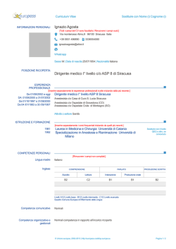
Europass
Curriculum Vitae
a
Personal information
First name / Surname
E-mail
Nationality
Date and place of birth
Gender
Giorgio Agugiaro
[email protected]
Italian
15 May 1977, Sandrigo (Vicenza), Italy
Male
Work experience
Dates
Occupation or position held
From March 2014
Researcher
Main activities and responsibilities
3D city modelling, spatial data integration, GIS, energy simulations, urban planning
Name and address of employer
AIT – Austrian Institute of Technology GmbH, Vienna, Austria (http://www.ait.ac.at)
Dates
Occupation or position held
Main activities and responsibilities
Name and address of employer
Dates
Occupation or position held
Main activities and responsibilities
Name and address of employer
Dates
Occupation or position held
Main activities and responsibilities
Name and address of employer
Dates
Occupation or position held
Main activities and responsibilities
Name and address of employer
Type of business or sector
Dates
Occupation or position held
Main activities and responsibilities
Name and address of employer
Type of business or sector
2013 (March till September)
Visiting Researcher (FBK-funded mobility project)
3D city modelling, energy simulations.
TUM – Technische Universität München, Department of Geoinformatics (http://www.gis.bv.tum.de)
2010 till February 2014
Independent Consultant
3D surveying and modelling. Data and spatial data integration, GIS, 3D city modelling, Project writing.
FBK – Fondazione Bruno Kessler, 3D Optical Metrology unit (http://3dom.fbk.eu)
2005
Independent Consultant
Geodata input and analysis, GIS.
University of Padova, Department of Architecture, Urban Planning and Surveying (www.daur.unipd.it),
Laboratory of Surveying and Geomatics
2004
3-month Internship (during the university master, see “Education and training”)
Urban planning, environmental impact assessment
PRO.TEC.O. s.c.r.l., Via C. Battisti, 39 – 30027 San Donà di Piave (VE) – Italy (http://www.proteco.cc)
Civil Engineering, Urban and Territorial Planning.
2003 (Jan-Jun)
Independent Consultant
Hydraulic modelling, hydraulic risk assessment.
MED Ingegneria S.r.l., Corso Stati Uniti, 1/17 – 35127 Padova – Italy (www.medingegneria.it)
Water-resources management, coastal hydraulics and geophysics.
Education and training
Dates
2006-2009
Page 1/8 - Curriculum vitae of
Agugiaro Giorgio
For more information on Europass go to http://europass.cedefop.europa.eu
© European Communities, 2003
Title of qualification awarded
EU Ph.D. (“Doctor Europaeus”, cf. http://www.stat.unipd.it/uploads/File/dottorato/new2012/informazioni/PhD_label_uk.pdf)
Principal subjects
Geomatics, Ph.D. thesis: “Advanced methodologies of acquisition, integration, analysis, management,
visualisation and distribution of data in the framework of archaeological and architectonical heritage.
Name and type of organisation
providing education and training
University of Padova, Department of Architecture, Urban Planning and Surveying
Technical University Berlin, Institute for Geodesy and Geoinformation Sciences (www.igg.tu-berlin.de).
Ph.D. funded by Fondazione Cariparo (Cassa di Risparmio di Padova e Rovigo) and DAAD
(Deutscher Akademischer Austausch Dienst).
Dates
Title of qualification awarded
Principal subjects
Name and type of organisation
providing education and training
Dates
Title of qualification awarded
Dates
Name and type of organisation
providing education and training
Dates
Name and type of organisation
providing education and training
Dates
Name and type of organisation
providing education and training
2003-2004
Master in “Projecting infrastructures in the framework of Territorial Planning”.
Civil Engineering
University of Padova.
1996-2002
University of Padova, Degree in Environmental Engineering. Final grade: 104/110.
2000-2001
Universität für Bodenkultur, Vienna, Austria. Erasmus/Socrates year exchange programme.
1991-1996
Scientific high school: Liceo Scientifico Statale “Paolo Lioy”, Vicenza, Italy. Final grade: 60/60.
1994-1995
“Bertha von Suttner” Integrierte Gesamtschule, Kaiserslautern, Germany.
School-year exchange program with AFS (see “Social skills and competences”, later on)
Personal skills and
competences
Mother tongue(s)
Italian
Other language(s)
Self-assessment
Understanding
Listening
Reading
Speaking
Spoken interaction
Writing
Spoken production
German
English
C2
Proficient user
C2
Proficient user
C2
Proficient user
C2
Proficient user
C1
Proficient user
C1
Proficient user
C1
Proficient user
C1
Proficient user
C1
Proficient user
C1
Proficient user
Spanish
A2
Basic user
A2
Basic user
A2
Basic user
A2
Basic user
A2
Basic user
Social skills and competences
Since 1995 I have been working as a volunteer for AFS at national and international level.
AFS is an international, volunteer-based organisation that selects, prepares and assists high-school
students and host families from all over the world willing to participate to intercultural exchange
programmes (www.afs.org). Good teamwork capabilities and intercultural skills are therefore
requested and endorsed. In 2000/01 I worked with the Vienna AFS chapter, in 2005 I took part to a
two-month EU-Japan exchange project (http://www2.afs.or.jp/volex2005).
Organisational skills and
competences
I have organised conferences, seminars and volunteers’ exchanges (mainly) in the AFS framework at
European level.
Computer skills and competences
Good knowledge of both Windows and Linux operating systems, GIS and CAD packages, DBMS,
FME, 3D City DB, photogrammetric and laser scanning specific software packages. Java and Python.
Teaching
Affiliations
Lectures and seminars on GPS, GIS & Laser scanning (in Italian, English and German, 2005-2013)
Seminars and summer schools organised by FBK – 3DOM (2010 – 2014).
International Society for Photogrammetry and Remote Sensing, WG 4.1: Methods for the Update and
Verification of Geospatial Databases. http://www2.isprs.org/commissions/comm4/wg1.html
2012-2016: Secretary
Page 2/8 - Curriculum vitae of
Agugiaro Giorgio
For more information on Europass go to http://europass.cedefop.europa.eu
© European Communities, 2003
Scientific publications
Please refer to the attached list of for a comprehensive list of scientific publications.
I hereby grant the permission to use my personal data according to the Italian Personal Data Protection Code, Legislative Decree no.
196/2003 June 2003.
Vienna, 16 June 2014
Page 3/8 - Curriculum vitae of
Agugiaro Giorgio
For more information on Europass go to http://europass.cedefop.europa.eu
© European Communities, 2003
AGUGIARO GIORGIO, Publications (as of June 2014)
Book chapters
Agugiaro, G., 2014, 2D & 3D GIS and web-based visualization. In "3D Recording and Modelling
in Archaeology and Cultural Heritage - Theory and Best Practices", F. Remondino and S. Campana
(Eds), pp. 101-112, Archaeopress, BAR International Series 2598, ISBN 9781407312309 (171
pages).
http://www.archaeopress.com/ArchaeopressShop/DMS/7FC96829-C390-4C6A-956B197BAC5BC67E.PDF
Agugiaro, G., Remondino, F., 2014, 3D GIS for Cultural Heritage sites: the QueryArch3D
prototype. In "3D Recording and Modelling in Archaeology and Cultural Heritage - Theory and
Best Practices", F. Remondino and S. Campana (Eds), pp. 145-150, Archaeopress BAR Publication
Series 2598, ISBN 9781407312309 (171 pages).
Journal Articles
- Poli, D., Remondino, F., Angiuli, E., Agugiaro, G., 2014, Radiometric and geometric evaluation
of GeoEye-1, WorldView-2 and Pléiades-1A stereo images for 3D information extraction. ISPRS
Journal of Photogrammetry and Remote Sensing (in press).
- von Schwerin, J., Richards-Rissetto, H., Remondino, F., Agugiaro, G., Girardi, G., 2013, The
MayaArch3D project: A 3D WebGIS for analyzing ancient architecture and landscapes. Literary
and Linguistic Computing. doi: 10.1093/llc/fqt059
- Agugiaro, G., Kolbe, T.H., 2012, A deterministic method to integrate triangular meshes of
different resolution. ISPRS Journal of Photogrammetry and Remote Sensing, vol. 71, pp. 96-109.
ISSN: 0924-2716.
http://www.sciencedirect.com/science/article/pii/S0924271612000858
- Agugiaro, G. Remondino, F., Girardi, G., von Schwerin, J., Richards-Rissetto, H., De Amicis, R.,
2011, QueryArch3D: Querying and visualizing 3D models of a Maya archaeological site in a
web-based interface. Geoinformatics FCE CTU Journal, vol. 6, pp. 10-17, Prague, Czech Republic.
ISSN: 1802-2669.
http://geoinformatics.fsv.cvut.cz/pdf/geoinformatics-fce-ctu-2011-06.pdf
- Remondino, F., Rizzi, A., Jimenez, B., Agugiaro, G., Baratti, G., De Amicis, R., 2011, The
Etruscan in 3D: from space to underground. Geoinformatics FCE CTU Journal, vol. 6, pp. 283290, Prague, Czech Republic. ISSN: 1802-2669. Web:
http://geoinformatics.fsv.cvut.cz/pdf/geoinformatics-fce-ctu-2011-06.pdf
- Remondino, F., Zucca, F., Agugiaro, G., Rizzi, A., 2010, Pareti verticali e LiDAR - Esperienze
dalle Dolomiti. GEOmedia, vol. 5, pp. 6-10. ISSN: 1128-8132.
- Achilli, V., Agugiaro, G., Salemi, G., Stevanato, G., 2008, Modello digitale 3D dell’area
archeologica di Montegrotto mediante integrazione di dati GPS e laser scanner in ambiente
GRASS GIS. Bollettino della Società Italiana di Fotogrammetria e Topografia, vol. 1(2008), pp. 8399. ISSN 1721-971X.
Page 4/8 - Curriculum vitae of
Agugiaro Giorgio
For more information on Europass go to http://europass.cedefop.europa.eu
© European Communities, 2003
- Agugiaro, G., Salemi, G., Achilli, V., Cervato, C., Cuppari, F., 2008, Il rilievo laser scanner con
texturizzazione HDR dei portali della chiesa di Mattia a Budapest. Recupero e conservazione, n.
83, anno XIV, deLettera Editore, pp. 40-45.
- Agugiaro, G., Achilli, V., Salemi, G., 2007, Il rilievo topografico e la creazione di un modello
digitale 3D texturizzato in Montegrotto Terme, via Neroniana. Indagine archeologica 2006.
(Zanovello P., Basso P., eds.) Quaderni di Archeologia del Veneto, XXIII, pp. 19-(21)-28.
- Biagi, L., Sansò, F., Achilli, V., Agugiaro, G., Belluomini, P., Benciolini, B., Betti, B., Bonacina,
C., Caldera, S., Casella, V., Cosso, T., Esposito, S., Forlani, G., Franzini, M., Gemini, M., Mazzoni,
A., Pinto, L., Salemi, G., Scaioni, M., Scuratti, M., Sguerso, D., Spalla, A., Tornatore, V., Vassena,
G., Visconti, M.G., 2006, Il servizio di posizionamento in Regione Lombardia e la prima
sperimentazione sui servizi di rete in tempo reale. Bollettino della Società Italiana di
Fotogrammetria e Topografia, vol. 3(2006), pp. 71-90. ISSN: 1721-971X.
- Agugiaro, G., Salemi, G., 2004, Integrazione di metodologie VAS e VIA con GRASS. Case
study: la tangenziale ovest di Padova. Geomatic Workbooks, vol. 3, Geomatics Laboratory,
Politecnico di Milano - Polo Regionale di Como. ISSN: 1591-092X
- Agugiaro, G., Salemi, G., Rizzato, P., Achilli, V., 2003, Integrazione di metodologie VAS e VIA
in un sistema informativo geografico. Case study: la tangenziale ovest di Padova. Documenti del
Territorio, vol. 52, Centro Interregionale di documentazione per le informazioni territoriali, pp. 3-9.
http://www.centrointerregionale-gis.it/Rivista/Arretrati/Rivista_52.asp
Conference Papers
- Auer, M., Agugiaro, G., Billen, N., Loos, L., Zipf, A., 2014, Web-based visualization and query
of semantically segmented multiresolution 3D models in the field of Cultural Heritage. ISPRS
Annals of the Photogrammetry, Remote Sensing and Spatial Information Sciences, vol. II-5, pp. 3339. ISPRS Technical Commission V Symposium 23–25 June 2014, Riva del Garda, Italy.
http://www.isprs-ann-photogramm-remote-sens-spatial-inf-sci.net/II-5/33/2014/isprsannals-II-5-332014.pdf
- Agugiaro, G., 2014, From sub-optimal datasets to CityGML-compliant 3D city model:
experiences from Trento, Italy. Int. Arch. of the Photogrammetry, Remote Sensing and Spatial
Information Sciences, vol. XL-4, pp.7-13. ISPRS Commission IV Symposium, 14–16 May 2014,
Suzhou, China.
http://www.int-arch-photogramm-remote-sens-spatial-inf-sci.net/XL-4/7/2014/isprsarchives-XL-47-2014.pdf
- Billen, N., Auer, M., Loos, L., Agugiaro, G., Zipf, A., 2013, MayaArch3D: An integrative
analytical platform for 3D archaeological data. Scientific Computing and Cultural Heritage 2013
conference, Heidelberg, Germany, pp. 9-12.
http://www.academia.edu/5169712/SCCH13_-_Scientific_Computing_and_Cultural_Heritage
- Nex, F., Remondino, F., Agugiaro, G., Filippi, R., Poletti, M., Furlanello, C., Menegon, S.,
Dallago, G., Fontanari, S., 2013, 3D Solarweb: A solar cadastre in the Italian Alpine landscape.
Int. Archives of the Photogrammetry, Remote Sensing and Spatial Information Sciences, vol XL7/W2, pp. 173-178. ISPRS2013-SSG, 11-17 November 2013, Antalya, Turkey.
http://www.int-arch-photogramm-remote-sens-spatial-inf-sci.net/XL-7-W2/173/2013/isprsarchivesXL-7-W2-173-2013.pdf
Page 5/8 - Curriculum vitae of
Agugiaro Giorgio
For more information on Europass go to http://europass.cedefop.europa.eu
© European Communities, 2003
- Fronza, A., Dalla Torre, S., Agugiaro, G., 2013, Docfa 4: rappresentazione grafica vettoriale e
integrazione 3D. Atti della 17a Conferenza Nazionale ASITA, Riva del Garda (TN), pp. 723-730.
http://www.geopartner.it/download/asita_2013_v-02.10.2013.pdf
- Filippi, R., Poletti, M., Furlanello, C., Nex, F., Remondino, F., Agugiaro, G., Menegon, S.,
Dallago, G., Fontanari, S., 2013, 3D SolarWeb: approccio integrato per la stima del potenziale
fotovoltaico sui centri abitati. Atti della 17a Conferenza Nazionale ASITA, Riva del Garda (TN),
pp. 583-596.
- Saygi, G., Agugiaro, G., Hamamcıoglu-Turan, M., Remondino, F., 2013, Evaluation of the roles
of GIS and BIM for the information management of historical buildings. ISPRS Annals of the
Photogrammetry, Remote Sensing and Spatial Information Sciences, vol. II(5/W1), pp. 283-288.
XXIV International CIPA Symposium, Strasbourg, 2-6 September.
http://www.isprs-ann-photogramm-remote-sens-spatial-inf-sci.net/II-5-W1/283/2013/isprsannals-II5-W1-283-2013.pdf
- Poli, D., Remondino, F., Angiuli, E., Agugiaro, G., 2013, Evaluation of Pleiades-1A triplet on
Trento testfield. Int. Arch. of Photogrammetry, Remote Sensing and Spatial Information Sciences,
vol. XL-1/W1, pp. 287-293. ISPRS Hannover Workshop 2013, Germany.
http://www.int-arch-photogramm-remote-sens-spatial-inf-sci.net/XL-1-W1/287/2013/isprsarchivesXL-1-W1-287-2013.pdf
- Macay Moreira, J. M., Nex, F., Agugiaro, G., Remondino, F., Lim, N., 2013. From DSM to 3D
building models: a quantitative evaluation. Int. Arch. of Photogrammetry, Remote Sensing and
Spatial Information Sciences, vol. XL-1/W1, pp. 213-219. ISPRS Hannover Workshop 2013,
Germany.
http://www.int-arch-photogramm-remote-sens-spatial-inf-sci.net/XL-1-W1/213/2013/isprsarchivesXL-1-W1-213-2013.pdf
- Richards-Rissetto, H., Robertson, J., Remondino, F., Agugiaro, G., Girardi, G., von Schwerin, J.,
2012, Kinect and 3D GIS in Archaeology. Proc. 18th IEEE Int. Conference on Virtual Systems and
MultiMedia (VSMM 2012), Milan, Italy, pp. 331-337.
http://ieeexplore.ieee.org/stamp/stamp.jsp?arnumber=06365942
- Agugiaro, G., Nex, F., Remondino, F., De Filippi, R., Droghetti, S., Furlanello, C., 2012, Solar
radiation estimation on building roofs and web-based solar cadaster. ISPRS Annals of the
Photogrammetry, Remote Sensing and Spatial Information Sciences, vol. I(2), pp. 177-182. XXII
ISPRS Congress, Melbourne, Australia.
http://www.isprs-ann-photogramm-remote-sens-spatial-inf-sci.net/I-2/177/2012/isprsannals-I-2177-2012.pdf
- Agugiaro, G., Poli, D., Remondino, F., 2012, Testfield Trento: Geometric evaluation of very high
resolution satellite imagery. Int. Arch. of Photogrammetry, Remote Sensing and Spatial
Information Sciences, vol. XXXIX-B1, pp. 191-196. XXII ISPRS Congress, Melbourne, Australia.
http://www.int-arch-photogramm-remote-sens-spatial-inf-sci.net/XXXIXB1/191/2012/isprsarchives-XXXIX-B1-191-2012.pdf
- Capaldo, P., Crespi, M., Fratarcangeli, F., Nascetti, A., Pieralice, F., Agugiaro, G., Poli, D.,
Remondino, F., 2012, DSM generation from optical and SAR high resolution satellite imagery:
methodology, problems and potentialities. IEEE Geoscience and Remote Sensing Symposium
(IGARRS 2012), Munich, Germany, pp. 6936-6939.
http://ieeexplore.ieee.org/stamp/stamp.jsp?tp=&arnumber=6352567
Page 6/8 - Curriculum vitae of
Agugiaro Giorgio
For more information on Europass go to http://europass.cedefop.europa.eu
© European Communities, 2003
- Richards-Rissetto, H., Robertsson, J., von Schwerin, J., Agugiaro, G., Remondino, F., Girardi, G.,
Forte, M., 2012: Hands-Off: using Kinect to virtually query the ancient Maya city of Copan,
Honduras. Computer Applications and Quantitative Methods in Archaeology (CAA), 26-30 March,
Southampton, UK.
- Remondino, F., Rizzi, A., Agugiaro, G., Jimenez Fenandez-Palacios, B., Menna, F., Nex, F.,
Baratti, G., 2011, Rilievi e modellazione 3D. Atti della 15a Conferenza Nazionale ASITA, Reggio
di Colorno (Parma), Italy. ISBN: 978-88-903132-6-4.
http://www.attiasita.it/ASITA2011/Pdf/046.pdf
- Agugiaro, G., Remondino, F., Stevanato, G., De Filippi, R., Furlanello, C., 2011, Estimation of
solar radiation on building roofs in mountainous areas. Int. Arch. of Photogrammetry, Remote
Sensing and Spatial Information Sciences, vol. 38(3/W22), pp. 155-160. ISSN: 1682-1777.
http://www.pia11.tum.de/pub/PIA11_Agugiaro_et_al.pdf
- Agugiaro, G., Remondino, F., Girardi, G., von Schwerin, J., Richards-Rissetto, H., De Amicis, R.,
2011, A web-based interactive tool for multi-resolution 3D models of a Maya archaeological site.
Int. Arch. of Photogrammetry, Remote Sensing and Spatial Information Sciences, vol. 38(5/W16),
pp. 23-30, (on CD-Rom). ISSN: 1682-1777.
http://www.int-arch-photogramm-remote-sens-spatial-inf-sci.net/XXXVIII-5W16/23/2011/isprsarchives-XXXVIII-5-W16-23-2011.pdf
- Remondino, F., Zucca, F., Agugiaro, G., Rizzi, A., Plos, D., Sgrenzaroli, M., 2010, Mapping
vertical cliffs - Experiences from the Dolomites. European Lidar Mapping Forum 2010, Den Haag,
The Netherlands.
- Agugiaro, G., Kolbe, T.H., 2009, Embedding of high resolution models into a low(er) resolution
digital elevation model. (Seyfert, E., ed.) Band 18 der Jahrestagung der Deutschen Gesellschaft für
Photogrammetrie, Fernerkundung und Geoinformation e.V., pp. 217-226, Potsdam, Germany.
ISSN: 0942-2870.
http://www.citygml.org/fileadmin/user_upload/_temp_/Agugiaro/2009_02_AgugiaroKolbe_Jena.pd
f
- Agugiaro, G., Kolbe, T.H., 2009, Definition of a transition surface with the purpose of
integration between a laser scanner 3d model and a low resolution DTM. Int. Arch. of
Photogrammetry, Remote Sensing and Spatial Information Sciences, vol.38(5/W1), (on CD-Rom).
ISSN: 1682-1777.
http://www.isprs.org/proceedings/XXXVIII/5-W1/pdf/agugiaro_kolbe.pdf
- Salemi, G., Achilli, V., Agugiaro, G., 2007, High dynamic range (HDR) textures in the
framework of cultural heritage. (Gruen, A., Kahmen H., eds.) Optical 3-D Measurements
Techniques VIII, vol. I, pp. 286-293, Zurich, Switzerland. ISBN: 3-906467-67-8.
- Cola, S., Simonini, P., Achilli, V., Salemi, G., Agugiaro, G., 2006, Displacement field of a 1g
model slope from digital image techniques. (Zhang, L.M., Wang, Y.H., eds.) Physical Modelling in
Geotechnics - 6th ICPMG '06., vol. 1, pp. 177-180. BALKEMA – Proceedings and Monographs in
Engineering, Water and Earth Sciences. Taylor & Francis Group (UK). ISBN: 0-415-41586-1.
- Agugiaro, G., Salemi, G., Achilli, V., Polo, P., Mastrocola, P., 2003, Creazione di DTM in ambito
fluviale (da dati CTR e di rilievo) per la valutazione del rischio idraulico. Atti della 7a conferenza
nazionale ASITA, vol. 1, pp. 21-26. ISBN: 88-900943-5-4.
Page 7/8 - Curriculum vitae of
Agugiaro Giorgio
For more information on Europass go to http://europass.cedefop.europa.eu
© European Communities, 2003
Conference Posters
- von Schwerin, J., Richards-Rissetto, H., Agugiaro, G., Remondino, F., Girardi, G., 2012,
QueryArch3D: A 3D WebGIS System linking 3D visualizations to archaeological data.
Computer Applications and Quantitative Methods in Archaeology (CAA), Southampton, UK.
- von Schwerin, J., Richards-Rissetto, H., Agugiaro, G., Remondino, F., Girardi, G., 2012,
QueryArch3D: A 3D WebGIS System linking 3D Visualizations to Archaeological Data. 2nd
Cracow Maya Conference, Jagiellonian Univeristy, Cracow, Poland.
- Agugiaro, G., Drigo, M., Martini, M., Signorini, M., Frangipane di Regalbono, A., Salemi, G.,
Cassini, R., 2010, Integrated surveillance of vector-borne diseases using GIS: definition and
implementation of an open-source environment. Atti del XXVI Congresso nazionale della Società
Italiana di Parassitologia, Perugia, Parassitologia, vol. 52(1-2), pp. 293. ISSN: 0048-2951.
- Drigo, M., Martini, M., Signorini, M., Montarsi, F., Porcellato, E., Agugiaro, G., Salemi, G.,
Cassini, R., 2010, Preliminary results on the presence of ticks and tick-borne pathogens in the
Colli Euganei Natural Park, Veneto Region. Atti del XXVI Congresso nazionale della Società
Italiana di Parassitologia, Perugia, Parassitologia, vol. 52(1-2), pp. 167-168. ISSN: 0048-2951.
- Signorini, M., Montarsi, F., Drigo, M., Agugiaro, G., Frangipane di Regalbono A., Cassini R.,
2010, Increment of sandflies density detected through a 5-years entomological monitoring of a
recently described leishmaniosis focus in north-eastern Italy. Atti del XXVI Congresso nazionale
della Società Italiana di Parassitologia, Perugia, Parassitologia, vol. 52(1-2), pp. 185. ISSN: 00482951.
Ph.D. thesis
- Agugiaro, G., 2009, Advanced methodologies of acquisition, integration, analysis, management,
visualization and distribution of data in the framework of archaeological and architectonical
heritage. Università di Padova & TU Berlin.
http://paduaresearch.cab.unipd.it/2342/
Other publications
- Occasional articles (in German) for the Austrian AFS magazine
http://www.afs.at/news-and-events/zeitschrift-intercultura/
- EU-Japan Handbook, 2005 (EU-EFIL-AFS Japan Project)
http://www2.afs.or.jp/volex2005/index.html
- Progetto "Rumore Giovane", 2004 (with Legambiente Padova)
http://www.legambientepadova.it/files/rumore_giovane_definitivo.pdf
Page 8/8 - Curriculum vitae of
Agugiaro Giorgio
For more information on Europass go to http://europass.cedefop.europa.eu
© European Communities, 2003
© Copyright 2026 Paperzz