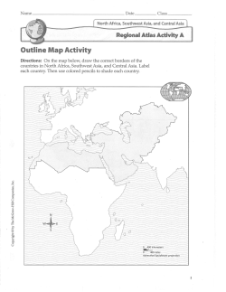
Publication of the Atlas of the Seas
-The 140th Anniversary of the Hydrographic Office of Japan-
by Kunio YASHIMA
GEBCO GC member
Japan Hydrographic Association
Content of Presentation
・ Outline of the Atlas of the Seas
・ What is JHA ?
・ History of Hydrographic Activities in Japan
・ Example s of 3-D seafloor images of ocean and seas
surrounding Japan
・ Example of 3-D seafloor images of Japan’s bays
and inland sea
・ Example of 3-D images of submarine volcano
・ Example of ocean currents images around Japan
2
Outline of Atlas of the Seas
・ Published in September 12 2012 by JHA, to celebrate the
140 anniversary of the Hydrographic Office of Japan
・ Edited by Editorial Committee, Atlas of the Seas,
consisting of JHOD & JHA staffs.
・ Intension……to introduce easy-to-understand visually
the ocean and seas surrounding
Japan, mainly seafloor features by 3-D methods
・ Style……A4 size, 60pages booklet, not for sale
3
•What is JHA?
JHA:
• was established in 1971.
• is a public service corporation established
under supervision of JCG.
• is responsible for and engaged in:
• reproduction & distribution of Japanese
official paper charts & ENC
• conducting training courses in
hydrography & oceanography
• dissemination in hydrography & oceanography
4
The History of Hydrographic Activities in Japan
1871
1872
1921
1925
1925
1948
1953
1971
1979
1984
2002
Hydrographic Department was established under the Navy.
First Japanese nautical chart was published.
IHB was established with Japan as a member.
First Bathymetric survey was conducted using acoustic sonar
equipment.
First Bathymetric Chart- The Adjacent Seas of Japan- was published.
HD was incorporated into Maritime Safety Agency, which was
newly established in 1948 (later renamed Japan Coast Guard).
SV Daigo Kaiyo met with a shipwreck by the Myojin-sho volcanic
eruption.
Relief Contour Methods (3-D image by manual) Bathymetric Charts
N0.6901 (3-D image by manual) was published.
GEBCO 5.06 was compiled under the scientific coordinator, Dr Yoshio
Iwabuchi (JHD) and published (CHS).
SV Takuyo obtained 10,924m as the world’s deepest depth in the
Challenger Deep of Mariana Trench . (GEBCO adopted 10,920 m
instead of 11,034 by Vityaz in 1957).
5
HD was renamed Hydrographic and Oceanographic Dept .
First Japanese nautical chart
“Kamaishi Bay” was published in 1872.
First Bathymetric Chart published in 1925.
Relief Contour Method (3-D image by manual)
Bathymetric chart was published in 1971.
GEBCO 5.06 was compiled under the scientific coordinator
Dr Yoshio Iwabuchi, JHD and published by CHS in 1979.
SV Takuyo obtained 10,924m in the world’s deepest
depth”Challenger Deep”in 1984.
HMS ChallengerⅧ visited JHD in 1952
Challenger Deep and SV Takuyo
Cover of Atlas of the Seas with red and
cyan glasses
Index map of the Atlas
Tectonic plates surrounding Japan
View from space above Tokyo
Boundary between the Pacific P. and the North American P.
Kuril-Kamchatka Trench and Japan Trench
Daiichi-Kashima Seamount
Boundary between the Eurasian P. and the Philipine
Sea P.-Nankai Trough
Nankai Trough Anaglyph
The meeting point of three plates-Suruga Bay-Mt.Fuji
The ocean floor of the Pacific Plate
Pacific seafloor with many seamounts
Takuyo-Daigo Seamount (Guyot)
The ocean floor of the Eurasian Plate
Toyama Seachannel-meandering extends about 750km
Submarine Volcanoes
Distribution of volcanic islands and
submarine volcanoes
Myojin-Sho
submarine caldera
Japan‘s Bays and the Inland Sea
Seto Naikai (Inland Sea)
Peak flow of tidal currents
Naruto Strait
Tidal current in Naruto Strait is 10.6 knt
(fastest in Japan) and generates big vortices.
Cauldron in Naruto Strait
Hayasui Strait-World’s Deepest Cauldron
Peak current velocity is more than 5
knots(about 9km/h)
Maximum depth 460m (about 360m
below surrounding seabed)
Ocean currents and sea surface temperature
Kuroshio non-large meander
Kuroshio large meander
Arigato
Thank you for your kind Attention
Kunio YASHIMA
JHA
2 Oct 2012
26
© Copyright 2026 Paperzz