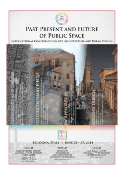
WHAT IS “PAST PRESENT AND FUTURE OF PUBLIC SPACE”?
“Past present and future of public space” is an Italian project, developed as an academic
postdoctoral research activity by Luisa Bravo, at the Department of Architecture, University
of Bologna (Italy), under the supervision of an international Scientific Committe and with the
support of a Steering Committee.
Started in 2012 and presented for the first time in Italy at the Biennale dello Spazio Pubblico
in 2013, the project has already involved more than ten prestigious foreign Universities
and more than one hundred international scholars and professionals, public administrators,
artists and designers, photographers and film-makers, coming from Europe (Italy, The
Netherlands, Switzerland, Norway, Spain, Portugal, UK, Greece, Germany, Cyprus,
Turkey, Bosnia Herzegovina), from the Middle East (Lebanon, Israel, Saudi Arabia), from
China (Hong Kong), from Taiwan, Australia, United States of America, from South America
(Brazil, Colombia) and from New Zealand.
Nationals partners are involved as well, such as INU - Italian National Institute for Urban
Planners, Biennial of Public Space, International Society of Biourbanism, CNBA - National
Council of Architectural Libraries, IBC - Institute of Cultural Heritage, Emilia-Romagna
Region, Laboratorio di ricerca sulle città dell’Università di Bologna, Urban Center Bologna,
Municipality of Bologna, Academy of Fine Arts in Bologna, Cineteca di Bologna, Professional
Association of Architects in Bologna, Professional Association of Engineers in Bologna,
New Design Center Emilia-Romagna, Fondazione Cassa di Risparmio Bologna and Genus
Bononiae.
The aim of the project is the exploration and discussion of new dimensions of public realm,
intended as results of research activities, through a multidisciplinary approach on public
space and related topics, comparing theories and projects with advisors and correspondents
from different contexts.
The international conference, which takes place from June 25 to June 27, 2014 in Bologna
(Italy), is intended to be a large public event, promoted and supported by City Space
Architecture.
WHAT IS “CITY SPACE ARCHITECTURE”?
City Space Architecture is a nonprofit cultural association, founded in Bologna (Italy) in
2013, aimed to create a network of people from all over the world discussing about architecture and urban design.
http://www.cityspacearchitecture.org
PROJECT COORDINATOR
Luisa Bravo
Charter Member and President of City Space Architecture, Italy
SCIENTIFIC COMMITTEE
Margaret Crawford Marc Crunelle
Mirko Guaralda Maria Hadjisoteriou Nilly R. Harag Karin Hofert Konstantinos Ioannidis
Richard Ingersoll José Manuel Madrigal
Roberto Mingucci Valentina Orioli
Piero Orlandi Angela Petrou Joaquim Sabaté Bel Rania Sassine Claudio Sgarbi Hendrik Tieben University of California Berkeley, USA
Université Libre de Bruxelles, Belgium
Queensland University of Technology, Brisbane, Australia
University of Nicosia, Cyprus
Bezalel Academy of Arts and Design, Jerusalem, Israel
Universitat Politècnica de Catalunya, Barcelona, Spain
University of Stavanger, Norway
Syracuse University in Florence, Italy
Lebanese American University, Lebanon
Università di Bologna, Italy
Università di Bologna, Italy
Institute of Cultural Heritage, Emilia-Romagna Region, Italy
University of Nicosia, Cyprus
Universitat Politècnica de Catalunya, Barcelona, Spain
Lebanese Academy of Fine Arts, Lebanon
Carleton University, Ottawa, Canada
Chinese University of Hong Kong, China
STEERING COMMITTEE
Luisa Bravo
Antonio Caperna
Giuseppe De Luca
Pietro Garau
Manfredo Manfredini
Saverio Mecca
Raffaele Milani
Pierluigi Molteni
Raffaella Radoccia
Charter Member and President of City Space Architecture, Italy
International Society of Biourbanism, Rome, Italy
Università degli studi di Firenze, Italy
Biennale dello Spazio Pubblico, Italy
University of Auckland, New Zealand
Università degli studi di Firenze, Italy
Laboratorio di ricerca sulle città, Università di Bologna, Italy
Accademia Belle Arti di Bologna, Italy
Biennale dello Spazio Pubblico, Italy
ORGANIZING STAFF | Charter Members and Councilors of City Space Architecture
Camilla Carmagnini, Valerio Francia, Simone Garagnani
VOLUNTEERS | Members of City Space Architecture
Danilo Calza, Olimpia Cermasi, Eleonora Fabrizio, Simone Fenu, Alessia Francia, Luca
Poni, Silvia Tagliazucchi, Ivo Tudgiarov, Francesca Zoboli
ACKNOWLEDGMENT
People
Giovanni Bacci, Dipartimento di Architettura, Università di Bologna
Elettra Bastoni, Elettra Bastoni photographer
Angela Belluzzi, Stefania Giovagnoli, Ufficio Cerimonie, Università di Bologna
Marina Boldrini, Biblioteca comunale Sala Borsa
Paola Congedo, You Can Group, Bologna
Gian Luca Farinelli, Francesca Andreoli, Anna Di Martino, Cineteca di Bologna
Cristina Franchi, Silvia Di Vincenzo, Genus Bononiae
Pier Giorgio Giannelli, Marta Badiali, Ordine Architetti di Bologna
Giovanni Ginocchini, Urban Center Bologna
Matteo Giovanardi, Torre Prendiparte
Silvana Grandi, Scuola di Ingegneria e Architettura, Università di Bologna
Antonio Iascone, Studio Iascone Bologna
Raffaella Inglese, Coordinamento Nazionale Biblioteche di Architettura
Egidio Lomi, Accademia Belle Arti di Bologna
Anna Manfron, Sonia Venturi, Biblioteca Comunale dell’Archiginnasio
Fabio Mantovani, Fabio Mantovani photographer
Pierluigi Molteni, Studio Molteni Bologna
Milena Naldi, Quartiere San Vitale, Comune di Bologna
Mario Piccinini, Istituto Nazionale di Urbanistica
Mario Spada, Chiara Pignaris, Biennale dello Spazio Pubblico
Alfredo Ricciotti, Hotel San Donato
Elena Roda, Valerio Cosma, Circuito Cinema Bologna
Giuseppe Mario Tomaselli, Valentina Fini, Compositori Comunicazione
Partners
Biblioteca Archiginnasio, Bologna
Cinema Europa, Bologna
Hotel San Donato, Bologna
Scuola di Ingegneria e Architettura, Università di Bologna
Biblioteca Sala Borsa, Bologna
Hotel I Portici, Bologna
You Can Group, Bologna
Book of abstracts
Morphology and Design
Historic patterns: conservation and sustainability
Suburban world
Walkability, cyclability, green corridors
Quality of architecture and urban design
Space and Remembrance.
Sarajevo, the Historical Syntax of a Fragmented City.
Inés Aquilué Junyent
Universidad Politécnica de Cataluña, Spain - [email protected]
After the research done on fragmented cities such as Berlin or Jerusalem by well-known
authors, the case study of a new fragmented urban environment is being elaborated: the
reconstruction of Sarajevo, ex- Yugoslavian city and current capital of Bosnia-Herzegovina.
The aim of the studies reported here was to identify the inclusion of collective memory in
urban space after a warfare conflict. To communicate the real effect of remembrance in
public spaces, devastated city is being analysed as an informational field.
City overlaps layers of information, layers of history. Each layer has its own space under
construction and thanks to these overlaps urban spaces build their own identity. The complex
net that connects the different historical layers can be analysed through a morphological
perspective, to identify the traces that produce this virtual historical map. The deepness of
each trace is directly related with the process that conformed it, this is the reason of analysing
spaces under conflict, in view of the fact that they suffer severe, dangerous and permanent
urban effects.
In this case the Siege of Sarajevo was a recent conflict that took place from April 1992 till
February 1996. During almost four years the city changed completely and the present urban
planning has to resolve the question of how to maintain the memory of the conflict. The Siege
is an irreversible part of the history of Sarajevo and also of its urban space. In that sense the
objective is to highlight which strategies are elaborated to face the inclusion of memory in a
city that is not physically divided, but after the war was separated by an administrative border
between the Federation of Bosnia and Herzegovina and the Republika Srpska.
The studies showed that some historical heritage has been maintained but some other has
been mislead. Besides, the society of Sarajevo is elaborating a debate about the space under
historical memory such as the construction of The Siege of Sarajevo Museum or the opening
of the War Tunnel of Hope Museum. The debate about how to solve the problem about the
spatial memory is also a debate about the sustainability of the city. Furthermore, ecology is
understood as an evolution of the city that does not eradicate any of its historical layers and
its deep informational traces. Sarajevo is involved in a decisive construction of its new social
system extremely related with its spatial system and its borders. In addition the discussion
about the social and special heterogeneity should be submitted.
Keywords: Public space, places, landscape of memory.
A102 - Morphology and design. Historic Patterns: Conservation and Sustainability.
Public open spaces of historic centres
as a resource for urban re-composition.
G. Bertrando Bonfantini
Politecnico di Milano, Italy - [email protected]
The first informal calls about the cultural heritage by Horizon 2020 program address this
issue to a perspective of development of European tourism. This objective has to be carefully
considered and discussed.
This paper aims to contrast the idea that the future of historic centres in today contemporary
cities is to become ‘thematic parks’ oriented to a touristic urban economy. This idea is the
epigonic legacy of a banal functionalism, the limits of whom were highlighted since the
Sixties by the criticisms against the abuse of the zoning town-planning techniques, and a
reductive notion of living space.
To conceive and set up the contemporary city as a patchwork of thematic parks and highly
specialised urban parts will produce the effects of a relevant loss of its real habitability
conditions. On the contrary, historic centres and their public open spaces can play a
meaningful, plural and complex role as ‘urbanity infrastructures’ in nowadays cities.
To conceive the historic centre and its public open space as an ‘urbanity infrastructure’
means to underscore their characters as an endowment for the contemporary city: a potential
that may, or may not, find expression in helping to bring about habitability conditions in
present-day urban areas. Not a space taken away, not a self-referential place, but rather a
space that is embedded in the contemporary city, with a role to play in its overall organisation.
In the palimpsest of the new urban formations, the historic city is an opportunity for the
formulation of a re-composition project, in view of the great ductility and the rare relational
qualities that characterise it. This is a space that continues to play a potentially strategic role
in the structuring of the system of urban centralities and the organisation of high urbanity
and habitability areas.
Thus, the historic city has become a theme/system in the urban restructuring plan towards
habitability targets for the contemporary city. At the heart of the planning action on the
historic city, there is that which today represents a complex set of integrated urban policies.
This is a set of policies which might affect not just the spatial characters – built-up space
and even more importantly open space – and the operating modes or the performance
profiles (for example, in terms of time schedules), but also the living practices of the different
population groups in the composition of their possible ‘coexistence’ modalities for effective
and livable urban habitats.
Keywords: Historic centres, historic city, public open space, urban regeneration, urban recomposition.
A107 - Morphology and design. Historic Patterns: Conservation and Sustainability.
The “regaining” of public spaces
to enhance the historic urban landscape.
Roberto Bolici, Matteo Gambaro, Cristiana Giordano
Politecnico di Milano, Italy - [email protected]
One of the major themes for building activities in the nearby future is represented by the
requalification of the urban heritage and by increasing quality in living the city (CRESME
2001), in strict relationship with the environment and with the necessity of integrating all the
components that are involved. Because of this, the contemporary research is mainly focused on
themes such as regeneration and requalification of built heritage: that’s why, even historically,
open spaces design comes second. This attitude has caused a progressive downgrading of
open spaces: from the center of social life to residual space, “without a shape, without precise
symbols and without a name” (Huet 1999). The main target of this essay (referring to topic
1 about the morphology and the design of public spaces for both recovering historic patterns
and improving the quality of urban shapes) is that of identifying new sceneries for the design
of public spaces for enhancing particularly relevant urban landscapes, that are often restricted
or protected, parts of the cultural heritage intended as “a coherent set of different heritages,
buildings and landscapes, that is both identifying value of the local context and a resource
for further development” (Schiaffonati and others 2011). Using the systemic approach of
technological and environmental design, and through the analysis of specific case histories,
we will have the possibility to find out what is critical so that we can suggest new models in an
ecological and environmental key, starting from the benefits of spaces and their morphological,
cultural and perceptive aspects. In this way the urban shape will regain its articulated identity
optimizing the relationship between technological innovation and quality of inhabited space,
and realizing a system of urban parts connected one with the other to the existing city. esigning
public spaces means also designing how to use them, that’s why it will be fundamental the
enhancement of cultural characteristics, even through the reinterpretation of historic road
network, “giving a route a dialogue value, delineating sequences and marking out hierarchies,
constructing itineraries between streets and public squares, reconnecting residential areas in
routes and suggesting a synopsis of various possible narratives” (Jappelli 2012). The principle
of this proposal is “to free the spaces”, against the general rule of “cannibalization”; creating the
conditions to transform a space into a place, finding a new meaning to the design that becomes
clearer also to the community (Dierna 2005). Furthermore, the combined use of tangible and
intangible public spaces (that means the web and the other forms of communication that are
typical of our age), could represent an important opportunity to experiment technological
infrastructures and participative processes.
Keywords: Public spaces system, urban design, management plan, enhancement of cultural
heritage, historic urban landscape.
A108 - Morphology and design. Quality of architecture and urban design.
Relation between public space and territory:
a civic identity defined from the history.
Silvia Tagliazucchi
Università di Bologna, Italy - [email protected]
In the history, the public spaces have always distinguished urban settlements of every
civilization, they have determined the focus of the whole urban structure , the focal point
of the meeting and the proportion of the space in the Community model, described by the
straight relation between the physical size and the identity of the urban context.
Now the public spaces often don’t satisfy needs of society: the extension of the city and the
improper space distributions in the suburbs’ urban planning, together with the lack of time
that characterizes our era, have led the citizens to use, with the same public standard, places
with other functions. The loss of recognition of the public space as a fulcrum, inevitably
leads to a loss of its identity and its symbolic shared concept according to a collective
sensorial quality. The mismatch to a specific space, then it leads to a total involvement civil
environment, involving to extend the considerations and excluding distinctions or solutions
for places and for representation scales considered.
“Our feelings are local, but our experiences relate to the whole territory”. This process
makes the whole current considerations made by Saverio Muratori in the 60s, because
he outlined, in a diachronic succession of civilizations and their corresponding territorial
system, a sort of universal and very real spirit’s phenomenology that marks the different faces
of different society. He defined the territory as “the highest scale representation category of
organisms in the anthropic space”, containing all possible other scalar degrees (from town
to ordinary objects).
These thinkings have been fleshed out on paper with the cartographic interpretations that
make up the last of his works, Studi per una operante storia del territorio. For Muratori,
the need for a recovery of consciousness and consequently, its re-acquisition of knowledge
of the territory, are possible only through his interpretation. The interpretation of the
territory is considered at any scale of representation, with the intention of emphasizing the
close relationship between each constituent element of human environment, giving them
the opportunity to recover again the civic values especially for the public spaces, nowadays
hardly to distinguish.
Keywords: Identity, public space, territory, history, Saverio Muratori.
A109 - Morphology and design. Historic Patterns: Conservation and Sustainability.
(Re) construction of historical memory: identity
and urban re-valuation of the first diagonal of Chile.
Andrea Fernández Covarrubias, Emilio Reyes Schade, Julio Sandoval González
Universitat de Barcelona, Spain - [email protected]
In the process of urban regeneration, the re-valuation of public space and the elements
that configure it assume the potential in the regeneration process, integrating elements as
the basis components in the consolidation of urban dynamics. Also the contained memory of
the city understood as public inheritance, is a continuous and participatory process in which
we construct the sense of belonging and place.
The (re) construction of historical memory of the Avenida Diagonal Pedro Aguirre Cerda,
the first diagonal axis of Chile, has partly defined the structure of the landscape of the city
of Concepcion, being a container of social, historical and natural processes that accidentally
occurred.
Lamentable yet ideal scenario have been the successive earthquakes that have made our
country a fertile ground for rethinking and materialising ideas. It is, in the post-1939
earthquake, when the reconstruction permitted revolutionary thoughts coming from modern
Europe and that were materialised, with a privileged location in both the historical space and
in the physical city.
The appearance of this axis, in the apposition of the foundational damero’s plane, is an
innovative project that breaks this historic urban trend, taking into Chile, and more specific
into Concepción, a chance to expound innovative ideas, aimed to change the urban landscape
prevailing at that time.
In terms of spatial configuration, this diagonal axis is a superposition of historical layers
in their development and materialization that has become a mass of history and that is still
in development. In other words, it is dynamic and open, consolidating it periodically as an
identity space city landscape, harmoniously uniting both the civic world represented by the
square courts with the academics symbolised in the University of Concepción.
It is proposed to unravel and rescue the particular historical context that adds a value
in the configuration and coordination of the various parties in relation to the on-going
transformation and constitution of this urban piece and its constant identity re-evaluation in
favour of the regeneration processes.
Keywords: Public Space, reconstruction, memory, urban landscape, urban regeneration.
A111 - Morphology and design. Historic Patterns: Conservation and Sustainability.
Saudi Arabian Highland
Architectural Heritage (Asir Region).
A. Awad, H. Mortada, M. Eissa
King AbdulAziz University, Saudi Arabia - [email protected]
Saudi Arabia has a variety of rich architectural heritage, which in some parts are in danger
of disappearing. Asir region to the south west of Saudi Arabia has important architectural
heritage to be documented. Documentation of Asir architectural heritage was carried out as
a part of the TRABASA (Documentation and Analysis of Traditional Architecture of Saudi
Arabia) project by a team of the Vienna University of Technology (VUT) in cooperation with
the King Abdul Aziz University in Jeddah (KAU). The work was carried out by a group of
students of KAU under supervision of faculty members.
This paper presents survey, documentation and analysis of the unique architectural heritage
of Asir region. The region was divided into three main parts; each has its own architectural
heritage characteristics.
This paper summarizes the report, which was prepared with the aim of documenting some of
the heritage buildings to explore and learn about the variation of architectural style of each
part. Local topography, geology, climate, and some social behaviors were discussed as major
factors affecting the variation of architectural style of each part. Local topography, geology,
climate, and some social behaviors were discussed as major factors affecting the variation of
architectural heritage of Asir region in general and for each geographical part of the region.
Keywords: Asir, heritage, documentation, architectural style, climate.
A113 - Morphology and design. Historic Patterns: Conservation and Sustainability.
Mediterranean public spaces
from ancient genomes to new paradigms.
Emanuela Nan
Università di Genova, Italy - [email protected]
The Mediterranean coasts possess an accumulation of exceptional urban places that are
uniquely rich, layered and complex, and whose physical and geographical features have
enabled them to play a fundamental role in the development of civilisations. The port cities
around the Mediterranean are highly sophisticated artefacts of major heritage value and are
the outcome of a process dating back to the beginning of time but also expressing the varied,
many-sided present day as well as looking forward to the future.
But the complex connotations of this urban fabric cannot simply be explained as a
consequence or a product of the interaction between the morphology of the Mediterranean
territory, the evolution of a single civilisation, or the result of applying different rules. More
interestingly, they are the end product of contaminations and cross-fertilisations that were
mainly spontaneous and peaceful and that came about thanks to the contacts, exchanges and
interchanges between the various populations and cultures of the basin. Because of these
processes, which took place over time and across cultures, each Mediterranean port city
developed its own identity and each one is completely different from the others, whilst at the
same time being undeniably and indissolubly connected to them as an inextricable part of a
whole system. On the other hand, whilst Fevre points out that historically, in the process of
defining a system of connexions built on flexible and alternative systemic considerations,
the difference between port-cities and other urban fabrics lies in the fact that they developed
through reinterpretation by osmosis rather than through antagonistic comparison between
different civilisations, from the various critical geographic features that describe and define
the Mediterranean basin it is evident that, faced with this new ‘advanced’ dimension of the
territories, which has been pushed to an extreme at their interfaces and in their relationships
with the global network, the recognisable, particular nature of the Mediterranean port cities
is being expressed and maintained on the basis of a double logical transversality: on the one
hand, an evolving network that is spatial-systemic and genomic in nature is interacting and
interweaving and is being defined by the set of connections each port city possesses, whilst
it remains rooted in its own history and its own subsequent evolvution; on the other hand,
each port city is proposing and reinterpreting its own series of connotative/connotating and
dynamic signatures and relationships in terms of its space and layout, by causing configurative
models from the past to intersect with the new stimuli and vocations that are being proposed,
and imposed, by current needs.
Keywords: Mediterranean, genomes, new logics, relationship.
A115 - Morphology and design. Historic Patterns: Conservation and Sustainability.
Ludovico Quaroni’s competition project for the urban
park of Manifattura Tabacchi and Navile Park in
Bologna, between conservation and urban regeneration.
Matteo Sintini
Università di Bologna, Italy - [email protected]
Winner in 1985 of the second phase of the design competition launched by the Municipality
of Bologna for the urban park of the Tobacco Factory and harbor Navile, the project, not realized,
is presented by one of the protagonists of Italian architectural culture of the twentieth century
and not only that, Ludovico Quaroni, who works in collaboration with a number of architects,
which include authors of important projects related to the development of the city of Bologna after
second World War. Considering the high number of participants in the first phase (138 groups),
the competition can be seen as a great opportunity to reflect on an important part of the city, in
some ways a hybrid, situated on the edge between the center and the early nineteenth’s century
expansion. The project presented here, belongs to the late work of Roman architect, who died in
1987, considerable as a moment of ripeness, almost conclusive, of the author’s research, (began
in the late fifties with the contest for the area of the CEP at Barene of San Giuliano, in 1959),
about design (in particular see the meaning of the term used by M. Tafuri about Quaroni’s work)
as a methodological tool of architectural project, for restoring urban and regional unity. This is
enriched here, by new instances related to value of the natural environment, which enter in those
years in disciplinary debate on the wider, and “ancient”, theme of conservation and sustainability
of city centers (see in Bologna, Cervellati’s plan for the restoration of historical centre vs project
for The Fiera Disctrict), to the base of the whole experience of the twentieth century Italian
architecture and in particular of the second half.
The Quaroni group’s proposal, aims to restore a state of order in an urban fragmented context,
which sees the presence of many memories of the historical city. Redefinition of space carries
out through the preservation of the tracks and overlaps, with the same logic of the fragment, a
new system of episodes, regulated by a drawing made of clear structuring elements, with a formal
image easily describable. This process of figurative re-composition, is largely focused on the
design of the void. Respecting the required program from the competition, the new parts realize
measured relationships between them and, at the same time, fix direct relationship with the major
ones of the old town (see attached image) within the physical dimension and the real city. It is
significant then, consider how these issues are reported in a cultural context, that of the city of
Bologna, which certainly gave to the debate on the conservation of historical centers, one of the
most interesting contributions and how, the presence of the Bolognese architects involved in the
project, may have contributed to introduce in the proposal submitted, a special sensitivity to this
effect. The outcome of the story at the end, is a valuable element to compare contents, mentioned
above. Quaroni’s proposal was abandoned, and project assigned to architect Aldo Rossi, author
who starts from similar considerations to those of Quaroni, but reaches different results.
Keywords: Design, void, memory, conservation-rigeneration, public.
A120 - Morphology and design. Historic Patterns: Conservation and Sustainability.
Landscape design project
for the fortress in the center of the city: Niš (Serbia).
Jelena Rakocija
Aristotle University Thessaloniki AUTh, Greece - [email protected]
The Fortress of Niš situated in the city center and categorized as the historic monument
of great importance, is characterized as historic, cultural and urban landscape. The paper
represents a theoretical framework for enhancement and rehabilitation of historical cultural
landscapes that occur within urban environment with primary aim of improving quality
of life through creating places for recreation and relaxation, spaces for living and social
interaction and together with the trend for the enjoyment of space, it is presented a concept
for affirmation of historic sites as a way to maintain and improve cultural heritage. Goal is to
represent landscape architecture as a science dedicated to study and design of landscapes,
through identification of landscape characteristics and historical qualities. The proposed
methodological approach has been applied on the Fortress in the center of the City of Niš,
Serbia a case in point for historical, cultural and urban landscape. As a result of the landscape
analysis, design proposal for reshaping of the historical landscape of Niš Fortress was made.
Purpose of the Niš Fortress landscape design project is to make complete study of landscape
architecture for finding suitable design proposal for accomplishing two main goals:
1. Formation of networks of historical paths with main purpose to revive the image of Ancient Christian Niš and birth city of Roman emperor Constantine the Great, with Fortress of
Niš as a starting and focal point, once acropolis of Ancient and Byzantine Niš.
2. “UnFolding the River”: Continuation and connection of spaces of the Fortress to the river
Nišava. The potential of the Niš Fortress as a historic landscape has been reconsider in correlation to the belonging urban and natural environment, what gave the guidelines for future
sustainable development of the city. The conclusion made is that a key element in giving Niš
its worldwide identity is understanding and presenting of reach layered history that occur
inside the fortress in coexistence with natural ambient.
Keywords: Fortress in Niš (Serbia), urban conservation, genius loci, historic landscape,
landscape architecture.
A121 - Morphology and design. Historic Patterns: Conservation and Sustainability.
Notations on Countertourism/Art practices
and interventions in public spaces
of Getsemaní Cartagena Colombia.
Carlos Hoyos Buchelli, Andrés Jurado
Pontificia Universidad Javeriana de Colombia - [email protected]
Our proposal is a conceptual articulation around artistic practices related to public
art, urban dynamics and gentrification in an area of Cartagena - Colombia. In Getsemaní
Cartagena, Colombia, public policies derived from the declaration of Cartagena as cultural
heritage of humanity by UNESCO, and the profitability of current tourism, have developed
mechanisms of expulsion and dispossession of the inhabitants of this neighbourhood. In
general terms, the historical center of Cartagena is the product of the commitment to the
conservation of its architectural heritage discarding the intangible heritage and the cultural
and historical dimension the neighbourhood has for its local residents.
During 2012 we created and worked on a project called MEMORIAS DE LA LIBERTAD
- Habla Getsemaní Barriada. This project was intended as a platform to activate the reoccupation of the neighbourhood’s public space by the local people. In dialogue with the
Getsemaní community leaders we developed a series of artistic interventions such as a
mobile cinema, newspapers, photo murals, maps of possible local development and posters
produced at a low - budget printing facility. Through these and other concrete actions, the
locals made visible the conflicts generated by public policies in spaces of heritage character in
the neighborhood. They participated in discussions led by the community leaders about the
public spaces: the commons, the port, the main square, etc.. and opened up their perception
of the architecture from a historical, political and aesthetical perspective, thus reinforcing
their own right to remain in and develop their territory and urban space.
The process continues and these interventions in their environment seek to raise a
critical view of the concept of ‘historical memory’ (promoted by the local government and
multinationals interested in tourism) and for this view to transform those policies and resist
the gentrification process. We must create topics for discussion and dialogue. There is an
urgency to visualize other ways of generating habitable cities, that are different to the cities
that the business and tourism imagine.
For more Info about the project go to:
1)
http://tres.memoriasdelalibertad.org/
2)
http://www.sliminal.org/?portfolio=memorias-de-la-libertad-iii
3)
http://bit.ly/11tKXPv
4)
http://getsemanimemoriasdelalibertad.blogspot.com/
Keywords: Mutations of gentrification, public interventions, architectural heritage, artistic
operations, public space occupation.
A137 - Morphology and design. Historic Patterns: Conservation and Sustainability.
Informality as common link.
Morphological similarities in medieval tows and favelas.
Vânia Raquel Teles Loureiro, Valério Augusto Soares de Medeiros
Universidade do Brasília, Brazil - [email protected]
Universidade do Brasília, Brazil - [email protected]
This paper explores the parsimonious Portuguese medieval towns urban space, based
on a morphological approach, aiming at comparing its configurational performance to the
present day “Favela”. It is intended to analyse how the organic form feature, found both in
Portuguese cities and contemporary “informal” settlements, is an expression of the urban
ethos, regardless its cultural origin or period of development. In a diachronic perspective,
organic patterns have always existed: the possible distinct phases might be much more
similar than they seem to be. They are believed to be result of a very specific strategy of local
planning – spontaneous process, a bottom up way of making city.
Salingaros (2013) defines that this organic and spontaneous form is part of city’s diachronic
process and so, in the timeline of urban settlements, only Modernism has simplified urban
complexity, turning away from the suitability to man concept. Consequently, “favela’s” urban
space seems clearly incoherent with the legal and formal city of today, which rules simplify
and standardize space organizing laws. The belief of similarity guiding this paper searches
for an inherent potential in favelas, once bottom up self-organizing spaces represent quality
and adaptability levels unseen in top down (planned) areas.
In terms of concepts, methodology and techniques, the study is based on the Theory of
the Social Logic of Space, “Space Syntax”. The urban analysis is conducted according the
morphological approach, considering the scrutiny of geometrical and topological aspects in
the selected sites. The sample includes the Portuguese medieval towns (or sites) of Óbidos,
Marvão, Santarém, Lisboa and Porto, and a few cases of informal settlements (or Favelas):
Cova da Moura, Cova do Vapor (both in Portugal), Jacarezinho, Vidigal, Timbau and
Rocinha, all in Rio de Janeiro, Brazil.
Findings have pointed that the organic lay out identified in the sample is closely related,
both in terms of geometrical form and configurational relationships. It seems that this
“spontaneous” strategy follows a very clear “natural” order, which lead to the proper
relationships among the private and the public spaces. This experimental study suggests that
this type of city form is also closely related to geographical, “natural” or political constraints,
which conducted to the parsimonious design. In this sense, it seems that the difference
between medieval towns and favelas might just be a matter of time lapse.
Keywords: Favela, organic form, Portuguese medieval town, self-organization.
A139 - Morphology and design. Suburban world.
Cohesion and Diversity in Heritage Patterns:
from the historic city to suburbia in
the Porto Metropolitan Area, Portugal.
Elisabete Cidre, Sara Sucena, Joaquim Teixeira
UCL, Bartlett School of Planning, UK - [email protected]
UP, Faculdade de Arquitectura do Porto, Portugal - [email protected]
UP, Faculdade de Arquitectura do Porto, Portugal - [email protected]
This paper aims to explore and question the physical and spatial heritage values that define
the public realm in/of historic settings, from the historic city urban fabric unit of analysis
(the historic building) to its suburbia(n) heritage landscape(s).
The division and separation of policy and practice, of remits, boundaries and disciplines,
undoubtedly leads to the fragmentation of spatial interventions, to one-off architectural
pastiche infill schemes and structures, to mismatched and cut-off urban expansions into the
rural hinterland. Nevertheless, from the historic city core through the expanse of urban settings, heritage values draw and define site specific sustainable patterns of intervention, which
in turn impact on the design (and [re-]creation) of its public realm.
By looking at the Porto Metropolitan Area, in Portugal, as a case-study, this presentation
aims to disseminate interim reflections of an on going collaborative project. It aims to
enhance the understanding of heritage values and pattern, its construction and definition
in different spatial contexts, highlighting the importance of the anonymous patterns to
the development of heritage identity, so often narrowly associated with only monumental
structures. It questions the historic public realm as resulting from a cohesive monumental
anonymity, whether in the historic core or the suburbia environment, so rich in industrial
heritage and its own spatial heritage patterns.
By drawing from empirical co-research, this study aims to illustrate that the sustainable
practice of methods and methodologies is paramount to achieving such cohesion, an ethos
that could easily be embraced in diverse urban, peri-urban and rural landscapes.
Keywords: Heritage city, heritage suburbia, historic public realm, design dimension.
A143 - Morphology and design. Historic Patterns: Conservation and Sustainability.
Drosscape.
A new layer in public space network.
Massimo Lanzi
Università degli Studi di Napoli “Federico II” , Italy - [email protected]
Territories of Drosscape define a plurality of spaces of varied size and nature (from the
territories contaminated by industrial and urban metabolic waste or damaged by intensive
processes of environmental modification up to the interstitial spaces of the infrastructural
network) which, by infiltrating the tissues of the metropolitan city, define a critical porosity.
In Europe, this issue has taken on great relevance, especially in those countries where large
parts of the territory, sometimes whole regions, were sacrificed to an intensive use of land
and water, changing extended ecosystems.
In Italy, where the Drosscapes are strongly characterized by extensive pollution and
environmental contamination, it is clear an urgent problem of “construction of knowledge”.
The multi-disciplinary complexity expressed by the Drosscape, made clear by the interaction
of ecological, environmental and infrastructural issues with the strategies of urban
transformation, is a course widely underestimated by traditional design disciplines, while
there is a greater awareness in related disciplines such as earth sciences and landscape
ecology. The ecological consequences of these interactions in fact extend far beyond the
compromised sites with a domino effect involving extended parts of ecosystems and urban
territories.
This territorial dimension therefore require incremental and multiscalar recycling strategies,
able to define a new season for the “project of the ground” and lead to the construction of
a territorial network of open spaces within a city, in turn, defined as “multiscalar system”.
For this purpose the proposed paper will describe the research activities carried out by the Unit
of Naples, within the PRIN “RE-CYCLE. Nuovi cicli di vita per architetture e infrastrutture
della città e del paesaggio”, about the theme of recycling the Drosscape and the ecological
and urban regeneration of contiguous territories as a prerequisite for the construction of
“new soils” to be allocated to the gradual formation of a network of multifunctional open
spaces for the contemporary city. Starting from the technical and procedural reconsideration
of the “reclamation project” to go beyond the sectoral practices traditionally used, the unit of
research explores the possibilities of new temporal scenarios, new aesthetic categories and
new relationships with the soil offered by a “new soils “of Drosscape not intended as surfaces
but as real three-dimensional devices.
Keywords: Drosscape, public space, recycle, new soils, reclamation.
A219 - Morphology and design. Suburban world.
Suburban strategies in the mid-twentieth century:
the case of Sorgane, Florence.
Marco Giuliotti
Università di Genova, Italy- [email protected]
An entity like the city, constantly developing through its history both in architecture
and in the social, deserves a deep analysis to ensure that any action on it may be considered
appropriate.
In Italy, the theme of the morphological evolution of the city has always been a topic that
has long debated. In organisms with so high historical value is difficult to intervene in the
existing fabric, full of problems and debates in the field of restoration and recovery. The
easiest way to go then immediately appears that the expansion in the suburbs, embracing
in part the American model of Los Angeles. For example, this occurred in the middle of the
last century, the neighbourhood Sorgane in Florence, an entire area designed specifically to
cope with the population growth of the city after the war.
Through this project we can see the desire to experiment with theories on society that
animated dialogues of architecture at that time. Directed by architects such as Ricci, Savioli
and Poggi, Sorgane is a very ambitious project, which sought to provide accommodation to
12,000 people and thus form a core self in an area of suburban neighbourhood.
However, the contemporary zoning and growth of the city included the expansion in eastwest direction, so in contrast to the creation of this district to the south of the urban core.
The total project Sorgane then remained unfinished, definitely crashing and completing only
the first part of the whole, and providing accommodation to about a third of the expected
total project.
Important to go into the analysis of the project is to know and understand the historical
context: the rationalist theory metabolized during the Second World War, the architects
were trying to find a suitable test to be able to explore a thought that Italy was not yet used to
the difference in other countries. his paper, through the deepening of understanding of the
historical district of Sorgane, wants to analyze and
understand the Italian situation in the mid-twentieth century in the development of the urban
suburbs, in the outer part of Italian culture but necessitated by population growth expected
in the city.
Keywords: Suburbs, urban planning, rationalism.
A230 - Morphology and design. Suburban world.
Alphaville - Tamboré and Barra da Tijuca: private
entrepreneurs structuring the public open space system.
Ana Cecília Mattei de Arruda Campos
PUC Campinas, Brazil - [email protected]
At the second half of the XX century, an urbanization process took place in Brazilian
metropolises which, in a successive and continues manner, created complex and large scale
urban sections, moving to the suburbs, previously occupied mostly by the low and middle
classes, ample segments of the economic elite.
Alphaville-Tamboré and Barra da Tijuca constitute distinct urban processes which stand out
in Brazilian landscape development – both are tied to the expansion of middle and high class
residential areas in São Paulo and Rio de Janeiro metropolises, breaking patterns and creating
new morphological references through the programmed actions implemented by private
entrepreneurs under distinct State regulations. These specific areas ended up sheltering
and popularizing an urban residential model also known by its restricted access, the gated
compounds, for which, up until 2014, there is no specific legislation. This urban model
and its standards, with variations, have spread throughout other Brazilian cities. Initiating
in the middle 70’s, they concentrated not only residential nuclei, but also commerce and
services that are not restricted to local use, creating centralities. By recreating functions in
reduced scale, these enterprises sell not only land parcels, but also urban segments. With
the restricted access the social conviviality is no longer characterized by the diversity and
plurality.
There is a lack of commitment with the generated city as a whole - these specific urban
sections have enormous autonomy and reflect a process of social and spatial segregation, due
to the homogenous nature of its inhabitants and limits imposed to free circulation and access
to the territory. The generated landscape and the public open space system are the center of
this analysis: landscape being understood as impressions of human actions imposed on the
territory, which reveal its appropriation based on specific production methods.
The parallel analyses of both these metropolises, having distinct urban centers and internal
systems, allow us to identify a larger view of the recent Brazilian urban transformations,
and understand the process involved in the construction of the contemporary suburbs in
São Paulo and Rio de Janeiro. Although disconnected, existing in locations of different
characteristics regarding formal and legal aspects and restricted accessibility, contain in
their structure a dependence which originates from our social-economic relations.
Keywords: Landscape, open spaces, suburbanization, gated community, land division.
A231 - Morphology and design. Suburban world.
The social life of gas stations.
Giulio Giovannoni
Università degli studi di Firenze, Italy - [email protected]
Literature on gas stations is attributable to a handful of approaches: a nostalgic/historical
approach on the first vernacular manifestations of such roadside artifacts; an opposite bleak
approach, stressing their features of “nonplaces”; the obvious branch of technological
literature; and a few others. Almost never are gas stations considered as public spaces.
However gas stations, as well as other curbside artifacts, abound of social life. This is
particularly true in Italy, where thanks to the post-war tradition of Autogrill, gas stations are
often much more than just a place to fill up. They provide coffee shops, restaurants, pastry
shops, as well as newsstands, stores, food vendors, not to say of the inevitable Mac Drives. Al
that accessible, easy to park, and in many instances open 24/7, in a country which shuts at
7.00, or at best at 9.00 p.m.
Therefore gas stations end to be the crossroads of many social interactions, especially – but
not only –of youth subcultures. For these reasons gas stations deserve being studied for what
they are, avoiding both nostalgic and bleak approaches.
The paper presents the first results of an ongoing research on the social life of gas stations
in central Italy. It is structured in three main sections. Section one provides an historical
framework in order to explain today’s social relevance of gas stations in Italy. Section two
presents the research findings on the social life of such ‘architectures in motion’. Section
three discusses the implications of such findings on the design of gas stations.
Keywords: Public life, gas stations, suburban life, nonplaces, public spaces.
A235 - Morphology and design. Suburban world.
The city without agglomeration: urban identity and
vernacular architecture in the recently suburbs. A case study.
Gianni Savarro
Politecnico di Milano, Italy - [email protected]
The built landscape is very different from idealization of the eighteenth-century travelers, in which travel in Italy saw in ‘beautiful country’, a happy balance between nature and
architecture. In areas of the country most industrialized and populated, the identity of the
place is barely recognizable, especially in suburban areas, where the progressive overlapping
forms (architectural, infrastructural) uncertain and conflicting, has turned the city into an
area without agglomeration, a formal repertoire, conformed and decontextualized, diffused
in the territory without distinction, which has generated a multitude of ‘places to rethink’.
Pseudo spaces-urban that open questions on the effectiveness and future of planning and the
role of architecture in the (possible) reconfiguration of urban places
The contribution aims to analyze the evolution of urban Alessandria (Italy), that presents,
on the scale of the small town, the limits and weaknesses above, perhaps exacerbated by the
lack of a entrenched urban history able to maintain a quality of architecture. The comparison
between the historic core and residential neighborhoods have grown since the war, has
revealed that the building has lost its character of vernacular architecture, that will be unable
to combine the contemporary with the place and its history.
The contribution, without any presumption to make improbable solutions to the question,
would like to offer, with the classification of the buildings, an opportunity of reading the built
landscape in which the architecture, in the academic sense, if not almost track or not decisive
to reverse the decline of the identity of the place.
Keywords: Modernity and open spaces, Alessandria: urban history and development,
architecture versus building.
A238 - Morphology and design. Suburban world.
Open spaces out of town:
landscape as public space.
Cristina Mattiucci
Università di Trento, Italy - [email protected]
The paper aim to explore the ordinary open spaces that performace as connective public
spaces in the broad morphology of contemporary city.
Starting from a review/updating of the concepts of everyday and ordinary and presenting
some research observations of everyday encounters or situations that determines the
publicness of a place, we will focus on the open spaces out of town, exploring the landscape as
public space. Actually, if we look at the contemporary city, that has been grown up by means
of various decentralization processes (suburbanization, sprawling, shrinking, regional
metropolization...), we notice how it has been developing on wide territories, with urban/
rural in-between features, as well as with material and virtual connections, where human life
happens in several and unplanned places by means of everyday trajectories, practices, uses.
Here the landscape, conceived as open space, sometimes preserved for its values of not-built
or as interstitial space, not always planned, plays a role as pubblic space, just because of its
being able to give place to the not always planned activities or to the archetypical claims and
desires, that characterize the publicness of the places.
We will present some research materials* able to reveal its potential ambiguity and manifold
possibility of uses and transit (as park, garden, square, walkplace, fitnessplace, playground...)
composing a latent collective and communal actions, sometimes temporary, sometimes
recurrent, sometimes evidently placed, that - added together - make practices of public
space. Looking at these situations means understand how such uses build unconventional
public spaces and see which are the places of the public city that amplify the urban out of its
traditional borders.
The issue deals with the understanding the social dimension of the landscape producing
places with community significance, from one side. From the other side, it foreshadow
the challenges to imagine and design the contemporary landscapes, by means of little but
absolutely tactical interventions, where the publicness has to be added to all the other
required qualities (cultural, ecological, etc).
*Research materials come from experimental and teorethical work in progress. The research project
of reference - “Mountain as an urban garden. Understanding devices and operational proposal for
Alpine Metropolis” - is carrying out at the University of Trento and at the ENSA Paris - la Villette, in
partnership. It is founded by FP7 - European Framework Program 2007- 2013 - specific program
“People” - Actions Marie Curie – COFUND (project: “Trentino - The Trentino programme of research,
training and mobility of post-doctoral researchers” of the Autonomous Province of Trento).
A241 - Morphology and design. Suburban world.
Architecture of the Earth and settlement identities.
Cycle‐routes as new linear public spaces.
Chiara Occelli, Riccardo Palma
Piolitecnico di Torino, Italy - [email protected]
Politecnico di Torino, Italy - [email protected]
The main hypothesis of the proposal is that the lack of identity of the contemporary public
spaces is also the product of the fact that they have lost their power of representing the
geography of the places within the collective imaginary. Since their invention public spaces
have always founded their identity role also on the relationships between their architecture
and the architecture of the Earth. This is the case of Rome and its very early public spaces:
the first Foro Romano was the architectonic representation of the ancestral marsh, the
construction of the Circo Massimo meant the transformation of the Murcia Valley in an
monumental architecture, and so on.
Today the cycle‐routes are emerging as a new kind of linear public space in which people
can enjoy the same “mixité” of events and functions of traditional ones, like urban squares
and streets. Along cycleroutes we can find tourists, walkers, inhabitants, runners, and in the
crossed territories grows a new economy of services.
So the experience of traveling on cycle‐routes ‐ but also only of walking ‐ could represents
a new occasion to develop identity processes in order to improve the quality of the
contemporary public spaces. Therefore the architectural design of this linear spaces as
public spaces is today very important for the sustainable development of the our territories.
Specifically we think that the reuse of the dismissed infrastructures as cycle‐routes allows to
emphasize the geographic features of these great linear architectures. An attentive project,
in fact, could highlight how the infrastructures are able to tell us the architecture of the Earth
again. Our contribution, after developing the theoretical basis of the main topics, presents
two projects that work on this direction. The first regards the cycle‐route of the Cavour
Canal, the first great infrastructure of the unitary Italian State, a monumental and territorial
architecture which brings the water of the Po river from Turin to the Ticino river, near Milan.
The second one is the project for the cycle‐route of the Lake of Varese.
In both cases the projects aim to design the cycle‐route as public space and “geographic
architecture” able to produce identity processes. In the case of the Cavour Canal the cycle‐
route becomes for all the visitors a geographic theatre of the hydrographical system of the
eastern Piedmont. In the case of the Lake of Varese the cycle‐route represents the shape of
the Lake by means of a system of little pavilions for services which bring back the experience
of passing through the chapels of the Sacro Monte of Varese.
Keywords: Cycle‐routes, infrastructures, identity, architecture, geography.
A322 - Morphology and design. Walkability, cyclability, green corridors.
Urban Oasis: an integrated water shelter
and city-scape beacon.
Lauren Heritage-Brand, Victoria Masterman
University of Adelaide, Australia - [email protected]
University of Adelaide, Australia - [email protected]
This paper will explore the concept of an urban oasis. It presents the concept of “Oasis:
an integrated water shelter”, conceptualised as a facility that contributes to the cycability of a
city. Oasis presents itself as a multiple-purpose drink station, bus shelter, public seating area,
bike rack, public artpiece and environmental education tool that, at its core functionality,
captures, stores and purifies rainwater so that commuters can park, rest and access water
after a walk or ride to the ‘station’.
Oasis proposes to use a unique combination of technologies to offer sustainable transport
commuters with a pleasant and functional place that provides clean, safe water and also aids
in community place-making and environmental education. In this way, Oasis will be an
eye-catching beacon within the urban landscape that encourages and supports sustainable
mobility, teaches the value of urban water security and reports on water storage to urban
water managers. The paper explores available technologies and a range of modular adaptable
designs to suit various urban landscapes, drawing on a range of fields including urban
planning and design, landscape architecture, natural resource management, urban water
engineering, digital communications and technologies and the visual arts.
Meeting the demands of urban dwellers and urban resources: integration is the key. Like
smartphones, today’s consumers expect public infrastructure to provide a similar level of
integration to combine utility, comfort and user friendliness, and in a unique and attractive
form. Oasis will deliver a modular adaptable shelter system that catches, filters and stores
rainwater, providing commuters with drinking water and a place to securely store or hire
bikes or wait undercover for public transport. Oasis locations are mapped via a smartphone
app, reporting on water availability, contributing to rainwater measurements and raising
awareness of urban water management.
The paper will explore modular design options and functionality issues of water purification,
considering the needs of cities with less than optimal air and rainwater quality, together with
the requirements for bicycle storage and hire facilities (accessible via a smartphone app),
online rainwater monitoring, as well as incorporating biologically inspired design elements
that enable the Oasis to become a piece of interactive public art.
This paper will explore the benefits and challenges to integrating such a diverse range of
functions into a modular and adaptable design so that it meets city regulatory requirements
and a developer’s vision.
Keywords: Cyclability, urban water management, rainwater, place making, integration.
A325 - Morphology and design. Walkability, cyclability, green corridors.
Urban Mobility and Public Space:
a challenge for the sustainable livable city of the future.
Elisa Ravazzoli, Gian Paolo Torricelli
EURAC Research, Institute for Regional Development
and Location Management , Italy - [email protected]
Università della Svizzera italiana - [email protected]
Urban mobility and public space constitute two of the main challenging topics in many
debates on sustainable contemporary city. But what are the relations between public
space and urban mobility in contemporary city? Scrutinizing this question is not only a
key to understand our society; it is above all an opportunity to think about a more livable
and inclusive city. The way people move around the city (e.g. zig-zag mobility), the type of
mobility habits (e.g. co-modality), the transportation mode and means (e.g. carpooling, carsharing, and bike-sharing) together with the access to spaces and places, certainly define the
quality of our everyday life and practices. What is clear is that the movement of people in, out
and around the city is not random, and the different types of fluxes they create transform the
city urban structure and how public space is used, lived and perceived by urban dwellers. By
suggesting a theoretical contribution, the paper seeks to investigate the relation between the
city urban form, the daily spatial mobilities and the public spaces in order to develop a vision
for a sustainable city of the future. Precisely, the paper examines the significance of “moving”
in public space in relation to the city urban form; it addresses the question of to what extent
urban mobility can create better public spaces; and it explores how public space can help
mobility to become more sustainable. By bringing together notions of sustainability, flows,
place, mobility, citizenship, and identity, this contribution conceives public space not only as
a space people just cross, but in the contemporary process of re-imagining the urban, public
spaces plays a key role as an “urban collector” “full of meaning”.
Keywords: Public space, urban mobility, contemporary city, fluxes, everyday urbanism.
A332 - Morphology and design. Walkability, cyclability, green corridors.
Understanding walkability – some other concepts:
morphology, syntax and morphosyntax .
Ana Paula Borba Gonçalves Barros
Universidade do Brasília, Brazil - [email protected]
The ever increasing problem of mobility in cities has sparked the interest of studying
non-motorized means of transportation in greater depth, thus reinforcing the importance of
walkability for urban dynamics. In addition, we can see a progressive interest in researching
the aspects related to the morphology of urban space – arising from urbanism – with a focus on
walkability in the area of Transport, as it was shown by the works of Cervero and Kockelman,
1997; Amâncio, 2005; Handy, 2007; Reid and Cervero, 2010; etc. Despite this increasing
interest, there seems to be a conceptual conflict regarding the understanding of the shape of
the city and its implications to the act of walking, especially when its concepts in urbanism
and transports are confronted, envolving the aspects of morphology, configuration and
syntax (cf. The Theory of Social Logic of Space).
Holanda (2013), for example, states that it is inadequate to treat morphology and syntax
as distinct aspects, “because morphology is the generic category that refers to all studies
relative to configuration”. On the other hand, in the field of Transports, morphology deals
essentially with the geometrical aspects of shape, that is, it does not study the relation
between the components of shape and space – the relation between the built space (private
spaces, such as buildings) and the urban voids (public spaces, such as streets, sidewalks,
squares, etc). Thus, the present research aims to emphasize the need for a more relational
perspective, (based on systemic and structuralist thinking), which is under explored in the
field of Transport. In order to do that, after studying walkability based in different authors
and areas of expertise, we propose a new denomination – morphosyntax.
Morphosyntax is a solid concept in linguistics in which the terms morphology and syntax
are merged, thus enabling the research not only of the geometric aspects (morphology), but
also of the topological ones (syntax) of the urban space, that is, this kind of analysis allows a
reading of the whole, and not only the parts of the urban space.
Keywords: Morphology, syntax, morphosyntax, systemic thinking, walkability.
A333 - Morphology and design. Walkability, cyclability, green corridors.
Walkability and urban design
in Lisbon.
Ana Paula Borba Gonçalves Barros, Luis Miguel Garrido Martínez
Universidade do Brasília, Brazil - [email protected]
Superior Technical Institute, Portugal
The problem of mobility in cities is not a recent one, with the first registries dating
back to the Roman Empire (Vasconcellos, 1998). However, with the invention of the
automobile having taken place a little over a century ago (Vieira, 2008) and the priority
given to this particular means of transportation, the act of walking in the large contemporary
cities has been progressively compromised. Based on these premises, this study explores
the relationship between walkability and urban design in Lisbon, Portugal, taking into
account the morphological approach and the existing relations between the components
of the city (syntax). The strategies recommended by the Space Syntax were adopted as the
main theoretical and methodological foundation, using its axial maps as the main tools for
interpreting the elements that compose the urban form. In addition, pedestrian countings
were carried out according to the Gate Method in order to verify the real flow of pedestrians.
The research was conducted in three neighborhoods in the city of Lisbon (Graça, Campo
de Ourique and Telheiras), all of which have different spatial configurations. Graça presents
an irregular street pattern, due to its rugged terrain, with a predominance of “T” shaped
crossroads; Campo do Ourique has an orthogonal street pattern once the terrain is mostly
flat and it presents “X” shaped crossroads; and finally Telheiras, which presents a mixture of
the other two street networks already mentioned. In the first two neighborhoods mentioned,
there were a significantly greater number of pedestrians than in the last one, even if the same
parameters were used for the survey.
When compared to the configuration results, it was possible to notice that the street
hierarchy resulting from the axial map, as well as from information about land use, show a
greater dynamism for Graça and Campo de Ourique, which favors a clearer spatial structure
for the pedestrians to walk. On the other hand, the logic for the separation of flows in
Telheiras and the corresponding relation between the built space and the urban voids,
with the predominance of voids, seems to minimize the power of the streets as an element
that conducts the flow of pedestrians and vehicles, producing and empty space. It can be
observed, therefore, that the walkability or the areas more prone to pedestrian displacement
tend to be those that provide a clear spatial reading resulting from its hierarchy, which
articulates directly with the issue of urban density.
Keywords: Urban mobility, urban configuration, space syntax, counting, pedestrians.
A334 - Morphology and design. Walkability, cyclability, green corridors.
Continuity and change
in Brasília’s superblocks.
Frederico de Holanda, Manuela Ribeiro
Universidade do Brasília, Brazil - [email protected]
The first part of this paper concerns Brasília’s residential areas in general. The second
focuses on the “superblocks”. They constitute the greater part of the city’s urban tissue. Each
superblock contains eleven apartment buildings in average, plus a kindergarten, a primary
school, sports courts and a play ground. More recent superblocks include a magazine and
newspaper stand and a small building for a local neighbours’ association.
Geometrically, superblock plans are approximately a square on the ground, measuring
in average 240m x 240m, with a population that ranges from 2,500 to 3,500 people,
depending on the type of flats. The traditional discourse on superblocks praises the
generous permeability for pedestrians, considering that all residential buildings are over
Corbusean pilotis. The paper suggests this is rather mythical than real. Barriers of various
sorts proliferate in the superblocks’ interior space. The relations with surrounding magnets
– bus stop, local shopping, secondary school, clubs – are ill defined.
The pilotis are not enough to grant good connections. The traditional design also suffers
from a strict division between car space and pedestrian space. The former lack vegetation
and front façades, the latter are often segregated in introverted schemes without profiting
from the lively movements of coming and going of vehicles. Spatial units concerning form
and size are redundant: they present no clear differentiation among them, causing problems
of misinformation and disorientation.
Finally, the third part of the paper concerns the analysis of a superblock designed by one of
the authors, located in the North Wing of the “Pilot Plan” (the original part of the present
metropolis defined by Lucio Costa). This superblock is currently under implementation.
The application of Space Syntax tools and some other variables attempts to reveal whether or
not this superblock is a reproduction of previous experiences, and in what aspects. The task
of the project has been all the more challenging because of the strict regulations that preside
over designing residential spaces in Brasília’s Pilot Plan, declared World Cultural Heritage
by UNESCO since 1987.
The analysis will focus on the design rather than on the results implemented on the ground,
because of its unfinished status. And yet, something may be said from what is now ready,
suggesting that perhaps there is some degree to innovation here.
Keywords: Brasília, superblock, modern residential space, innovation.
A404 - Morphology and design. Quality of architecture and urban design.
Urbanity in Brasília’s superblocks.
Frederico de Holanda, Manuela Ribeiro
Universidade do Brasília, Brazil - [email protected]
The literature about Brasília is almost consensual stating that the residential areas
(superblocks) are monotonous and deserted. But a closer look can perceive variations in the
configuration of its public spaces and patterns of copresence. When Lucio Costa designed
the superblocks he intended to promote public spaces conductive to social appropriation.
The general principles suggested – 240m x 240m in size; uniform template, up to six
floors; buildings with pilotis; peripheral wooded track; tree-like street system; green spaces
permeating buildings – would guarantee urban quality to all superblocks, regardless of the
variety of building materials and of the configuration of the apartments. Moreover, social
relations among different social classes who dwell in them would be encouraged by the use of
collective facilities arranged in the grouping of superblocks.
As the city was developed, the neighborhood unit’s attributes and the superblock’s internal
organization were changed. Although today’s reality does not correspond to Costa’s
expectations fully, some superblocks have more intensive use of its public spaces, revealing
some urbanity in a city with strong modern influence. The hypothesis of this paper is that
these behaviors are linked to certain spatial variations that followed the implementation of
the superblocks. The research corroborates studies in urban planning that investigate the
relations between architecture and human behavior. In the hypothesis presented here, the
sociological performance is simultaneously associated to global and local spaces attributes.
Various aspects concern this: accessibility relations between public spaces; number of doors
that open to them; visual permeability between open spaces, and between public and private
space; size of the spaces; number, type and distribution of activities; availability of shaded
areas and places to sit. The analysis starts with the comparison between spatial patterns and
encounters systems of eight superblocks distributed by Pilot Plan of the Brazilian capital that
have different configurations and appropriations.
To analyze the spatial patterns, Space Syntax tools were used and a field work depicting
activities and facilities in each superblock was carried out. Data is processed by the statistical
tool Principal Components Analysis (PCA) for validation of the relations among spatial and
social attributes’ variables.
Keywords: Brasília, superblock, public space, setting, social behavior.
A405 - Morphology and design. Quality of architecture and urban design.
Collective architecture.
The Sao Paulo Art Museum (MASP) by Lina Bo Bardi.
Renata Priore Lima
Universidad Politécnica de Cataluña, Spain - [email protected]
The Sao Paulo Art Museum – MASP - and its belvedere, with spectacular views of the city,
are one of the most important and emblematic urban references of the city of São Paulo and are
the key focal points of its public space configuration. The building which was designed by the
Italian-Brazilian architect Lina Bo Bardi is situated in São Paulo’s main street, the ‘Paulista’
avenue, and connects the city from various angles and perspectives, being both a node and a
landmark. It is also an icon of Brazilian modern architecture, sumptuous yet discreet. But what
makes MASP so special is the relationship between the building and its square-belvedere, that
creates a unique configuration, a very popular public space in the heart of the metropolis. Part
of the international modern architecture debate, MASP was designed in 1957 and completed
in 1968. Although it has an important painting collection, it is the building itself which conveys
the real meaning of the movement, transforming the whole ground floor into a public space.
The ground floor of the museum belvedere connects the sidewalk of the ‘Paulista’ avenue,
that has a many variety of uses and activities and represents today an important financial and
cultural center. It also encourages interaction (viewings, talks, meetings) between people,
stimulating the development of many kinds of social activities. The relationship between the
building and public space can be explained by the harmony of contraries, or ‘twin phenomena’
as explained by Aldo Van Eyck who believes in the ‘opposites cohesion’ as the material basis
for a new reality construction. MASP also represents the common space sense, that in some
way is in the birth of the cities. In this context, the objective of this article is to debate the role
of the architecture of buildings as major contributors in the creation of collective public spaces
configuration by analysing the case of the São Paulo’s Art Museum. For that, design tools
and guidelines will be identified through an urban reading, with the intention of explaining
dimensions, proportion, location and new connections created within the city and ultimately
its urbanity. Another aspect to further investigate could be the role of MASP in constructing
a cultural vocation for the ‘Paulista’ avenue. To achieve our aims aerial photos, topographical
plans, impressions and local photos ‘en situe’ will be analysed as well as other relevant studies,
graphics and analytic schemes, plans and sections. For Manuel de Solà Morales, the urban
project uses and develops specific elements and episodes that relate people to things. In this
case, MASP works like one, reinforcing the collective sense of the city and amplifying the
paths of urbanity*.
*This PhD research is financed by Capes (Coordenação de Aperfeiçoamento de Pessoal de Nível Superior - Brasil).
Keywords: Sao Paulo Art Museum (MASP), public and collective space, urbanity,
architecture.
A406- Morphology and design. Quality of architecture and urban design.
Urban Images: reconstructions.
Oswald Mathias Ungers.
Martina d’Alessandro
Università di Bologna, Italy - [email protected]
The following considerations elaborate on the ‘project’ as an opportunity for writing and
drawing about the layered and complex system of the contemporary city. The relationship
between the ancient Roman grid and the contemporary urban fabric is analyzed considering
Ungers’s projects in Cologne and Trier as a paradigm. The Cologne’s works, - Via Culturalis
(1999), Diözesan-Museum (1997) and Wallraf-Richartz-Museum (1996-2001) - as well
as Trier’s designs, - Konstantinplatz’s rehabilitation (1981-1983), Thermen am ForumMuseum (1988-1996), and the Entrance to the Kaiserthermen archeological complex
(2003-2007) - offer the opportunity to reflect on the relationship between the ‘project’ and
the ‘ancient’ and, more specifically, among Ungers’s work, place and history.
To understand the meaning of the mentioned projects by Ungers it is necessary to analyze the
relationship between urban images and design, and to understand how the city’s peculiarities
and history are important issues of the project. City, in Ungers’s work, is like a ‘book’ on
which he can read and understand the main themes of architecture. Ungers’s interest is
focusewd on the urban fabric, the ancient heritage and the urban images reconstruction.
As Ungers writes about Trier: “The memories of my youth are linked to the Roman culture
of the Trier region. It is here that I feel at home and it is here too that lie the roots of my
architectural thinking. […] The landscape, the architecture, and Roman heritage of this
region have left a deep mark on my consciousness and determined the essential traits of my
thought and action”.
Through these buildings, Ungers understands the meaning of the city, designs places and
establishes new relationships and spatial organizations. Ungers’s attitude towards history
and archaeological data is focused on the interpretation of the city as a palimpsest on which its
structure grows layer upon layer, and develops according to a system of overlaps and conflicts.
Ungers’s attitude in facing up to the historical context, while designing architecture, implies
defining an architecture that increases the palimpsest of history by superimpose a new layer.
Ungers’s projects, then, communicate with the past by means of the knowledge of history
and redesign of the city through the addition of elements.
These buildings are significant when compared with the current architectural context, where
there is a total absence of interest for the city and the history. They represent a paradigm to
define a method that considers the relationship between the city and design.
Keywords: Urban images, contemporary city, place, history, palimpsest.
A410 - Morphology and design. Quality of architecture and urban design.
Social approach of brownfields sites.
Marcello Scalzo, Luca Da Frassini
Università degli studi di Firenze, Italy - [email protected]
The experience (practice) of the “BROWNFIELD SITES”, specifically of the abandoned
industrial building, is for a long time a relevant demostration of the dynamics of socioeconomic development in our cities. A change of intended use in wide open space is
particularly visible on the SUBURBS AREA, transforming their consolidate conception.
This abandon of small and large industrial structures is strictly connected, not only, to the
building sector crisis, but also to the urban texiture alteration, bringing to an extremely fast
obsolescente of the Industrial structures.
Studing the brownfield sites and buildings mean taking in consideration the problems
relating to the crisis of our cities. For this reason we need to analize all the social and cultural
mutation happened over the last few years.
The object of the present research, the “Deposito ATAF” (The ATAF Storage) or “The
Varlungo Tram Central station” and their sorrounding areas are located at the begging of
the suburbs of Florence, the Varlungo area in the south of the city, on the right bank of the
Arno river. This Was an important historical area located on the director that connected the
city center to a Factory zone, powered by the river’s energy.
Redeveloping the structure of The “ATAF Storage” and his sorrounding areas in a (Youth)
Social Centres mean creating a polyfunctional building, not just a place where young people
get together.
We want to promote a meeting place for everyone, trying to put together people from
category and VARIOUS RANK. We thing that only a HORIZONTAL APPROCH can
developing a way of social activity based on different aspect: creative, cultural, recreational,
informative and educative, aimed to the wellness promotion and the youth unrest prevention.
For this reason, the “Spazio di aggregazione giovanile” (SAGT) can be equipped with one or
more multifunctional rooms. Others lab-rooms, more or less connected to the main building,
will become the headquarter for the orientation and social encounters, a SEED of a “sharing
life”. It is just to feeling as part of a group, keeping out the fear for the future leads, that we
can be real satisfy.
A412 - Morphology and design. Quality of architecture and urban design.
Bicentenary plaza in Mexico City.
Antonio Esposito
Università di Bologna, Italy - [email protected]
A few years ago the government of the Federal District of Mexico City has planned the
recovery of the historical center of the town, after decades of social marginalization and
physical deterioration. In this program assumed a strategic role the area of Tlaxcoaque,
particularly deteriorated, whose arrangement would be an opportunity to celebrate the
Bicentennial of Independence and the Centenary of the Revolution, with a great public
project.
This area is located at the end of an avenue opened in the Thirties starting from the Zócalo,
the big central square of the city, a place of popular and institutional identity of the country.
This avenue delivers the big Cathedral on the north and on the south, the small Concepción’s
church, one of the oldest remaining from the early colonial period. In 2007 it was organized
a great international design competition in which this project won unanimously, earning the
commission for the executive project and the construction work.
The project offers an analysis of the city from historical to make a proposal of contemporary
architecture by opening a monumental green space, able to dialogue remotely with the
hardness and greatness of Zócalo. It aims to create a large square garden, which is available
both to the collective rituals of the city as to the peaceful enjoyment of individuals, isolated
from the urban chaos that surrounds it, through a green wall made of climbing plants covering
a metallic structure of seventeen meters high and two thick, divided into five levels. A new
urban space 250 meters long and 40 wide, partly covered by a large retractable curtain that
emphasizes its spatial character and offers shelter from sun and rain. It is spread around and
behind the small volume of the church who finds himself a proportional relationship with the
gigantism of the modern city, through the classical mechanism of including an architecture
in a larger one. A mirror of water, surrounding it on two sides, visually amplifies the volume.
The lawn of the floor has been hypothesized, based on the experience of Luis Barragan in
the great alameda of the Central Campus in Mexico City, with a mixture of stone and grass,
a combination that allows for a massive foot traffic and where, after a long time, the grass
prevails on the stone.
The project aims to retrace the process of architectural design of public space by a positive act,
according to the example of the historic city, not as a simple space defined in the alternative
to the building, as is often found in modern city. But if the process is old, the project aims
to be fully immersed in the ideas and forms of contemporary reality, in the contradictions
and vagueness of the society of multiple images, so wisely described by Italo Calvino in his
lecture on Visibility.
The assertive sign of large-scale, contrasts with the ambiguity of the forms, techniques
A414 - Morphology and design. Historic Patterns: Conservation and Sustainability.
and materials. It is an object and a space of difficult classification, a hybrid that makes its
heterogeneous nature, the most distinctive element of its identity, conceptually placed
between the idea of the square of the European tradition and the idea of the large building
hall, but as it is built mainly of vegetation, it may also fall in the category of the garden.
The disproportion between the width and length as well as the continuity of the perimeter
wall, attribute it an internal character that we find in so many open spaces of the historic
Mesoamerican architecture.
The sharpness of the inner core, contrasts with the accidental nature of the surrounding
garden, shady and fragmented, which slopes hide the low volumes of collective facilities and
services: an auditorium, a gallery, a police station, deposits for the open air events, accessible
through some gates that open into the large rectangular perimeter, between the green of
the horizontal plane and the vertical plant wall. The garden around the large enclosure,
with dense evergreen trees and the ground covered with shrubs and flowers, is a pillow
that cushions further the relationship between the chaos of urban life and the metaphysical
character of the interior.
A414 - Morphology and design. Historic Patterns: Conservation and Sustainability.
Public space project between grammar elements,
poetics and management.
Daniela Corsini
Università degli studi di Firenze, Italy - [email protected]
This issue is the result of my PhD research activity. The main goal of the research is to
understand the key factors of success and failure in public spaces’ design and management.
What is a successful public space? In literature, many definitions of public space have been
developed and they show contradictions between them.
The generated ambiguities have an impact on the projects’ objectives: there is a lot of
difference ‐ of political vision too ‐ between a popular public space and a public space
frequented by all. The presence, the meeting, the debate and the clash are four ways to live
a public space, but they have very different impacts and required different strategies and
actions. When a government embarks on a project of public space, it becomes necessary
sharing the main vocabulary and meanings with designers and citizens.
From the success to the design’s quality of public spaces
Many authors address the issue of the success or failure of public spaces, by identifying
parameters to the interpretation of the design’s quality of them. For example the Berkeley
School has assigned a fundamental importance to the distributive characters of space. Many
considerations converge on the issue of integration between the components, avoiding the
functional specialization.
Case study: the municipality of Zaragoza
To verify what came out from literature, I examined Zaragoza’s public spaces: the city offers
an interesting range of public spaces considered successful places. The topics that emerged
from the analysis of Zaragoza’s public spaces were compared with other European case
studies, in a way to verify that they were not local phenomena. The wide variety of public
spaces analyzed revealed some considerations:
- How and in which cases the citizens’ participation has a positive influence on the success
of the project?
- Does the design end with the construction of the space or does the project continuously
modify in the course of time?
Related to the design’s quality of public space, it is confirmed that the space requires an
interpretation that must first respond to functional and technical elements: the failure of
some Zaragoza’s squares clearly derives from the non‐consideration of thermal comfort or
the lack of uses in the public space and its surroundings.
However grammar’s elements are not enough: the poetics of the designer is fundamental
too. This is the ability of finding solutions, where the functional and technical constraints
are solved according to the community’s identity. Grammar can be learned and transmitted,
while poetry is related to the subjectivity of the designer and to the culture of the place.
A416 - Morphology and design. Quality of architecture and urban design.
Considering the great importance of poetics for the success of a public space, does it still
make sense to develop guidelines?
Can a space without poetics be a successful place, even if well designed from the technical and
functional point? Can a space with technical and functional problems be a successful place,
even if endowed with great poetics force? Is poetics destined to be a subjective element, at
the mercy of the experience and ability of the designer?
Keywords: Public space, design’s quality, grammar’s elements, poetics.
A416 - Morphology and design. Quality of architecture and urban design.
Piano at the Ground Level. Urban analysis of the Center
Georges Pompidou, Potsdamer Platz and Saint Giles Court.
Laura Ribeiro de Toledo Camargo, Gabriela de Souza Tenorio
Universidade do Brasília, Brazil - [email protected]
From observing the current dynamics of cities and the development of contemporary
architecture, many critics are arising in response to the creation of iconic buildings as formal
experiments that do not contribute to the local experience. Motivated by these critics, this
paper aims to analyse and understand the importance and the participation of architecture in
the construction of a better public realm.
The analytical method seeks to understand, evaluate and manipulate the principal attributes
of a public space based on the features that make it a platform for public life. The analysis
focuses on the public realm in three areas of study- the resultant space of the interaction
between the buildings, the interstitial space and the constructed spaces. Projects by the
architect Renzo Piano were selected due his international architectural recognition - a body
of work shaped by the contexts in which they operate. The projects are situated in global
cities and propose new configurations of public space: Center Georges Pompidou, Paris;
Potsdamer Platz, Berlin; and Saint Giles Court, London.
The analysis was made seeking the features which make architecture successful in the sense
that it aggregates people and creates interesting spaces that favor human permanence;
the paper evaluates whether the Renzo Piano projects display these features. Each project
has its own particularities. Starting with the dimensions, each project contributes to the
public space at a different scale. Despite this, the variables analysed were the same for each
context, and the effects were considered regarding the proportions and the programmatic
possibilities offered by each.
After understanding the site and its history, the study of the public life and its local attributes,
this paper highlights the strengths and weaknesses of each of the projects and how they
contribute to the specific place. Understanding the results took into account not only the
present but the entire lifetime of each project, raising some potential problems or successes
for the future.
It is possible to conclude that the three projects contribute positively to the public space,
stimulating urban improvements and constitute good-practice examples, each at a different
intensity.
Keywords: Architecture, public space, pedestrian, insertion, Renzo Piano.
A417 - Morphology and design. Quality of architecture and urban design.
Urban growth in the Kathmandu Valley:
the transformation of public space.
Raijan Man Chitrakar, Douglas Baker, Mirko Guaralda
Queensland University of Technology, Australia - [email protected]
Traditional towns of the Kathmandu Valley boast a fine provision of public spaces in their
neighbourhoods. Historically, a hierarchy of public space has been distributed over the
entire town and continues to be in active use. However, rapid growth over the past three
decades in many of the towns has resulted in haphazard development with little provision of
public space. Recent studies indicate that the loss of public space is a major consequence of
the uncontrolled urban growth of the Kathmandu Valley and its new neighbourhoods.
This paper reviews the impact of urban growth on the quality of public space in the Kathmandu
Valley over the past six decades, and examines the changes that have taken place within
new urban neighbourhoods. A case study of three new neighbourhoods was conducted to
examine the provision of public space.
The following key issues are identified in this paper:
a) Governance and regulations have been a challenge to regulate rapid urban growth;
b) The current pattern of neighbourhood formation is found to be different from that of
traditional neighbourhoods due to the changes with rapid urban development;
c) The quantity and quality of public space have been found compromised in both planned
and unplanned new neighbourhoods; and
d) The changing provision of public space has contributed to the changing use of space in
new neighbourhoods.
Findings from the research indicate that neighbourhood public spaces are changing and this
transformation has led to a changing socio-cultural milieu.
Keywords: Urban growth, urban neighbourhoods, public space, transformation, Kathmandu
Valley.
A418 - Morphology and design. Quality of architecture and urban design.
Urban Cohesion:
A public space network assessment.
Ana Júlia Pinto, Antoni Remesar
Centro de Sistemas Urbano e Regionais (CESUR - IST), Portugal - [email protected]
Centre de Ricerca Polis (CRPolis-UB), Spain - [email protected]
Urban territories frequently face problems related to the lack of cohesion what is a working fact for planning and urban design processes. If a certain territory is not accessible or
visible and is not socially and economically balanced, its chances of urban success are practically non-existent. Aiming to tackle these problems, we argue that “city making” must incorporate urban cohesion processes involving two dimensions: the city’s form issues and its
socio-economic and socio-cultural factors.
Our conviction is that public spaces play a fundamental role in the processes of urban
cohesion. We consider public space a complex set of elements, linked and related in a
dynamic way. Therefore, it is this complexity of spaces, connections, dynamics, relationships
and complementarities that makes necessary to consider public space network as a key point
for the advancement of urban cohesion.
Intending to contribute to the strengthening of urban cohesion, we propose a method capable
of assessing the cohesion of public space networks, not only within the urban structure of the
neighbourhood, but also their links to the surrounding city networks. With this method we
intend to identify the main critical points where urban cohesion fails, paving the way for the
definition of intervention strategies promoting cohesion.
This assessment method, is not limited to the study of the morphological factors of the
public space network, but also includes the social and economic dynamics generated by
the network. This is the reason why we do not propose a strictly quantitative methodology,
but instead we include qualitative factors, once we consider that to evaluate urban cohesion
processes it is vital to take into account the dynamics generated by social appropriation and
urban functions.
With this in mind, we have analysed two radically different study cases in Barcelona – the
Barceloneta neighbourhood, a historic quarter outside the old walled city that is now part of
its consolidated urban fabric, and the Baró de Viver neighbourhood, an area that can still be
considered peripheral to the city.
The analysis of these two cases allows us to assess both the role that the urban layout
plays in the configuration of the public space network, forcing us to reflect on the role of
“boundaries” as fundamental elements in the articulation among the local and overall public
space networks in the city; and the role of several socio-economic dynamics affecting to the
everyday life of these neighbourhoods.
Keywords: Public space, urban cohesion, public space network, assessment method.
A423 - Morphology and design. Quality of architecture and urban design.
The transformation of public space in a waterfront
neighborhood in Can Tho city, the Mekong Delta,
Vietnam.
Nga Nguyen
Queensland University of Technology, Australia - [email protected]
The Mekong Delta is a “water” land. The network of rivers and canals cover the whole
area of the Mekong Delta and create a water grid across the flat plane. Water can be seen
everywhere and is essential for agricultural livelihoods, transportation, communication,
fishing and all kind of daily domestic activities of the Deltaic people. Waterways consequently
structure the landscape with networks of rivers, canals, mangrove forests and rice fields.
They also create the Mekong Delta’s unique water‐related form of public space that could be
revealed through social activities and beliefs. However, under the influences of recent urban
development policies, cultural assimilations, and economic orientation, Deltaic people
seems gradually change their traditional water‐related lifestyle, particularly in their habits
which used to shape their distinctive public space.
The paper will identify the integration of waterscape and locals’ social practices in waterfront
settlements to grasp the hidden transformation in public space of Deltaic people.
By working with locals in the waterfront neighbourhoods in Can Tho city in four months
using photovoice and interview method, that phenomenon will be explored based on
following objectives:
1. The traditional and unique public spaces in the Mekong Delta.
2. The shift from water‐oriented lifestyle to land‐oriented habit.
3. The local demand of new public space form.
Findings from this paper will add to understanding of public space transformation in the
Mekong Delta and procedure a voice of local community participants in the struggle to guide
urban design in the waterfront neighborhood.
Keywords: Mekong Delta, public space, waterfront neighborhood, photovoice.
A424 - Morphology and design. Quality of architecture and urban design.
Residual public infrastructural spaces
in urban contexts.
Emilia Corradi
Università Gabriele D’ Annunzio, Italy - [email protected]
More frequently, the public space is represented by residual areas, historical stratifications
with contemporary fabric, and now is defined as consolidated public space the generated
one by urban infrastructures, especially in viaduct sections. This category of public spaces
is characterized by an extreme contradiction that identifies them: they are highly specialized
in form/function of the road, high performing in technical services related to their specific
function to accommodate only vehicular traffic, but they are imperceptible to the user they
are created for, the driver. At the same time, they are invasively perceived by the pedestrian
user who crosses them with a slow time, they are low performing in aesthetics and design
features, lacking in any spatial and contextual references, in equipment, typical of public
spaces, and in architectural and urban quality; they are unable to generate urban and
environmental relationships.
Often these places are located between the historic city and new expansion areas, and they
are real urban symbols as identity and sense of belonging of a community.
The abstract proposals research activity carried out on the role of infrastructure in the
construction of places that have both territorial and urban identity as a case study of
applied design experience performed on a node in the urban city of Chieti, a true public
space characterized by a church of the 1600s, with its square/parking in front, bounded
by a junction and a viaduct and involves a complex road junction in the Madonna delle
Piane neighborhood. The node is one of the city’s most important, is situated in a strategic
position for the connection, the achievement and the enjoyment of basic services to citizens,
the university “G. D’Annunzio”, the regional health district “Clinicizzato Hospital” a
kindergarten, nursery and middle school.
The applied research developed with the project “Adaptation of the connecting road of
Vestini Street to the intersection of Madonna delle Piane” is based on the identification of
some characters of the place, on the study of users and of the use at different times of day. The
research built a program of concerted activities with the Municipal Administration through
agreements with the various owners of the areas; it identified a series of actions of informal
design from which it is possible to draw the functional elements, the program depending on
the use of different users, the identification of technologies for the safety of pedestrians, the
improvement of the environmental system and the regeneration of a more complicated area
to be implemented through educational activities in the neighboring schools.
Keywords: Waste, streams, users, interactivity, regeneration.
A426 - Morphology and design. Suburban world.
Designing the city: a contribution to (re)think the
public space project in the contemporary city.
Rodrigo Coelho
Universidade do Porto, Portugal - [email protected]
Considering the tendency for expansion, diversification and fragmentation of the present
city´s urban spaces, and considering that in the last decades the public space lost much of
the formal and functional attributes which it had in the past (in the historical city), the main
problem we face as architects and planners, seems to be how to articulate and (re) build (new)
public places that materialize, in a qualified manner, the collective experience (the new ways
of living, social interaction and displacement) of the “newer parts” of the city, and that
simultaneously incorporate attributes that transform them into memorable and perennial
spaces - landmarks of the city that is to come.
Contradictorily, what the recent practical and theoretical outputs appear to demonstrate
is a relative devaluation of the structuring role of public space, especially in those less
consolidated parts of the city. Regarding the architectonic and urbanistic pratice we conclude
that, in a time of mediatization of architecture (in particular by the enhance of the image
and iconographic values), the construction of the city and the materialization of public space
expresses, in many cases, a generic and epidermal responses with visible consequences in
terms of urban structure and perception of the city. Regarding the theoretic outputs, the
insights also don´t seem, in general, to contribute for a theoretical framework committed to
a consistent practical knowledge, or the resolution of the key issues and challenges that the
city faces today.
Taking into account these considerations, and starting with a breaf diagnosis that will focus
on the major “weaknesses or controversies” that we identify in the theoretical discourse on
the city and on public space, this paper will seek to focus on the importance of urbanistic
vocation of public space, identifying three main issues ou key purposes to think and retreave
the public space project in the contemporary city.
The three key purposes that will help us to recognize the strategic importance of public space
in the contemporary european “enlarged city”, and that will be analyzed by using diferent
case studies, are:
- public space as an ordering element of “new urban expansion”;
- public space as a factor of reconstruction of the “city without a plan”;
- public space as (re)structuring element of the “metropolitan city”.
Keywords: Public space, landscape, contemporary city, urban project, urban regeneration.
A427 - Morphology and design. Suburban world.
Measure and proportion
as keyword for qualitative town squares.
Roberto De Lotto, Susanna Sturla
Università di Pavia, Italy - [email protected]
In the paper authors will refer to a specific public space that is the town square. About this
issue, Italian tradition is clearly recognizable since the renaissance period.
According to Marco Romano (2008) a “thematic square” has a recognizable figure and
name; it is defined as a space for public use with significant architectures and with a high
quality urban design. It is a convergence point or a center of gravity for a given urban area.
It constitutes, by itself, the informed chosen location of the representation of the centrality
of public, civil and religious institutions, bounded by the main monuments that embody the
most significant historical memories and every privileged public function.
The town square is a central place in citizens’ mind; it is a place full of meanings that,
considering different specific locations and urban contexts, have settled the historical
signs and founded the values of civilization, of the meeting, the spirituality of the Church,
the political and administrative power, the stage of identity and sense of belonging to a
community, which allows everyday demonstration of the power of the so called “civitas”.
Camillo Sitte (1889) in his critical approach to “modern” squares stated that “a free space
inside a city owes the name of square to the fact of being well-defined, identified and closed”.
In the second half of the XIX century Sitte condemned the fact that the term “square” was
freely used also for isolated empty spaces surrounded by four streets; places on which the
right to build was not exerted. A purely undeveloped lot is not a town square. What Sitte
underlined can be easily transferred to contemporary times.
Apart from the two cited scholars, a large bibliography is available about the meaning, the
perception, the shape of public spaces such as squares; a less developed argument concerns
the measure and the proportion of such spaces in relation with their sense.
It is now interesting to deepen the relation: among the meanings (and themes) of town
squares and their physical features; between the morphological structure of plazas depending
on the foundation period considering also subsequent transformations; between the shape of
squares and the fact that they derive from an act of will or from an organic sequence of events
during history. Some physical characters are persistent and in the paper authors will develop
an exhaustive description.
The analysis comes from a didactical exercise in the last three years in the Course of Urban
Design in the University of Pavia. Students developed 80 survey sheets based on free web
information and measured Italian and European squares.
Keywords: Town squares, urban shape, measure and proportion, urban design.
A428 - Morphology and design. Quality of architecture and urban design.
Brazilian urban landscape construction:
nature and urban settlements.
Ana Cecilia Mattei de Arruda Campos, Fany Galender
PUC Campinas, Brazil - [email protected]
PUC Campinas, Brazil - [email protected]
The dynamic urban changes in Brazilian cities since 1970 are not followed by a systemic
understanding towards the urban space constitution that involve the natural elements and
embody the social relationships by the public governments and private entrepreneurs. The
lack of public open spaces properly planned, designed and built is a reality in most Brazilian
cities nowadays, and do not guarantee a minimum quality to people’s daily.
The remaining natural structures in urban areas such as mangroves, dunes, slopes, riversides
and forests have being suffering pressure for occupation by mostly housing settlements.
Randomly occupied, without a systemic understanding by public governments, the integrity
of these areas is permanently and irreversibly damaged. Culturally, some of these natural
structures with relevant landscaping importance are not understood as potentially useful
resources, but hindrances towards urban development. The research projects named “The
open spaces systems and the constitution of the contemporary public sphere in Brazil”
(2006-2011) and “The open spaces systems in the Brazilian urban form constitution:
production and appropriation” (2012-2016) held by the Architecture and Urban Planning
School of São Paulo University (FAUUSP) analyze thirty-five cities in order to characterize
and diagnose the relationship between the public open spaces and the urban form, among
other aspects. Although the restricted federal environmental legislation, the public and
private entrepreneurs have no global understanding of the local landscaping structures in
order to integrate them into the urban design. For instance, road and sanitation infrastructure
services do not include together the open spaces design. By the other hand, there are some
municipal initiatives that evolved drainage and sanitation, housing and preservation issues
besides spring sources and significant vegetation areas such as parks specially designed
along rivers and reservoirs with different local results such as in São Paulo, Campo Grande,
Belém, Manaus, Vitória and Rio Branco. Also, some real state private entrepreneurships
integrate natural structures by the force and pressure of environmental legislation. Brown
field decontamination, soil permeability increasing, environmental compensation held
by vegetation suppression are some of these actions. They change from city to city as a
consequence of the local environmental legislation municipalities such as Rio de Janeiro
and Curitiba. Although still few and incipient initiatives, some satisfactory results towards
new forms of occupation are reached such as public open spaces connection, urban forest
increasing or mangroves recomposition in residential subdivisions or public parks donated
to communities, mainly directed to higher income people.
Keywords: Open spaces, urban form, landscape design, urban design, public policies.
A429 - Morphology and design. Quality of architecture and urban design.
Favela: informality leading spontaneity
into contemporary city.
Vania Raquel Teles Lourerio, Valerio Augusto Soares de Medeiros
Universidade do Brasília - [email protected]
This paper explores the value of informality in contemporary city. The “favela” as the
exponential representation of informal organization might be a unique yet misunderstood
space. The work is based on a configurational approach that studies urban form looking to
understand the social effects and consequences of space layouts – Social Logic of Space
(Hillier and Hanson, 1984).
Contemporary city space has reached dimensions that allows new issues to urbanism (or
new scales of already existing ones), such as the study of complex informality – the scale
of informal settlements has changed in a way that they must be evaluated as part of the city,
impossible to deny. It is necessary to understand how its presence can be so strong within
some cities and how it affects urban life there. But most of all, it is urgent to see informality or
organicity as a specific type of order and no more as a chaotic type of space.
Frederico de Holanda (2010) contributes to valuate informality in contemporary city by
recognizing that diverse volumetric and spatial configurations lead to exceptional urbanity
levels. He also states the need for interaction between both sides – public organized space
frequently benefits from informal activities. So this paper aims to look at informal urban
shape and discuss its place in contemporary city, why is it considered illegal and why is it so
important.
This work is methodologically divided in two phases, first of all a theoretical discussion
about contemporary city, formal/informal, planned and spontaneous, as well as all the
concepts related to the acknowledgement of “favelas” effect on city and of informality on
space. Second, to ensure the empirical achievements, a configurational study comparing
Brasília to Rio de Janeiro based on Space Syntax methods (Social Logic of Space) to analyze
urban morphology. Findings prove the importance of an organized complexity that makes
it possible to deal with the new urban scale of contemporaneity. “Favela”, as a bottom up
structure doesn’t interact correctly with the legal and formal city around and once it is
possible to look up for qualities in informality, it is also possible to discuss the errors of
modernistic approaches in urban space.
Keywords: Informality, contemporary city, favela.
A440 - Morphology and design. Quality of architecture and urban design.
Lebanon:
NO Public + NO Space = NO (Public Space).
José Manuel Madrigal
Lebanese American University, Lebanon - [email protected]
Lebanese territorial reality accepts several interpretations. Most of the different paths
between oriental and occidental cultures provoke a dynamic cross point. This territory
reflects the consequences coming from an imbalanced statement. Speed and flexibility
assume specific meanings in this country.
Palimpsest ends to be a strong identity signal, visible in so many points. Recycling, as an
attitude, is not a continuous reference along history, but at the same time short local
resources could justify it.
This paper tries to present the specific complexity of the public space, as the result of crosscultural concepts and managing the land as the most limited resource. The paper is divided
in two blocks, according to their respective scales:
- territorial questions will be presented after analyzing the land apprehension process around
the old railway network, alternative uses applied till today, and eventual solutions to recover
the memory of this territorial branding;
- urban problems will be tackled. Existing cultural crash in the last century has led to urban
spatial alteration in Lebanese cities.
The result is an underutilization of some of these spaces. In the end, both problems
converge on the dilemma between public and private space concepts. Consequences of the
development of public life within a society subjected to continuous wear by power struggles
gotten in the last hundred years will be analyzed.
A reflection on these topics is proposed as college social contribution.
Keywords: Public space, urban form, territorial trends, Lebanon, Mediterranean.
A442 - Morphology and design. Quality of architecture and urban design.
From necessity to wealth. Increasing the typology of
public spaces through infrastructure.
Carmela Canzonieri
Università Kore, Italy - [email protected]
According to the Charter of Public Space, June 2013, public spaces are “an integral and
meaningful part of the urban architecture and landscape, with a determinant role in the overall
image of the city”, they “have the prevalent role of aggregation and social condensation”.
Indeed in the history of urban design public space has been directed primarily to human use
as gathering space, which will then take on an image role.
The paper aims to consider additional typologies of public spaces, spaces not primarily
intended for human purpose, but that through imaginative, multidisciplinary design, become
capable of accomplishing both technical and social purposes.
Given the scarcity of land and resources, one question could be: how to extract public space
from functional necessary space? Several cases can be analyzed.
1. The new no engineering approach to stormwater treatment has shown design at different
scales where a technical requirement has developed into a successful public space: at the
urban scale the town of Augustenborg, Sweden, at the site scale Waterpleinen – or Water
Squares proposed in Rotterdam are just two examples.
2. Transportation corridors are modified at different levels, both for a continuing less impact
use, or when dismissed, allowing for different uses.
3. The new interest on how to manage climate change, the heat island phenomenon in
urbanized areas, has generated plans for increasing the number of trees in cities, creating
not only acreages of vegetation, but opportunities for public spaces.
The critical observation of cases will give some guidelines for the shift from necessary
requirements to meaningful opportunities.
Keywords: Space typology, stormwater, naturalization, reforestation.
A444 - Morphology and design. Quality of architecture and urban design.
Multi-City Design. Technology, science and art for an
affordable housing and urban space planning.
Alessandro Marata
University of Bologna, Italy - [email protected]
The transformation of contemporary urban spaces is more and more sudden, simultaneous and contradictory. Request and supply are often divergents and citizens needs and expectations are not satisfied.
The need of a resilient and adaptable city imposes updatings and reflections about concepts
as: accessibility, approachability, mobility, media, urban sustainability.
It’s perhaps possible to trace a way through the different characterizations on contemporary
public urban space: resilient city, slim city, sin city, simulacre city, glamour city, onnipolis,
panic city, fractal city, convertible city, shared city, vertical city, smart, bit, up-grading,
green...
Keywords: Urban clusterization, urban metabolism, urban sustainability, onnipolis,
affordable.
A445 - Morphology and design. Quality of architecture and urban design.
Public space
and urban quality.
Laura Valeria Ferretti, Carmela Mariano
Università di Roma La Sapienza, Italy - [email protected]
Università di Roma La Sapienza, Italy - [email protected]
The paper presents the results of a research work on the topic of the project and the public
space’s quality, as part of the larger research program of the University Sapienza “The city
over the city. Urban regeneration processes and housing policies. Building up public-private
relationship “, funded in 2012.
The work was developed through an initial analysis of the urban policies in some cities,
identified as best practices, deployed on the theme of public space by some city governments
in Europe (Copenhagen, Lyon, Barcelona, Saint Etienne), and a second step of comparative
evaluation with some programs (Green Quality Points, Urban Parking Program and
Centopiazze) deployed in Rome in the 90s.
The objective of this work was to verify:
- the methods, the procedures, the planning framework and instruments within these policies
are implemented, and the scale of intervention (from the widespread policies in large areas to
the specific interventions in the neighborhoods);
- the stakeholders, the methods of found finding and the public-private partnership;
- the procedures for the design control and management, implementation of the building and
maintenance phases of public space;
- the strengths and weaknesses of each program.
The analysis results have been systematized, identifying exportables solutions and new,
possible, operational references (guidelines) useful to overcome some of the problems
detected in the case of Rome (marginal role of the public entity, absence of intervention
quality controls, lack of guidelines and design guidance, technical and organizational failure
in the decentralized administration structure, etc.).
The final work has provided a project experiment on two specific areas in Rome: Mandrione
and Grottaperfetta, identified by the general planning instrument as project areas for public
space enhancement (local centrality). On these areas, has been proposed an intervention
model which simulates the application of the identified guidelines, with the aim of suggest a
possible virtuous process from of design and procedural point of view.
Keywords: Open spaces, urban quality, identity, urban design, guidelines.
A446 - Morphology and design. Quality of architecture and urban design.
Functional ambiance.
Peter Volken Smitd
Rotterdam University of Applied Science, The Netherlands - [email protected]
From everyday practice, we have increasingly noticed that city‐streets are more and more
(re)designed either functional or aesthetical. Unfortunately this leads to streets that lack
liveliness, and therefore, urban quality. In collaboration with the spatial planning agency De
Urbanisten, Rotterdam University of applied science has developed a design methodology
that facilitates designers to create vibrant city streets where functionality and ambience are in
balance. We’ve named this method: Functional Ambiance. It appears that pre‐eminently, the
functional design discipline wants to design city streets solely based on functional criteria.
Conversely, it seems to be that the spatial design discipline focuses only spatial quality.
This practice leads to misunderstanding and miscommunication between the two design
disciplines, resulting in winners and losers.
The prevailing practice nowadays seems to aim for maximizing each discipline, rather than
optimization of an overall concept. It visibly has a negative impact on citystreet and therefore
on the quality of the city itself, as well as on the type of urban quality that results from this.
The outlined developments lead to a conflict between functionality and ambience, streets
are based on the one or the other. However, the city benefits from diversity, simultaneity,
dynamics, friction and differentially.
What is missing here, is an integrated design strategy, in which the various disciplines that
contribute to the design of a city street (landscape architecture, urban planning, architecture,
civil engineering, and traffic engineering) cooperate with equality and cohesion. We, from
Functional Ambiance, think that designers can create appropriate spatial conditions in order
to achieve the development of vibrant city streets.
In order to form a suitable method, we started an extensive research project, including
literature research, best practise research and we’ve worked with professional test teams
in different cities. We’ve examined 10 exemplary Western European city streets. We have
interviewed the people who have designed these streets; and in addition we have subjected
the streets to various analyzes. As a result, we were able to figure out how usage of these
streets relate to the spatial interventions in the street.
How quality on the functional scale as well on the scale of ambience can be linked to the
initial design, design strategies and design choices. This study concluded that there are 8 key
concepts which determine the quality of urban streets. These 8 concepts can also be traced
from a theoretical foundation and can be divided in the field of the ‘world of places’ and the
‘world of flows’.
The concepts are symbolism, flow, network, crisscross, twine, zoning, front yard and
clustering. These concepts helps the professionals to discuss common goals instead of
A447 - Morphology and design. Quality of architecture and urban design.
fighting for sectoral results. To facilitate this ‘debate’ we’ve developed a toolbox, including
a 8‐legged spider graph. This spider graph forms the basis of the method of functional
ambiance. In a design process, it is essential to from start on determine a common ambition.
When formulating a shared ambition, the spider graph helps to visualize the ambition. The
deposition of the current situation against the aspired situation, the spidergraph immediately
shows the design task ahead.
The implicit collectivity becomes explicit. The methodology has been extensively tested by
multidisciplinary professional design teams in several Dutch cities. Initially, these teams
were unaccustomed to the use of these concepts, which were not conventional to them. But
within two hours, each test team was able to come to a jointly result, based on a constructive
and open debate. Consequently, a shared and therefore joint ambition arose.
The research project has come to an end and at this moment several Dutch cities and
consultancy firms are using this method for designing high quality urban streets.
Unfortunately, it is too early to present results of a street that was executed with Functional
Ambiance methodology. It’s that fresh! The second half of 2013 the method is presented in
the Netherlands through articles, lectures, seminars and a webinar.
As a result the method has gradually gained a wide recognition in the Netherlands. We would
like to seize this opportunity in the conference to give international prominence to the
Functional Ambiance methodology, to a degree that this open source methodology is going
to be a common concept in the world of Spatial Planning.
www.functionalambiance.nl
A447 - Morphology and design. Quality of architecture and urban design.
Analysing the Role of Religious and Cultural Heritage on
the Formation of the Urban Landscapes of Isfahan, Iran.
Maryam Ahmadi
Notthingam Trent University, UK - [email protected]
One of the most significant elements in the reconstruction of the ancient city of Isfahan
in Iran during the Safavid period is the Chahar Bagh Avenue and its surrounding gardens
which, date back to the 17th century.
Inextricably attached to this great public space in Isfahan are the themes of garden and
paradise, which ultimately led to a synthesis of the traditional depiction of Islamic paradise
and the political view of Safavid architecture and its urban representation in Chahar Bagh.
Chahar Bagh, which has demarcate the urban pattern of Isfahan until today, is the most
prominent town axis that establishes a kind of dialectic relationship between the gardens and
the city. This is based on a possible hypothesis that the adherence to the Quranic image of
Paradise is an important aspect of the Safavid period.
This paper aims to identify the possible influence of two categories of factors on the planning
of Chahar Bagh Avenue and, in particular, the design of its formal quartered gardens.
First, the impact of the ancient and Islamic Persian garden pattern. Second, the representation
of Paradise in the Qur’an, which points to the celestial image of paradise as depicted in the
Islamic Persian gardens for the design of the gardens of Chahar Bagh Avenue.
Keywords: Historic urban landscape, Persian garden, Chaahr Bagh, paradise structure,
elements.
A448 - Morphology and design. Quality of architecture and urban design.
Re-Greening approach: regenerate gardens and
courtyards as a green infrastructure in the historical city
core. The case of Florence.
Giuseppe de Luca, Francesco Alberti, Valeria Lingua
Università degli studi di Firenze, Italy - [email protected]
Università degli studi di Firenze, Italy - [email protected]
Università degli studi di Firenze, Italy - [email protected]
The problem addressed by Re-Greening approach concerns the deterioration of urban
green spaces and courtyards quality from several points of view: climate effects, rainwater
infiltration and aquifer recharge, presence of gas components, soil contamination, thermal
comfort.
According to Haldley, Ennos, and Pauleit: «in many existing urban areas where the built
form is already established, is not feasible to create large new green-space. Thus, greenspace
will have to be added creatively by making the most of all opportunities, for example the
greening of roofs, building facades, and railway lines, street tree planting, and converting
selected street into greenways. Priority should be given to areas where the vulnerability of the
popolation is highest» (Adapting cities for climate change: the role of the green infrstructure,
in «Built Environment», vol. 33, no. 1, 2007, p. 127).
According Sir John Harman: «A good environment is a key to successful urban renewal. It can
make a substantial contribution to improving social and economic conditions. While those
responsible for urban regeneration will always think first about how the city will best serve
the citizen’s needs, they must also start to think about how it will impact on [and be impacted
by] the wider world» (Sir John Harman, Chairman of the Environment Agency, 2003). Soil
performs a number of crucial functions, which makes it environmentally, economically and
socially important.
Soil is an interface between the geosphere, the biosphere, the hydrosphere and the
atmosphere, and is a largely non-renewable resource. The dynamic soil system delivers
functions and services vital for human societies and the environment (EU Thematic Strategy
for Soil Protection [COM(2006) 231].
Among these, soil stores, filters, buffers and transforms a large variety of substances,
including water, inorganic and organic compounds, and is a major sink and source for
greenhouse gases. It also serves as the basis for human activities (landscape and heritage).
On average, the soil area covered with impermeable material is around 9% of Europe.
The increase in the last decades was not due to increase in population, in most of the countries,
but rather to changes in population behavior [European Commission, SWD(2012)101)].
In 2005, almost 50% of human population lived in an urban area.
It is expected that, in 2050, roughly 80% of the entire European population will be
urbanized (United Nations, 2011). Re-Greening approach is concerned with the networking
of historical garden, green spaces and urban courtyards can convey to the definition of an
“urban green infrastructure”.
The historical core of Florence City is the case study.
A449 - Morphology and design. Walkability, cyclability, green corridors.
The idea is that, in several european historical cities, gardens, either monumental or
not, courtyards used as parking lots or occupied by superfluous additions, or merely
poorly maintained courtyards, may represent a large “reserve” of unbuilt areas which,
if appropriately used or transformed, could form together a “green infrastructure” both
improving environmental quality and increasing the amount of public-use areas (for
children’s playgrounds, for relaxing, for walking) in parts of the city lacking in urban facilities
with respect to legal requirements.
Keywords: Urban regeneration, public space, sustainable city, green city.
A449 - Morphology and design. Walkability, cyclability, green corridors.
Multidisciplinary fields
Public life from a phenomenological approach
Perception and senses in the urban space
City and food
Urban agriculture
Culture, signs and humanity
as key-factors against oblivion in historic centres.
Carla Furcas, Sonia Pintus
Università di Cagliari, Italy - [email protected]
Università di Cagliari, Italy - [email protected]
Imagining a city without considering its history, its culture, its traditions, its spirituality,
is not possible. We would end up living in “deserted” cities towards a rapid and irreversible
decline. Nevertheless, in the city of Cagliari (Sardinia), the importance of preserving history
and urban culture is deeply felt.
Cagliari may be considered as an urban context in which, despite the changes brought about
by the previous generations, such as the aristocracy and the middle class, the families who
currently live in the old town (especially in the Marina District) provide an intense spirituality
which under no circumstances should be lost. In fact, it conveys a sense of popular pietas
(loyalty, devotion), which cannot be deleted, for it is an emblematic expression of culture,
traditions, and values which become extremely clear during the religious festivals, some of
which have already been recognized as Mankind Heritage by UNESCO.
Nowadays, historic neighbourhoods are enriched with increasing stories, especially in port
cities, where the contamination with other cultures, markets and ways of living becomes
strongly evident. Presently, new phenomena of human mobility are occurring, albeit with
different connotations. Additionally, they have become episodes for confrontation, dialogue,
and gathering, so as to “find each other”. On no account should the neighbourhoods be
undermined, but the integration amongst the inhabitants should be facilitated. In other
words, the new contamination will be able to increase the inner wealth, by activating
situations that may help overcome the numerous occasions in which the “other” is still
rejected. Hence, it is necessary to express and externalize what has been spontaneously
done in these neighbourhoods, in order to foster the acquaintance, the mutual respect, and
a multiethnic society. To this purpose, even the outer signs become important, since they
symbolize the traits of citizenship, culture and people’s civilization.
These are the signs through which an inner and spiritual significance is manifested externally,
expressing our culture and civilization. Our humanity needs, indeed, to give substance to an
idea, a colour, a flag, a statue, in order to recognize it with harmonious criteria of growth and
civilization. Thus, it ought to be avoided that human identity fades into oblivion. This can be
overcome through new forms of urbanity which can stimulate social relations and integrated
identity processes in the historic centres.
Keywords: Culture, traditions, signs, humanity.
B105 - Multidisciplinary fields. Public life from a phenomenological approach.
Environmental perception in urban public spaces:
Soho Square, London, case study.
Patricia Martin del Guayo
Architectural Association’s School in London, UK - [email protected]
Climate plays an important role in citizens’ everyday life. Weather is an ever-present
aspect of our routine and defines many actions and choices we make daily. In fact, climate
and culture are inextricably linked, defining each other continuously.
Weather, as an ecological variable and physical parameter, has an impact on individual,
social, and economic behaviour and on the knowledge and identity of a place. Nevertheless,
urban environments tend to minimize the perception of weather by the proliferation of
indoor public spaces with stable climatic conditions. The idea that architecture is opposed
to weather is a common belief within the discipline. This paper proposes to move further
and consider climate and architecture as complementary. As architecture is not a way of
cancelling and denying climate, so weather does not define and constrain architecture. Both
climate and architecture interact with each other as interrelated components of a bigger
system such as the city. A more integrated view of architecture and climate will create more
stimulating environments and enhance consciousness of the importance of climate.
A phenomenological framework that considers people and environment as a unity can help
to address sustainability issues in architecture. Phenomenology proposes a rethinking
of environmental issues in terms of their influence on our everyday lives. In addition, a
phenomenological approach to architectural design features a comprehensive perspective
that includes users and their cultural context. Considering the contemporary challenges
of architectural practice, the anti-dualist and comprehensive character of phenomenology
makes it a relevant framework in the search for a more inclusive conceptual basis for
sustainable architecture.
This study analyses the influence of weather conditions on people’s perception of the public
space, with Soho Square, London as case study. For that, the public space was periodically
visited and observed and people using the public space were interviewed. The study
adopted a phenomenological approach to research emphasizing the importance of personal
perspective and interpretation of the surrounding environment. The role of individual
perceptions is as relevant for the study of people’s behaviour in urban environments as the
objective qualities of the built and climatic environment. The central aim is to explore and
to interpret the relationship between climate and public space by examining behaviour,
experience, and meaning in a descriptive and interpretive manner as they are observed in
everyday life.
Keywords: Public space, phenomenology, case study.
B108 - Multidisciplinary fields. Public life from a phenomenological approach.
Bottom-up practices
to re-write “interstitial spaces”.
Daniela Panariello
Università di Genova, Italy - [email protected]
My Ph.D. research investigates the reasons which push the inhabitants not to live anymore
public spaces planned and organized by the institutions, from above; on the other side, it
highlights a certain number of urban spaces usually forgotten even by the urban cartography.
The object of my study lies in particular in the practices, activities, dynamics and motivations
which lead a part of the population – the migrant one – to enjoy specific spaces, turning them
into places through a daily process of symbolic valorisation of the urban space. That is thanks
to the migrants, who spend their spare time practising leisure activities which are intimately
bond to the space they live in bringing to life processes aiming at a new symbolisation and
to assign new purposes (‘re-symbolisation’ and ‘re-functionalisation’) to places defined by
the literature as ‘interstitial’. The repetitive and not coincidental presence of such groups
of population in those spaces indicates the existence of those inhabitants’ needs which the
society has not learnt yet to listen and understand.
This new multicultural and daily ‘demand for a city’ is expression and synthesis of glocal
processes that take place in the urban area.
The interstitial space object of the study has been included in the urban path within the
old town centre, mapped with walkscapes trying to identify the different interstitial spaces
existing and their use and then focusing on the single interstitial space of our interest.
Various methodological tools have been used to an interpretation of such spaces: mapping
by walking, mapping by photographs, mapping by cartography “in negative”, environment
dossier, positional cartography and a scheme mapping the organisation of the space.
All the mentioned mapping processes aimed to the deconstruction of old categories used
to describe the city and its spaces, breaking the functionalist idea that has governed and
modelled the city until now through policies from above to rewrite it from below, by practices
that make the urban spaces living and liveable.
These graphic representations of the space are fundamental to analyze the structure of the
social group taken in exam and the practices developed in it, its grade of permeability and
openness, to discover which symbolic and physical limits delimit and characterise those same
spaces. Today the opposition center/periphery, vacant/full space is not so exhaustive to
describe interstitial space and through my research I’d like to find new languages to describe
“interstitial space”.
Keywords: Interstitial spaces, bottom-up, practices, migrants, qualitative methods.
B116 - Multidisciplinary fields. Public life from a phenomenological approach.
The over-familiar landscape
that escapes to the absent-minded gaze.
Marco Mareggi
Politecnico di Milano, Italy - [email protected]
Public spaces are a relevant part of the urban landscape of the ordinary city. Referring
to the European Landscape Convention, studies and designs of public spaces, in particular
of open spaces, could appropriately focus on the different users that inhabit it and
recognize themselves in these spaces. So, near to the traditional studies on morphological
characteristics and on the amount of urban materials and equipments, it is useful to explore
the performances of public spaces in innovative ways. The proposed approach invites to refer
more and more to territorial practices and rhythms of use, that is a way to emphasize and
highlight everyday life and ordinary city, not only by describing but also in order to design
and plan. Paying attention to everyday urban practices, both in their recurrent patterns and
for their extraordinary variety and vitality, means “grasping a phenomenology that cannot be
known through theory or cognition alone” (Amin, Thrift 2002: 9). Several lines of research
have approached this issue. Sociology has gone deeper into the analysis of social behaviours
and, thanks to the time budgets, has put a focus on the temporal dynamics of individuals at
a quantitative level. Anglo-Americans approaches favour phenomenological descriptions of
what happens in the public space, with an interest in spontaneous and informal uses as a
key passage to realize an “everyday urbanism” (Liegton Chase, Crawford, Kaliski 1999).
Otherwise, Danish school of architecture and planning re-reads and designs “life between
buildings” (Gehl 1987). Studies on diffused and sprawled city have put a stress on attentive
observation of space in relation to social types (Venturi, Scott Brown, Isenour 1972; Boeri,
Lanzani, Marini 1993). Time schedules and chronographic analyses of the Italian school
emphasize changing characters of the city (Bonfiglioli, Mareggi 1997).
The paper offers a short review of the different lines of these researches and presents some
experiences and tools worked out in researches, public policies and didactic urban design
workshops. These describe, also in a tendentious way, practices of use, urban populations
and their rhythms of presence in the places, as useful elements for future transformation of
public open spaces. These descriptions of ways and rhythms of uses focus on lived landscapes
of the ordinary city (the over-familiar landscape that escapes to the absent-minded gaze).
They offer to the planning and architectural projects (but also to the definition of public
policies) tools to deal with in relation to the demands of care and habitability coming from
different urban populations with different schedules and calendars, largely unheeded in
the building of new expansions and in the management and maintenance of the public and
private open space of the existing city.
Keywords: Everyday life, urban rhythms, practices of uses, ordinary city.
B117 - Multidisciplinary fields. Public life from a phenomenological approach.
Changing cities:
what’s new for the public space project?
Cecilia Maria Saibene
Politecnico di Milano, Italy - [email protected]
The attempt I did in my thesis research, that I want to deepen and point out now, was about
the observation of the public space, within some design approaches. I have identified some
partial paradigms of changing cities, to define and underline emerging issues, fruitful to
understand the meaning and the features of the public space in the contemporary city, beside
traditional issues pointed out by the specific literature. Constructing the public sphere
through the design of public spaces may appear an obsolete research topic. The public space
has been analyzed from many points of view and according to the most diverse ideological
nuances, but in the specific literature you can highlight a lack of dialogue between the
different approaches. It is important to recapture the plural character inherent in the concept
of the public who can ensure the survival and strengthening of it.
The thesis entitled: “Public Spaces in Changing Cities. Issues and Perspectives”, proposes
a kind of “catalogue of experiences”. These experiences can be related to some current
and interesting expressions of the disciplinary debate about the contemporary city or
to movements more codified. The study is focused around the two movements of New
Urbanism and Landscape Urbanism and around the terms Ecological Urbanism, Everyday
Urbanism, Sustainable Urbanism and Sustainable Cities, Walkable Urbanism and Walkable
Communities, Creative Cities, Smart Cities, Open Cities and Livable Cities.
Some approaches about public space are traditional and systematized, some other are
new, emerging, uncertain and perhaps even unnecessary. Plans, architectural projects,
landscaping projects, informal and temporary interventions, initiatives and events led by
organizations and groups, or simply public practices are issues for the research reflection
about public space intended as “welfare space” reconstructing the relationships between
space, democracy and citizenship, and between space, people and practices to recreate a
public sphere renewed and vital. What is the meaning of the public space in the contemporary
city, in the actual situation of economic, political, social and cultural crisis? What kind of
public spaces and public life are produced within these “frames of meaning”? Are there
approaches that can give new impetus to the design of public space in the contemporary city?
Is it just a rhetorical, repetitive and obsolete view? (The public space is, also, a key to explore
and verify the relevance and the fertility of these fields of inquiry that are now structuring).
Are emerging new themes and lines of action fruitful for the design of public spaces? What
public spaces are needed? Will they be intended to what new forms of urbanity? To what kind
of populations? For what purpose?
Keywords: Contemporary city, new approaches, welfare, populations, practices.
B118 - Multidisciplinary fields. Public life from a phenomenological approach.
Youth: “I want MY space!”;
case study of “Pezoulia” in Volos.
Sofia Koukoura, Nikolina Tsouka
University of Thessaly, Greece - [email protected]
The purpose of this paper is to define how young people can change the character of
public spaces according to their preferences, behavior and actions. Young people need a
public space that reflects parts of their characters, so that they can fit in. Such spaces should
be wide open but also have a unique character; they should couple their size with coziness
and have distinct areas for youngsters. Moreover, it is essential for the young users to feel
free and creative in familiar public spaces.
Our case of study takes place in Volos, Greece. Volos is a coastal city that hosts the University
of Thessaly and, consequently, students consist a significant population group of the city.
A great number of people of the city go to the seafront to take a break from their everyday
routine, to have fun, relax, socialize and meet new people. While the seafront is used by all
age groups, there is a specific area at the end of the seafront, which is mostly used by young
people. The locals call this place “Pezoulia”.
This area attracts specific groups of citizens and particularly ages between fifteen and twenty
seven, especially during the months April to October. It is very common, when you take a
promenade along the seafront, to see youngsters enjoying themselves while reading a book,
listening to music, chatting or drinking homemade coffee. Most of them, because of the
economic crisis, prefer this kind of entertainment to going to a bar or a café.
For all these reasons, this place has become a “trendy” landmark, but it is also regarded as a
meeting point.
“Pezoulia” is a linear space, which operates like a corridor that links nature (sea) with
artificial environment (Agios Konstantinos’ Park). ‘Pezoulia” is consisted by cemented
benches, which are seated one after another on an aligned axis. At the same time, each bench
is divided into separate parts, which can host one or two large groups of people.
This study has included an interview – based research with literature review. We want to
focus on the attitudes and the perceptions of people who spend time in this area.
What is more, the expected reasons for choosing “Pezoulia” include; the physical form
(attached to the park, with sea view), the fact that the space itself encourages relaxation.
Last but not least, it is one of the most economic proposals for entertainment. Finally, our
conclusions are that the youngsters have “occupied” this area and gave a stigma.
Keywords: Public space, young people, familiarization, seafront, meeting point.
B119 - Multidisciplinary fields. Public life from a phenomenological approach.
Public spaces in the modernist city:
investigations on Brasília’s public spaces.
Lucas Brasil Pereira
Univeristy of Brasília, Brazil - [email protected]
Brasília, capital of Brazil, arose from political and historical yearnings to occupy the
heartland of the country. Its design, of a strong representative character, even if not
thought as an ipsis litteris materialization of the Athens Charter, brought with it the quest
for implementing a set of ideas gestated within the Modern Movement. Breaking with the
traditional model of Brazilian cities while dramatically reducing the role of the private in the
drawing of the city, its reading and urban flow (HOLSTON, 1993), Lucio Costa created a
very particular potentiality for appropriation and interaction with the public spaces of the
city.
The large and profuse voids in the city – which, for years, were attacked with incisive critics have proven, over time, as, par excellence, the venue for mobilization and appropriation. So
common in the landscape of Brasília, public spaces, unlike what happens with the claimed
traditional Brazilian cities, form the urban fabric that shows a sui generis relationship
between public and private within the city.
These characteristics are easily expressed when, for example, one observes that the buildings
of the Pilot Plan (the original area projected by Lucio Costa) were originally thought - and
in its large majority thus constructed - as projections, elevated on pilotis, keeping the soil
public and allowing a wide circulation and permeability for pedestrians. There is also a
focus on neighborhood relations, in which residents should have easy access to education,
health, leisure and could, also easily, interact with nearby community services in general. In
addition, the project represents a new form of organization of the city, always guided by the
presence of public spaces.
The question launched, however, is the extent to which this ideal of modernity carried out
by Modern Movement serves, contemporaneously, the wishes and representations of the
population of Brasília in relation to public spaces?
This paper presents observations and findings of ongoing research for evidence to answer
this question. How the current inhabitants relate themselves with this tessiture based
in the public and not in the private, as most commonly occurs? How they deal with the
configuration provided and integrated by these so profuse, and always present, public spaces
in the landscape and the routes arrangement? Which social representations and discourses
do unfold from the relationship of the inhabitants with this urban setting?
Keywords: Brasília, modern movement, public spaces, urban voids, social representations.
B201 - Multidisciplinary fields. Perception and senses in the urban space.
The art of mapping,
a new concept for representing public space.
Christina Matika
University of Thessaly, Greece - [email protected]
Through architecture and urban planning scholars research concepts and phenomena of
space and urban reality in general. Artists on their side approach public space with different
tools. The interest for the present study focuses on how artists use maps as raw material, to
produce works of art for public space (installations). In other words, how the artists tried
to interpret and capture the reality in a conceptual, abstract and alternative way, based on
the subconscious, the imaginary and psychogeography, and utilizing mapping, which is the
realistic representation of public space.
Thus, schematically, an artwork that is in public space, and not in a museum or gallery, is
associated with an art for public space and that in its turn is linked with another kind of art
resulting from urban design. Moreover, it is linked with the art of mapping (map-making)
and finally with “Map artists”. In artistic production we meet art projects as a result of an
emotionally charged course, projects – “documents” virtual or verbal of a rapidly changing
urban landscape, projects - “digital dystopias”, projects – “imaginative perceptions” of
invented places, retracted from oblivion, artworks of desire or revocation. In general, the
common aspect is that all projects unfurl the “palimpsest” of memory, which is experienced
by the artist.
Up to date, plenty of artists have dealt with mapmaking, using different techniques and
processes. The charm of their work is the result from disorientation caused to the viewer.
They alter, transform, rebuild, recreate, and extend the limits of maps and of course space
beyond geographical barriers.
To support my case, I am referring to David Hanauer and Matthew Cusick, who in their
work suggest an entirely different supervisory review of the city. The first one manufactures
Persian rugs-tapis with patterns from Google Earth images (World wide carpets series).
His technique is based on the traditional art of handmade carpets (rugs from the Orient),
using aerial photographs of towns like Las Vegas and Los Angeles, and creating surreal
montages of the suburban urban design.
Through the technique of handmade rug he explores the dividing lines of traditional and
modern.
The second one creates fancy illustrations of people and animals, marine and terrestrial
landscapes, all handmade and exclusively from recycled maps. To form the pieces for his
collages, he collects fragments of obsolete cartographic works like old encyclopedias,
manuals, road maps and Atlases.
Then, he places the cuttings in layers and produces animated familiar forms (Map-form
figures).
B202 - Multidisciplinary fields. Perception and senses in the urban space.
To conclude, the key issues that the survey is trying to approach are summarized below:
- The potentialities of Art to assist in the promotion of the imaginary in physical space.
- The association of primary map, as the imprint of “real”, with the artwork as a representation.
- The modification of the “correct” way of reading the urban reality, through the production
of “new” interpretations.
- The investigation of alternative, abstract, conceptual representations that emerge as a new
view of reality.
Keywords: Art of mapping, imaginative maps, representation, work of art.
B202 - Multidisciplinary fields. Perception and senses in the urban space.
Aqui em bsb:
postcards of Brasília.
Ana Cecilia Schettino, Isabella von Mühlen Brandalise, Paula Macedo César
Universidade do Brasília, Brazil - [email protected]
Aqui em bsb is a group that develops postcards of Brasília, Brazil’s capital. We intend to
explore the city in different ways, under a subtle and human perspective. We try to avoid
the traditional touristic postcards, as well as the idea that Brasília is a cold city due to its
modernist plan.
The group produces postcards by collections. We have already published three editions so
far: aqui na n1 (here at n1), aqui tem pessoas (there are people here) e aqui nas escalas (here
in the scales). Each one has its own approach, either in theme and material choices.
aqui na n1 shows monuments and city landmarks at a big avenue in Brasília, named N1.
This collection uses lomography (analogue photography) to capture the famous places under
a different point of view. There are also interferences of small and ludic human figures,
illustrations that reinforce the new understanding of each space.
aqui tem pessoas impersonates the city by personal and poetic little thoughts with the
starting proposition “if Brasília was a person...”. The lack of pictures and material choices
aim to instigate imagination.
Lúcio Costa, the urbanist who planned Brasília, divided the city in four scales: gregarious,
bucolic, monumental and residential.
aqui nas escalas explores those scales with their particular characteristics and languages,
represented in colors and illustrations of elements. Moreover, it invites people to cut and play
with the elements together, forming their own cities.
Keywords: Postcards, Brasília, mail, city, design.
B203 - Multidisciplinary fields. Perception and senses in the urban space.
Urban perceptions
and public space.
Marichela Sepe
Università di Napoli Federico II, Italy - [email protected]
The elements of human perception have an essential link to cities and public spaces. Cities
are perceived by the senses as networks of symbolic signifiants that can influence human
behaviour. As Augè put it: “The city has a fictional potential, in the sense that it has provided
a setting for the leading 19th and 20th century novelists. While perhaps this is to state
the obvious, it can make us think about two complementary and inverse movements, two
interlocking perspectives: the author is seen through the cities he has depicted, just as the
cities are seen in the work of those who have celebrated them.
Conversely, mere mention of the name of the authors suffices to conjure up an image,
perhaps a little indistinct but nonetheless persistent, of the cities they have evoked, with the
noises, colours, vistas and above all the secret alchemy which, in the eyes of the promeneur,
can transpose places into moods and sensibility into a landscape”. Indeed the perceptions
are influenced by our sense organs, which can vary from one person to another, and our
preconceptions, shaped by socio-cultural conditioning.
“In this formulation perception is grounded in sensations which are a series of environmental
stimuli and involves cumulative, analytical and synthetic, processes of the brain, each working
together to give use a sense of a world, or geographical understanding.
Perception is therefore a relationship to the world and a decision-making process with
respect to that world”.
The senses contribute to a primary knowledge of the world. Sensory landscapes are created
by the senses - hearing, smell, sight, touch and taste - as classified by Aristotele. This list do
not include the perception of pain or balance or others produced by two or more senses.
As Laundry pointed out “Depending on classification, somewhere between 9 and 21
human sense have so far been identified, more (up to 53) if you include those recognized by
metaphysicians”.
The sensory stimuli are generally perceived as a whole: people may experience them
individually in specific actions or by paying attention to a particular perception. “The
individual dimension can only be separated out by deliberate actions (closing one’s eyes,
blocking one’s nose or ears) or by selective attention. While vision is the dominant sense,
the urban environment is not perceived visually”.
Bacon, for example, argued that the “changing visual picture” was “only the beginning of the
sensory experience; the changes from light to shade, from hot to cold, from noise to silence,
the flow of smells associated with open space, and the tactile quality of the surface under foot,
are all important in the cumulative effect”.
Starting from these premises, this paper aims to describe the influence given by the five
B204 - Multidisciplinary fields. Perception and senses in the urban space.
human senses to the perceptions and liveability of public space . Usually perceptions are
the expression of local, religious and political identities (Charter of Public Space, 2013),
but there may be other cultural motivations which, by imposing new modes of behaviour
and tastes, have an influence on the overall perceptions of the environment we live in and its
place identity.
As regards, the paper will focus on the transformation of places caused by globalization and
the general tendency in the contemporary city for perceptions to be blunted. A synthesis of a
case study carried out in the framework of Div@ter digital platform research project (2013),
where the relationships between public space and urban perceptions represents the main
question, will complete the work.
Keywords: Urban perception, place identity, public space, perceptive survey.
B204 - Multidisciplinary fields. Perception and senses in the urban space.
Sensing places
and the perception of urban environments.
Alexandra Gomes
University College of London, UK - [email protected]
This paper intends to explore the importance of the analysis of sensory perception in
spatial planning and to contribute to a more comprehensive and multi-sensory approach.
On the one hand I will look into the urban realm and consider how different elements have
been affecting the individual and the collective use of public space through the sensory
regimes they can imply. On the other hand, considering the senses as mediators of human
understanding and experiencing of space I will highlight the nonvisual ‘sensescapes’ of the
city with the intent of providing urban planners with better tools to a design or redesign of
urban space. Findings from street interviews in Bishopsgate (London) will illustrate how the
different elements of the urban realm act together promoting different sensory perceptions
of public space.
The main proposition is that a multi-sensory approach to urban design and planning
is capable of offering a broader understanding of space, describing its character and
atmosphere, but can also contribute to a more sensuously fitting new way of designing space
while strengthening the identity of place.
Keywords: Multi-sensory, perception, urban realm, urban design, spatial planning.
B207 - Multidisciplinary fields. Perception and senses in the urban space.
Perception of time in urban spaces.
Marialuce Stanganelli
Università di Napoli Federico II, Italy - [email protected]
The paper proposed seeks to evaluate how the perception of time characterizing a specific
period and culture has affected the production of spaces and, in turn, the shape of urban
landscape. Previous studies on urban landscape production have not fully investigated the
convergence between space and time perception. In urban studies time has been mainly
considered to act as “memory,” or, in a sense, as the mean for stratification of signs and meanings
that define a landscape. To be sure, over history, different civilisations have created different
concepts of time. This has affected language and spaces produced by man: from “cyclic time” of
the Medieval Age, which produced spaces perceptible only for single parts, to the “structured
time” of the Modern Age which produced modular and perspective spaces; and, now, to the
time perceived by contemporary man and characterized by simultaneity which has produced
emerging mixed rural-urban spaces. The building of space by men is strictly linked to the idea
that man has about time and about the way in which time develops during the day, during life
or in a historical period. The everyday activities are marked by time and are developed in spaces
which are organized and specifically adapted for the activity, its length, its collocation in the
daytime, its relation with other activities and their respective time. Urban space represents in
any culture the set where the story of the community’s life is represented. As a kind of novel, the
urban space entails the conceptualization of an articulation and an order of time of the spatial
story. It is necessary to define what has to be seen first and put in the foreground, what is to
be glimpsed, what expectation should be given and in which way the sequence of the spatial
perceptive story should develop: before, during, after and finally are the adverbs of time
associated with the perceptive use of urban space. The perception of time affects the realization
of urban space as well as the production of pictorial space. Actually, cities grow at a disconcerting
speed and seem to go too fast to be regulated by any kind of rule. Contemporary urban space
is no more a space conceived for public life or sociality, more and more often it seems to be the
space resultant from building. In this context, it is important to give new drives to theoretical
studies on urban shape. This can be done looking in a different way at things already seen under
traditional approaches. This work tries to give a new way of reading and understanding urban
spaces during the centuries, reaching to conclusions that could be of interest for urban designer
and planner. Here it is sustained that the chaotic situation of contemporary city is due to the
circumstance that contemporary urban spaces are no more conceived as “temporal space”, they
have lost their narrative (temporal) dimension and the “daily-life” dimension becoming spaces
without identity. Some strategies to reconcile space and time are identified.
Keywords: Time, public spaces, identity.
B209 - Multidisciplinary fields. Perception and senses in the urban space.
The emergence of a new public space
within the private space: the case of Julfa, Isfahan.
Paria Valizadeh
Middle East Technical University , Turkey - [email protected]
Lived space is not mere place where people can represent themselves as a legitimate part
of the community, rather the place where ideologies can also find their realistic potentials
in the present. At a time that dominant ideologies are merely serving the interests of ruling
power, space and in particular public space turns into an apparatus in the hands of state; a
ground where is employed to represent ideological tendencies of ruling power.
The matter of totalizing a specific ideology in the whole society is often accompanied
with putting limitations upon public space. However the outcomes of executed sanctions
could not confine to public realm of society, rather are stretched to include private realm
of individuals’ life as well. Since in the lack of a free public space to fulfill sociability, a new
space within the private space has to emerge; an alternative space to freely perform banned
activities.
Following the establishment of Shia as the state religion in Iran and the religion that could
be experience in public, other minority religions would be tolerated if being experienced in
private. This is the issue that leads to emergence of a new public space within their private
space. In this light, the ongoing study aims to examine qualities of this new public space, how
and to what extent it is capable of responding to the needs of
its users. Accordingly, the case of Julfa as a neighborhood where from its advent was
designated for settlement of the minority Christians within a Muslim-majority country of Iran
by providing observations could make discussions more tangible. Moreover it is expected
to present how disturbing balance between public-private spheres, transformsocio-spatial
organization of Julfa neighborhood and threatens its particular identity.
Keywords: Public space, private sphere, new spatiality, representation, urban context.
B210 - Multidisciplinary fields. Perception and senses in the urban space.
Brasílias possíveis. Possible Brasílias.
A poetic interpretation of the city.
Paula Macedo, Rogerio Camara
Universidade do Brasília, Brazil - [email protected]
Brasílias possíveis aims to contrast the city imagined by the architect and the city as it is
perceived by the people, inviting the audience to think about their relation with the city. It
is an invitation to discover possible Brasílias, that inhabit people’s imaginary and everyday.
This study started as an unrest about the interaction of people with the public urban space
and culminated in a poetic reading of Brasília, in which words, visualization and urban space
intertwine in individualized subjective readings of the city.
The project is a poetic reading of Brasília, that materializes in textual productions which are
later delivered to the city, through urban interventions. It is possible to identify three kinds
of text and each one has its own way of interaction with the city and its passersby. It was
written haikais, a poetic form that values conciseness, that sought to capture particularities
of Brasília. It was used stickers to spread the poems by the city. It was also written proses
about reflections on issues that emerged during the development of the project, distributed
by pamphlets. The third kind of text is “if Brasília was a person...”
This proposition guides the text construction process. With the answers, it was noted
that the personification of the city is often a mirror of what the respondent thinks about
Brasília. Feelings take place through the transposition of these sensations in personality
characteristics of the Brasílias that live in those people.
This project was developed in partial fulfillment of the requirements for the Bachelor’s
degree in Graphic Design at the University of Brasília. It is composed by a review of the
themes related to the occupation of urban spaces, modernism and Brasília, followed by an
analysis of the different media employed by projects coherent with the proposal.
Finally, a detailed description of brasílias possíveis is presented, along with an outline of the
works developed in the context of this project.
Keywords: Brasília, city, poetic, urban intervention, design.
B211 - Multidisciplinary fields. Perception and senses in the urban space.
School architecture utopias:
the Greek, “urban” school as a change of paradigm.
Daphne Dimopoulou, Eua Lantzouni
March Ntua, Greece - [email protected]
In this essay we will deal with the dialectic relationship between school space and public
space. We are going to approach this issue through the acknowledgement that, the way
that people interact with each other not only composes a social reality but also creates
architectural forms. The contact of different urban alterities constitutes a reflection upon
school architecture as a social product.
Through the identification of space (school and public space) as a mechanism of shaping
the identity of a person, we use the concept of “limit”, as a tool for the understanding of
inner and outer spaces( inside/outside of the school).Based on the concept of “in between”
(ambiguous spaces that intervene between certainties, dominant identities, intentions and
worldviews), the transitional space creates an interaction of the two parts (inside-outside)
but concurrently functions as a discontinuity. Furthermore, the concept of “place” emerges
from the cognitive processes of memory and prediction. Based on those thoughts, I. Illich
introduced the concept of “descooling”. Meaning the substitution of the material school
building with educational activities in public space. This way the limits between school and
society are abolished and the school opens up to the city.
A typical example of a school building that applies both the principles of constructivism in its
architecture and those of descooling in its educative perception, is the primary, public school
in Koletti street in the center of Athens, Greece.
Designed by N.Mitsakis as part of the innovative school building project of the ‘30s, this
school is one of the most authentic expressions of the radical principles of the Modern
Movement in Greece. The freedom of movement, organization, the use of spaces and the
educational process, takes place both in common areas of the school and the public space
of the city. The paradigm of this school, will give us the chance to perceive public space as a
way of dwelling, that urges us to encounter with structural discontinuities of social reality.
Furthermore, it will make us wonder if a slight effort of freeing ourselves from the dominant
ideologies, a change of paradigm could possibly (!) be a productive experiment…
B213 - Multidisciplinary fields. Perception and senses in the urban space.
Urbanity and legibility at Av. Cora Coralina,
Goiânia-GO / Brasil, from Jane´s Walk movement.
Ana Carolina Carvalho Farias, Liza Maria Souza de Andrade, Gabriela de Souza
Tenório
Universidade do Brasília, Brazil - [email protected]
Universidade do Brasília, Brazil - [email protected]
Universidade do Brasília, Brazil - [email protected]
The advent of the industrial revolution raised the claim of the urbanism as a discipline
responsible for the creation of a new social and spatial order. Throughout the twentieth
century, the progressive urbanism was applied both in interventions in consolidated urban
areas as in the construction of new cities. Brazil was a fertile territory where some cities,
as Goiânia, were built under influence of industrial city and garden city models. South
Sector, a residential district of Goiânia, was inspired by the picturesque organic design of
the garden city, with isolated houses, green areas and culs-de-sac. However South Sector
suffered interventions that contradict its own nature and undermine its vitality, such as the
implementation of Av. Cora Coralina in year 2000. Designed to relieve traffic problems in
the region, the avenue was built by cutting culs-de-sac and passing through green areas,
bounded by closed, uniform and passive edges, unattractive to walk or stay.
Monotonous landscapes like this generated throughout the twentieth century a series of
overwhelming criticism of the model-based urbanism, for ignoring the physical and cultural
reality of the intervention areas, resulting in residual public spaces due to zoning and
standardization.
Still at the end of the World War II, noting the insufficiency of the planning, the discipline
of urban design emerged, with an interdisciplinary humanistic approach, working the space
on local scale and associated with other reality aspects. Since the 60s, authors like Jacobs,
Lynch, Appleyard, Whyte, Gehl, Hillier and more recently Kohlsdorf, Holanda and Tenório,
these with studies on the morphological dimensions of the places (DIMPU - FAU/UnB),
intensified researches on the complexity of the relationship between space and society,
forming the conceptual framework of legibility and urbanity.
This research will demonstrate a method of evaluating the morphological performance of
the public space at Av. Cora Coralina, regarding its urbanity and legibility, validated by the
Jane’s Walk movement, a community tour inspired by the ideas advocated by Jacobs on the
city streets vitality. During the Jane’s Walk conducted in the research area in December
2013, the participants revealed not feeling welcome in that environment and believe that its
construction worsened the quality of the neighborhood. Starting from the user’s perception
and urban design guidelines on pedestrian scale, we elaborated a diagnosis on the study area
and pointed paths for its rehabilitation, aiming to provide attractive spaces for walk, stay and
life in society.
Keywords: Urbanity, legibility, walkability, Jane’s Walk, morphologic dimensions.
B220 - Multidisciplinary fields. Perception and senses in the urban space.
Contesting public space’s look and identity: aesthetics
as a field of conflict between opposing interpretations
of public space.
Margot Mecca
Universitat Autónoma de Barcelona, Spain - [email protected]
The appearance of public space is often a source of conflict between groups of users with
different interpretations of it; often this kind of contrasts pretend to be neutral, merely a
matter of “good taste” - but in fact it disguises a crucial issue: how public space should look
like? Who can shape its appearance? Which symbols and markers of identity are allowed?
Far from being simply related to taste or trends, the appearance of public spaces is in fact
a key issue for the right to the city and it’s related to other important issues such as urban
regeneration, control policies and perception of fear. The naturalization of aesthetic criteria
can hide uneven power relations and finally enable cultural hegemony.
In order to depict this phenomena we will use the case study of via Palazzuolo, a street in the
center of Florence. This street is the battlefield for contrasting interpretations concerning
its identity, where the aesthetic issue is crucial. On one side we have a more traditional and
nostalgic view of the street, a group of users whose aim is to make via Palazzuolo look like
other streets of the area, that is to say middle-class and tourist-friendly; on the other side we
have the new inhabitants of the streets, people coming from “Third world” countries that
are an increasing presence in the district and that want to mark public space, to get a sense
of belonging. A third group is composed by middle-class people who like the multicultural
composition of the street and want to promote it making via Palazzuolo attractive for its
mixed and international atmosphere.
The ongoing dynamic in the street sees the different groups confronting in a continuous
negotiation, both formal and informal. However groups’ powers, in this play, are uneven: for
instance, newspapers have built a pervading negative representation of via Palazzuolo as a
dangerous place; their attitude towards the street enhances the more traditional position and
consequently influences the ongoing negotiation.
We will use the study case of Via Palazzuolo (featuring a photographic reportage by Valentina
Tomasello) to describe how the discourse on aesthetics is used to influence policies and
bypass other issues such as integration, right to the city, participation of new citizens in the
making of the city – a sort of Trojan horse that reduces the public debate on the future of the
city to a matter of mere taste.
Keywords: Aesthetic, neoliberal urbanism, conflict, migration, inner city.
B224 - Multidisciplinary fields. Perception and senses in the urban space.
Constructing the urban landscape through the use of
smartphones: a contemporary study of the sense of public
spaces from “Loft Lifestyle” to the rise of smart towns.
Luigi Bartolomei, Alberto Bortolotti
Università di Bologna, Italy - [email protected]
The infinite space Smartphones provide has rendered daily life as flexible, spontaneous
and user defined. Its influence has expanded into our personal dwellings, expanding space,
information and virtual interaction within the private home. A form of such flexibility in the
home was seen with development of Loft housing. The typology of the Loft as a dwelling
developed in the 1960s, primarily dominated by artists who sought inexpensive living and
large open spaces within major cities such as New York. By the 1980s however, the loft as a
dwelling was marketed and desired by high paid singles and couples.
This trend emerged primarily in countries that were shifting from a heavy industrial based
economy to that of an emerging service‐based on, that is, in much of the United States
and in Western Europe. With it, came the culture of LOFT, that is, the benefits that come
with living in configurable spaces that the user can alter as he or she desires. In 1982 John
Hopkins University published “Loft Living. Culture and Capital in Urban Changes” by
Sharon Zukin. This decade also saw the birth of the first “smartphone”, produced by IBM as
SMART_PHONE (Ante‐litteram), which was capable of accessing data and could send and
receive fax and emails. This model would have been marketed starting in 1994.
Thus, the novelty of a device which could access information and send and receive data from
any place existed as a technological device and theoretical concept beginning in the early
1980s. It is not a coincidence that both the concept of an elastic Loft Lifestyle and that of the
Smartphone were developed in parallel. Furthermore, as the smartphone today has begun
to enter our homes, engulfing within it the public realm, both are now subject to the user’s
alternations and overall configuration. It is then possible to suggest how user defined spaces
could operate on a large scale; that is, on the landscape.
This article reviews the trend and progress of both the loft and smartphone and examines the
ways in which data transmitted via smartphone affects traditional boundaries of public and
private space, and surpasses dwelling scale to that of landscape. Using Ravenna, Italy as a case
study, this article speculates how user defined spaces will begin to operate as smartphones
within towns, creating a vast network of information rendering the landscape more complex
and saturated with accessible data.
Keywords: Loft lifestyle, smartphones, urban landscape, Ravenna.
B225 - Multidisciplinary fields. Perception and senses in the urban space.
What role can urban form and typology play in
re-establishing a sense of place and belonging in
contemporary society?
Zoë Fiennes
University of Edinburgh, UK - [email protected]
This paper will explore the role of urban form and typology in enabling a sense of place and
community within contemporary society; asking whether meta-design can answer a need for
containment within particular communities in which social behaviour becomes meaningful.
Could we cultivate urban space and reclaim architectural forms in a way that can once again
enable our built environment to be life enhancing?
Contemporary society is comprised of a kaleidoscope of disjointed world views, disintegrating
systems of ethics and fragmented urban landscapes. These factors have divorced people from
a sense of locality and place. We need to re-harness the power of buildings and enclosed
architectural spaces to regain a sense of place and belonging.
This paper addresses the following question: can urban space and architectural forms play
a role in enabling a sense of place? In order to explore this question we need to see places
and buildings , not only as static objects whose geometrical and decorative aspects carry the
signature of past and present tastes, and styles, but to see them as also being constituted by
new pathways of use. Historical buildings and places are re-worked by contemporary usage,
both by people and current infrastructures.
It may be that we need to look to our architectural heritage, not as a collection of ‘museum
pieces’ or rotting structures, but as signs of the significance of our social history. Establishing
continuity between our past and our present is essential to the project of redefining what it
is to feel at home in the world.
Keywords: Meta-design, life-enhancing, belonging, place, continuity.
B226 - Multidisciplinary fields. Perception and senses in the urban space.
Rediscovering waterscapes food potential as a new tool
for the preservation of the Venice Lagoon Ecosystems.
Chiara Buffa, Giulia Marabini
Living Devices Lab, Italy - [email protected]
Our research proposes a reflection on the processes that are transforming the relationships
of food interdependence binding cities and ecosystems, through an exploration of recent
mutations in the use and governance of water landscapes taking place in the Venice Lagoon
and suggesting an improvement of their food potential.
The hypothesis underlying this reflection is that, when cities are no longer relying on
ecosystems, they renounce to govern them in a sustainable way, relinquishing, if not
destroying, the bonds with them. Green spaces and ecosystems cease to be perceived
as landscapes on which the community may structure and intertwine in a creative way its
relationship of food dependencies from land and, or, as in the case of Venice, from water, the
matrix of the lagoon landscapes.
Water is the element with which Venice inhabitants were able to strike up a dialogue that has
resulted in an extraordinary inventory of techniques and knowledge that made possible the
coexistence with flows and tides and the preservation of a lagoon constantly threatened by
silting phenomena over the centuries. This dialogue hands us down the story of a city that is
not just surrounded by water, but that has evolved and developed by intelligently governing,
maintaining and transforming the complex system of liquid geographies that support it.
Several recent studies report how, in the last century, the public management of the lagoon
space has completely lost the original goals of preservation for common collective benefit,
liberalizing its use, including the right to erode, pollute, consume, bury. A clear symptom
of how the city has severely disconnected itself from the frail ecosystem that surrounds it.
Nevertheless it is precisely the awareness of wounds and lacerations in the environment, that
in Venice, as in many other cities, determines the emergence of a new social demand for
green spaces dedicated to the cultivation of sustainable food production. We wonder if this
demand, which is currently transforming disused spaces into urban gardens or traditional
vineyards, can be extended to the space of water. How many and which are the productive
degraded and abandoned water landscapes that could be recovered? How many and which
edible aquatic species in the lagoon are under‐ used as food supply? How can we imagine
best practices of aquaculture integrated to the fragile sensitive intertidal landscapes?
Our investigation will suggests possible strategies to afford those issues. Maybe the creation
of a new food imagery tied to the incredible richness of water ecosystem in the Venice lagoon,
will contribute to renew the interest to rediscover and manage it as the common space that
sustains the life of the city.
Keywords: Food, ecosystems, water landscapes, commons, Venice lagoon.
B303 - Multidisciplinary fields. City and food.
Public Markets.
Re-discovering the centrality of markets in cities, their relevance
to urban development, jobs creation, entrepreneurship and their
importance for the social development of the neighbourhoods.
Sara Caramaschi
Università degli studi di Roma Tre, Italy - [email protected]
Markets have existed for millennia as an important part of the cities, towns and villages.
They ensured the access to affordable fresh food and other commodities; they were the
primary channels of food distribution and the most vibrant public places.
After a period of decline, in the face of pressure from changes in industry, technology,
business, agriculture and urban environment, today they still represent the place where the
heart of the city could be found. Markets play a central role within the towns and territories
from an economic, cultural, social and touristic approach, as well as in the spatial planning
because they create activity, trade, tourism, and cohesion: they are important sites for social
interaction and successful public spaces.
Local governments have re-discovered or are rediscovering the centrality of these places in
their cities and their relevance to urban development, their role in jobs creation and their
importance for the social development of the neighborhoods.
There is a growing interest in the use of public markets as focal points for city regeneration
and community initiatives. Public markets of all shapes and sizes provide numerous benefits
to the vendors who sell in them, to their customers and to the areas in and around.
These “never-ending places” are a bridge between the rural and the urban worlds: policies
for a sustainable territory, reduction of CO2 emissions, promotion of local and km0 products
or the increase of rural areas attractiveness are some of the benefits from this cooperation
although all cities need to take actions to improve, communicate and further develop this
relationship.
Markets are key public spaces that potentially offer opportunities for local economic
development and employment, for social interaction and connection, social inclusion, the
mingling of different cultures and the building of a sense of local community. As public
spaces, they encourage people to gather, make connections, discover their similarities and
appreciate their differences.
Some European experiences show that urban planning, considering needs and opportunities
of each neighborhood and taking into account markets as an important axis of the
regeneration, is a basis for an efficient and rational development.
In the past markets have been fundamental public spaces; today they still represent vibrant
and multifunctional places and in future, with specific measures, they could contribute
to answering the needs of neighbors, consumer trends and demands, and lowcarbon
neighborhoods.
Keywords: Public markets, revitalization, sustainability, community, urban regeneration.
B312 - Multidisciplinary fields. City and food.
Self sustaining strategies from vernacular communities:
spatial analysis of self food production chain in
traditional settlements.
Bilge Özel, Saverio Mecca
Università degli studi di Firenze, Italy - [email protected]
Università degli studi di Firenze, Italy - [email protected]
Local traditional communities were relating to their settlements differently and more
tightly in comparison what happens in the modern cities. Vernacular settlements derive
from “built to meet needs” philosophy as an rational but cultural response to the basic
requirements of their survival. The architecture in vernacular culture is achieved by an
elevated management of the natural resources in a rational manner.
The main feature of vernacular communities undoubtly bases on “collective living”.
Individuals collaborate together to deal with the living challenges and resolve the common
problems like need of shelter and production of food. Like architecture, the realization
of productive activities follows an experimental method and evolves according to the
environmental changes. With integrated agriculture systems and their close relation with the
nature, vernacular settlements demonstrate self-sufficient amenities. Productive activities
are mainly achieved in public and private levels. In this case, the dwellings, as the smallest
units of the collective production, have a relevant role in the private production chain.
For these single productive rings, the dwellings, the “patio” has a fundamental function
as it offers privacy with a semi-open introverted form. Furthermore, the patio, with its
great capacity to provide a central organisation for the production facilities becomes a
phenomenon in the vernacular habitat units. As observed in numerous traditional settlements
in Mediterranean region such as Medina and Sardinia, the patio is mostly surrounded by
stalls, domestic laboratories, wells, furnace and storages of the cultivated products. “Casa
fattoria” in Sardinia represents a typical example for the patio typology.
The production, in the other hand, takes place in the “urban gardens” at the public level.
Civic uses or “usi civici” in Italian pre-unity era used to be the community gardens where
a collective cultivation of the plants for food was done. Prevention of the negative effects of
human-initiated climate change requires self-sustaining urban systems and the concept of
production and consuming locally is getting more vital for cities of today. This is why, the
paper aims to point out the self-sustaining attitudes from vernacular communities through
case studies from Mediterranean area.
Keywords: Self-sustaining communities, survival architecture, built to meet needs,
productivity of vernacular settlements.
B321 - Multidisciplinary fields. City and food.
Guerilla eats and bicycle espresso. Reviewing the
changing contemporary food culture in urban Helsinki.
Mika Savela
The Chinese University of Honk Hong, China - [email protected]
The Finnish urban food culture traditionally differs from continental European traditions.
Restaurants, bistros, eateries or street food have never been similarly integral to everyday
life as perhaps in many world cities. In Helsinki, the relatively young urban history, strict
regulations on the sales of food and alcohol, diminishing traditional food markets, modernist
urban planning heritage and strong control of the cityscape, have all contributed to imposing
limitations on contemporary urban activities, especially happenings related to food. Since
the early 2000s, many influences and fashionable tendencies in the international urban
culture have begun to visibly change the economic and cultural scenery of Helsinki.
As a result, the demand for more diverse experiences also related food has surged among the
younger urban generations along with the rediscovery of culinary traditions and local food.
However, as food trends popular in other parts of the world, such as food trucks, pop-up
restaurants and urban farming have been introduced in Helsinki, they have often faced major
challenges in regulations concerning food and the use of public space, creating conflicts
between current urban values shared by many residents and the regulations mostly fashioned
in the past decades by several city departments.
Many such cases have highlighted a larger problem of heavy urban management hindering
natural creativity and activities and public pressure induced by the great urban public has
ultimately been able to produce changes in the city policies. Continuous clashes of popular
food events and carnivals with rigid bureaucracy have created a political stance in developing
a city wide culinary culture strategy and considering food as part of the urban culture, design
and the development of certain city districts. The success has been deeply connected to
widespread campaigns, urban activism and well-designed information in the social media.
This paper looks into several cases of the speedy urban food culture development in Helsinki
over the past five years, with focus on the success story of Restaurant Day, a small illegal food
event turned into a global phenomenon.
By reviewing the phenomenon especially in traditional and social media and public
documents, the paper showcases and evaluates how urban food culture and the sense of
ownership in public space have activated communities and created real policy changes, by
exposing the conversation on urban rules and guidelines to a greater public, and slowly
penetrating into the official strategies on food and the city, planning and urban space making.
Keywords: Urban culture, food, Helsinki, events, urban, public space.
B322 - Multidisciplinary fields. City and food.
Ruralurbanism:
productive landscapes.
Daniela Buonanno
Università di Napoli Federico II, Italy - [email protected]
Urban growth is changing the face of the earth and the condition of humanity. In the last
century, global urban populations have expanded from 15 to 50% of the total, which itself
has gone up from 1.5 to nearly 6 billion. The size of modern cities in terms of numbers as
well as physical scale is unprecedented. Driven by global imperatives such as climate change
mitigation, more equitable economic models, and dietary health concerns, urban agriculture
has in the past few years moved from an issue at the edge of public discourse to one at its
center. We are now talking about urban agriculture in new terms, as something strategic and
infrastructural: the question today is how a significant amount of urban agriculture can be
reintegrated into the cities.
Reintegration through architectural forms has become the most important issue for the
contemporary city. Ruralurbanism, agricivismo, civiurbanism, weak urbanization (Branzi,
2005) are just some of the terms by which the Architecture is trying to meet this no longer
avoidable idea of re-thinking urban settings and the forms of human association itself. The
current environmental conditions require us to design spaces “habitable and farmable” at
the same time.
Therefore we can consider the urban project as an opportunity and a very suitable tool to put
the already existing and observed elements of a territory back together again, establishing new
relationships between them and connecting different parts into a new integrated network.
In this context, here is reported a study that is part of my doctorate thesis at the School of
Doctorate in Architecture, PhD Course in Urban Design and Planning of “Federico II”
University of Naples.
In this study we have dealt with the changing dynamics of the contemporary urban scenarios,
characterized by a progressive divestment of their original functions and soil sterilization.
Our aim is to shed light on the new evolving environments and to disclose the covert features
of the future urban landscape, which will emerge from social demands and will embody social
expectancy. The study we propose a possible approach to adapt different forms of habitability
and to build a new form of collective memory through the idea of fertile city, by assuming
three different interventions with the same clear purpose: to connect different parts of the
city, to integrate previously unrelated spaces, to produce land.
Keywords: Ruralurbanism, dispersed city, productive landscapes, food, hybridization.
B406 - Multidisciplinary fields. Urban agriculture.
The role of rural space
in the medium-large Italian cities.
Giampiero Lombardini
Università di Genova, Italy - [email protected]
The paper intends to propose a comparison between medium-size urban areas, that in
the case of Italy, are defined “metropolitan”, but with a population between 250,000 and
1.000.000 inhabitants. These areas are too small to be considered effectively “metropolitan”,
but at the time too large to be considered instead medium-size cities.
The paper investigates these urban contexts (9 cases) with a special reference to the
relationship between the city center and its urban region, in particular rural areas. In fact,
every urban case is different by each other in terms of relationships between compact urban
area, the other centers of urban systems and the rural context. These relationships are the
result of long-term historical processes and different trajectories od development. The
hypothesis is that the areas outside of the compact settlements could provide in the future
(and in part today too) a range of services and strategic assets for these urban systems.
Rural areas surrounding the city can be considered a great collective public good (or a
common good too), since it is fundamental to maintain the ecological balance of the city,
for the production and reproduction of ecosystem services, or to provide the city with the
resources it increasingly need (food, water, energy).
The rural area is also where the city can close their natural cycles (energy, waste, waters) and
thus ensure greater safety to the city. Rural areas, in the context of metropolitan Italian cities
is subject to a double erosion: on the one hand an excessive consumption of agricultural land
and in the other hand processes of abandonment caused by of marginal role of agricultural
activities. So, peri-urban space becomes a place of great interest to design an important part
of the public city, consisting of paths, green areas, services, networks and infrastructures
that can guarantee the maintenance of the collective function in favor of the city.
The comparative analysis is based on urban indicators and descriptive statistics and can help
to build a global vision of the differences and similarities detected locally and potentially
useful to construct scenarios of development and governance of these urban regions.
Keywords: Periurban, rural, public space, ecological services.
B415 - Multidisciplinary fields. Urban agriculture.
Peri-Urban agriculture
and cultural Heritage.
Stefano Bigiotti, Marco Spada
Università di Roma La Sapienza, Italy - [email protected]
Università di Roma La Sapienza, Italy - [email protected]
The development of agricultural entrepreneurship, in the farming areas near the cities,
is limited and conditioned by the consequence of the urbanization phenomenon with his
infrastructure grid, the unlawful buildings, the uncertainly contract and the problems caused
by the wrong prevision of the urban development. To the other side, the proximity at the
city and so at the urban zone, could represent a potential opportunity to grow and develop
for the bordering areas, for example supplying secured and controlled food product and the
guarantee of the ambient safety.
The connection between the city and the farmland could represent an opportunity to improve
the welfare of the whole area near the city, that is possible with a close relationship between
the development of the sustainable agriculture and the city. This renewed interest in the
agricultural production depends not only by urban reason or economics interest, but by a
new conception of city that can improve the use of agricultural gardening to overcompensate
the empty spaces between the industrial and the rural areas, that peri-urban spaces which are
including between buildings and cartographic empty.
The paper will illustrate that the cohabitation of agricultural and the city is possible, analyzing
the case of the American Rust Belt, the northeast large area in the united states characterized
by the presence of an old and dismissed iron industry surrounded by an extended space
of farm field. In the lasts years American policy, that is rather unknown by the European
academic literature, promotes to standardise interventions for the process documentation of
all the cultural heritage buildings of Detroit, Cleveland and Cincinnati and the agricultural
development of the nearest areas; in this paper will evaluate the different approaches and the
economics consequences for the Rust Belt controlled decrease, with the aim to formulate
a theoretical model, which is applicable in different urban landscapes and multiple social
contexts of the global city.
This dissertation will look for a theoretical approach for an universal peri-urban agriculture
to realized on the future, a new image of the city that, as Richard Ingersoll said, could be
attended as a home garden.
Keywords: Peri-urban agriculture, Rust Belt, cultural heritage, shrinkage city and food.
B423 - Multidisciplinary fields. Urban agriculture.
New approaches
Publics and their spaces
Lighter, quicker, cheaper interventions
City as a common good
Mapping the commons
Agro environmental park as an instrument
for regional and environmental planning.
Alessandra Natali Queiroz
Pontifícia Universidade Católica de Campinas - [email protected]
This research aims the study of open space systems and contemporary urbanization
in the area of Limeira, a member of the Administrative Region of Campinas, in the state
of São Paulo, Brazil. The analysis demands answers both in territory classification and
configuration and the project of the contemporary regional park, or so denominated as “agro
environmental park”, with the purpose of strengthening inter municipal bonds. Some of the
issues that guide the research are the inquiries about the design of open spaces or the new
configuration of the landscape, considering the conflicts generated by stricter environmental
laws, which relate the maintenance of biodiversity to the isolation of sites.
The challenge proposed here is to make the contemporary regional park an object of debate for
public policies to address social and environmental needs such as: leisure, sports in general,
cultural and folkloric activities, farming or forestry, conservation of the ecosystems, through
which different levels or scales of intervention and accessibility to places could be defined.
The agro environment park must not be regarded as a simple solution but a possibility to
think and act. Moreover, it ought to be possible to focus upon the local reality searching for
more adjustable and consistent mechanisms to accomplish this enterprise. Because, unlike
other important regions provided with natural resources such as the metropolitan region of
São Paulo, the agro environmental park concept aims at interfering in an area that shares
economical and social similarities, where fauna and flora are almost inexistent, since they
have been replaced by urbanization and agricultural lands serving the global market. The
proposal for the agro environmental park is to accomplish an instrument for regional and
environmental planning.
Therefore, we study the design issues of the spaces where we witness the dialectic between
urban, agricultural and rural, reflecting on possible proposals of landscape design, with an
emphasis on open spaces in the area of environmental interest. The design of open spaces,
by their own cultural characteristics of production and use, must be in constant process of
discussion, essential to researchers, technicians and professionals. They may be projects
that approach the debate of this research in a Brazilian region where industrialization and
mechanized agriculture have degraded almost completely the nature and constitute an
important element of reflection that craves the propositional level.
Keywords: Contemporary urbanization, landscaping, environmental and regional planning,
contemporary regional park, open spaces system.
C106 - New approaches. Publics and their spaces.
Peripheral ambient and cultural democratization:
Silo Espaço Cultural @ Norteshopping.
Inês Filipa Teixeira Amaro Alves
Universidade do Porto, Portugal - [email protected]
I’m sending you a proposal to the International Conference on Art, Architecture and
Urban Design, as a PhD Candidate at Art Education and researcher. My thesis is centered
in a Shopping Center – NorteShopping – that was programmed with a space dedicated to
culture – Silo.
This is a commercial space with a huge flux of people, located in the suburbs of Porto witch
have a great potential covering a large population diversity. Analyzing the composition of
this structure we can observe the existence of a small molecular space inside another one,
much more explored. The connection between those spaces is an alleyway that functions as
a filter to the inside of Silo.
To intensificate the peripheral dimension of this way, the space is also surrounded by an
automobile access to the sealing. Inside of this place we can reach a permeable sensation, that
surrounds, designed by the Pulitzer Prize Eduardo Souto Moura, conceived an introspective
space, like a capsule.
It is proposed an analysis that will look for to main answers: 1) how a cultural place inside a
consumption one contributes to a cultural democracy and new kinds of participatory arts and
2) what kind of appropriation is made inside of it and how this capsule configuration defines
it public.
Being this structure on the peripheral area of Porto, it is also proposed an approach that
will question the shopping interiors-image as a small town, and it impact in a suburban
surroundings. The restrictive limits of the disciplines doesn’t make sense anymore;
“architecture and urbanism are no longer enough to understand, plan and control the urban
landscape, neither the conduct of its inhabitants”. (Lootsma, 2010) Maybe the decentralized
and fragmented environment of the suburbs could develop a great role on the structure of an
experimental platform, intervening on the territory with a greater urgency for change.
Keywords: Hybridism, interdisciplinary, consumption, publics, public space.
C107- New approaches. Publics and their spaces.
Urban landscape,
open spaces and public participation.
Arfanara Najnin
University of Muenster, Germany - [email protected]
Public open spaces like, greeneries parks, play grounds and open breathing spaces are
considered as the lungs of an urban areas, where people can breathe, relax and feel as they
are. Those open spaces are not only for urban beautification rather a link between man
and nature, and ensure relief from the monotony of urban life. Planning and designing for
urban open space is not a new concept, rather it has been practiced for decades. Valuing
public opinion and adding public participation in open space design and planning is one
of the recent additions in modern urban planning process. Planning urban open space
through assessing public accessibility at the same time conserving the natural history and
urban ecology is a new approach of town planning. Such integrated planning through public
participating is well practiced in UK, USA and some states in Australia.
This study has carry out based on those integrated urban planning approach and evaluate
the small scale plan of a small town called Jessore Municipality in Bangladesh. The research
is completely based on people’s perspective and will try to identify the historical and cultural
importance of municipality parks and open spaces and investigate their present physical
condition and maintenance problems of the town. It will be done by users’ opinion survey
and urban design element and criteria analysis.
Different age group of people will surveyed to know their impression about the existing
urban open spaces and it also investigates visitors’ ideas for preservation and improvement
of the sites and tries to make link with urban design element and criteria for open space
design. Based on public opinion, this study has proposed plans for the selected urban spaces
in Jessore Municipality of Bangladesh to introduce integrated approach of planning in small
scale in developing nations to make a city lively, while protecting the city’s cultural and
natural green heritage.
Keywords: Urban open spaces, landscape design, green environment, public participation.
C108 - New approaches. Publics and their spaces.
Áreas de Riscos:
the city as playful space.
Isabella von Mühlen Brandalise, Nayara Moreno de Siqueira, Rogério Camara and
Tiago Barros P. e Silva
Universidade do Brasília, Brazil - [email protected]
Universidade do Brasília, Brazil - [email protected]
Universidade do Brasília, Brazil - [email protected]
Universidade do Brasília, Brazil - [email protected]
This paper describes Áreas de Riscos (Areas of Risks), a project of a pervasive games
system for mobile devices that focuses on subjective relations between people and city. The
system is composed by two games: Áreas and Riscos, related to places and routes marking,
respectively. In order to develop the solution, there is firstly a theoretical concern about our
time, the contemporaneity.
The approach investigates contemporary aspects such as emergent and rhizomatic systems
and their relation with urbanism and society, especially in comparison with modernists’
principles. In addition, the study involves people’s everyday practices, their experiences and
narratives, exploring the role of the player as a narrator of his operations in the urban space.
Finally, there is a study about games and their potential of change, notably when they are
pervasive and collaborative. In pervasive games, there is not a clear distinction between game
and reality, so that both situations can benefit from one another.
The methodological process starts with a study of the major concepts, followed by analysis
of similar projects, constant generation of alternatives, development of the final solution
and discussion about the results. During the process, Riscos came first and Áreas was
incorporated after a reinterpretation, generating the idea of a games system composed of
both. Áreas de Riscos is about a cartographic construction of places and routes, exploring
errancy and otherness of people in the urban space, adopted as playful space. Players enter
very few data about themselves, so that their identity in the game is the graphics that they
generate. In Riscos, players mark their physical position in the map. Each point of marking
is connected to the previous, evidencing the player’s routes during the day. There is
interaction between the players when their routes get crossed, and they can either form a
group, sharing their distances, or begin a conflict, trying to break the other’s line. Áreas
focuses on collaboration and overlapping of places. Players mark their areas according to
their georeferenced position, creating circles over the map.
When areas of different players are near each other and overlap, they form an intersection,
which is the main point of the game.
As a conclusion, Riscos and Áreas are complementary in the sense that, working as a system,
they report people’s tactics and everyday practices, forming poetic, complex, emergent and
unexpected cartographies of the city.
Keywords: Design, pervasive game, city, narrative, cartography.
C109 - New approaches. Publics and their spaces.
Áreas de Riscos:
a photography experiment in the city.
Isabella von Mühlen Brandalise, Rogério Camara
Universidade do Brasília, Brazil - [email protected]
Universidade do Brasília, Brazil - [email protected]
During the development of Áreas de Riscos (Areas of Risks), a pervasive games system for
mobile devices, there is a photographic experiment. Áreas de Riscos is about a cartographic
construction of places and routes, exploring errancy and otherness of people in the urban
space, adopted as playful space.
The photos aim to simulate the digital experiences through physical interferences in the
public space. A plastic circle is placed in specific spots of the city and photos are taken with
smartphones.
The cities used as scenarios are Brasília, Recife and Olinda, in Midwest and Northeast Brazil.
The pictures can be used as a poetic expression and divulgation of the game. Moreover, they
show different aspects and landscapes of each city, as well as raise the ambiguous question
about what are their respective areas of risks.
Keywords: Game, city, photography, urban art.
C110 - New approaches. Publics and their spaces.
A critical definition
of the concept of “public space”.
Sarah Isabella Chiodi
Politecnico di Torino, Italy - [email protected]
What do we mean when we talk about public space? We asked some privileged testimonials
during the research programme of relevant national interest (PRIN 2009) titled: “Public
spaces, mobile populations and processes of urban reorganisation”. Among the questions
in the in-depth interview on relations between urban populations and public space, we asked
for a definition of public space and the identification of some significant spaces in the city of
Turin, in the City Centre and the San Salvario district and the quarter of Barriera di Milano
closer the outskirts of the city.
The definition of the concept of “public space” highlighted certain significant aspects. One
of these concerns a sort of standardisation among the various affirmations, that identify
public space as an, albeit, weak space for socialisation, to which certain thoughts on the role
of commerce and new media are linked. Another emerging and opposing aspect emphasizes
a clear difference between the different views, which depends largely on the professional and
cultural experiences of each interlocutor.
In summary are recognized some different approaches: public space as a relational space,
“cappuccino” space, weak sociality space, new relational spaces and a new type of public
space: the “District Houses”. Photos of Turin public spaces and interview passages are
reported.
Keywords: Public space, relational space, safety, weak sociality, District Houses.
C113 - New approaches. Publics and their spaces.
Towards a new
cartography of public space.
Spyridon Ampanavosa, Metaxia Markaki
University of Harvard, United States of America - [email protected]
ETH Zurich, Switzerland - [email protected]
In his book Me++, William Mitchell describes cities in the 21st century as expanded human
bodies, using networks to augment their senses and extend their field of actions. Indeed,
in contemporary cities, traditional boundaries have started to dissolve. As an effect of the
popularization of digital telecommunications, the thin line between public and private space
tends to become blurred.
On one hand, public space has broadened. Not only has it done so by extending its field
in the digital world, but, what’s more, by invading private space. New platforms of social
interaction are created; places of political free speech, exchange and participation as blogs,
forums, groups or websites emerge. The de-territorialization of public gives the ability to
the traditional cellule of privacy to become a place to host all possible connections, public
conversations and functions. The network is the new urban site before us.
On the other hand, the use of networking tends to make the urban experience more and
more mediated. Digital networks suggest a state of connectivity independent of locality.
People stay connected to their private networks even if they are located in public spaces.
Each person, using her own interface, consists a distinct node in one or more networks at a
time. Public space is transformed from a common ground of social interactions to a neutral
space, hosting distinct individualities that carry their privacy with them.
In 1748 Giambattista Nolli engraved the Pianta Grande di Roma, an iconographic plan of
Rome, using a dark color to represent the built, shady, private space of blocks and buildings,
while open air and enclosed public space was noted in white. However, the emergence
of networks as the defining scheme of our era suggests the creation of a new digital layer
superimposed over the traditional urban map. A layer that is composed not by solid forms
prescribed by spatial limits, but rather by black and white dots defining the public and private
nodes on a network of communication.
As the new identity of public space is formed as an amalgam of urban places and electronic
spaces, having the properties of both the physical and the informational world, a contemporary
version of the Nolli map remains a challenge.
This paper aims to address a theoretical approach towards the emerging identities of public
space as well as to present an alternative view for the construction of a contemporary Nolli map.
Keywords: Public-private limits, networked city, reconsidering Nolli map.
C116 - New approaches. Publics and their spaces.
The shopping mall as an emergent
public space in Palermo.
Annalisa Giampino, Marco Picone, Filippo Schilleci
Università di Palermo, Italy - [email protected]
Università di Palermo, Italy - [email protected]
Università di Palermo, Italy [email protected]
As Doreen Massey (2005) pointed out, space matters. Does public space matter as well
today? Since the early seventies, several studies have explored public space as an emerging,
and in many ways innovative, universe of actors, spatiality and socio-territorial practices
which invaded the public spheres of our cities (Habermas, 1979; Rossi, 2008).
However, ‘public space’ may have a wide variety of interpretations which relate to a semantic
overlapping between a sensitive material sphere -The Space- and a intangible metaphorical
one -The Public- (Bianchini, 1990; Crosta, 2000; Hajer and Reijndorp, 2002; Harvey,
2006; Low and Smith, 2006; Rossi, 2008).
As Crosta (2000) reveals a new dichotomy stems from those inseparable elements of public
space: material space, conceived as the product of the relationship between territory and
its society, and public, conceived as the result of the relationship between society and its
country.
This means that material space and public sphere become the cognitive domains and
functions within which public space takes shape. From a disciplinary point of view, this
duality, as Smith and Low (2006) emphasized, produced two different scientific literatures:
a first series of studies, developed in the philosophical and political context, investigates
an a-spatial public sphere, while a second trend almost exclusively relates to the spatial
dimension, including disciplines such as geography, urban planning and anthropology.
Therefore, together with the constitutive uncertainty of the planning discipline, which
has been thoroughly discussed in urban literature (Faludi, 1986; 1987), an additional
uncertainty must be taken into account, proceeding from the polysemy of the term, and from
the co-existence of different approaches.
From a critical reflection on the concept of public space as it is now used by urban scholars
and city managers, this paper suggests that public space should not be considered a ‘product’
(defined through quantitative and objective parameters), but rather as a ‘construct’ (defined
through its qualitative and relational dimension) and a ‘process’ (thus referring to the
performative and deconstructional theories inspired by Jacques Derrida).
Public space will therefore be related to governance effects, considering the social
interactions between institutional and non-institutional actors and practices (Ferraro, 1990;
Crosta, 2000).
Much has been written on the role of public space in contemporary societies, and many
scholars agree that public space today is a controversial and arguably critical concept.
It may actually seem that even the basic idea of what is or should be ‘public’ is experiencing a
deep and troublesome reconsideration, as new forms of privatization slowly but firmly erode
C118 - New approaches. Publics and their spaces.
its fundaments. Within this conceptual framework, this paper aims at critically analyzing the
idea of public space today, with particular attention to the idea of public space as a shopping
mall. Characteristics of the Italian way of using shopping malls, and their social and spatial
consequences, are investigated and analyzed through case studies in Palermo.
Keywords: Public space, local and regional planning, identity, shopping malls.
C118 - New approaches. Publics and their spaces.
Occupy movements as insurgent
public space in a ‘marginal’ context: a case of Palermo.
Annalisa Giampino
Università di Palermo, Italy - [email protected]
From more than one point of view, during the last thirty years of the 20th century, we have
been assisting to the end of a historical cycle whose relevant legacy –connected to the public
systems deconstruction of social protection- is still to be analized in order to give an account
of what has been felt as a more general “public” crisis in the contemporary societies.
The credibility and validity of the economical and social neoliberal model probably acts as the
most effective explanatory variable of the change occurred and, in the same time, the original
reason which lead to the success of several new cultural cathegories such as uncertainty,
fragmentation and a more generalized distrust towards values and common goods.
As regards the societies, this process of radical transformation is something that has also
involved the space –specifically the urban space-.
It has been affected by the shock wave as many scholars from different disciplines referred
to the postmodern turn (Sennett, 1977; Boyer, 1992; Sorkin, 1992; Mitchell, 1995,
2003; Filion, 1996). The western cities urban space, hanging in the balance between
commodification and privatization, has run into a real crisis for the effect of an increasing
social polarization. This issue needs to be explored in both practicies and planning tools
embracing the question of the progressive retirement of the State (Dewey, 1927) -for sake
of a supposed effectiveness and specificity of the public intervention measures- which has
re-addressed the traditional urban policies based on the public monopoly with a heavy impact
on the administrative structures, the subjects involved (Geddes and Le Gales, 2001) and the
democratic and inclusive nature of the urban policies.
This context refers to the protest movements and social mobilizations asserting their
presence in the urban public “sphere” and their “rigth to the city”.
In Palermo, the illegal occupation phenomena and the movements fighting for the right to
the house constitutes a significant case study which critically deals with the ineffectiveness
of public policies for social and housing matters, quite apart from the ambigous role they
assumes with respect to realities characterized by significant marginality, social and phisical
degradation, criminal organization.
This paper, trough case studies related to the occupation of a property owned by the
municipality of Palermo (ex area ONPI, situated in Partanna, ZEN, etc.), aims to answer the
following questions:
- How to consider, in a fragile and controversial context as the south of Italy is, the illegal
housing occupations often linked to crime?
- Can all these processes or “insurgent” actions be considered as an inclusive form of
planning?
C119 - New approaches. Publics and their spaces.
- How can practicies and social production initiatives of the public space suggest alternative
form of citizenship/representation, planning/urban spaces policies connected to their own
problems?
Keywords: Right to the city, illegal occupation, insurgent practice, space of democracy.
C119 - New approaches. Publics and their spaces.
The role of urban features
in ethero-organization of public spaces.
Roberto De Lotto, Cecilia Morelli di Popolo, Elisabetta Maria Venco
Università di Pavia, Italy - [email protected]
In the “complex city” (theories from Batty to Hall, to Camagni) it is valuable the non
linearity of the links among the components and the effects of these links. When the city
government has a top-down structure, the planning and administrative schedule, and the
citizens participation, have modest and delay results, as it is well known. The bottom-up
planning with a continuous and effective participation, togheter with a flexible approach to
city planning, can activate a series of shared growth processes and urban regeneration.
Considering the actual modifications in social and economic contexts, and the speed to
deal with this changings, the necessity to find a balance against the growing urban chaos
can derive from ethero-organization phenomena (Bertuglia), in particular in the solution of
urban emergencies.
The city evolution leads to analize many spaces as vacant lands not built or abandoned, as
spaces in the grip of negligence, forgetfulness and chaos.
Starting from the definition, as in the Charter of Public Space (Roma, May 2013), the open
space reached a new identity, thanks to the active presence of groups of citizens, organized
into associations that presided, renewed, recycled and make their own space also thanks to
a new way of planning.
These kind of open-spaces may be considered as sites for a temporary or definitive use,
depending (or not) on a urban project.
It is possible to verify it in some contest, in particular in parts of high-density city, such as
some american Central Business Districts (like New York), or some experiments in North
European countries (like in the city of Strasbourg or Saint-Etienne).
In several studies (Mela and Preto, Bertuglia and Staricco, Pumain, Sanders and Saint-Julien)
the ethero-organization allows a better balance between pure top-down (planning) and
pure bottom-up (self-organization) city management. Planning process has to consider the
spontaneous urban method. The urban outcomes from this self-orgnization are uncertain,
but the goal of the social awareness of the citizens about spaces is reached.
The paper aims to show how ethero-organization process can help to improve the quality of
public spaces and urban life thanks to the citizens action; citizens can reflect themselves in
self-made spaces. It will be analized the morphological background and the urban features of
the context in which these experimental self-made open space are a success.
Keywords: Complex city, flexibility, self-organization, urban ethero-organization, vacant
lands.
C120 - New approaches. Publics and their spaces.
The morphology of the post-industrial city:
the Manchester mill as ‘symbolic form’.
Eamonn Canniffe
Manchester Metropolitan University, UK - [email protected]
The contemporary post-industrial city has developed within a system where every square
metre of its area might be assessed for its economic productivity and market value. Retail
space, leisure space, even public open space, as well as housing and work environments
are quantifiable and comparable in financial terms as the ultimate test of their value. This
conception of urban space as units of capital has its origins in the industrial development of
centres such as Manchester where , largely unencumbered by earlier urban patterns, the idea
of the modern city could thrive.
As a ‘shock city’ Manchester, during the peak of its industrial growth in the early nineteenth
century was an object of fascination and repulsion to the visitors it attracted. Opinion and
rhetoric dominated social economic and political debate but dispassionate spatial analysis
was rare. In the view of contemporary authors the town had few significant public spaces,
instead being largely comprised of the vast industrial structures which crowded around the
roads and canals.
The mills were assessed for legal and insurance purposes, however, at a time of rabid
competition and the prevalence of industrial accidents. The surveys that have survived
provide the first opportunities to assess these examples of new urban space.
The image results of a settlement composed of a single type, the mill or warehouse. Ancillary
structure, most especially the workers’ housing did not merit recording.
In these products of spatial calculation the Manchester mill can be seen to set the pattern
both for the productive spaces of industry and the spatial framework of the contemporary
city, where the public space is one of consumption rather than community.
The supervised and privatised public space of the contemporary city finds its genius loci in
the industrial typology of its commercial origins.
Keywords: Laiser faire, Manchester, morphology, regeneration.
C126 - New approaches. Publics and their spaces.
Victor Gruen:
the environmental Heart.
Leonardo Zuccaro Marchi
TU Delft, The Netherlands - [email protected]
Victor Gruen (Vienna, 1903 – 1980) is the pioneer of the regional shopping centres, he is
the “Mall Maker” as M. Jeffrey Hartwick`s calls his book about the Austrian-born architect.
Well known for his first commercial projects which have been copied and analyzed in all the
world influencing mostly negatively the structure of the cities and of societies, Gruen focuses
his attention already in the `60s on the importance of the environment crisis in his both
theoretical writings and projects.
How can Gruen be personified with both the “Mall Maker” and the “Architect of the
Environment’? In the first `70s Gruen presents Die Charta von Wien, as an attempt to
readapt the CIAM`s Charte d` Athenes to the contemporary conditions, with a brand new
emphasis to the ecological environment as well.
The Lecture will deal mainly with these contradictions and synergies between the
“consumeristic” architecture and its role on the city in relation with environmental issues
posed by his inventor. The complexity of the connections between consumerism and ecology
and the references between CIAM and Gruen, appear important themes for a discussion
about public space and our contemporary urban condition too.
Keywords: Gruen, CIAM, commercial, environment, public sphere.
C127 - New approaches. Publics and their spaces.
DummyPublic.
Proposal for a 3 day live event.
John Dummett
University of Dundee, UK - [email protected]
Each of us is a solitary shadow of that inscrutable and illegible thing called ‘the public’.
Endlessly reproduced in demographic profiling, sociological analysis and artists’ impression’
of new public spaces, these textual and visual images of the ‘public’ perform as fictional
doubles that abbreviate a contingent social reality into a rhetorical abstraction.
Displayed on hoardings surrounding urban redevelopment projects, the ‘artists’ impression’
is a common apparition of this abstraction. Operating as an advertisement out to persuade
the ‘artists’ impression’ is a precautionary rehearsal of a desired future public.
Adopting ‘live writing’ as a critical medium dummyPublic would operate as a live textual space
for 3 days of in situ writing and discussion with attendees of the International Conference
on Art, Architecture and Urban Design. Utilizing examples of artists’ impressions of future
public spaces as a ‘stage set’, the conversations would consist of one to one and group
discussions that question and unpack the debates, attitudes and opinions that inform visual
and textual representations of public space.
Over the 3 days summaries and notes of the discussions would be transcribed onto clear
plastic sheets displayed alongside artists’ impressions of future public spaces, all of which
will be mounted on a freestanding metal frame (3m x 3m x 3m). The sheets would be
continually updated and annotated to identify and expand upon questions and issues raised.
Working with these written notes, a fictional conversation would be devised and formatted
to appear as if it was the documentation of a live exchange made using a tablet or smart
phone. This documentation would be time coded and mapped to give the impression that
the conversations occurred as the participants were present in a hypothetical public space.
The selection of a digital form has been made to enable the participants to include publicly
available online content, which will forge connections between the live writing and existing
critical, theoretical and creative material.
The process would result in a pose event PDF publication that would document the 3 days
and a final draft of the fictional conversation, this document would be circulated to the
participants and ideally serve as the basis for an ongoing dialogue.
C129 - New approaches. Publics and their spaces.
Favara:
social roots revive a historical centre.
Natalia Woldarsky Meneses
Carleton University, Canada - [email protected]
Favara, Sicily, a city of 33,000 people, is on the edge of abandonment and decay.
Following the world wars, the city quickly expanded and sprawled uncontrollably with no
planning regulations in effect.
The historical city centre was slowly abandoned, buildings deteriorated, shops closed and
families no longer strolled through its main square, Piazza Cavour. Awakened by the tragic
death of two children buried under a collapsed historical building in 2010, the city began a
demolition strategy in the name of ‘safety’. Between 2008 and 2010, three major local grass
roots organizations formed, all with the similar intention of revitalizing their crumbling city
centre. The determination demonstrated by members of the local groups Sicily Foundation,
FARM Cultural Park and Associazione Culturale NICODEMO arises from their attachment
to the city and social roots to the community. Their persistence is revealed through social and
cultural events they organize that have begun to reinvigorate the city. Today, these socially
rooted locals seek to reconnect the historical centre and take back abandoned portions
of the city as public space, as well as reclaiming Piazza Cavour. The locals are a catalyst of
changing social and cultural spheres, their efforts to ameliorate the city embodies the spirit
of the Favara. This article encompasses an urban analysis as well as fieldwork visits which
include interviews and surveys. While much of the historical centre suffers from decay and
abandonment, focus is given to Piazza Cavour. An Italian piazza is part of a city’s social and
urban fabric, and therefore, integral to city life. Culturally and historically engrained within a
city, a piazza cannot seize to exist. While its purpose can change, be it as a religious, political,
or mercantile centre, it has the ability to renew itself because it remains open, public and
ideally a social space that responds to a cultural context. The ‘spirit’ of the piazza is embedded
in itself, what Norberg-Schultz refers to as genius loci, that which gives a place ‘character’.
The research presents the local attitude regarding Piazza Cavour and the historical centre,
the social, political and urban challenges the grass roots organizations face and the changes
the historical centre has witnessed since the founding of these organizations.
Keywords: Favara, historical centre, social rootedness, attachment, grass roots organizations.
C130 - New approaches. Publics and their spaces.
Instances of spectacular urbanism in the 3.0 era: new
agencies for spatial de-commodification in the pseudopublic spaces of the Macanese themed environments.
Manfredo Manfredini
University of Auckland , New Zealand - [email protected]
The consolidated relationships between the private realm and public sphere in everyday
life are deeply affected by the pervasive occurrence of ‘digital atmospheres’. This particularly impacts on individual and collective relational, cultural and emotional experience, profoundly reframing the social life and the use of the public space. Offering access to complex
mixed realities, the new technologies fundamentally transform the notion of presence, allowing people to ordinarily experience the permanent transition between physical places and
between them and the spaces generated digitally. This transformation has a crucial impact on
role and function of the architecture of the city and its infrastructural systems, particularly
concerning the public realm.
The new framework offers to peoples’ exposure and interaction unprecedented challenges,
continuously redefining the operational spaces of social interaction; its domains, borders,
languages and media. The pervasive presence of manifold sets of controlled spaces
and media has been suspected of entangling the public and the entire society within
distractive realities. According to Mouffe, our subjugation and cultural dependence on
the entertainment corporations involves also the commodification of any residual genuine,
civic and communicative actions. Yet, atmospheres of freedom and spaces for the growth
of independent form of subjectivity seem to emerge more and more consistently with the
support of the new networks of digital technologies. Unexpectedly, the appearance of
these atmospheres of freedom introduces areas of independence even inside some of the
most consumption-oriented closed systems. The constitutive instability introduced by the
new framework inside those over-determined, heterotopic scripted spaces provokes the
emergence of novel multidimensional informal, un-expected and un-planned places that
grant access to new forms of social relations.
Macau – the city with one of the world’s densest urban area, fastest GDP growth and
highest tourism expansion – hosts one of the most extended, rapid, coherent and effective
construction of spectacular and heterotopic urban spaces. This part of the city, designated
as Cotai Strip and defined by the inverted pseudo-public spaces of the integrated resorts
mini-cities, dramatically mobilises the critical requisites that generate the creative space
(perception, language, memory and feelings), offering an extraordinary opportunity to study
the abovementioned transformation of users’ practices and behaviours. The paper discusses
the problems emerging in the “public spaces” in this ‘urban laboratory’ and proposes an
interpretation of the changes occurring in that space of spectacle and simulation, speculating
on the condition of the new public nature of the urban space and its response to the
fundamental rights to the city.
C132 - New approaches. Publics and their spaces.
Cultivating the city. Tactics of public spaces cultivation as
instrument of urban and social regeneration in Bologna.
Luca Vandini, Elena Vincenzi
Politecnico di Milano, Italy - [email protected]
Architetti di strada, Italy - [email protected]
In the spring of 2013 association “Architetti di Strada” was invited to collaborate to a
project of urban regeneration for a medium-size social dwelling neighbourhood placed
in the first ring of modern urban growth out of the historical city centre of Bologna. The
neighbourhood called “Quadrilatero fuori porta” for it characteristic rectangular shape has
passed in the last decades the typical evolution of large part of the city.
The progressive substitution of inhabitants has contributes to a parallel social separation and
a deep indifference in the care of common spaces. Unlike many others social dwelling neighbourhoods in the city of Bologna the “Quadrilatero fuori porta” has a significant amount of
common open spaces, which instead of being used by the inhabitants have become vacant
land and reason of conflicts and degradation. We proposed with the support of ACER (Local
agency of social dwelling management), Comune di Bologna and Quartiere San Donato to
organize a project of regeneration pointed in the recover of common open spaces trough new
form of participation as tactics to stimulate social meeting and inclusion.
The aims of this project is both to regenerate the whole area from a spatial and social point of
view and to demonstrate how is possible to perform these kind of regeneration basing it on
the care of common space.
The project/process forecasts a progress of actions and interventions, which produce at the
end a complete regeneration of the whole neighbourhood. The choice to start the process
setting up a common kitchen garden has to be seen as a strategy to active inhabitants’
meeting and participation, trough the care of green spaces.
Cultivating has to be intended here as a collective gesture, as an incentive to the creation of a
new form of active neighbourhood aimed to the care of common spaces.
We propose to describe our intervention and its results through a portfolio of images and
short texts in which showing the temporary process and the progress in terms of spatial
intervention and social inclusion. In a photographic time trip we can travel trough the
creation of the common kitchen garden, the setting up spaces
for social meeting, the realization of furniture with recycled materials, the performance of
street actors and all the activities and interventions prepared during the project.
Keywords: Spatial innovation, urban cultivation, re-active citizenship, social regeneration,
Bologna.
C201 - New approaches. Lighter, cheaper, quicker interventions.
SOS
Seating fOr Socializing.
Francesco Rossini
Universidad Politécnica de Cataluña, Spain - [email protected]
The city is exchange, interaction, complexity, it is “the topographical and social device
that is capable to make effectiveness the exchange and the meeting between the people”
(Roncayolo 1978).
In the modern cities the fast urban development implies major interest in economic’s
therms. An important factor in the evolution of emerging cities is to control and preserve
the public character of the new developments. In this meaning the project represents the
creation of spaces for “collective use” where the possibility of interaction comes from a
spontaneous and temporary combination of street’s furnitures. The proposal comes from
the concept that any space can become a place for collective use, through the interaction/
exchange and user participation. The main idea of the project is to generate a social catalyst,
a temporary and collective urban experiment, through which is possible renovate/activate a
space when is needed. Flexibility and portability are others features of the proposal.
SOS consists of 27 low density polyethylene blocks. The materials is recyclable, is impact
resistant with high mechanical strength. The blocks (37x37x37cm) are placed in a container
formed by an aluminium structure from the overall dimensions of 115x115x115 cm which
can be easily transported.
The images show the transformation of the NW North River Dr. in Miami, where is it possible
to see how the shape and the perception of the space can change through a simple operation
of socializing.
SOS can be used as a temporary and itinerant urban redevelopment, a flexible space
where users can freely decide the position of the blocks and the resulting use. The playful
component generated by the interaction and self-construction of their space may represent
a moment of social aggregation and exchange that can overcome the static nature of the
elements that normally compose the urban space.
C211 - New approaches. Lighter, cheaper, quicker interventions.
Assembly and disassembly of temporary public spaces:
establishing the theoretical needs.
Philip Crowther
Queensland University of Technology, Australia - [email protected]
Contemporary cities no longer offer the same types of permanent environments that we
planned for in the latter part of the twentieth century. Our public spaces are increasingly
temporary, transient, and ephemeral. The theories, principles and tactics with which we
designed these spaces in the past are no longer appropriate. We need a new theory for
understanding the creation, use, and reuse of temporary public space.
The first step in developing such a theory is to identify and articulate what fields of knowledge
are needed, and to establish an underlying structure so the theory can provide guidance in
the application of such knowledge.
This paper will present ongoing research that starts that process through critical review and
technical analysis of existing and historic temporary public spaces. Through the analysis of a
number of public spaces, that were either designed for temporary use or became temporary
through changing social conditions, this research identifies the tactics and heuristics used
in such projects. These tactics and heuristics are then analysed to extract some theoretical
principles for the design of temporary public space. The theories of time related building
layers, a model of environmental sustainability, a hierarchy of recycling, are all explored.
The paper will also explore the ancient theory/concept of ‘spolia’ and its relevance in a
contemporary setting.
The paper will go on to identify a number of key questions that need to be explored and
addressed by a theory for such developments: How can we retain social meaning in the fabric
of the city and its public spaces while we disassemble it and recycle it into new purposes?
What role will preservation have in the rapidly changing future; will exemplary temporary
spaces be preserved and thereby become no longer temporary? Does the environmental
advantage of recycling materials, components and spaces outweigh the removal or social loss
of temporary public space?
This research starts to identify the knowledge gaps and proposes a structure for a developing
theory of public space making in the age of temporary, recyclable, and repurposing of our
urban infrastructure; a theory of how to create lighter, cheaper, quicker, and temporary
interventions.
Keywords: Temporary, public space, design for disassembly.
C212 - New approaches. Lighter, cheaper, quicker interventions.
Projects for public space. Temporary interventions for
different possibilities of use, appropriation and meaning.
Antonella Bruzzese
Politecnico di Milano, Italy - [email protected]
The paper suggests a point of view on the projects for public space that shifts the focus
from the design of the space to the ways of its perception, its meaning and especially the
way it can be appropriated and used by people. It is not a new topic: the literature and the
debate about public space can bear witness to it. Moreover, the proliferation of projects that
blur the borders between art, civic activism and architecture is a symptom of the theme’s
relevance. Nevertheless, how to create the possibility to change the nature of public spaces
going beyond the single event, taking roots in the long run is still an open question.
To build public space’s “quality” and try to respond to real needs it is necessary to wonder
about the meaning that public space has in the contemporary city, going beyond the common
rhetoric; take a broad concept of urban quality not only limited to aesthetic field; therefore,
widen the range of ways and tools for build, support and especially keep and manage public
spaces, overcoming traditional ways to think about their design. Different urban realities
have recently adopted approaches to the design of public space characterized by temporary,
ephemeral and at low cost interventions aimed - even before changing spaces - to modify the
perception and the way of use. This type of temporary interventions, in Italy and abroad, have
been promoted not only by architects, artists, associations and variously composed groups
using bottom-up strategies, but also by some public institutions who have just grasped the
potential of a kind of approach capable of suggesting new possibilities of use, appropriation
and meaning.
The paper will discuss some well-known cases and a number of projects in which who writes is
directly involved showing different ways to construct new meanings and new forms of quality
in public space: (a) temporary interventions that allow people to experiment alternative uses
in the space of the street; (b) temporary interventions that anticipate uses in transformation
contexts ‐ big construction sites or abandoned areas e.g. - while waiting more favourable
conditions to proceed with transformation; (c) temporary interventions that allow wider and
more shared forms of appropriation, involving people in the management of places.
The different cases will be the occasion to critically discuss examples of intervention in
public spaces, to enlighten pros and cons and suggest further work and research directions.
C214 - New approaches. Lighter, cheaper, quicker interventions.
Ultra low cost landscape:
Parco Uditore in Palermo.
Manfredi Leone
Università di Palermo, Italy - [email protected]
Palermo, Siciliy, 15 October 2012. A piece of rural landscape has been given back
to the city: hundreds of people flood between Indian figs (opuntia indica),hackberries
(celtis australis) and pepper trees (schinus molle), discovering an hidden place, closed to
public since a very long time, what is survived from a hard and strong urban development,
just because it is a public property. At the beginning of 19th century the place is a huge
cultivation of Indian figs, the city is far away. The land comes in public hands as a military
zone in the 30’s, just before the II WW: a fuel underneath tank is built, connected to the
harbour with a pipeline. After the war the land remains a public place, but in reality the 9
hectares land is hired by a family who maintains cultivation of figs (selling figs leaves to feed
cattles and sheeps). From the ’60 the 9 hectares landpiece is what remains untouched by the
growing high density surrounding city. The family runs the land up to 1992 when is leasing
is broken by the Regional Government (the land owner) because a suspect connection with
the mafia superboss Toto’ Riina, supposed to use this land to hide himself from Police and
weapons underground. Then from 1992 to 2012 the place is closed and quite abandoned.
A big sandstone wall separates this countryside landscape from the growing city along almost
80 years. At the end of 2010 some citizens from the neighborhood start to put pressure on
the regional governments to have a park where a survived rural landscape is. This will met
some researchers works from the University of Palermo. Then a informal committee starts
a process to avoid new previewed buildings in the area (offices for 3.500 peoples), asking a
park instead. A public subscriptions starts, facebook pages are created, reaching soon more
of 8.000 likes and signs. Design and studies for the park are provided by The University
of Palermo for free (Faculties of Architecture and Agriculture). Coordination and works
are offered by sponsoring industries and craftmans, but overall is very important the effort
given by some volunteers, citizens who strongly believe in the renovation process. A kind of
participated project. After one year since the committee creation, the regional government
decides to help donating 100.000 Euros and the possibility to use the area. Works started
in late 2011 to create a “Public ultra low cost landscape” (about 0,50 Eur/m2). Some red
objects (a kind of tribute to the world famous Parc de La Villette in Paris) point out the green
area, underlining artifacts along a virtual connection line. Today, one year and half after the
opening, Parco Uditore is an hyperpark, a green rural area, witness of an ancient landscape
but also a social place where communities meet each other, where kids and young people can
play and rest, where communities’ identity is really celebrated every day and more projects
are growing weekly about environmental, ecological and landscape issues. From citizens to
citizens, an urban low cost landscape still in progress.
C224 - New approaches. Lighter, cheaper, quicker interventions.
A road as a street.
Organizing extensive urbanization.
Alvaro Domingues
Universidade do Porto, Portugal - [email protected]
The shift from “city to urbanity” brought with it a profound metamorphosis of the city:
from centripetal to centrifugal; from limited and contained form, to a de-confined geography;
from readable and structured space, to a field of forces organized by new mobility and
spatiality; from contrary or hybrid of “rural”, to a transgenic landscape; from an organization
structured by relation to a center , to a system of several centers; from dot on a map, to a spot,
etc, etc...
The density of agglomeration and inter-relationship - the conventional assumption of what
is called a “town/city” - no longer necessarily means physical agglomeration of buildings,
jobs, population or infrastructure. The accessibility, speed, connectivity and mobility can
take place in large areas covered by more or less intense zapping between people, goods and
information.
During centuries the urban settlements were dependent on simple technologies for
transportation and packaging of people, goods, information and energy. The distance was a
cost, a difficulty, a risk. So the city was crowded and dense. Outside its walls lacked everything
and the roads were bad and dangerous. The city had a virtual monopoly of the infrastructure.
Today, the geography of technological prosthesis that support urbanization are the most
distinct: there are increasingly vast territories traversed by networks, systems, technologies
and infrastructure of mobility - roads, rail, telecommunications, power grid, water networks,
sanitation, gas, etc.. The “city” has lost its monopoly of infrastructure
Meanwhile, vicinity, relationship, interaction, etc. are qualities that are no longer
solely dependent on physical but on “relational” proximity; This holds true both for
the organization of social relations of friendship and for the very relations of economic
organization (production, distribution and consumption of goods and services).
Contemporary urbanization is an de-confined “outside” of uncertain limits, drawing a
magma or a nebula that spans vast territories - as Melvin Weber wrote in 1966: an urban
territory with “no place nor limits”, organized by networks of interconnections traversed by
flows and where sociability and relationship is based on the motion - The Street of the Road
is the generator and technical dispositive that makes this urbanization possible.
Keywords: Street, road, extensive urbanisation, public space, infrastructures.
C304 - New approaches. City as a common good.
Private control and public openness. The development of
London’s public spaces since the mayor’s 2009 manifesto.
Camilo Vladimir de Lima Amaral
University of East London, UK - [email protected]
This research aims to analyse the ongoing privatization of the public spaces in London. It
also seeks to explore the impact this process felt as a result of the 2009 policy document created
by the mayor’s office named ‘A Manifesto for Public Space - London’s Great Outdoors.’ The
manifesto argues in opposition to the growing ‘corporatisation’ and exclusion of private
controlled spaces; and in favour of spaces that are: open ‘for all Londoners’, flexible,
inclusive, connected to the urban context, affordable, and with a planning process overseen
by the Public Sector. In order to understand if these goals were achieved, an initial inventory
has been conducted in various entities, including the planning portal of the UK government,
the Great London Authority website, the British Property Federation website, as well as the
website of major property corporations and Local Authorities. During this first phase, the
developments proposed following the 2009 manifesto were listed. These advancements
were divided into four categories: Urban interventions in reference to public-private
partnership; new developments in vacant areas or brownfield sites; Regeneration schemes
with Compulsory Purchase; and large-scale building in central areas. The examination of
this information made it possible to identify the most important cases in each group. The
objective of this article is to analyse whether these developments include privately owned
and privately managed public spaces or whether they remain genuinely public, under the
control of the local authority, thus examining the manifesto’s effectiveness on London’s
lived spaces. We aim to clarify how the actual practice of the developments interferes with
everyday life and connects to macroeconomic strategies. This dissection of the complexity
of the contemporary production of urban space demonstrates how recent urban space
privatization phenomena are connected to practical transformations on the experience of
the city. The analysis also reveals the relationship between social control and the democratic
openness of public space. Our study aims to contribute to the recent debate of proposed
changes to housing policies. It may also help clarify the intensification of specific tendencies,
ultimately leading to a better understanding of the questions involved in this policy issue.
Keywords: Public space, urban policy, London, democracy, privatization.
C315 - New approaches. City as a common good.
The work of cities.
Daniel Screpanti, Piernicola Carlesi
Universidade do Porto, Portugal - [email protected]
Università dell’Aquila, Italy - [email protected]
The distance from the reality of contemporary “urban narrative” (Secchi, 1984) has
ascribed, to city projects, strong and specific responsibilities for the current increase in
disparities between rich and poor.
The ability of urbanism to counteract emergence or increasing of social inequality was also
questioned, because of ineffectiveness of analytical and design methods that discipline is
currently able to offer (Secchi, 2013). The “new urban question” probably requires a new
investigation of relationships between economy, society and territory. For this reason, it also
needs to reconsider disciplinary “ground of values”, common values of today’s society such
as technology, mobility and ecology, which have always built objectives of urban plan.
The devices that brought the new individual freedom in economic exchanges and social
relations allowed people to make incessant demand for goods and services but have
not strengthened and stabilized “labour capacity” of the globe as it was assumed. The
opportunity to imagine and satisfy infinite needs has generated uncertainty and divestment,
outlining contents of a global crisis of production.
The major dissociation of growth is therefore observable in urbanized contemporary systems
where the production of well-being, at the same time satisfies the “indefinitely extensible”
needs of men (Einaudi, 1933) and creates job insecurity.
The same insecurity emerges over all in the evident collection of economic injustice and
the phenomena of territorial discrimination and exclusion. Although the value of labour
is an essential condition to humanize an environment, in the past decades it has been too
often forgotten in the construction of conceptual problems and practice of urban design. A
research hypothesis believes that the current gap between wealth and poverty, is an effect
of labour insecurity rather than a cause of the “multidimensional character” of the crisis,
crossing major economies of the planet.
This is especially evident in the contexts where effects of production instability are more
obvious. With regards to urbanized system containing small or medium-sized cities, for
example, there are radical effects due to transition from pre-industrial or “third Italy”
industrialization (Bagnasco, 1977) to the current production system and contemporary
relations between labour and territory can be seen more clearly than in other situations.
These reports, from the beginning of the Industrial Revolution onwards, have always resulted
in new urban issues and, as a consequence, in different policies and projects for the city.
Up to this time, in a globalized environment characterized by loss of centrality of the state
and its ability to regulate social and economic processes, analytical and design devices have
failed in order to reduce “insecurity” tackling spatial forms of injustice, facing consequences
C322 - New approaches. City as a common good.
of climatic change and rethinking mobility as a fundamental part of citizenship rights.
Finding conditions of “labour stability” in contemporary urbanization implies consequently
verification of ability of urban policies and urban planning to build, tackle and resolve
problems caused by how actually productive processes are territorialized.
Keywords: Globalisation, land use, social exclusion, maps, urban design.
C322 - New approaches. City as a common good.
Urban Activism:
the case of Augusta’s Park, São Paulo, Brazil.
Camila de Souza Silva, Liza Maria Souza de Andrade
Universidade do Brasília, Brazil - [email protected]
Universidade do Brasília, Brazil - [email protected]
The participatory dimension of urban planning presented today can be considered as
part of the heritage of criticisms to the modern urbanism , which emerged from the 1940s
with the “planning” and since the 1960s with “ urban design “ with resonance today in
the world on local action. The activism of the urban popular movements, especially in
economic development in countries struggling for the right to the city, is attempted to fight
the established economic and political powers that now dominate the decisions of urban
city while , check out the classic urbanization imposed “top-down “ , making a new way of
planning and design , as user perception is seen as important by the decisions of the urban
context .
The city of Sao Paulo presented a great boom on real state sector on last decade, providing
radical changes on urban environment which is emphasizing some old urban conflicts like
gentrification, land speculation, mobility crisis and environmental issues. On this context,
Augusta Park, a 25.000 m² native grove and one of the last empty area in a highly dense and
expensive area in downtown is a symbolic case of conflicts between the main urban players:
population, government and private build companies.
The Augusta Park movement had started to claim this area as public park 10 years ago, but
since 2013 this movement is gain visibility thru the local community, inspiring a number of
local actions to claim another green public area and feeding a new debate about green parks
in Brazilian big cities. Simultaneously, this action grows conceptually emerging on the self
management dimension on debate about the future of this park, highlighting the “bottomup” direction of the urban planning.
Considering the present revival of urban activism and claim for urban rights all over the world,
the present paper intends to analyse the Urban activism in São Paulo by the Augusta Park
example situating it on this worldly movement of activisms but considering the particularities
and complexities in the context where this phenomena happens.
Keywords: Urban activism, self-organization, self-management, microplanning, public
space.
C325 - New approaches. City as a common good.
Contemporary landscape urbanism principles as innovative
methodologies: the design of an armature of public spaces for
the revitalization of a shrinking town in Upstate New York.
Olimpia Cermasi
Università di Bologna, Italy - [email protected]
The paper proposes the case study of Cohoes, NY as an example of the potentials of a
series of landscape urbanism strategies on reprogramming the existing open spaces and
network of connections in order to revitalized a shrinking city.
The project presented responds to the decaying character of Cohoes, and the resultant
“donut pattern” of an emptied downtown and the dispersal of the town to its extents. Cohoes
belongs to an axes of former textile industries centers, tied together in a linear system
by the Hudson river. The reversed pattern came about once the industrial activities were
dismantled: the downtown center, formerly connected to the industrial sites along the river,
was progressively emptied while the constantly decreasing, and now elderly population,
moved out in the peripheries. The cost of gas now makes this car-dependent system not
sustainable for the population of Cohoes, while the absence of a downtown center reflects
the economic stagnation, that results into a social pattern of isolation and complete absence
of any “common good” and public activity.
The project propose to look for opportunities into the existing downtown area- and
articulates a series of strategies focused on the reprogramming and conversion of the
existing “left-over” open spaces- to turn them into “public spaces”. The strategies presented
are articulated into a time line, in which the objectives are implemented at different time
intervals. The mechanism aims to trigger several micro processes within the project, in order
to follow through the shrinking pattern in a positive, ecologic way.
At first, the public transportation network is re-designed in order for the city downtown to be
more accessible from the peripheries and more connected from within itself. The car traffic
is consequently reduced to enhance pedestrian movement. On this armature of movement
network infrastructure, we propose the reprogramming of a series of existing unused open
spaces (like redundant parking lots, space left between buildings, leftover green areas)
to create a system of open spaces efficiently used by the city inhabitants. As the existing
underutilized open areas become patches of urban agriculture for community use, the
redundant parking lots adjacent to the existing few commercial services are retrofitted with
public services and recreational events and turned into new civic spaces. As a last step, the
project proposes the use of the waterfront area as a large productive park, proposing urban
agriculture as a way to contrast economic stagnation and support the community.
Keywords: Shrinking cities, landscape urbanism, programming open spaces, community,
urban agriculture.
C331 - New approaches. Mapping the commons.
Chances to be free:
from sharing to proximity through the public space.
Letizia Montalbano
[email protected]
A progressive dwindling of free and accessible public spaces, apparently connected quite
intimately with changes in the life of Italian cities over the last decade, has beset Italy and the
splendid squares that have so frequently served as inspiration and model for innovative cohousing projects in the rest of Europe.
Indeed, the cartography of relationships that once guaranteed—thanks to a particular genius
loci and a mixité solidified over centuries—a quality of life and a daily exchange distinct from
the socio-spatial separations of northern European rational functionalism, now appears to
have blurred.
In the meantime, new spontaneous forms are emerging. From the virtual to the real to the
virtuous, they appear to be redesigning the spaces and times of a community that takes shape,
joins together, and melts on the wave of events to fully be in the time of things, in a “dasein”
that requires no framework or prefiguration and where streets, arcades, and gardens once
again perform the role of thread that links lives and activities of their inhabitants as they relax,
work, hang out, and reflect.
Is it possible today to achieve a harmonious dialogue between citizens’ desire to participate
and those who govern, between creative energy and the desire to live with a renewed sense
of community?
In an attempt to follow the traces of new landscapes redesigned by those who, through
participatory actions, social streets, and creative practice, spontaneously tend public space,
my reflection takes inspiration from Alexander Langer, who as early as the early 1990s, in
response to the constant reduction in opportunities for chance interactions and a decrease in
gardens and uncultivated spaces where one could cultivate humanity through exchanges with
others, proposed free opportunities as a sure antidote to the growing danger of widespread
anomie.
Keywords: Proximity, community, sharing, relationship’s cartography, social street.
C333- New approaches. City as a common good.
Selling the city walls.
From public to private: the processes of dismantling, recovery of
materials, sales of land and construction of the bourgeois home.
Beatrice Bettazzi
Università di Bologna, Italy - [email protected]
The walls have always been the symbol of the community surrounded by them. From
the middle of the nineteenth century, the processes of urban renewal and the advent of the
railroad, as well as the dissemination of theories hygienists, lead, in many situations, the
decision of destroying the city walls, with a vary and different processes across the European
context. While in Vienna, at the end of the century, the deep circle area around the city after
destruction of the wall, originates the “Ring”, projected to contains new house museums,
theatres, libraries as well as the pavilion of the Secession, in Bologna in 1902 the destruction
is decreed after much controversy.
In the Bologna case, the space resulted by the wall city demolition is not remarkable in size
and have been occupied by the gradual flowering of bourgeois villas, especially in the south
and east area of the city.
From one extreme to another: the city walls identify and protect the community as a whole,
while the bourgeois home fragmented and particularized space, activating self-representative
and self-centred devices and processes.
The paper aims to document the processes of transformation and reuse of these areas, in
the transition pathway from the collective and public dimension to the private and socially
exclusive use.
Keywords: History, walls, identity, bourgeois, villas.
C402 - New approaches. Mapping the commons.
Public space, infrastructure, landscape:
an interdisciplinary matrix for urban continuity.
Ana Luísa Brandão, Pedro Brandão
IST Lisbon University, Portugal - [email protected]
IST Lisbon University, Portugal - pedro.s.brandao@tecnico. ulisboa.pt
The spatial growth of the industrial city corresponds not just to utopia but to a new capacity of
production: new kinds of urbanization infrastructures, new urban services organization, and
new theoretical and practical knowledge, that gave origin to the discipline of urbanism. The
decline of this capacity comes with a “crisis” of the industrial model followed by a transition
process to a post-industrial urbanity, with complex characteristics that are difficult to
synthesize as a uniform model. Rather than focusing on a single system, this transformation
process emphasizes different forms of spatial, social, economic and cultural organization and
the diversity of emerging urban contexts.
The current production model corresponds to a diversification (and also specialization) of
urban knowledge separated in different disciplinary areas - it entails a deepening approach
of each sectorial field (e.g. mobility, communication, or environment). But diversity is also
translated into a greater difficulty to integrate different disciplinary knowledge, in operational
tools or “models” able to deal with the complexity of today’s cities. The transition seems
to carry indeterminacies, difficulties in understanding, and conducting transformation in a
more uncertain context.
If complexity is growing, what elements or strategies can we use to interpret and act in these
spaces, in contexts of changing conditions and latent uncertainty?
In this paper we intend to show an interdisciplinary perspective, encompassing some
of the deficits of knowledge. To discuss the complexity of a transition phase, we seek to
characterize the new post industrial urban places, in a contextual review and a study on the
specific case of the South Bank of Lisbon Metropolitan Area. We present a conceptual and
operative matrix, based on the principle of urban continuity anchored on urban systems
with structuring potential – landscape, infrastructure and public space – the commons. The
hypothesis we place is based on the common and persistent values of landscape (production
potential, ecological sustain), infrastructure (mobility facilitator, urban activities support)
and public space (interaction, sharing and identity capacities). The process of mapping this
existent values and elements, shows potential for interaction and integration between them.
It is possible to form a coherent structure, acting as a reference in the transition process,
managing uncertainty and balancing changing needs, actors and resources.
Other outputs of this study shall be evident, as a contribution to a more flexible and interactive
approach to urban design and planning, focused on interdisciplinarity perspectives of urban
space production.
Keywords: Public space, infrastructure, landscape, interdisciplinary, uncertainty.
C405 - New approaches. Mapping the commons.
A manual for memory re-assembly:
Famagusta, Cyprus.
Socrates Stratis
University of Cyprus, Cyprus - [email protected]
This manual is a blueprint for a ritual of collective mourning of the lost and found of the
Greek Cypriot residents’ domestic belongings which are left behind in their Famagusta
residencies in the summer of 1974, when forced to leave by the Turkish army. The manual
will be useful to the volunteers of the Cypriot Civil Defense who will access the residencies
in the fenced in area@ucy of Varosha when the Turkish army will allow so.
The manual is a product of architecture as spatial agency, operating in emergency conditions
in contested spaces such as Famagusta Cyprus. The objective is to enrich an existing
Emergency plan for the day after Cyprus Republic gains Varosha from the Turkish army.
The Emergency plan refers to the evaluation of buildings’ and infrastructures’ health and
safety by structural engineers and architects.
It ignores though the symbolic value of any invaluable domestic belongings left over in the
buildings after the war looting, (left over journals, photos, clothes, broken furniture, lamps,
closets and pianos). Such domestic belongings can become the medium for the residents,
their children and their grandchildren to bridge the gap of 40 years luck of access to their
residencies.
The Manual for Memory Re-assembly (MMR) aims to transform such practice into a
collective one, therefore engendering a common ground for the Famagusta’s inhabitants, so
much needed because of the continuous ethnic conflict between Greek Cypriots and Turkish
Cypriots.
The Manual maps the building stock of 30,000 former inhabitants (houses, apartments,
hotels and public buildings), using a physical model that the Famagustians have constructed
of their city, plus a phone catalogue of the pre 1974 period. The Manual consists of four
parts. The first one describes visually the equipment needed by the volunteers to process the
found belongings and make them accessible to the residents.
The second part refers to the methods of collecting the material, of processing it, of
transporting it to a main space. The third part is about ways of exhibiting the material and
how the residents will be able to go through the archived material and decide what to take.
The fourth part is about the processing of the non-acquired belongings to a collective
exchange between the Turkish Cypriots and Greek Cypriots inhabitants of the Famagusta
area and the rest of the Cypriots.
Keywords: Spatial agency, architectures of emergency, memory, Famagusta, Cyprus,
contested spaces.
C414 - New approaches. Mapping the commons.
Differential connection versus
exclusive boundary in the city.
Mónica Val Fiel
Universitat Politècnica de València, Spain - [email protected]
The city is a complex phenomenon that becomes the projection of our ways of doing and
an absolute reflection of our culture. Besides, it is also a determiner of our attitudes and
living stage of all social processes. Therefore the spatial form is understood as a determining
process and reflection of our nature, rather than as a boundary line.
This project shows that dialogue is established within the limits, and questions its existence.
Sites reveal the existence of gaps. On the one hand, the project aims to evidence the areas
that have been diluted in the city, displaced by infrastructure and swallowed gradually by
buildings. On the other hand, the project aims to recover these places, defining them with
authority and identity, turning them into creative spaces, places of differential meeting.
Facing a prevailing social isolation, this project recovers creative spaces and areas of
exchange and movement. It connects the depths that exist in the thin black line of alignment
and redraws the map of the city with a fat pencil.
Ultimately, the main purpose is to raise the value of states, processes and spaces that claim
dialectical attitudes against exclusive differentials. The project collects a whole series
of motionless encounters in our journey through the city. The images show the different
attitudes of building through time: appropriation, privatization, fragmentation, exclusion,
and its possibility of change.
The project “Dialectical Attitude” is located halfway between what would be classified as
documentary photography and built image. The project is composed of two sets of photographs.
A first series of images, as an inventory, shows the degree of permeability established between
the private and public spheres. Conversely, a second series of images shows in greater or lesser
degree the dialectical attitudes established between the locations chosen.
Keywords: Differential exclusive, interaction, public space, documentary photography,
conceptual architecture.
C417 - New approaches. Mapping the commons.
Networks rendered visible. Towards an open process. Europan
architectural competition as a collective intelligence network.
Gregoris Kalnis
University of Cyprus, Cyprus - [email protected]
The concept of collective intelligence opens up new avenues in the potential approaches
to many contemporary issues of a political, economic, social and moral nature, by laying great
emphasis on the dynamic relations which are developed among the contributing parties.
In turn, the collective space that emerges as the outcome of this ‘open’ process can function
as the field where confrontation with differences, contrasts, conflicts and controversies that
define architecture on the making, will take place. At the same time it can prevail as the field
where shared characteristics will be identified due to the coexistence of diverse factors and
situations. This paper investigates the hypothesis that the creation of knowledge occurring
through the detailed mapping of European networks, may be a key factor in developing a
common ground for communication resulting in citizens’ participation in public affairs. The
paper will seek to demonstrate that any spatial issue can be grounded on the desire to render
visible the network to which it belongs, in order to efficiently respond to any requirements
that this network specifies.
The paper especially focuses on modes of urban design culture exchange between hundreds
of European cities within the context of Europan Europe over the span of 25 years. The
main objective will be to demonstrate how collective practices between project actors (cities,
architects, experts, developers) formulate gradually the design project, profiting from the
platforms offered by the Europan Institution (forums,
workshops, debates). Consequently, the making of the urban design project has hybrid
characteristics, depending both on the specificity of the actual context and the dynamics of
networks of actors that span all European cities involved.
Through mapping and documentation over time, of specific controversies between actors
(human and nonhuman) who participate in a design process and constitute the networks
and under the lens on ANT theory, I investigate the contribution of Europan’s architectural
competition networks to the development of an ‘open’ design process, and their potential to
develop into Collective Intelligence Networks.
The acknowledgement of the networks’ development and operation can reveal possible
implications that the emergent knowledge can have. Every kind of knowledge around a topic
provides and maintains the capacity to develop related forms of reactions. In a similar way,
acknowledgement of Europan’s architectural competition network, could contribute to the
evolution of the term ‘design’ in planning, in terms of its connotation as a collective process
and its understanding as an ‘open’ research process.
Keywords: Collective intelligence, public realm, actor-network, controversies, Europan.
C421 - New approaches. Mapping the commons.
Public space and commons as the main resource for the
rehabilitation of social housing settlements in Italy.
Luca Gullì
Università di Parrma, Italy - [email protected]
Public housing settlements (Peep) in the Emilia-Romagna region represent a very
significant moment public authorities actions in urban government in the last fifty tears.
In the context of the regional planning, these experiences have been assumed as the main
instrument to drive an effective and wide urban policy, aimed at achieving a wide set of goals,
dealing with different urban issues.
This fact has produced a very considerable mixture of effects, directed not only to housing
policies, but to produce wider results, better able to improve the entire quality of the
suburban environment. As land-use regulatory tools, as vehicles for the achievement of
new social equipments and as new settlement big enough to contain very large amounts of
open and public space for the community, these public projects were intended to restore
a balanced urban growth and, at the same time, to produce places with a clear and modern
landscape identity.
This very ambitious program produced very different rates of effectiveness and some of these
settlements, especially those located in the extreme positions and distinguished by scattered
and rough design solutions, have suffered from very marginal and isolated conditions.
During the years, instead, the high amount of public spaces and social equipments (which
is the main quality that distinguish the Peep districts in this region), has become the main
resource to support the improvement of urban life quality and the rise of a mixture of social
functions. So, these settlements have witnessed a consistent evolutionary process, which has
much changed and tempered their isolation, developing and strengthening community and
identity features.
This fact has been in deep contrast with the opposite process of recent urban growth that
took over in all the peripheral areas surrounding the Peep settlements, which has produced a
low quality environment with lack of social and public spaces.
This is the reason why these areas are now to be considered a precious resort and a starting
point for any attempt to inaugurate a new urban regeneration policy: the peculiar setting
aspects and the historical inheritance contained in these public areas, with their still whole
amount of commons, can play a guidance role for any renewal strategies able to extend their
influence to the wider suburban environment.
This research is aimed at reporting this rich and various urban inheritance, gathered in the
Peep settlements. Such resources are made of material goods and equipments, as well as
cultural and behavioral shared commons and are supposed to be the reference for the set up
of a multi-purpose set of renewal tools. First target and mail example of this strategy is the
San Donato borough in Bologna, a peculiar part of the city which has witnessed a complex
C423 - New approaches. Mapping the commons.
urban and social history. With its extremely extensive and scattered configuration of open
spaces, balanced by a dense and various cultural and social landscape, all of this in front of a
great variety of different urban tissues (many layers of different planned public housing areas
and some huge examples of dwelling complex), this environment represents the best case
for testing any urban renewal strategy measured with a balanced mix of different strategies,
better able to become a reference for careful and sensible public decision-making.
Keywords: Social housing, suburban rehab, social equipments, public space, EmiliaRomagna.
C423 - New approaches. Mapping the commons.
Re-considering the public sphere
of the city at the geographical scale.
Fabiano Micocci
Lebanese American University, Lebanon - [email protected]
Today the categories of public and private are no more actual. The sphere of references
of what can be considered of common significance is actually blurred with private interests
and processes of speculation that are transforming quickly the urban landscape. Today cities
are altered and their public image is re-shaped accordingly to economic forces and by the
absence of a democratic intervention policy. Notwithstanding these considerations, images
of the city are still evocative and suggestive.
The imaginative power of contemporary cities is embedded is their actual are real
configuration where buildings coming out from high mechanism of speculation aesthetically
collaborates. From this point of view the skyline of the city become of public domain and
reassembling singular intervention into a whole, as for the case of Manhattan. In the case
of some Mediterranean cities, where the geographic configuration of the territory is highly
characterized, the skyline establishes a close dialogue with the natural setting of territories.
This is why some cities can be considered a wide scale geographical artifact with regional
relevance and with new aesthetical and collective meanings.
If thus boundaries between public and private are merged, the meaning of property should
be rethought. Consequently, there exist two scales for the public: the geographical scale
with territorial extension and the local scale of single and small intervention. Rethinking
cities from this point of view means to trigger process of transformation that can operate at
different layers: if the ground floor is the level 0, we can start to consider all the other levels
as opportunities to develop a new conception of public spaces where private and public are
merged for common goods.
Meaning of this kind are investigate taking into consideration the city of Athens and Beirut.
If the economical crisis is striking the Greek capital city with the consequence deterioration
of the public sphere, huge investments are quickly transforming Beirut with the irremediable
weakening of the public domain. In both cases is possible to envision a new hybrid landscape
that can drive towards new methods of intervention, requalification and revaluation rebalancing to re-shape the disjoint liaison between public and private.
C428 - New approaches. Mapping the commons.
Facilitating spatial negotiation.
Agnieszka Mlicka
University of the Arts London, UK - [email protected]
How to realise a truly public space? This research project suggests that, prior to
producing a physical public space, the interests of space must be negotiated to elucidate the
public good. Rather than designing for people, we have to design with people. This project,
undertaken as part of an interdisciplinary practice-led doctoral research, explores how the
act of collaborative painting can facilitate the negotiation of architectural and urban space.
The concept of facilitating spatial negotiation is based on the fundamental idea that
architecture is inherently dependent upon others (Till, 2009). The approach of the
methodology builds upon two types of practices: spatial agency and critical spatial practice.
These practices share many characteristics despite originating from the disciplines of
architecture and the arts respectively. Spatial agency indicates a shift away from a focus on
the architectural product towards a situated and embedded praxis which is conscious of, and
works with, its social, economic and political context (Awan, Schneider, & Till, 2011). A
critical spatial practice is situated between the disciplines of art and architecture, investigating
their modes of operation while drawing attention to the wider social and political problems
(Rendell, 2006). Both practices employ various methods to transform space, to empower
and engage people, while remaining critical of their own approach and aware of the entire
context of existing relationships, networks and processes. To pursue these objectives, this
research harnesses the process of painting to engage people in the negotiation of space
during informal two-hour meetings. Previous sessions involved participants from the general
public, architects and students of architecture (see fig.1-6 for examples).
For the conference, I propose to demonstrate this method through practice itself. The
event would ideally take place as part of the special session focusing on the case study of
Bologna. In parallel to the discussion of Bologna’s public spaces, a large canvas sheet will
function as a common ground to accumulate ideas, juxtapose arguments and construct
shared goals. This process of confrontation, negotiation and collaboration is visualised to
facilitate and document the participants’ contributions and interactions. Alternatively, this
project’s methodology could be used to facilitate a larger discussion, drawing together the
contributions from the day of presentations. This event will give form to a common ground
and, thereby, contribute to a better understanding of the nature and characteristics of public
space.
Keywords: Contemporary painting, architectural design process, spatial agency, critical
spatial practice, graphic facilitation.
C434 - New approaches. Mapping the commons.
Emerging trends
Urban hacking
New languages in the public realm
Smart cities
Urban happiness and well-being
Public space for street-scape theatrics. Guerrilla spatial
tactics and methods of urban hacking in Brisbane, Australia.
Christopher Cox, Mirko Guaralda
Queensland University of Technology, Australia - [email protected]
Queensland University of Technology, Australia - [email protected]
It could be argued that architecture has an inherent social responsibility to enrich the urban and spatial environments for the city’s occupants. However how we define quality, and
how ‘places’ can be designed to be fair and equitable, catering for individuals on a humanistic
and psychological level, is often not clearly addressed.
Lefebvre discusses the idea of the ‘right to the city’; the belief that public space design should
facilitate freedom of expression and incite a sense of spatial ownership for its occupants in
public/commercial precincts. Lefebvre also points out the importance of sensory experience
in the urban environment. “Street-scape theatrics” are performative activities that summarise
these two concepts, advocating the ‘right to the city’ by way of art as well as providing
sensual engagement for city occupants. Literature discusses the importance of Street-scape
Theatrics however few sources attempt to discuss this topic in terms of how to design these
spaces/places to enhance the city on both a sensory and political level.
This research, grounded in political theory, investigates the case of street music, in particular
busking, in the city of Brisbane, Australia. Street culture is a notion that already exists in
Brisbane, but it is heavily controlled especially in central locations.
The study discusses how sensory experience of the urban environment in Brisbane can be
enriched through the design for busking; multiple case studies, interviews, observations and
thematic mappings provide data to gather an understanding of how street performers see
and understand the built form. Results are sometime surprisingly incongruous with general
assumptions in regards to street artists as well as the established political and ideological
framework, supporting the idea that the best and most effective way of urban hacking is
working within the system.
Ultimately, it was found that the Central Business District in Brisbane could adopt certain
political and design tactics which attempt to reconcile systematic quality control with
freedom of expression into the public/commercial sphere, realism upheld. This can bridge
the gap between the micro scale of the body and the macro of the political economy through
freedom of expression, thus celebrating the idiosyncratic nature of the city.
D102 - Emerging trends. Urban hacking.
Make it. Change it.
Urban makers and city space.
Luca Vandini
Politecnico di Milano, Italy - [email protected]
Following David Harvey, contemporary city space can be considered one of the most
evident displays of power structure inside our world capitalistic economy. A space in which
we are forced to consumption and against which we have to fight to change ourselves (change
ourselves by changing the city).
Inside the traditional economical landscape we are today meeting a new form of production
and consumption, and is called the revolution of “Makers”. However today the “Makers
movement” is mainly conceived only as a technological and digital based movement where
personal creativity and technical skills come together in a new form of craftsmanship which is
going to strongly change our approach to market and to production.
There is instead a sub-category of Makers that is strongly involved in space and in specific
in urban space, and I propose to call them the Urban Makers. These Makers share their
necessity of doing in a open, collaborative and inclusive way do not simply living or acting in
the city; they have urban space as their main goal, they “make” urban space to change it. Even
if Urban Makers is a sub category its range of action is rather wide and spans from guerrilla
and community gardener, to tactical design and flash mobbing, from temporary squatter of
abandoned sites to new market and exchange fair organiser.
Overtaking the approach of the DIY (do-it-yourself) and stating the same insurgent necessity
of “occupy” movement the Urban Makers develop through their creativity urban space not
simply placing something in it but cutting, pasting and editing the space. The main questions
are: can this approach of Urban Makers be so revolutionary for the rethinking and reuse
of urban space as the Makers movement is intended to be for world economic market and
production? Is this approach to space talking about a new kind of relationship between
citizen and city and urban space?
The answer can be outlined following the interventions of some Urban Makers active
all around Europe (Collectif ETC, Collettivo orizzontale and others). The aims of my
considerations is to describe how today there is an innovation which begins by spatial
interventions and how economical and social needs of innovation can pass through a new
organization and a new process to “make” urban space.
Keywords: Spatial innovation, urban makers, urban hacking, social urbanism, urban re-use..
D105 - Emerging trends. Urban hacking.
Open-minded urbanism.
Andrea Di Giovanni
Politecnico di Milano, Italy - [email protected]
Public spaces are still frozen nowadays. How is it possible to free emergent and innovative
better utilizations of contemporary public spaces within the city and to restart enjoying life in
public giving new meanings and identities to the public sphere (Habermas 1962)?
In our opinion it is important to mind and fill the gap between the urban space (its original
and ideal-typical definitions) and the actual utilizations carried on by the urban populations
(Pasqui 2008), trying to invert the decline caused by a loss of meaning and usefulness of the
urban spaces in respect to the present and actual needs and wishes of contemporary urban
populations and “communities of practice” (Wenger 1996).
Of course the loss of meaning and utilizations, and the physical disorder and uncertain status
of the scattered landscapes of the contemporary city produce a loss of identity and a kind of
weakening of the traditional urbanity (Consonni 2012) that however needs to be considered
and managed by providing trough design a new (different from the past) logic and a new
sense and usefulness to the contemporary city, and primarily to the contemporary public
space. It could be basically a problem of sensemaking (Weick 1995), but of course the
sense comes out of social practices and actual utilizations (Di Giovanni 2013). hat has been
generally happening over the last decade is basically that people are claiming new and much
more open or suitable public spaces for leisure activities.
Spontaneous episodes of appropriation and informal uses repeat over and over within
abandoned and useless public spaces, former industrial sites, neglected welfare facilities,
urban voids…
According to this phenomenon, new trends based on “self-made urbanism” (Rosa Weiland,
2013) have occurred: people get organized autonomously in order to provide what they
need and what they are looking for in everyday life in terms of facilities and performances
of the urban public space, trying to state and support new trends and ways of sociability and
public life.
If “self-made urbanism” is the outcropping phenomenon, at the bases of that, public space
reclaiming could be considered as the most significant expression of some fundamental
needs. Self-made urbanism and public space claiming suggest at least two aspects: first of all
they clearly express today’s needs, trends and possibilities of public life.
Furthermore they fully represent the possibility of having “Vita Activa” as an essential
character of the human condition while being in public (Arendt 1958).
If this could be considered the general framework of social behaviour what are architects and
urban planners expected to do?
If people have a profound need to mind the space and to act within it, and if they can perform
D107 - Emerging trends. Urban hacking.
selfmade arrangement of the urban public space, what are designers for? The paper wants
to discuss about how contemporary “ordinary spaces” could be managed by improving a
continuous and subsequent strategy of design and management based both on professional
design layouts or guidelines and on a social re-definition processes of meanings, uses and
physical features of public spaces.
The purpose is of course to have more vital and vibrant public spaces as a result of both
spontaneous social actions and cleaver professional design solutions.
Keywords: Ordinary public space, public life, informal use, self-made urbanism, process.
D107 - Emerging trends. Urban hacking.
Multiplying the spatial dimensions.
Performing arts as a tool for urban planning and design.
Anna Moro
Politecnico di Milano, Italy - [email protected]
In a context of scarce resources where the municipalities are often unable to answer to
strong and sometimes explicit claim for adequate services and quality of life in urban open
and public spaces, urban design and planning are placing themselves into a different scenario
open up to driving bottom-up forces. In this panorama the hypothesis, contextualized within
an international bibliography, is that traditional urban expertises are switching from an
authorship foundation of the project to an open and deconstructed approach which follows
new rules and paths.
The main part of the paper identify some first new tools for urban design and planning, using
the suggestions coming from two different projects.
One is a project of site-specific performances in a public square in Milan, developed through a
research of Politecnico di Milano, in cooperation with public institutions, the neighborhood,
artistic associations, which contributes, together with light physical interventions, to
produced important effects like the change of state of the public space and the change of the
perception, qualifying from an anonymous space to a recognizable place.
The other is an itinerant project, a “public march” inspired by an artist, in between among
theatre, dance and social denounce, that has been brought in different public places in the
north of Italy, producing temporary but significant transformations of space and leaving
implications behind.
These two project show how the specificity of performative art can give to urban disciplines
a set of unexpected information about characters, quality, sense and potentiality of space.
Moreover, the inclusive, open and increasing structure of the urban performances chosen,
gives hints about virtuous mechanisms that
could drive the project-process and the transformation itself. The paper exploit the two cases
in order to suggest design tools and planning strategies for public space transformations,
trying to define modes of replicability. The two projects are described through an hyper-text,
mixing video shoots, text description and drawings.
In the conclusions, the paper reflects on the implications of this approach focusing on the
issue of a more permeable project, in line with urban rhythms and cycles, enriched in term
of feasibility. The goals should be the increase of tangible effects like the transformation of
places, a real use and attending of sites, activation of self-standing processes of requalification
of the city, improvement in the quality of life and, even more relevant nowadays, economical
sustainability of the project.
Keywords: Project, process, art, space, quality of life.
D201 - Emerging trends. New languages in the public realm.
The symbol and the ideology of monumental urban
architecture into modernism and in the digital era.
Ludmila Santos de Andrade, Neander Furtado Silva, Ecilamar Maciel de Lima
Universidade do Brasília, Brazil - [email protected]
Universidade do Brasília, Brazil - [email protected]
Universidade do Brasília, Brazil - [email protected]
The symbolic urban architecture according to Perez-Gomes is representing, one that can
be recognized as part of our collective dreams, with a fully inhabited place. Therefore, the
success of cities must be measured by its ability to negotiate with the multiple discourses of
memory offered by its inhabitants, the monumental symbol in this case should be the realm
out the city as a sum of the feelings of the residents.
The public realm should be an architectural space, built consciously and reflective selfpar excellence. Society increasingly emerges in new digital technologies yearns for urban
areas aimed at pedestrians, urban centers with architectural spaces of multiple paths
built consciously and that the city impress the speech the collective memory in the public
dimension.
It is easy to understand that the only way to conceptualize a modern design for urban cities
should be against the monumental therefore the ideology only wanted to dismiss the past
for the only reason that the memory of its only symbols should perpetuate for the future
generations according to Fredric Jameson,1982. Fortunately, due to the new digital
technologies this methodologies are now being questioned and replaced by concepts of a
multiple city open to adapt and reconfigure according to the requirements proposed by the
speeches of its users. I believe that the symbols are ephemeral and transitory as the society
just like the inhabits of these new cities.
However many of our cities were built on modernist guidelines, this includes my-Brasíliabeacons of the ICMA. (International Congress of Modern Architects) these guidelines have
left marks of totalitarianism modernist. Faith in progress and the development of a new and
celebrated utopian discourse, between the radical and the reasoning of the only irreducible.
The unwavering ideology on the machine to build delimited a new dominant notion so onedimensional and immovable that the sequels to date are reflected in the cities.
For this reason this article tries to demonstrate how the hypocrisy of the use of the against the
monumental symbols of the modern age has enabled a destruction of memory of the signs of
the cities to the detriment of his redemption.
And how the new proposals of monumentality adopted by digital architecture of the city
seek to build the city with a multiple encoded text to be filled with the lives of its users?
Conceptually the monumental urban architecture has been changed? The symbol and the
ideology of the monumental in the city aims a new approach?
In answers to questions raised we should stick in the characterization of mutation of the city
and society which increasingly emerges in virtual. From this, we can understand some points:
the readability of space increasingly must allow the multiple discourses, memories, and the
D208 - Emerging trends. New languages in the public realm.
multiple variations of speed (cars, pedestrians, bicycles and motorcycles) in their transient
and dynamic movements for a number of possible routes open to the pleasure of discovery.
According to Geoffrey Hartman, the technological innovations produced within this urban
space, and consequently the new practices of appropriation of the same urban space on this
way seeking sensory variation of the set. The symbol and the ideology of the monumental in
the sphere of digital architecture creates ephemeral and temporary displacements, Bernard
Tschumi. So how should be the speeches of the collective memories.
The immersion into the virtual world of hyper mobility, intended to influence a new type of
architecture for the city to be a sequential architecture of perspectives enabling the mobility
of citizens and the reflective self-consciousness in the city.
The urban architecture that interests us is one that requires these new possibilities of
inaccuracy as must be an urban design, cities must go beyond its mere construction of grides.
The urban cities to the new society must be able to create dynamic flows and allowing the
intense practice of memory and multiple displacements of the city’s inhabitants, users,
namely those who appropriate the urban space configure the city of a transient and ephemeral
and temporary way.
Because if you know that the world is on the move. The memory of shifts. The sensitivity
becomes. front of these concepts, the convergent space.. and we need from these new
assumptions you want an adventure of dynamic structures that are part of the evolution of
form. Possible new routes open to the pleasure of discovery. Accessible cities, thanks to a
network of public spaces.
Keywords: Public spaces, monumental, modernism, digital urban era, dynamic flows.
D208 - Emerging trends. New languages in the public realm.
Rethinking the role of Public Spaces for Urban
Resilience: case study of Eco-village in Cenaia.
Bilge Özel, Saverio Mecca
Università degli studi di Firenze, Italy - [email protected]
Università degli studi di Firenze, Italy - [email protected]
Urban areas are high-complex living organisms and are in constant process of
transformation produced by the requirements that vary from the political, economical,
cultural and above all changing climate factors. Resiliency, which is mostly used as an
ecological term, is still an abstract concept in urban design but can be reinterpreted in this
context according to the similarity between the urban areas and living organisms.
Urban resilience can be defined as the capacity of the cities to absorb shocks and
perturbations without undergoing major alterations in its functional organization and
economic, physical and social systems. Resilient cities are not only surviving potential risks
and threats, but rather catching the positive outcomes that the changes and transformations
might bring. Resiliency, for these reasons, is a necessity in order to reduce the negative
impacts of the above-mentioned changes and increase the safety of the cities.
In order to gain resiliency, the urban systems need to be strengthened with the adaptable
urban spaces which attribute to the cities the ability to cope with the changes without losing
their characteristics. Furthermore, public spaces have a significant role in climate change
mitigation to reduce the negative effects of these changes on the urban areas.
In this context “adaptability” and “diversity of uses” become two main concepts in the
planning of public spaces of future. While adaptability provides a high capacity of flexibility
in morphological terms to the public realm, the diversity of uses maximizes the effective use
of the public spaces. A densely used urban environment will have a reduced carbon footprint
in comparison with a single used ones.
On this basis, this paper elucidates the importance of the role of planning public spaces
in order to lead to the urban resiliency. In particular, this research presents the new
characteristics and new aspects of the future public realm by examples and case studies. The
main goal of this paper is to introduce and develop strategies and principles of resilience such
as “adaptability” and “diversity of uses” in the design process of the future public spaces.
Keywords: Productive public space, urban resilience, community planning, place-making,
self-sustaining communities.
D209 - Emerging trends. New languages in the public realm.
People as Infrastructure.
New ways of public space through network technologies.
Rossella Ferorelli
Politecnico di Milano, Italy - [email protected]
The aim of the essay is trying to give some answers to a central question under inquiry:
which effects do the web-based (immaterial) networks generate on the built (material)
environment? Since the cognitive, philosophical, technological and social shifts currently
ongoing are deeply undermining the classic criteria that determine “public” from “private”
in the modern city, public space is particularly the ambit whose identity is undergoing the
most critical evolution.
The essay would adopt an hermeneutic methodology, to give a coherent – yet not exhaustive
– vision upon a complex global phenomenon, only apparently disconnected from the
disciplines involving design. To experimentally draw a recapitulatory theory of the diverse
shades of the problem, we choose to use a referral in form of a guide-image, putting it under
question its efficiency throughout the research work.
An infrastructural identity of public space is then defined. The notion is composed of a
reconceptualization of the idea of infrastructure in the network era; a repositioning of the
strategic role of public space, given the former reconceptualization; some reflections about
how the contemporary citizens experience the daily practice of public space, becoming
its infrastructure themselves. This scenario is depicted linking the social experience
field with the material environment through the interface of NICT (New Information and
Communication Technologies) and LAMT (Location-Aware Mobile Technologies).
Particularly, the question is analyzed under two complementary points of view.
On one side, the process of spatialization of information is involving the internet through
the widespread diffusion of locative media and the progressive appearance of georeferencing
inside social networks, even towards an asymptotic convergence with expert GIS
representations, somehow with some points in common with the situationist practice of
“neogeography”.
On the other side, the evolution of some architectural typologies and their partial melting
into the public space can be interpreted as the effect of informatization of space, or the
direct effect of the networks on the use and practice of space, and, as a consequence, is a new
trigger for the transformation of its domains into new hybrid forms.
Keywords: Infrastructure, networks, locative media, people, neogeography.
D210 - Emerging trends. New languages in public realm.
European Creativity and Urban Regeneration.
Ana Oliveira, Fernando Paulino
Istituto Universitario da Maia, Portugal - [email protected]
Since the end of the 80’s, with Charles Landry’s investigation towards the theorization and
formalization of the Creative City’s concept, Creativity has been faced and been marking,
besides other economic activities, the city’s life.
It is in the city that many of the post‐industrial societies have been finding the necessary
impulse for the urban and economic revitalization. Under the sign of Creativity, from the
‘80’s onwards, various European metropolises answered to the stagnation that resulted from
the collapse of the industrial society (Albuquerque, Luísa Arroz, 2006).
Through the strengthening of its cultural fabric, supporting artists and infrastructures,
the Creative Industries grew and developed. Among many other british cities, Liverpool
transformed itself in an important cultural pole, being mostly know by its strong music,
literary and theatric scene (Garcia, Melville, Cox, Liverpool University, 2010).
Not forgetting the Liverpool’s Biennial, that first took place in 1999, 2008 was one of the
most relevant celebrations of the city’s cultural heritage: the year it sported the European
Capital of Culture’s title.
Starting from the Cities and Creative Industries’ evolution, this work aims to understand
what is the impact (present) and the impulse (future) that Creativity has in the cities, pointing
them as a safe font of economic sustainability and understanding the impact on the Urban
Regeneration.
Keywords: Creative cities, creative industries, urban regeneration, creative economy.
D212 - Emerging trends. New languages in the public realm.
Contemporary public spaces in urban knowledge
precincts: observations from Brisbane, Australia.
Surabhi Pancholi, Tan Yigitcanlar, Mirko Guaralda
Queensland University of Technology, Australia - [email protected]
Public spaces in contemporary globalized cities impart a collective and cohesive identity to
cities and act as common forums for people from different backgrounds to come together, and
make it a more liberal and democratic society. These spaces contribute to the overall quality
of life in cities by acting as places of interaction, relaxation and recreation, while fostering
creativity, art and innovation. The positive impact of a well designed public space over the
overall quality of urban life is evident, where not only the place is capable of delivering the
‘pause’ in the busy life, but also offering the ‘stimulation’ to the regular routine life. The
advanced era of technology, transportation and knowledge-based economic development
has led to an unprecedented increase in the scale and mobility of contemporary cities making
them more globalized and vibrant.
Nevertheless in this age of passive observation as proliferated by the use of digital media, the
need for communication and cohesion between the people and their active participation in
the functioning of the city stands as evitable as always. This is continuously reshaping the
urban environments around us giving rise to the need for design, planning and management
of public spaces that respond to the changing social, aesthetic and collective needs. It is not
only enough to design good public spaces, but to keep the interest of the public persistent
stands as a challenge. This paper highlights the observations from Australia’s new world city
Brisbane to outline the application of urban design as a tool to create and sustain inclusive
spaces in urban knowledge precincts, which caters diverse range of social, cultural and
democratic needs.
The paper seeks to identify the modified permeable typology of physical spaces that makes
it more viable and adaptive as per the changing needs of the contemporary globalized or in
other words knowledge society.
This research sheds light over how the perseverance of the ‘lived’ public space is dependent
on its creative and innovative cultural and social layer in the case of Brisbane’s urban
knowledge precincts. In doing so, it explores how the cultural events along with accessible
and inclusive activities contribute to the defining characteristics of public spaces in urban
knowledge precincts to be an effervescent, stimulating, vibrant and safe place.
Keywords: Contemporary public spaces, urban knowledge precincts, place making, quality
of urban life, Brisbane.
D214 - Emerging trends. New languages in the public realm.
Open Cluster City: a project to explore
the usage of open data for tomorrow city planning.
Andrea Galli, Lorenzo Massimiano
Politecnico di Torino, Italy - [email protected]
Università Gabriele D’Annunzio, Italy - [email protected]
The modern city is a complex and dynamic system that, today, can benefit from the almost
infinite possibilities of technology scattered ubiquitously, changing the way the city talks to
us, and how we live and interact within it.
The necessity of visualizing in the best way possible this new digital layer of data about
the city, has resulted in - data visualization - a discipline widely developed in the last few
years, that allows a deeper level of comprehension of the phenomenon of the city and its
transformation.
All this represents an incredible opportunity in planning the city of tomorrow, but it is not
enough. To find the right answers to the questions that big data generates about the world
we live in, it is necessary to use new tools for urban planning that allows planners to develop
and use, with total control, the new resources available, which would be unmanageable and
redundant in traditional analysis and planning processes.
Considering the traditional city strategic plans as obsolete and inadequate to guide the
transformation of a complex and extremely dynamic system such as the modern city, it is
possible to explore an innovative approach based on the use of computational tools to
optimize the performance of the system in relation to the goals of the project. For this reason,
a huge quantity of open data provided by public administrations of cities has been inputted
into an algorithmic planning process. A forward perspective would be to also include data
that has been directly generated by citizens to give them a proactive role into the decisionmaking process of their urban administration.
Open Cluster City looks at applying this strategy to the city of Turin, historically one of
the most important cities in the Italian production landscape. The aim is to suggest a new
urban scenario that, supporting the nature of the city, helps Turin to take a leading role in
the third industrial revolution with the diffusion of spaces for digital fabrication and flexible
working activities that help the exchange between different skills. The resulting context is a
polycentric city where, reducing the need of vehicular movements, citizens can rediscover
public space, and live in a new way between their places of living and work.
Keywords: Parametric urbanism, open data, smart city, computational design, third
industrial revolution.
D306 - Emerging trends. Smart cities.
Urban constellations: from the Dam to the Zuidplein.
Interpreting contemporary public space through dutch
transport nodes.
Joan Moreno Sanz,
Universidad Politécnica de Cataluña, Spain - f [email protected]
A long time ago, Humanity dreamed of looking at the sky and man was captivated by the
complexity of the firmament. In order to understand the Cosmos, ancient cultures conceived
strategies based on linking celestial bodies, defining imaginary figures. Constellations are
groups of fixed stars connected to each other by imaginary lines, an illusory network of
shining nodes and ethereal links. Most of the present urban centres became established into the
intersections of the transportation networks. The transport nodes are exceptional places where
material and energy are gathered. They are physical spaces where flows of people and goods meet
and, as a consequence, urban vitality flourishes. Crossroads, river and seaports, etc. configure a
hierarchical nodal structure of human activity in the territory, as an urban constellation made up
by dense and build transportation nodes and links. On the other hand, historical urban fabrics
reproduce these relationships between mobility, individual and architecture, from a complex
and hierarchical system essentially formed by streets and squares: places for motion and social
exchange. Traditionally, planned or spontaneous squares are symbolic places in connection
with political, religious and economic powers. However, they are primarily well connected,
vital and emblematic places for human interaction. Urban centrality has been traditionally an
issue of mass: density of activity and intensity of transit. However, new forms of motion, as
railway or car, and urban sprawl involved a transformation in the scale of these urban centres.
Nowadays, urban centrality depends on density and diversity of connections and activity. And
ublic space is the tool that links territorial and human scale. The heart of the city of Amsterdam
is the Dam, a hydraulic public work around which urban development is organized. Moreover,
the Dam is the historical scene where political, religious and financial power is established and
displayed. The arrival of the railway and the construction of the Central Station in the waterfront
displaced the urban centrality to this new urban gate. The connection between both: the Dam
and the Central Station, embodied new urban centrality and on the way from the historical to
the modern node new activity was placed. Actually, the city of Amsterdam supports the urban
development in transportation nodes as a strategy to create a constellation of new urban centres
around the Ring, as the Zuidas. Public space is the key in order to integrate territorial flows in
a domestic scale. New urban centralities, related to transport nodes in the suburbs of the cities,
take advantage of connectivity but they must create a new urban code based on improving the
integration of human activity, motion and architecture. A new urban constellation formed by
transport and urban nodes where public space is the cornerstone to manage diverse activity and
mobility in a symbolic and built environment.
Keywords: Mobility, urban centrality, public space, Amsterdam.
D311 - Emerging trends. Smart cities.
Environmental colour and well-being.
Galyna McLellan, Mirko Guaralda
Queensland University of Technology, Australia - [email protected]
Queensland University of Technology, Australia - [email protected]
According to the World Health Organisation (WHO), the world is currently undergoing
the largest wave of urban growth. The number of urban dwellers is growing by 60 million
every year. Studies have reported that high population density and heterogeneity of cities
may cause negative affective states and environmental stress. Thus, the rapid urban growth
brings up an issue of health-conscious environmental design.
The WHO has acknowledged the important role of architectural and urban design in
supporting the physical and mental well-being of urban inhabitants. At the same time, a body
of publications reflects growing concern among designers, theorists and the general public
regarding the expressed dissatisfaction with the quality of urban environments.
Unfavourable environmental conditions have often been associated with loss of emotional
attachment and a sense of belonging. People are critical of crowded, visually polluted
environments which contribute to physiological overloading.
The challenge for contemporary designers is to understand how to mitigate dissatisfaction
with qualities of urban areas, to reduce sensorial overstimulation and deliver aesthetically
attractive environments.
Significance of colour schemes in appraisal of the urban aesthetic has been traditionally
recognised by design professionals. However, the proven psychological and emotional
impacts of urban colour remain overlooked in design thinking.
This paper argues that health-conscious approach to environmental colour design requires
consideration of phenomenological human needs in addition to aesthetic and stylistic
preferences of a designer. A body of knowledge accumulated in environmental colour
psychology provides a foundation for a shift in the environmental colour design paradigm.
Though, some architectural critics suggest that design professionals have little understanding
of how different aspects of colour psychology can be integrated in design process. Lack of an
explicit design methodology has been described as a main constraint to applicability of the
related knowledge in design process.
An understanding a notion of environmental colour is essential in developing of a healthconscious approach to environmental colour design. Therefore, the proposed discussion
is primarily focused on conceptualisation of environmental colour in terms of the multiple
experiences.
Firstly, this paper will describe commonalities and differences in conceptualisation of urban
colour, architectural colour and environmental colour composition. Secondly, it will analyse
relationship between main determinants of urban colour images from pedestrian viewpoints.
The determinants will be identified upon a comparative analysis of historical and
D403 - Emerging trends. Urban happiness and well-being.
contemporary experiences of urban colour within instant, daily and seasonal timeframes.
In addition, a role of environmental colour composition in delivery of health-enhancing
environments, balanced sensorial experiences, timeless aesthetic qualities and positive
emotions will be briefly discussed.
Keywords: Environmental colour, environmental colour composition, experience of colour,
health-conscious environmental design, balanced sensorial stimulation, psychological wellbeing.
D403 - Emerging trends. Urban happiness and well-being.
Something happens.
Urban regeneration practices: designing public spaces.
Giulia Chiummiento, Federico Orsini
Università di Roma la Sapienza, Italy - [email protected],
Università di Ferrara, Italy - [email protected]
“If the city is the habitat in which human beings find the best conditions for their development and
evolution [...], at the same time, the current urbanization rate is leading many cities [...] to an abnormal
growth, causing the loss of those characteristics that make the city, not only attractive, but livable”
(Indovina 2009)
“[...] Something happens, because something happens, because something happens [...]” (Gehl
1996).
The urban development processes, that characterized the growth of cities during the last
two centuries, have compromised the human being habitat, favoring the emergence of social,
economical and environmental issues (segregation, increase of social inequity, air pollution,
loss of biodiversity, continuous increase resources consumption, etc.), with a consequent
impoverishment of urban environment. The life condition deterioration has also involved the
road and, more generally, the public space, that are turned into a space for cars more than
a meeting place (Ingersoll). This trend starts to evolve in the early 70’-80’s: in these years
some important studies and researches (Jacobs 1969, Lynch 1969, Gehl 1971, Alexander
1977, etc.) try to bring back the human being (considered as an open system) at the center
of design processes, and some virtuous administrations (Barcelona, Lyon, Copenhagen,
London, etc.) start to design public space as a mean of urban regeneration.
This paper, that is a part of a larger research regarding public space and conducted by the
authors, PhD students from the University of Rome La Sapienza and Ferrara DA, investigates
the emerging trends of the most recent urban transformations. The analysis is carried out
through a complete description of good practices, emphasizing the design methodologies,
the participatory processes, the adopted technological systems (for example different kind
of surface water systems, new pavement materials, new playground morphologies, etc.).
The chosen case studies show clearly that it’s possible to increase the quality of urban life
through an innovative design methodology, able to control the complexity of environmental
conditions. The case studies show how the projects are more places than spaces (Farinelli
2003), characterized by a strong atmosphere (Böhme 2010), in which all components of the
environment (light, air, shade, water, etc.) are well controlled. In conclusion, the paper shows
how these projects are able to activate processes that, as mentioned Gehl, make something
happens, triggering a waterfall of events, and, in this way, giving back to the public space the
role of social attractor, which is necessary to design a happy and healthy city.
Keywords: Public space, urban regeneration practices, environmental comfort, playgroud.
D404 - Emerging trends. Urban happiness and well-being.
The new Italian way of death.
Luigi Bartolomei
Università di Bologna, Italy - [email protected]
Two different trends are acting in Italy and changing its traditional religious profile and
its relation to death and burials. The first is the rise of secularization, gradually increasing its
strength with urbanization and industrialization emphasizing the differences between towns and
countryside, and, above all, between the northern and southern parts of the country. Besides
secularization, the second factor recently appeared in Italy to radically change its social and
religious landscape is the massive phenomenon of migrations, totally nonexistent before the
second half of the 1980’s and now visible and pervasive in all sectors of social and economic life,
thus updating the historical multiculturalism of Italian society. Both secularization and emerging
multi-faith groups beg for new spaces to celebrate lay farewell and new religious funeral worships
with dignity. These new spaces require therefore versatility both with regards to symbols, and
in relation to spatial configurations. Regional Laws encourage municipalities to build “Farewell
Rooms”, lacking religious symbols, but characterized by means of works of art. Meanwhile, many
private funerary enterprises are building “Funeral Homes”, indeed the most relevant news in
the Italian market of funerals and in the taxonomy of architectural Italian typologies. Completely
unknown in the Italian landscape until 1995, Italian Funeral homes are now about 80, most of
which in the northern part of the country, conquering sub-urban or industrial areas, declaring
a general reference to a unspecified American model of management. On the other hand
secularization and a multi-faith society are complicating the architecture and the organization of
cemeteries, which in Italy, for the most belong to municipalities. Urban cemeteries are becoming
mosaics of different burial traditions, organizing themselves in a “Cluster geometry”.
If, on one hand, the fragmentation of cemeteries reflects that of towns, from another point of view
it destroys their historical identity, favoring cremation and new places for burial. If, within lay
spirituality, the private custody of ashes or their dispersion in nature can be interpreted in several
cases as an escape from unsatisfactory burial alternatives, catholic religion parish communities
have begun to demonstrate a particular care for mortal remains and special places for urns within
the churches. This option is of particular interest with respect to theological and liturgical considerations but also urban ones, permitting the living to dwell closer to the tombs of the fathers,
re-discovering an ancient tradition. Despite their different origins, vocation and identity, which
this paper would like to focus on and distinguish, both farewell rooms, new Italian funeral homes
and colombariums for ashes storage, converge in rejoining the city of the dead with the one of
the living, inverting a trend which, since the time of Enlightenment, ostracized dead from urban
boundaries, founding death as one of the most significant taboo in European Society. Indirect
results of secularization and of a new multi-faith emerging society alludes to a reconciliation between death and life which is the most important result of this new way of Italian death.
D415 - Emerging trends. Urban happiness and well-being.
© Copyright 2026 Paperzz