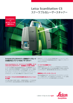
Leica ScanStation P16
ディテールを確実に計測
高い操作性
Leica ScanStation P16 は、直感的でユーザーフレンドリーなタッチスク
リーンを採用しています。 ボタン1つでスキャンを実行し、
ウィザードに
沿ってデータを処理、その場で確認ができるシンプルなワークフローで
す。また、無線LANにより、ハンドヘルド・デバイスでリモート操作すること
も可能です。
高い投資効果
魅力的なパフォーマンス、ワールドワイドに展開するサポート、そして質
の高いサービスは、結果的に所有コストを抑え、
これからレーザースキャ
ニングビジネスを展開していく場合も Leica ScanStation P16 は理想的
なソリューションです。
ダウンタイムの短縮
堅牢なレーザースキャナーは、–20°C から +50°C の過酷な温度環境でも
動作し、
また、防水・防塵の規格である IP54 に準拠しています。
スキャニングのトータルシステム
Leica ScanStation のポートフォリオは、ハードウェア、
ソフトウェア、サー
ビス、
トレーニング、およびサポートの包括的なソリューションをご提供し
ます。スタンドアローンの Leica Cyclone、CAD 用プラグインツール Leica
CloudWorx、ビューイングツール Leica TruView など優れた 3D 点群デー
タ用ソフトウェアで、3D レーザースキャナーが取得したデータを処理する
ことができます。
Leica ScanStation P16
テクニカルデータ
性能
電力
単発測定精度*
距離精度
測角精度
座標精度
電源
24 V DC、100 – 240 V AC
バッテリータイプ
内部:リチウムイオン × 2
外部:リチウムイオン(外部ポートで接続、同時使用、ホットス
ワップ可能)
連続使用時間
内部バッテリー:5.5 h(2個)
外部バッテリー:7.5 h(室温)
1.2 mm + 10 ppm
8"(水平)/ 8"(鉛直)
5 mm@80 m
ターゲット測定精度**
後処理ソフトウェアで最大 40 m まで抽出
2軸コンペンセータ
リアルタイムコンペンセータ搭載液体センサー、オン / オフ切
替可、分解能 1"、
ダイナミックレンジ ± 5'、精度 1.5"
レーザースキャニングシステム
レーザータイプ
超高速タイムオブフライト方式のレーザー、
ウェーブフォーム
デジタイジング(WFD)テクノロジー搭載
レーザー波長
1550 nm(不可視)/ 658 nm(可視)
レーザークラス
1(IEC 60825:2014)
ビーム拡散度
< 0.23 mrad(FWHM、
フルアングル)
前面ウィンドウでのビーム径
≦ 3.5 mm(FWHM)
測定範囲と反射率
80 m@反射率 18 %(最短測定可能距離 0.4 m)
スキャンスピード
最大 1,000,000点 / 秒
レンジノイズ*
10 m: 0.4 mm rms
50 m: 0.5 mm rms
動作環境
動作温度範囲
–20°C ~ +50°C
保管温度範囲
–40°C ~ +70°C
湿度
95 %、結露しないこと
防塵 / 防水
IP54(IEC 60529)
外観
スキャン範囲
水平
鉛直
360°
290°
データ保存容量
256 GB(内蔵SSD)または外部 USB デバイス
スキャナー
寸法(D × W × H)
重量
238 mm × 358 mm × 395 mm
12.25 kg(バッテリーなし)
内部バッテリー
寸法(D × W × H)
重量
40 mm × 72 mm × 77 mm
0.4 kg
マウント
直立または逆さま
操作オプション
通信 / データ転送
無線 LAN または USB 2.0 接続のギガビットイーサネット
オンボード ディスプレイ
フルカラータッチスクリーンディスプレイ タッチペン付き、
VGA(640 × 480 ピクセル)
レーザー求心装置
レーザークラス 1(IEC 60825:2014)
求心精度:1.5 [email protected] m
レーザーポイント径:2.5 [email protected] m
オン / オフ切替可能
フルカラータッチスクリーンのオンボードコントロール
リモートコントロール:Leica CS10/CS15/CS20/CS35 コントローラ、
または iPad、iPhone 等の
スマートフォンを含む他のリモートデスクトップデバイスを使用;外部シミュレータ
主な機能
ワンボタンスキャン
ワンボタンでスキャンを実行
スキャン範囲の定義
ビデオまたはスキャンからスキャン範囲を設定;バッチ処理ス
キャニング
ご注文に関する情報
イメージングシステム
ライカジオシステムズ、
または正規代理店にお問合せください。
内蔵カメラ
解像度
ホワイトバランス
HDR
シングル 17° × 17° カラー画像 (4メガピクセル)
; パノラマ
画像(700メガピクセル)
2.2 µm
ズーム付きストリーミングビデオ;自動露出調整からアンビエント
照明
晴天、曇天、暖色・寒色照明、任意設定
トーンマッピング / フルレンジ
外付けカメラ
キャノン EOS 60D / 70D / 80D をサポート
ピクセルサイズ
ビデオ
Leica ScanStation P30/P40
Because every detail matters
Leica Cyclone REGISTER 9.1
Laser scan registration and
Geo-referencing
このカタログの仕様および製品の外観は、改良のため予告なく変更する場合があります。
すべての精度の ± 表記は、特に記載がない限り 1 シグマでの値です。
*
アルベド 78 % の場合
**
4.5インチ 白黒 HDS ターゲットのフィッティングアルゴリズムによる
スキャナー:IEC 60825:2014 に準じたレーザークラス1製品
レーザー求心装置:IEC 60825:2014 に準じたレーザークラス1製品
iPhone、iPad は Apple Inc. の登録商標です。
イラスト、説明、技術データは変更されることがあります。無断複写・複製・転載を禁じます。
Copyright Leica Geosystems AG, Heerbrugg, Switzerland 2016.
836253ja – 03.17
Leica Cyclone MODEL 9.1
Processing laser scans
into deliverables
The meshed ground surface is
shown displayed with colours
mapped by elevation
User control
of registration
network, including
target weighting
A detailed plant model is
integrated with structure and
ground surface models
Users can easily
model buildings,
roads, structures,
bridges, light
poles and more
2D thumbnail
window provides
a clear view
of all scans in
a registration
Visual Registration enables quick scan
alignment for fast and easy registration
The right choice
Whether capturing 3D geometry of roads, rails, tunnels and
bridges or high-definition scan data for topographic maps and
as-built surveys, you know you’ll need an accurate long range
scanning tool for your projects – the new ScanStation laser
scanners from Leica Geosystems are the right choice, because
every detail matters.
High performance under harsh conditions
The Leica ScanStations deliver highest quality 3D data and HDR
imaging at an extremely fast scan rate of 1 mio points per
second at ranges of up to 270 m. Unsurpassed range and angular
accuracy paired with low range noise and survey-grade dual-axis
compensation form the foundation for highly detailed 3D colour
point clouds mapped in realistic clarity.
Reduced downtime
The extremely durable new laser scanners perform even under
the toughest environmental conditions, such as extreme
temperatures ranging from – 20°C to + 50°C and comply with the
IP54 rating for dust and water resistance.
Complete scanning solution
Leica Geosystems offers the new Leica ScanStation portfolio
as an integrated part of a complete scanning solution including
hardware, software, service, training and support. 3D laser
scanner data can be processed in the industry’s leading 3D
point cloud software suite, which consists of Leica Cyclone
stand-alone software, Leica CloudWorx plug-in tools for CAD
systems and the free Leica TruView.
For quality project results
with complete statistical reports
Leica Cyclone REGISTER is the industry’s most popular software
for registering and geo-referencing laser scan data to a common
coordinate system.
Accurate registration and geo-referencing is a must for successful High Definition Surveying (HDS™) projects. Cyclone REGISTER
is the most rigorous, complete and productive software available
for this important process.
Users can take advantage of registration options based on scan
targets, scene features, overlapping point clouds, and/or survey
data.
Cyclone REGISTER provides detailed statistical reports suitable for
inclusion as project deliverables. Reports cover registration
accuracy, error statistics and histograms for each target and/or
cloud constraint.
Leica ScanStation P30/40
Available automation features, friendly wizards and powerful
algorithms provide unsurpassed office productivity, even for very
large scan data sets.
Features and Benefits
n Direct import of Leica Pegasus project data, including device
trajectories
n Direct import of DotProduct *.dp files
n Batch import of iSTAR and Spheron panoramic images
n Texture mapping with Auto-Align for panos to scans, supporting
iSTAR, Spheron, and Nodal Ninja workflows
n Texture mapping with HDR Tone Map editor
n Auto Alignment allows fast, automatic alignment of scans at
import or post-import
n SmartAlign layout tool at import improves auto-alignment speed
n Visual Alignment allows quick user-alignment of scans
n Cloud-to-Cloud registration as standalone or with targets
n Automatic target finding and fitting
n For use with Leica Geosystems and third party point cloud data
n Fly Mode for smooth, 3D fly-through navigation, including 3D
mouse support, in ModelSpace View window
Leica Cyclone REGISTER
For civil, plant, architectural and other 2D & 3D projects
Unmatched versatility and performance help make Leica Cyclone
MODEL the industry’s most popular standalone software for
analysing rich laser scan data and converting the data into
deliverables.
Among its advantages, Cyclone MODEL boasts powerful
visualisation and point cloud navigation plus the industry’s most
complete tool set. These tools cover a wide range of HighDefinition Surveying (HDS™) applications in engineering,
construction, asset management, heritage, forensics, and
other areas.
Cyclone MODEL provides unmatched office productivity,
automating many time-consuming tasks and even letting multiple
users work on the same data sets simultaneously – thanks to
Cyclone’s Object/Database foundation. Finally, Cyclone MODEL
reflects the data quality & accuracy advantages that users worldwide expect from Leica Geosystems.
Features and Benefits
n 3D navigation and “fly mode” with 3D mouse support
n Direct import of Leica Pegasus project data, including device
trajectories for easy TruView creation along device tracks
n Direct import of DotProduct *.dp files
n Batch import of iSTAR and Spheron panoramic images
n Texture mapping with Auto-Align panos to scans, supporting
iSTAR, Spheron, and Nodal Ninja workflows
n Texture mapping with HDR Tone Map editor
n Multiple, fast, convenient visualisation modes
Plant & building tools include:
n Best-fit modelling, catalogue fitting, clash detection
n Auto Pipe Finder and Pipe Run Finder - automatically find and fit
cylinders
Civil & related tools include:
n Data collector emulation
n Create contours, breaklines, COGO points, cross sections
n TIN/mesh creation, volumes, areas, clearances
Leica Cyclone MODEL
leica-geosystems.co.jp
© 2017 Hexagon AB and/or its subsidiaries and affiliates.
Leica Geosystems is part of Hexagon. All rights reserved.
安心のお客様サポ-ト
アクティブ カスタマーケアはライカジオシステムズとお客様の真のパートナーシップ
の証です。カスタマーケア パッケージ(CCP)は、ハードウェアに最適なメンテナン
スを、
ソフトウェアには最新バージョンを提供し、お客様がベストな成果を得られる
ようサポートします。ポータルサイト myWorld @ Leica Geosystems では有益な情
報を1日24時間365日提供しています。
© Copyright 2026 Paperzz