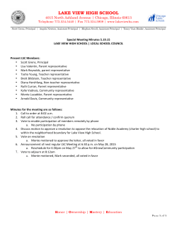
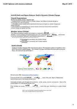
National Wetland Inventory and Assessment
High Altitude Himalayan Lakes
Sponsored by Ministry of Environment and Forests, Govt. of India
Space Applications Centre
Indian Space Research Organisation
Ahmedabad
January 2011
www.sac.gov.in
Map showing elevation ranges of India and surrounding area
INFORMATION NOTE
SAC/ESPA/NWIA/IN/03/2010
High Altitude Himalayan Lakes
Under the “National Wetland Inventory and Assessment” project
Sponsored by Ministry of Environment and Forests, Govt. of India
3D perspective view of Tso Kar Lake, Jammu & Kashmir
S. Panigrahy, J. G. Patel, T. S. Singh and T.V.R.Murthy
2
BACKGROUND
:
The Himalayan region is dotted with hundreds of lakes
from low elevation to the high elevations. Many of the
lakes of Himalaya are fresh water ones, with or without
inflow and out flow. The Himalayan lakes show varying
fed by snow-melt, precipitation and spring water flow.
The high altitude lakes are mostly oligotrophic unlike the
low altitude lakes, which are in various stages of trophic
state due to strong anthropogenic influence, the high
altitude lakes are still have a pristine environment.
chemistry in terms of solutes, bio-geochemistry, and
mineralogy vis-à-vis eco-hydrology of the lakes. These
are primarily related to enormous altitude variation
governing the climate, vegetation, lithology, tectonics and
type and intensity of erosion/ weathering at source.
High
altitude
lakes,
apart
from
their
ecological
significance, play crucial role in biodiversity, wildlife
habitat and socio-economic aspects. The high altitude
lakes in Ladakh are the only breeding grounds for
migratory bird species like the Black-necked Crane and
Bar-headed Goose in India. Local communities living in
The mountain lakes, caused by glacial activity, are
termed as tarns by geographers. Tarns are found mostly
in the upper reaches of the Himalaya, above 5500 m.
The high altitude lakes are fed by snow-melt, precipitation
the region are dependent upon the lakes for their
livelihood regardless of whether they are settled or
nomadic. Pasture lands near the wetlands are used for
grazing livestock. In Ladakh about 90 percent of the
and springs whereas lakes of lower altitudes receive
economy of local nomadic communities, near the lakes,
water from local rains, through streams, Nalas and
depend on their livestock which graze on wetland
springs. Many large lakes of Lesser Himalaya are fault
pastures.
basin lakes formed due to tectonic activity resulting in
blocking of the streams/rivers during Holocene period.
These have main source of water through precipitation
and underground springs. Such lakes are found in
Kumaun, Himachal Pradesh and Jammu. The Higher
Himalayan lakes of Spiti valley, on the other hand, are
3
Some lakes like Tso Moriri (Jammu and Kashmir) and
Manimaheshwar (Himachal Pradesh) are regarded as
monsoon season, area under aquatic vegetation, and
qualitative turbidity of water.
sacred and are revered by thousands of pilgrims each
year. The largest lake in the Himalayas is the Pangong
Tso, which is spread across the border between India
and Tibet. It is situated at an altitude of 4350 m. It is
nearly 134 km long and width of 8 km. A notable high
(but not the highest) lake is the Gurudongmar in North
A
classification
system
based
on
IUCN/RAMSAR
definition and amenable from remotely sensed data was
used to categorise the wetlands. Total 19 types of
wetlands were delineated using a hierarchical system.
This classification includes inland and coastal wetlands at
Sikkim at an altitude of 5148 m. Other major lakes
level-I followed by level-II comprising natural and
include the Tsongmo Lake, near the Indo-China border in
manmade wetlands within level-I, which were further
Sikkim (India). Two high altitude wetlands in India have
categorised into 19 types of wetlands at level-III. High
been designated as Ramsar sites. These include Tso
Altitude Wetland (HAW) is one of the class mapped,
Moriri in the state of Jammu and Kashmir and Chandratal
which is first such attempt in the country.
in Himachal Pradesh.
NATIONAL WETLAND INVENTORY AND ASSESSMENT :
Mapping of wetlands at 1:50,000 scale using satellite
remote sensing data and creating a geospatial data base
was taken up by Space Applications Centre under the
project “National Wetland Inventory and Assessment
(NWIA)’ sponsored by Ministry of Environment & Forests.
IRS P6 LISS III digital data having four spectral bands:
Green, Red, Near Infra Red, and Short Wave Infra Red
with spatial resolution of 24 m was used. Two-date data:
one acquired during pre-monsoon and another during
post-monsoon period was used to decipher the status of
wetlands during wet and dry period. The outputs include
the wetland boundary, the water spread in pre- and postIRS LISS III FCC showing the distinct signature of high
altitude lakes during pre-monsoon season
4
INVENTORY OF HIGH ALTITUDE LAKES
:
All lakes lying above 3000 m elevation are designated as
high altitude ones in this work. Mapping of the lakes is
done at 1:50,000 scale. Small lakes (<2.25 ha area ) are
also mapped as point features and assigned 1.0 ha
nominal area.The Digital Elevation Model (DEM) derived
from ASTER/SRTM data was used to generate elevation
contours and classify the lakes as per altitude range.
Spatial database of these lakes was prepared at state,
district and topographic map sheet level using coding
system, where each lake has a unique identification
number.
Lakes give unique signature on the satellite images,
Depending upon the state of water whether liquid phase
or frozen, the boundary of the lakes are prominent and
can be discerned with high accuracy. The pre- and postmonsoon images reflect the status of water, vegetation
and state (solid/liquid).
Number, Size and Altitudinal Distribution of Lakes
Sr.
No.
1
2
3
4
5
6
High Altitude lakes in various states (frozen, semi-frozen
and liquid) as manifested on LISS-III imagery
2
The Indian Himalayas cover approximately 591,000 km
or 18 per cent of India's land surface and spread over six
Himalayan States viz Jammu and Kashmir, Himachal
Pradesh, Uttrakhand, Sikkim, Arunachal Pradesh and
some parts of West Bengal. Total 4703 lakes are mapped
which lie above 3000 m elevation. This includes 1996
small lakes (<2.25 ha area). The total area of high
altitude lakes is 126249 ha. The lakes categorised under
various sizes, show that there are only 12 lakes
belonging to the very large size category having more
than 500 ha area. However, they contribute to highest
share of lake area (75.61%). Number wise, the smallest
size lakes (<2.25 ha) have the largest share (42.44%),
followed by very small ones (<10 ha) with 42.33% share.
Size-wise distribution of high altitude lakes
Class
Range
No. of
Area
lakes
(ha)
Very Large > 500 ha
12
95462
Large
100-500 ha
30
4861
Medium
25-100 ha
179
7434
Small
10-25 ha
495
7559
Very Small
< 10 ha
< 2.25 ha
< 2.25 ha
Total
1991
1996
4703
8429
2505
126249
Distribution of lakes as per size
5
Altitude-wise, maximum numbers of lakes are observed
in the elevation range of 4000-5000 m. There are 2642
lakes (56.2% of total number) mapped in this elevation
range with 100817 ha area (79.9% area). Very large
lakes are also observed in this elevation range. Only 761
lakes are mapped in the very high altitude range of
>5000 m elevation.
and Kashmir has the highest share of lakes. Numberwise, around 44.7% of lakes (2104 number) are found in
this state with 87.2% share of total area. Arunachal
Pradesh with 1672 lakes contributes 9.4% of area,
indicating small size of the lakes. Only 3 lakes are
mapped in West Bengal state with 82 ha area
(contributing to 0.06% of total lake area).
Distribution of lakes as per altitudinal range in Himalaya (high:
3000-4000m, higher: 4000-5000m and very high: >5000 m).
Altitude-wise distribution
Himalaya
Sr.
Category
No.
of high altitude lakes
in
Altitude
range (m)
No. of
lakes
Area
(ha)
1.
High Altitude
3000-4000
1300
8460
2.
Higher Altitude
4000-5000
2642
100817
3.
Very high Altitude
>5000
761
16972
4703
126249
Total
State-wise distribution
Two states: Jammu and Kashmir and Arunachal Pradesh
harbour very large number of high altitude lakes. Jammu
Distribution of high altitude lakes in Himalayan states,
India
State-wise distribution of high altitude lakes in Himalaya
Sr.
No.
State
No. of
lakes
Lake area
(ha)
% Lake
Area
1
Arunachal Pradesh
1672
11863
9.40
2
Himachal Pradesh
272
617
0.49
3
Jammu and Kashmir
2104
110131
87.23
4
Sikkim
534
3325
2.63
5
Uttarakhand
118
231
0.18
6
West Bengal
3
82
0.06
Total
4703
126249
100.00
6
Altitude-wise distribution of lakes in Jammu & Kashmir
Jammu and Kashmir
:
Sr.
Category
No.
Altitude
No. of
Area
Range (m)
lakes
(ha)
1.
High Altitude
3000-4000
468
3104
2.
Higher Altitude
4000-5000
1221
92390
3.
Very high Altitude
>5000
415
14637
2104
110131
Total
Size wise distribution showed that, among the lakes
mapped as polygons, maximum number (848) are in the
range of <10 ha area, followed by lakes of the size of 1025 ha area (182). However, this state have all the 12
large lakes (>500 ha area), found in the Indian Himalaya.
IRS AWiFS FCC (November 2006) of Jammu & Kashmir
Total 1143 lakes are mapped at 1:50,000 scale and 961
small lakes (<2.25ha) are mapped as point features,
taking the total number of lakes to 2104. Altitude wise
distribution of lakes showed that maximum number of
lakes (1221) is in the elevation range of 4000-5000 m.
This state also have highest number of lakes situated in
very high altitude range of >5000 m.
Size-wise distribution of high altitude lakes in Jammu & Kashmir
Sr.
No.
Class
Range
No. of
Area
lakes
(ha)
1
Very Large
> 500 ha
12
95546
2
Large
100-500 ha
23
4015
3
Medium
25-100 ha
78
3292
4
Small
10-25 ha
182
2842
5
Very Small
< 10 ha
848
3475
6
< 2.25 ha
< 2.25 ha
961
961
2104
110131
Total
The Pangong Tso is at a height of 4350 m above sea
level is the largest lake in Ladakh. It is a saline lake. Tso
Moriri and Tso Kar are two important lakes, saline in
nature are also located in Ladakh. Tso Moairi has been
designated as Ramsar Site. Some of the other important
lakes in the region are, the Neelang Lake in Budgam,
Patlong, Thaled, Longzang, Pangor etc.
7
China
LISS III FCC showing the Tso Moriri lake – a Ramsar site
(wetland area: 14530 ha, altitude: 4650m). Below:
photograph of the lake showing the pristine environment.
The Pangong Tso in Ladakh, India, the largest high
altitude lake as seen in LISS III FCC and a scenic
photograph of the lake.
China
A
India
(The Pangong Tso spread across India and China as
seen in IRS LISS III FCC. Lake area in India is 29345 ha,
altitude: 4350).
Tsokar lake as seen in LISS III during post-monsoon
(note the salt encrustation- A)
8
Arunachal Pradesh
:
Arunachal Pradesh is the easternmost state of India with
geographical area of 81,424 sq km Total 1672 high
altitude lakes were delineated. The total area under these
lakes is 11863 ha, accounting for about 7.6 per cent of
total wetland area of the state. Maximum number of lakes
are of small size (below 10 ha). There are no lakes of
very large size (>500 ha) in this state.
Altitudinal distribution pattern of these lakes showed that
highest concentration is in the range of 4000-5000 m
elevation range.
Size-wise statistics of high altitude lakes in Arunachal
Pradesh.
Sr.
No. of
Area
Class
Range
No.
lakes
(ha)
1
Very Large > 500 ha
2
Large
100-500 ha
3
363
3
4
5
6
Medium
Small
Very Small
< 2.25 ha
Total
25-100 ha
10-25 ha
< 10 ha
< 2.25 ha
77
251
900
441
1672
3170
3916
3974
441
11863
Map showing distribution of lakes in relation to elevation
gradients in Arunachal Pradesh
IRS LISS III FCC showing numerous high altitude lakes
in Arunachal Pradesh ( below: photograph of some of
the lakes in Tawang district: courtesy- Dr S Mehta).
Distribution of high altitude lakes in relation to elevation
gradient in Arunachal Pradesh
Sr.
No.
1.
Category
High Altitude
Altitude
range (m)
3000-4000
No. of
lakes
Area
(ha)
789
5178
2.
Higher Altitude
4000-5000
864
6636
3.
Very high Altitude
Total
>5000
19
49
1672
11863
9
Sikkim
:
2
The total geographical area of the state is 7,096 km .
High altitude lakes accounting for 40.79 per cent of the
total wetland area. Total 534 lakes are identified with
3325 ha area. Total lakes mapped as polygons are 259
with 3050 ha area. In addition 275 small lakes (<2.25 ha)
are mapped as point features. Maximum number of lakes
are of very small size (<10 ha). Unlike Jammu and
Kashmir, large size lakes (>500 ha) are not observed in
Satellite image showing the Gurudongmar Lake in frozen
and liquid state (below: photograph of the lake in June).
Sikkim.
Size-wise statistics of high altitude lakes in Sikkim
Sr.
Class
No.
Range
No. of
Area
lakes
(ha)
1
Very Large
> 500 ha
-
-
2
Large
100-500 ha
4
511
3
Medium
25-100 ha
20
885
4
Small
10-25 ha
55
823
5
Very Small
< 10 ha
180
830
6
< 2.25 ha
< 2.25 ha
275
275
534
3325
Total
Gurudongmar Lake is a well known high altitude lake of
the state. It is located in North Sikkim district at 5243 m
elevation, and is considered a sacred lake. Chholhamu
Altitudinal distribution shows that maximum numbers of
lakes are found above 4000 m elevation. Distributionwise, North Sikkim has the maximum number. There are
only 6 lakes in the elevation range of 3000-4000 m.
Distribution of high altitude lakes in relation to elevation
gradient in Sikkim
the highest lake in India. The lake is located near
Sr.
No.
1.
Donkiala Pass. It is the source of the river Teesta (Tista).
2.
Higher Altitude
4000-5000
323
1209
Tsomgu Lake is another important tourist destination in
3.
Very High Altitude
>5000
205
2097
534
3325
Lake, also in North Sikkim district, at 5300 m elevation is
Sikkim.
High Altitude
Altitude
range (m)
3000-4000
No. of
lakes
6
Area
(ha)
19
Category
Total
.
10
Himachal Pradesh
:
Himachal Pradesh is almost entirely mountainous with
altitudes ranging from 460 to 6600 meters above sea
level. Total 272 high altitude lakes were delineated
constituting 617 ha area that accounts for less than one
per cent of total wetland area of the state. Maximum
number of lakes (230) are of very small size (<2.25 ha
area). There are no lakes above 100 ha area. Altitudinal
distribution pattern of these wetlands showed that highest
concentration is in the range of 4000 to 5000 Meter
elevation range. Chandratal is the most famous high
altitude lake in the state. This beautiful lake is situated at
4300 m, in Lahaul and Spiti district. This is the source of
Map showing distribution of lakes in Sikkim in relation to
elevation gradient ( > 3000 m).
river Chandra. Manimahesh Lake at 4080 m lies in Budhil
valley of Chamb district. Annual Manimahesh Yatra takes
place after Janamasthami, in the month of August. Suraj
Tal Located near Baralacha pass in Lahaul part of Lahaul
and Spiti district at a height of 4980 m, is the source of
Bhaga river. Dashair Lake at 4270 m lies near Rohtang
pass which connects Kullu with Lahaul and Spiti.
Size-wise statistics of high altitude lakes in Himachal Pradesh
April 2006
January 2006
Tsomgu Lake as seen in IRS LISS III data and the
photograph of the lake in June
Sr.
No.
1
2
3
4
5
6
Class
Very Large
Large
Medium
Small
Very Small
< 2.25 ha
Total
Range
> 500 ha
100-500 ha
25-100 ha
10-25 ha
< 10 ha
< 2.25 ha
No. of
lakes
3
5
34
230
272
Area
(ha)
146
80
161
230
617
11
Altitude-wise statistics of the lakes in Himachal Pradesh
Sr.
No.
Category
Altitude
range(m)
No. of
lakes
Area
(ha)
Uttarakhand
:
In all 118 high altitude lakes were delineated constituting
1.
High Altitude
3000-4000
27
68
2.
Higher Altitude
4000-5000
167
424
total wetland area of the state. Among the districts, Chamoli
3.
Very High Altitude
>5000
78
125
has the maximum number (14) with 66 ha area, followed by
272
617
231 ha area that accounts for less than one per cent of
Total
Pithoragarh district (11) with 62 ha area. Majority of the lakes
are of very small size (<2.25 ha) and mapped as point
features. There are 28 lakes distributed with range of <10
ha category and one lake in 10-25 ha.
Size-wise statistics of lakes in Uttarakhand state
Sr.
No. of
Class
Range
No.
lakes
1
Very Large
> 500 ha
-
Satellite image showing the Chandratal in semi frozen
and melting state (below: photograph of the beautiful lake
during July)
Area
(ha)
-
2
Large
100-500 ha
-
-
3
Medium
25-100 ha
-
-
4
Small
10-25 ha
1
17
5
Very Small
< 10 ha
28
125
6
< 2.25 ha
Total
< 2.25 ha
89
118
89
231
Altitudinal distribution pattern of these wetlands showed
that about 67 wetlands exist in the elevation range of
4000 to 5000 m and 44 wetlands exist in the very high
altitude (>5000 m).
12
near famous Hindu shrine of Kedarnath. Other well
known high lakes in Chamoli district are Rupkund and
Hemkund situated at 4450m and 4329 m altitude
respectively.
IRS LISS III FCC showing the distribution of high altitude
lakes in the Uttarkashi district.
Altitude-wise statistics of lakes in Uttarakhand state
Sr.
No.
Category
Altitude
range (m)
No. of
lakes
Area
(ha)
1.
High Altitude
3000-4000
7
9
2.
Steep Altitude
4000-5000
67
158
3.
Very Steep Altitude
>5000
44
64
118
231
Total
Satellite image showing the Kedar tal lake (below:
photograph of the pristine lake in June)
Kedar Tal/Lake in Uttarkashi district at 4425 m elevation
is a famous one. It is near Gangotri along Kedar Ganga,
a tributary of Bhagirathi River. Shasra Lake is a popular
destination for tourists, situated at 4572m. This splendid
lake is in Uttarkashi district, after crossing the Kyarki Khar
pass. Vasuki Tal/Lake in Chamoli district lies at 4135 m,
13
Summary of High altitude wetlands in India derived using LISS III data (2006-7) under NWIA project
Sr.
No.
1
2
3
Jammu &
Kashmir
Himachal
Pradesh
Uttarakhand
Sikkim
Arunachal
Pradesh
Total Wetland Area (ha)
391501
98496
103882
7477
155728
1107907
1864991
High Altitude Lakes (ha)
110131
617
231
3325
11863
82
126249
% of total Wetland Area
28.13
0.63
0.22
44.47
7.62
0.01
6.77
Description
West
Bengal
Total
Altitudinal distribution of Himalayan lakes in India
Sr.
No.
1
2
3
4
5
6
High Altitude
(3000-4000m)
No. of
Area
lakes
(ha)
789
5178
27
68
468
3104
6
19
7
9
3
82
1300
8460
State
Arunachal Pradesh
Himachal Pradesh
Jammu and Kashmir
Sikkim
Uttarakhand
West Bengal
Total
Higher Altitude
(4000-5000m)
No. of
Area
lakes
(ha)
864
6636
167
424
1221
92390
323
1209
67
158
2642
100817
Very High Altitude
(>5000m)
No. of
Area
lakes
(ha)
19
49
78
125
415
14637
205
2097
44
64
761
16972
Total
No. of
lakes
1672
272
2104
534
118
3
4703
Area
(ha)
11863
617
110131
3325
231
82
126249
Size-wise distribution of high altitude lakes in India
Sr.
No.
State
Very Large
(> 500 ha)
Large
(100-500 ha)
Medium
(25-100 ha)
Small
(10-25 ha)
Very Small
(<10 ha)
<2.25 ha
Total
1
Arunachal Pradesh
-
-
3
363
77
3170
251
3916
900
3974
441
441
No.
of
lakes
1672
2
Himachal Pradesh
-
-
-
-
3
146
5
80
34
161
230
230
272
617
3
Jammu and Kashmir
12
95546
23
4015
78
3292
182
2842
848
3475
961
961
2104
110131
4
Sikkim
-
-
4
511
20
885
55
823
180
830
275
275
534
3324
5
Uttarakhand
-
-
-
-
-
-
1
17
28
125
89
89
118
231
6
West Bengal
-
-
-
-
1
60
1
17
1
5
-
-
3
82
12
95546
30
4889
179
1991
8570
1996
1996
4703
126249
Total
No. of
lakes
Area (ha)
No. of
lakes
Area
(ha)
No. of
lakes
Area
(ha)
No. of
lakes
Area
(ha)
No. of
lakes
Area
(ha)
No. of
lakes
Area*
(ha)
7553
495
7695
* Nominal assignment
Area
(ha)
11864
14
Database structure of High altitude wetlands created under
NWIA project (Example of the 12 large lakes)
Sr.
No.
Wetcode
Wetname
Area
(ha)
Perimeter
(km)
Altitude
(m)
Aqveg
(Y/N)
Turbidity
State
1
0107005211090002 Pangong Tso
29345
247.90
4350
N
L
Jammu & Kashmir
2
0115005213160001
22103
69.98
4890
N
L
Jammu & Kashmir
3
0107005212050001 Tso Moriri
14530
108.97
4650
Y
L
Jammu & Kashmir
4
0115005214100002
7026
48.81
5320
N
L
Jammu & Kashmir
5
0107005211030002 Tso Kar
6179
50.51
4760
Y
L
Jammu & Kashmir
6
0115006101040002
5556
43.03
4910
N
L
Jammu & Kashmir
7
0115005214050004
3592
37.27
5325
N
L
Jammu & Kashmir
8
0107005211140002
3473
40.67
4350
N
L
Jammu & Kashmir
9
0115005209150005
1939
69.85
4950
N
L
Jammu & Kashmir
10
0107005212090002
666
14.98
4975
N
L
Jammu & Kashmir
11
0115006102010001
654
12.21
5060
N
L
Jammu & Kashmir
12
0107005211080002
526
9.95
4680
N
L
Jammu & Kashmir
Wetland : Name of the wetland,
Y: Present, N: Absent, L: Low
Aqveg : Status of Aquatic Vegetation
Wetcode : Unique identification number 16 digit using
State code(2) + District code(2) + Taluka code(2) + SOI toposheet code(6) + Wetland number(4)
15
3D perspective view of part of North District, Sikkim
(IRS P6 LISS-IV image draped on DEM)
16
3D perspective view of part of West District, Sikkim
(IRS P6 LISS-IV image draped on DEM)
17
Some of the Important High Altitude Lakes of India
18
Chandratal Lake (Himachal Pradesh) – A Ramsar Site:
The Chandertal with its deep blue icy water, surrounded
by snow and acres of scree, constitute an important high
altitude cold desert wetland of western Himalayas. The
lake is in Lahul and Spiti district and situated at an
altitude of 4270 metres. The clean water of the lake with
small marshy patches around attracts many migratory
birds. Important species noted are: Snow cock, Chukar,
Black winged stilt, Brahmni duck, Golden eagle and
Chugh, Hoopoe, Yellow Headed Wagtail, Jungle crow,
Blue rock pigeon, Common rose finch, Black redstart,
Short toed Eagle, Common Sandpiper, Teal, Magpie
Robin etc.
The important wild life species found in the region are
Marmota Bobak, Snow leopard, Red fox, Snow wolf,
Capra ibex, Blue sheep, and Lynx.
The herbaceous growth in the catchment area is
remarkable for its variety. The important species are
Potentila, Ranunculus, Acquilegia, Primula, Aconitum,
Aster, Asteraglus, Bistorta affinis,Delphinium, Geranium,
Oxyria, Potentilla, Polygonum, Ranunculus, Rosularia,
Stellaria, and Thymus species. The common grasses
frequently encountered are Poa and Agropyron. These
grasses have rich nutritive value.
Wetland map of 5 km buffer area: Chandratal Lake
19
Some interesting facts
:
A true lake should have some liquid water round the year.
Thus, a high altitude lake which freezes solid all the way
down to the bottom during the winter may be disqualified
as a lake. A true "lake" must occupy at least 1.0 hectare.
Panch Pokhri is a group of three sacred lakes in Nepal
about 6 kilometers east of Ama Dablam (the mountain), is
the highest named lake in the world The main lake is at
5414 m elevation; the other two lakes are at 5430 m and
5494 m elevation respectively. Panch Pokhri (5494 m) is
about 700 m long and 400 m wide.
NASA declares: "At an altitude of 4727 m, Lake
Mansarovar” is one of the highest freshwater lakes in the
world.
Lake Namtso in Tibet is the largest high altitude lake in
the world. The altitude of Lake Namtso is 4700 m and the
2
surface area is 1940 km .
Chholhamu Lake(102.5ha) in Sikkim, at 5300 m elevation
is the highest lake in India. It is the source of the river
Teesta (Tista). It lies
Chholhamu Lake
Chhc
IRS LISS III FCC showing Chholhamu lake in Sikkim.
The very high altitude lakes are generally volcanic ones
lying on top of a volcano. However, they are very small in
size. The lake at 6,390 m, on the east face of Ojos del
Salado, the highest active volcano on the southeast side
of the border between Chile and Argentina is the highest
lake in the world. It is around 100 m in diameter, circular
in shape, thus the surface area is 0.785 hectare.
Proper lake (if size is taken into account), "Ridonglabo
Lake", around 3.0 hectares in size, lying at 5,801 meters
may be called the highest lake. The lake is about 14
kilometers northeast of the summit of Mt. Everest. It's
actually in a side valley on the northwest side of the main
Karda Valley, where the Karda Glacier ends in Karda
Lake.
Source:
http://www.highestlake.com/highest-lake-world.html
20
3D perspective view of Chushul Marshes and surrounding area, Ladakh Region
IRS P6 LISS-III imagery, Post-monsoon(2006)
This is a complex of shallow ponds, marshes, and wet meadows in broad, sandy valley to the
east (10000 ha) and west (1000 ha) of Chusul. The ponds and marshes are created by the
springs and streams flowing down into the valley from the Ladakh range to the southwest. The
average depth of the ponds here is one or two meters.
The aquatic vegetation found are: Hydrilla, Myriophyllum, and Potamogeton in the ponds, and
Carex sp., other sedges, and grasses in the marshes. The surrounding arid steppe is dominated
by Caragana sp. This is an important breeding area for several species of waterfowl, notably
Podiceps cristatus, Tadorna ferruginea, Charadrius mongolus, Tringa tetanus, and
Sterna hirundo. A number of species occur on the surrounding dry plains, including Tibetan
partridge (Perdix hodgsoniae), Tibetan sandgrouse (Syrrhaptes tibetanus), and wild ass
(Equus hemionus).
Area: 675 ha
Altitude: 4150m
For further details please contact:
Director
Space Applications Centre, ISRO
Ambawadi Vistar (P.O.)
Ahmedabad – 380015
Email: [email protected]
Adviser
Ministry of Environment and Forests
Paryavaran Bhavan
CGO Complex
New Delhi 110003
Cover: 3D Perspective view of Tso Moriri Lake, Jammu and Kashmir
Back cover: Gurudongmar Lake, Sikkim
© Copyright 2026 Paperzz